
Following the Gold Rush Trail through British Columbia’s Cariboo & Beyond
Follow the trail of the first prospectors who flocked to British Columbia in the mid-1800s in search of gold and riches. Travel through rugged mountains, steep canyons and past raging rivers of the Fraser Canyon and into the dry plateaus and rolling hills of the Thompson Okanagan and Cariboo regions. Continue north to Prince George, called the Northern Capital of BC, then east and south towards the stunning BC Rockies returning to Hope in Fraser Country.

A Sampling of Things To See and Do Along the Way
The Fraser Canyon offers up plenty to see. Yale Historic Site was an original Gold Rush boomtown where the steamers stopped as the waters of the Fraser River were too rough beyond this point for boats to navigate. It is known as the official start of the Gold Rush Trail although mile zero is actually in Lillooet.
Hell’s Gate Airtram offers a ride over the thundering waters where 200 million gallons of water cascade through the narrow passage of the gorge every minute.
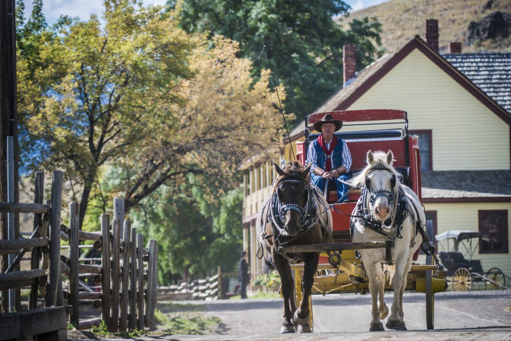
Entering the drier climate of the Cariboo you will find Historic Hat Creek Ranch. Dating back to 1861 you can relive the history through interpreters dressed in period clothing, take a stagecoach ride and pan for gold.
Continuing on to Clinton, check out this Wild West town! Antique shops, many with original storefronts, are full of treasures and an 1892 museum are reasons to take a break here. Then on to Williams Lake home to cowboys and the popular annual Williams Lake Stampede (July 1st). Do some gold panning in Quesnel, home to the world’s largest gold pan and check out Mandy the haunted doll at the Quesnel & District Museum.

A side trip to Barkerville is well worth the one-hour drive each way. This thriving historic town is a tribute to the gold rush era that made BC’s gold industry famous. 125 plus heritage buildings, displays, a theatre, events, activities and more showcase the life of Barkerville’s colourful past. Designated a Historic Site of Canada and a Provincial Heritage Property it is the largest living-history museum in western North America.
Known as the capital of Northern BC, the city of Prince George is a bustling community where arts and culture, events and outdoor adventure awaits. Visit the Exploration Place Museum & Science Centre with dinosaurs, fossils, hands-on experiences for kids and adults alike. The Central British Columbia Railway and Forestry Museum features original buildings and rolling stock and is home to one of the largest vintage rail collections in BC.
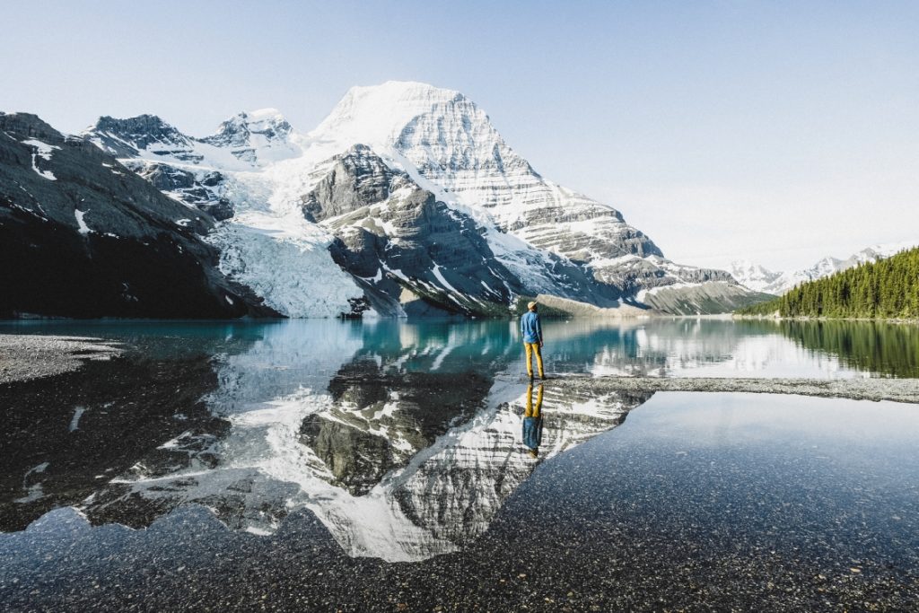
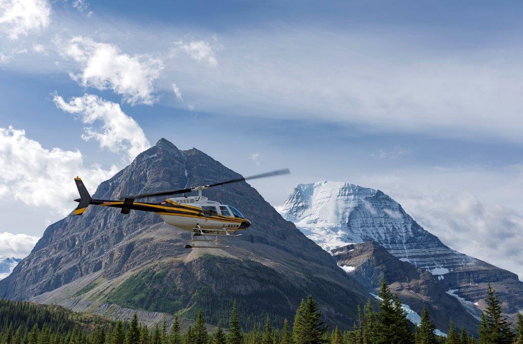
Situated at the foot of Canoe Mountain in the Robson Valley is the village of Valemount and the closest community to Mount Robson Provincial Park and Jasper National Park. Explore some of the many hiking trails for stunning views of snow-capped mountains, spectacular waterfalls and create lasting memories.
Along the way stop at Blue River and experience a boat ride down the river through Grizzly Mountain Valley and the world’s only inland temperate rainforest where you may be lucky enough to see bears, moose, osprey, eagles and other BC wildlife.
Outdoor adventurers will want to stop at Wells Gray Provincial Park to see and experience some of nature at its very best. A wide array of paths offer trails for different hiking levels plus stunning waterfalls provide many viewing opportunities, including Helmcken Falls, the fourth highest falls in Canada. Bring your kayaks and bikes and get ready to experience this amazing park.
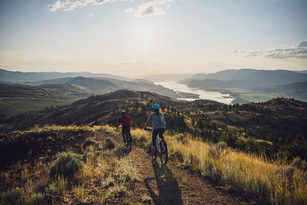
Kamloops is one of the major cities in the Okanagan with great restaurants, shopping, entertainment, arts and culture, sports and outdoor activities. Stop in at a winery or a local brewery. Visit BC Wildlife Park and experience wildlife up close.
Amazing white and yellow cliff formations are located in Castle Rock Hoodoos Provincial Park in Deadman Valley. Hiking is not permitted as the landscape is very fragile but stunning scenery provides an opportunity to take home some great photographic memories.
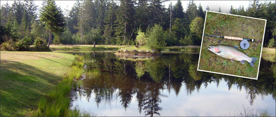
Spences Bridge lies at the confluence of the Thompson and Nicola Rivers and is a prime location for excellent fishing. River rafting, swimming, canoeing, kayaking or fishing are all close by.
This circle route has much to offer. Spend a few days, a week or more, exploring some or all of the communities and attractions along this route.
For a ‘guided’ tour read our suggested trip along the Gold Rush Trail.
TIP: If you find this blog interesting why not subscribe to the enewsletter and never miss another story!
For places to camp in British Columbia go to the Camping Map.
Share your BC travel and camping photos using hashtag #campinbc #explorebc
Haida Gwaii Adventures, British Columbia
Although I have travelled BC, especially between Vancouver and Prince George, more times than I can count, when my husband and I bought an RV we slowed down; really began to see this amazing province we call home. In this blog I am sharing one of our many BC explorations.
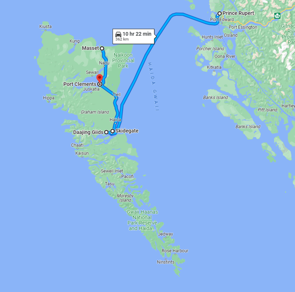
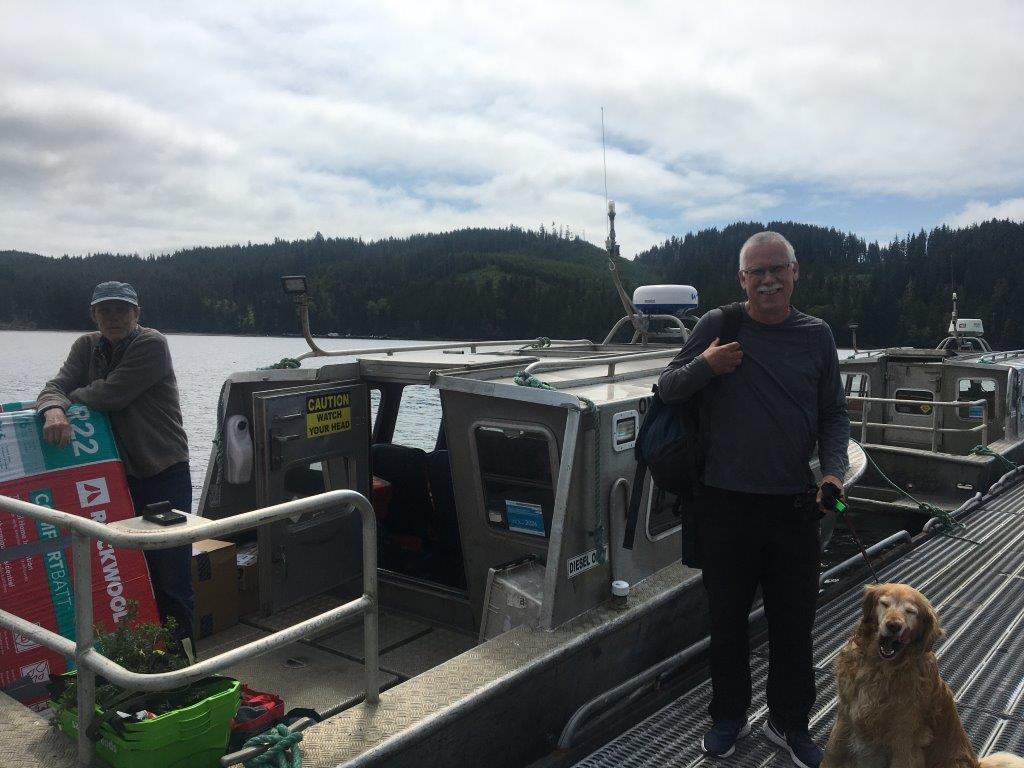
We had heard much about Haida Gwaii, the mystical secluded archipelago made up of a cluster of islands off the northern coast of BC. We were eager to discover it for ourselves. It’s sparsely populated and not easy to get to. Most of the inhabitants are indigenous and live in villages located almost exclusively on Graham Island.
There is an expression about remote communities that there are only three ways to access them, by water, by air or by birth. We chose water taking the ferry that is part of BC’s provincial ferry system from Prince Rupert to Skidegate on Haida Gwaii. Reserve early as it fills up fast particularly during the busy season. We encountered others who had not been so attentive in their planning. They were stuck on the island until they could secure another sailing. Not always easy with an RV.

A curious fact about the ferry to Haida Gwaii, not only does it take eight hours, but oversized vehicles need to be backed onboard. “Excuse me, as in backing up all the way down the ramp and onto the ferry?” Of course, if you need assistance the ferry workers have you covered. They have professional drivers that will do it for you if you prefer. As I do all the driving, I looked at my husband, “you got this,” he said. And I did, but it’s a long ramp and a technical drive not for the faint of heart.

Once on the island our first campsite was on the ocean surrounded by serene ancient forest just outside Daajing Giids (a more appropriate culturally representative name than the former Queen Charlotte City). It was quintessential west coast. A light rain fell, the kind that doesn’t really get you wet, but causes mist to form drifting across the beach and through the trees draped with moss.

We walked the rugged beach, and to our delight came across wild sea asparagus which we harvested for our dinner. In fact, wild harvest is a common practice. You won’t find any fancy high-priced touristy seafood restaurants here. The locals acquire and trade amongst themselves the abundance from the land and sea rather than marketing to visitors.

Next, we drove to Masset on the northern end of Graham Island. Along the way were many deer grazing beside the roadway, a local phenomenon. We rode our bicycles around Old Masset enjoying the authentic aboriginal village, oceanfront, and a quick bite at one of several food trucks that serve as “eating out” Masset style. You may also wish to trek just a bit further to Tow Hill to take in the vast Pacific Ocean vistas.

Heading back south to catch our ferry off island we explored Port Clements mingling with the locals as they fished off the pier in the heart of town. We also stopped for photos at area attractions Halibut Bite and Balance Rock.

The ferry between Haida Gwaii and Prince Rupert runs during the day, or you can take it overnight. Staterooms are available so you can get some rest as Transport Canada doesn’t allow you to stay in your vehicle below deck for safety reasons. Hecate Strait is renowned for its turbulent seas. We chose a daytime crossing on our way over to Haida Gwaii to take in the sights and an overnight on the way back to Prince Rupert (with a stateroom). The overnight ferry from Haida Gwaii aligned perfectly with our intent to board yet another ferry, this time from Prince Rupert to Port Hardy on the northern tip of Vancouver Island. This route might be known to those who have traversed the inside passage on an Alaskan cruise. The scenery and the wildlife are spectacular!
We recommend Haida Gwaii to the more adventurous. Its natural beauty is stunning but it’s short on amenities so prepare accordingly. The towns on Haida Gwaii are small. Ideally take your own accommodation (we had our RV), your own food (groceries are limited) and fuel can be very expensive as it must be barged in so fill up before you come. The number of eateries, coffee shops, stores and accommodations are sparse compared to mainland standards and the residents aren’t particularly fussed about catering to off-island interests so don’t expect much other than to supplement what you brought.
In short, this is no tourist mecca. You don’t come to Haida Gwaii for the modern-day amenities or atmosphere. You come to appreciate the simplicity, the unspoiled First Nations culture and wild natural wonder of the west coast.
TIP: If you find this blog interesting why not subscribe to the enewsletter and never miss another story!
For RVing and camping accommodations in British Columbia go the camping map.
Share your BC travel and camping pictures using hashtag #campinbc #exploreBC
It’s always a great day to #campinbc
Winter Activities On British Columbia’s Sunshine Coast for Snowbird RVers
From the artistic community of Gibsons northeast to the harbour village of Lund, mountains meet the sea along the Sunshine Coast, a mainland area uniquely only accessible by ferry, boat or plane. Winters are typically mild and range from 2 to 10ºC (20 to 50°F) during the day. In lower elevations, rains keep the flora and forests lush, while higher areas see snow.
There’s plenty to do both inside and out if you’re RVing here in the winter. Make sure to get out on the water and head up some slopes. You will be rewarded with majestic views and an excellent chance of seeing animals in their natural environment.

Arts, Shops and Spas
This scenic and inspiring region boasts a thriving art community with more artists per capita than any other area in Canada. The Purple Banner Tour is a self-directed studio and gallery tour. Purple flags along the Sunshine Coast Highway and local streets from Langdale to Lund indicate galleries or artists’ studios, many of which are open to the public. (Visitation appointments may be necessary.) Sunshine Coast Art Tours combines visits to some tasting rooms with a majestic flight over Sechelt Inlet. There are also many eclectic shops and boutiques to explore that sell locally produced and handmade items.

The town of Gibsons on the shores of Howe Sound has a collection of fine galleries, clothing and giftware shops and bookstores. Molly’s Lane and Marine Drive are some streets to check out, as are the Gibsons Public Art Gallery and the Sunshine Coast Museum and Archives. The Kube has working artist studios, an art gallery and curated retail.
In Sechelt the Raven’s Cry Theatre shows movies and hosts events and the shíshálh Nation tems swiya Museum has a large collection of artifacts including cedar baskets and ancient stone tools.
For a different experience visit the collection of yurts in Madeira Park at Fibre Works Studio & Gallery, a creative space for art exhibits and workshops. The Sunshine Coast also has funky thrift and vintage shops and there are craft fairs and year-round and seasonal markets, including the Gibsons Public Market, the Roberts Creek Community Farm Market and Powell River’s Townsite Public Market. Sechelt has a winter market in the pre-Christmas season and the Powell River Community Resource Center hosts the Uptown Winter Market.
There are fun and practical general stores, including one at Roberts Creek and Halfmoon Bay. Madeira Park is the main shopping centre for the Pender Harbour region.
Historic Powell River has an educational forestry museum and, in late winter, hosts the Powell River Film Festival in the classic Patricia Theatre, Canada’s oldest continuously running cinema. The townsite has over 400 buildings dating to the original 1910 town plan and, in 1995, was designated as a National Historic District of Canada. Stroll around for yourself or book a heritage walking tour. There’s also the unique opportunity to take in an Indigenous experience, such as the Tla’amin Nation Cultural Tours where you can meet skilled craftspeople and learn about traditional practices.
Of course, it’s not the West Coast without some zen spa treatments. A few to visit are Painted Boat Resort Spa in Madeira Park, with its Canadian Wilderness Scrub, Seabreeze Spa in Halfmoon Bay, Shades of Jade in Roberts Creek and Beyond Bliss in Powell River.
Click here for the Sunshine Coast Tourism events calendar.
Coffee Culture, Drinks and Dining
A dedicated coffee culture thrives in the Sunshine Coast. For mojo, pastries, brunch and more check out:
Black Bean Cafe, Beachcomber Coffee Company and Wheatberries Bakery in Gibsons
Gumboot Café, Roberts Creek
Basted Baker and Strait Coffee in Sechelt
Skookumchuck Café and Bakery, amongst the trees in Egmont
Base Camp Coffee, 32 Lakes Coffee Roasters and Bakery, River City Coffee Roasters and Edie Rae’s Café at the Old Courthouse Inn, all in Powell River.
Nancy’s Bakery, Lund (popular for its blackberry cinnamon buns).
Drinks and dining options range from sustainable restaurants and bistros to distilleries and taphouses. Here are a few to sample:
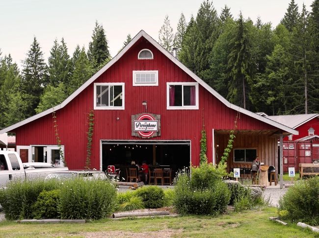
Tap Works Brewing Company, The 101 Brewhouse & Distillery, Banditry Cider, Persephone Brewing Company and farm and Sunday Cider, all Gibsons area.
Bruinwood Estate Distillery and Sea Cider Farm and Ciderhouse, Roberts Creek
The Backeddy Pub in Egmont for Pacific Northwest fare with inlet views.
Townsite Brewing for craft beer, Monks on Marine for a steak and Guinness pie and Costa Del Sol for Latin cuisine, all Powell River.
The Bricker Cider Company and TwentyTwo Taphouse in Sechelt. Also, El Segundo for Pacific tropical fusion and Jamar Canteen for Lebanese food and cooking demos. For comfort food try the Wobbly Canoe or the Gourmet Girl.
You can always refer to the BC Ale Trail for self-guided itineraries along the Sunshine Coast. Many establishments are dog friendly.
Outdoor Activities and Tours
When visiting the Sunshine Coast in winter you’ll need waterproof gear and to have extra clothing on hand. Plan any hikes—particularly in the off-season—and respect trail rules and any closures.
Wildlife such as elk, deer and coyotes are active year-round and blue herons and bald eagles can be easily spotted. Along the coast you will see seals and even sea lions, and molluscs and sea anemones in tidal pools. Guided wildlife tours are recommended for safety and best viewing. If you’re in Gibsons on a weekend the Nicholas Sonntag Marine Education Centre may be of interest.

Popular hikes and hiking areas include:
Soames Hill Park and “The Knob”, Gibsons, for sea and island views.
Iris Griffith Wetlands Park, Baker Beach Park and Mount Daniel/Garden Bay Marine Provincial Park near Madeira Park.
Pender Hill Park and beachcombing and birdwatching around Pender Harbour.
Cliff Gilker Park, Roberts Creek.
Smuggler Cove Marine Provincial Park and trails around Halfmoon Bay.
Suncoaster Trail and Skookumchuck Narrows Provincial Park near Egmont—witness the spectacular tidal changes of the Sechelt Rapids.
Sechelt area: Wakefield Road Beach, Kinnikinnik Park, Porpoise Bay Provincial Park and the lush forest of Hidden Groves.
Willingdon Beach Trail, Powell River.
Lund and area. Explore nearby marine parks, including Desolation Sound (by boat) and the Sunshine Coast Trail, Canada’s longest hut-to-hut hiking trail.
Creek areas and falls to visit in the winter are: Cliff Gilker Park, Langdale Falls, Homesite Creek, Kelly Falls and David Lam Falls in Blackwater Creek.

Inland from Sechelt, winter recreation fans enjoy the cross-country ski and snowshoe trails at Dakota Ridge. (Alpha Adventures organizes tours here.) The ski trails are well groomed and the snowshoe trails vary in difficulty. Just north are the trails in and around Tetrahedron, a wonderful provincial park for backcountry snowshoeing. Powell River is home to Knuckleheads, a sub-alpine area popular for snowmobiling and snowshoeing.
Tours are a great way to get out and about and experience the Sunshine Coast from a local’s perspective. Sunshine Coast Tours has a boating day trip to Princess Louisa Inlet (where you can see Chatterbox Falls); you can also charter a floatplane to view this hidden gem. Harbour Air Seaplanes offers scenic flights from Sechelt. Winter kayak or go on a boat tour of the Halfmoon Bay or Pender Harbour areas; various companies offer rentals and tours. Also, Sunshine Coast Shuttles out of Powell River drives people to/from the Sunshine Coast Trail and offers some supply services.
If you fish the Sunshine Coast is a dream come true, with its inland lakes and streams, meandering coastline and the Salish Sea. The Powell River area is famous for Chinook salmon and a winter fishing charter is an unforgettable adventure. Companies include OTB Charters (Pender Harbour) and Powell River Sportfishing and Coho Point Fishing Charters. All anglers in BC must obtain separate licences to fish in tidal (salt) water and/or freshwater.
NB: Visitor Information Centres across the Sunshine Coast may have shortened business hours in the winter.
TIP: If you find this blog interesting why not subscribe to the enewsletter and never miss another story!
Sunshine Coast Tourism reminds locals and visitors that they’ re on the traditional territories of the Tla’amin, Klahoose, shíshálh, Skwxwú7mesh, and Homalco Nations”. Its Know Before You Go webpage has details on safe, responsible and respectful travel.
Share your BC travel and camping pictures using hashtag #campinbc #exploreBC #bcnice #sunshinecoastbc
It’s always a great day to #CampinBC
Winter in Valemount, British Columbia: Where the Mountains Move You
If you want to embrace winter without the crowds, head to Valemount in east-central British Columbia, a village with epic snow-filled adventures and activities. But be prepared, this place takes the white stuff seriously.

Nestled in the Robson Valley, along and east of Highway 5 (Yellowhead Highway) and between the Rocky, Monashee and Cariboo mountains (to the east, south and west), Valemount is the closest town to Jasper, Alberta, which is just over an hour by car. This area gets snow and the locals live for it, with many of them working in the winter tourism industry and eager to show visitors what their playground is all about. There’s even a winter party in Valemount and it’s aptly called Winterfest. Mark your calendars for February 17, 2024.
Skiing and snowboarding
You won’t find a traditional ski mountain in Valemount, which means no lift lines either! Its unofficial hill is Crystal Ridge, Canada’s only sled-assisted ski area, with six semi-cleared runs (670 vertical metres) and a designated up-track for snowmobiles. The access trail is 12 kilometres of stunning mountain views, and the descent has fantastic tree runs and often pure powder.

Just outside of town is Five Mile Road, a logging road which, in the winter, is fantastic for tobogganing, skiing and dog walking. People can ski tour or snowmobile up the logging road and come down in style.
Cross-country skiing, snowshoeing, skating and more
Seasoned cross-country skiers and beginners can enjoy 14 kilometres of track-set trails at Jackman Flats (north of Valemount between the Rocky and Cariboo mountains) and Camp Creek (south of Valemount), both groomed by the non-profit Yellowhead Outdoor Recreation Association (YORA). With various loops to navigate, there are straightaways, curves and hilly stretches to have fun on. Camp Creek allows dogs and has a warming cabin and toboggan area.

Ungroomed ski trails can be found along the Fraser River at Tête Jaune Cache and overnight Nordic ski and snowshoe trips can be planned to cabins, though some are accessed via helicopter only. The McKirdy Meadow and Clemina Creek cabins are accessible via ski touring and snowmobile and are also maintained by YORA.

Overlander Falls Trail is close to town and Mount McKirdy is just minutes away and rewards snowshoers with remarkable lookouts. Snowshoeing and cross-country areas continue north and east of Valemount around the forests of Tête Jaune Cache, Rearguard Falls Provincial Park and Mount Robson Provincial Park, with the famous Mount Robson, the tallest mountain in the Canadian Rockies.
For outdoor skating, visit Cranberry Marsh (officially called the Starratt Wildlife Management Area) to glide on the lake, snowshoe or ski the six-kilometre loop, and bird watch while you’re at it. This area is very important for breeding and migration.
Indoor public ice skating takes place at the Canoe Valley Recreation Centre and drop-in curling is at the Valemount Curling Club on Elm Street, while Tourism Valemount has information on winter hiking and a booklet on geocaching.

If dog sledding is on your bucket list check out Cold Fire Creek Dog Sledding (250-968-6808; 1-877-295-8505). The company offers a range of tours, from 1 hour to overnight excursions.
Moose Lake and Shere Lake are great ice fishing options when conditions allow. A provincial fishing licence is required for all recreational anglers.
Snowmobiling/sledding
Unique to Valemount is its many kilometres of managed sledding (snowmobile) terrain. VARDA, the Valemount & Area Recreation Development Association, oversees four snowmobiling areas. Its website details where the sledding is permitted and lists trail pass information. Passes are required when sledding on VARDA-managed trails.
Expect amazing scenery and powdery snow, but also be prepared for variable conditions. You’re in the mountains after all. Visitors are encouraged to book a guide if new to the region and to always be aware and up to date on avalanche conditions. Snowmobile rentals are available from Alpine Country Tours and avalanche courses can be booked with Frozen Pirate.

Allan Creek is the first trail to open each season. It has snow bowls, meadows, frozen lakes and steep hills to explore. Clemina Creek offers excellent tree sledding, Chappel Creek boasts elevations from 1,830 m to 2,440 m and generally some of the best snow in the surrounding mountains, while the Westridge Family Loop (22 km) is fantastic for beginners and offers landscape views and a warming hut. Note that backcountry safety equipment is mandatory while at Crystal Ridge sledding hill.
Cat and heli skiing, scenic tours
Treat yourself to a cat skiing adventure with Cariboo Snowcat Skiing, or an unforgettable helicopter ride, guided ski touring or heli-skiing with Robson HeliMagic or CMH Heli-Skiing It’s recommended to book in advance with these companies, though cancellations do arise.
Whatever you get up to in Valemount this winter you will surely be moved by the magic of the mountains.
TIP: If you find this blog interesting why not subscribe to the enewsletter and never miss another story!
All visitors to the area who plan to venture out are strongly encouraged to educate themselves in avalanche awareness. For more information visit the Know Before You Go website, speak with a Tourism Valemount team member and check out the local webcams.
Note: Due to El Nino, the end of 2023 did not start out as a typical snow season in Valemount, and there was little snow in the community and at the lower lying areas such as Jackman Flats at that time. Check before you go regarding the condition of cross-country ski trails and ice conditions on Cranberry Marsh.
Tourism Valemount Visitor Centre
www.visitvalemount.ca; [email protected]
785 Cranberry Lake Rd, Valemount; (250) 566-9893
winter hours: Mon-Fri 8:30 am – 4:30 pm (closed 12:30 pm – 1:30 pm)
For more information on Valemount, read our summer article.
5 Ways to Enjoy Winter in Wine Country, Okanagan, British Columbia
As cooler temperatures emerge, and the snow blankets the vineyards, the valley transforms from a sun-soaked paradise to the ultimate winter destination. From champagne powder to frozen waterfalls to theatrical sleigh ride shows, the winter can be a magical time to explore the Okanagan.
1. Take A Winter Road Trip
With surrounding mountains and expansive lake views, Route 97 through the Okanagan Corridor is one of BC’s top scenic drives. In the winter, the sweeping landscape is enveloped in glistening tones of white and blue. Be sure that your vehicle or RV is ready for winter and always check road conditions in advance of your trip.

2. Winter in Wine Country
The colder weather brings with it the perfect opportunity to enjoy the elegant, bold reds the Okanagan is so good at crafting. Try out the exceptional vintages garnering international attention, and raise your glass to the upcoming year. Check out one of the many events at the Winter Wine Festival.
3. Winter Camping
What could be more magical than waking up in a winter wonderland? Enjoy the warmth of a roaring fire with mulled wine in hand, unwind in the great outdoors, and try your hand at winter camping. With many RV Parks and Provincial Campgrounds open year-round, escape to the Okanagan for the ultimate winter getaway.
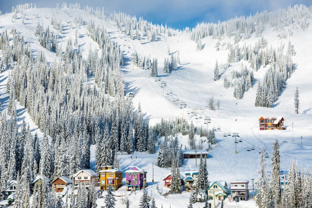
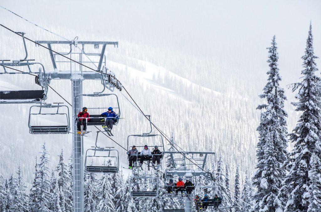
4. Ski Three Resorts in a Week
The Okanagan is home to a multitude of mountain resorts so you don’t have to travel far to hit the slopes. Known for unparalleled champagne powder, the mountains boast beautiful villages that will get you right into the festive spirit. And you don’t have to ski to enjoy the winter culture. From dog-sledding and ice-fishing to a horse-drawn sleigh ride to a rustic cabin in the woods – there’s an array of wonderful experiences for anyone looking to embrace the snow season.
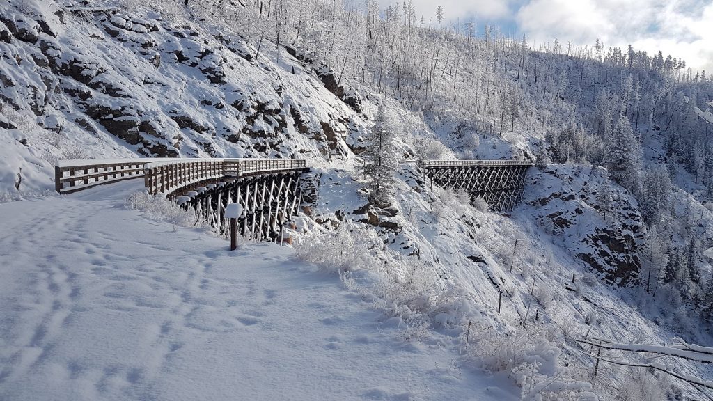
5. Snowshoe the Myra Canyon Trestles
Rent a pair of snowshoes this winter and explore the historic Kettle Valley Rail Trail. At Myra Canyon there are over 18 trestles and 2 tunnels to explore.
Whatever your winter preference this season, be sure to take a step back, enjoy the view, and welcome the festive charm of the Okanagan. To start planning your winter road trip visit route97.net. For more information on winter camping visit https://www.campingrvbc.com/winter/
TIP: If you find this blog interesting why not subscribe to the enewsletter and never miss another story!
For places to camp in BC this winter check out winter camping opportunities.
Share your BC travel and camping pictures using hashtag #campinbc, #explorebc
It’s always a great day to #CampinBC
Sooke to Port Renfrew: A Day Tour to Experience the Rugged Pacific Coast on Vancouver Island, British Columbia
Whenever friends or family visit Victoria and want to experience the rugged west coast but only have a day while on Vancouver Island, a drive to Port Renfrew is the place I take them! Along the route are sandy beaches, panoramic mountains and ocean views, sea lion caves, tidal pools, surfing, hiking trails and a variety of places to dine.

The route from Victoria downtown follows Highway 1 to Exit 10 (View Royal /Colwood) onto 1A that becomes Highway 14 to Port Renfrew. Highway 14 is paved to Port Renfrew and if you don’t stop it’s a four-hour return trip. Traffic is light on this highway so enjoy the drive.
Along the Highway 14 route to Port Renfrew are many places to explore – it would take days to see them all. I’ll suggest a few must stops along the way and other places you may want to consider!!
First stop for me is Serious Coffee located just past the traffic circle on the left in Sooke. My favorite is the granola bar and lunch sandwiches which are available to go. There are a number of other options for food/beverages in Sooke.
Before you depart from Serious Coffee in Sooke set the trip odometer!!
At Muir Creek , just 13 kilometers from Sooke, there is easy access to the ocean. Turn left at the bridge into the parking lot. A flat easy access trail leads to Muir Beach.
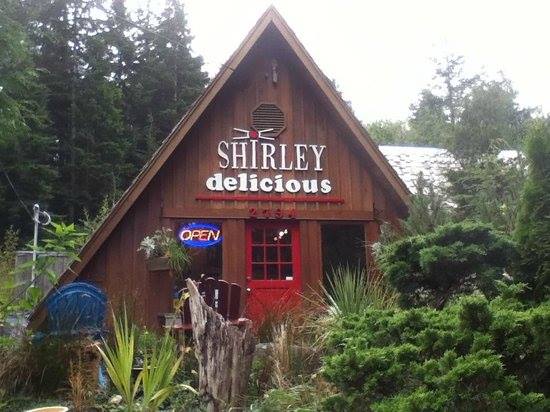
Sheringham Point Lighthouse, a Canadian Heritage Lighthouse, is 18 kilometres from Sooke. The access road is between the Fire Hall and Shirley Delicious. Turn left on Sheringham Point Road and proceed 1 km to the parking lot on the right side where there is a short trail to the lighthouse. The site is open to the public daily from 9 am to 8 pm. Caution is recommended as the shore is exposed to high winds and rogue waves.
For lunch or dinner we often take firewood for a favorite meal of hot dogs roasted over the open fire at French Beach Provincial Park – just 3 kilometers past the Sheringham Point Road. Ocean access to French Beach is an easy walk just a couple of minutes from the parking lot. Enjoy the beach walk and keep an eye to the ocean for whales and sea otters, and bald eagles perched tree top.
At Kilometer 28 from Sooke is Sand Cut beach. The parking lot is on the left adjacent to the highway. The hike down is about 15 minutes through forest with boardwalks and stairs to the beach.
Past Sand Cut beach parking lot, the highway dips down to the ocean through Jordan River. Cold Shoulder Cafe is a few hundred metres from Jordan River Regional Park just past the bridge. It’s on the corner where the highway makes a sharp right turn.

Continuing on Highway 14 to Port Renfrew, the next stop is Juan de Fuca Provincial Park. The park has four main areas: China Beach day use, China Beach Campground, the Juan de Fuca Marine Trail and Botanical Beach. Originally the trail was a lifesaving link from the graveyard of the Pacific that saw many shipwrecks along this coastal area.
China Beach day use is at Kilometer 35 from Sooke. The trail to China Beach starts at the end of the parking lot to the left of the entrance road. Although a bit of steep walk down it’s about 15 minutes along a wide and well maintained path to the beach. Enjoy the Sitka spruce, Douglas fir and cedar trees along the trail and when walking the beach watch for seals, sea lions and whales. This park is also a trail head for the Juan De Fuca Marine Trail that extends 47 kilometres to Port Renfrew.
For a stunning panoramic view of the Olympic Mountains in Washington State and Juan de Fuca Strait, take the North Main logging road right across from the entrance to China Beach day use. Proceed carefully up this active logging road for 2.2 kilometers and turn off the main road for about 100 meters. Although narrow there is sufficient space to turn around and return to Highway 14. Enjoy the views high above the water! Return down the logging road and turn right to Port Renfrew.
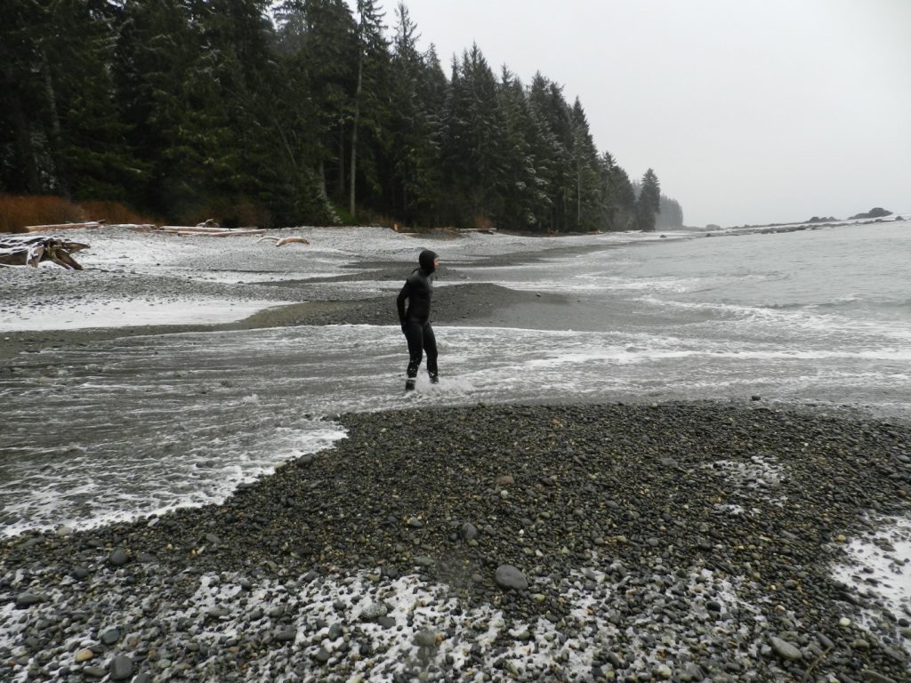
Continuing along Highway 14 to Port Renfrew at Kilometer 59 from Sooke is the turnoff to Sombrio Beach. This cobbled beach is popular for winter surfing and wilderness camping adjacent to the beach. If visiting during the winter a 4-wheel-drive vehicle might be required but most of the time the access road to the parking lot is accessible by car.
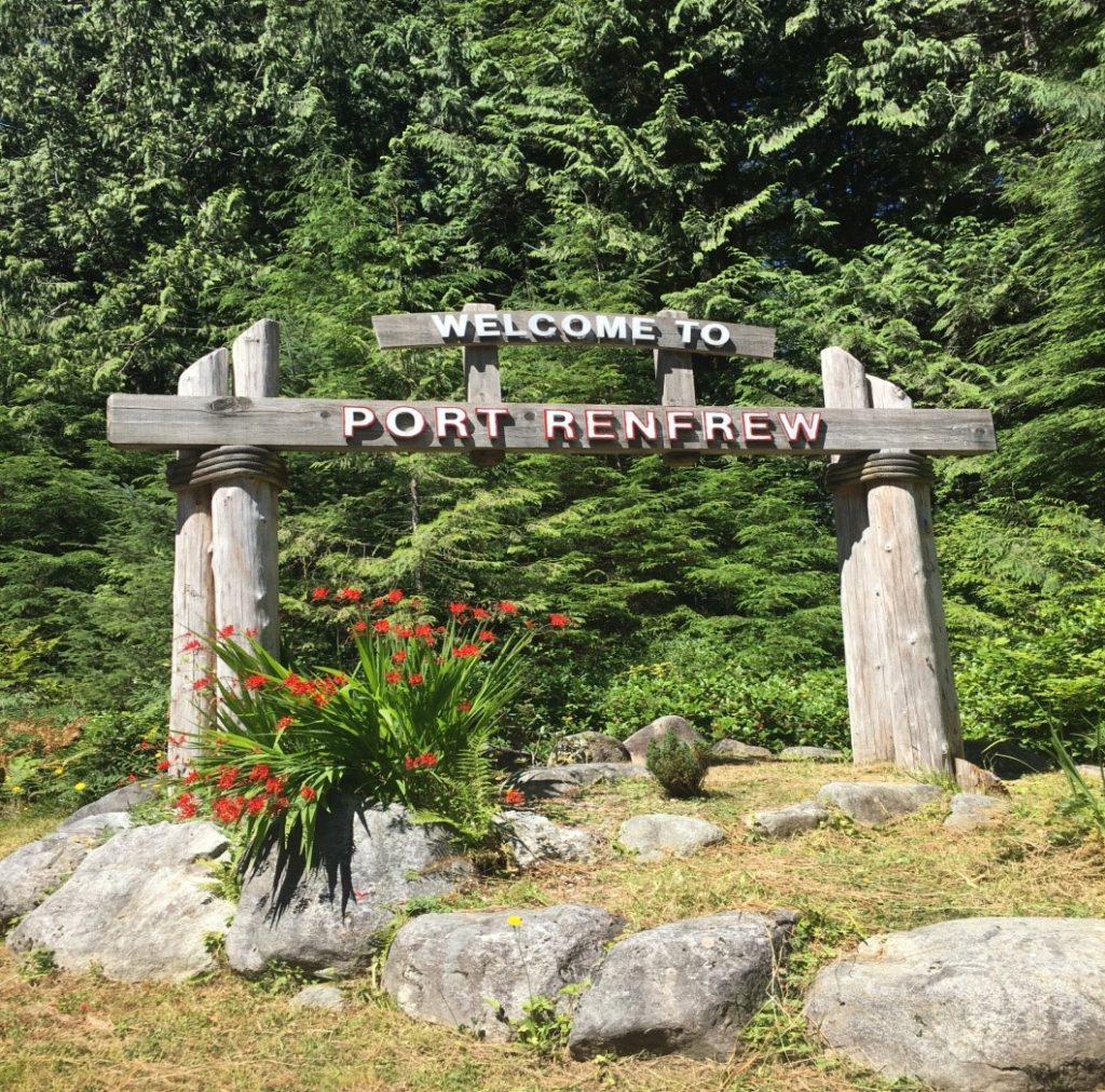
Proceed back to Highway 14, turn left and enjoy the short drive to Port Renfrew. If it’s summertime, and the flowers are blooming under the Welcome to Port Renfrew sign, stop as the humming birds may be feeding!!
Continue driving on Highway 14 as it takes you through Port Renfrew to Botanical Beach parking lot.
There is a coastal hiking trail along Botanical Beach that is the terminus of the Juan de Fuca Trail. The trail provides access to rugged beaches with geological rock features, and at low tide there are many rich tidal pools and kelp beds to view marine life. Explore the tidal area and see pools filled with brilliantly colored marine life. But remember to just view the marine life and avoid touching the water in these sensitive ecosystem pools. Sea urchins, barnacles, mussels, anemones and sea cucumbers are just some of the thriving intertidal life. I suggest “Seashore of British Columbia Guide” to identify mammals, fish, anemones, cucumbers, crabs and many other species.
If you want to experience viewing at its best visit Botanical Beach during low tide. I suggest checking the tide table for Port Renfrew. It’s best to arrive at the Park at least 1 hour before low tide. The time of the low tide will obviously determine when you have to depart. Please keep in mind when exploring the beaches and pools to be aware of wave activity and increasing water levels should the tide start coming in while you are exploring!!
So take your lunch with you and find a spot on the beach. If you didn’t bring a lunch then enjoy some of the food offerings in Renfrew. I like Bridgeman’s West Coast Eatery located on the dock at Pacific Gateway Marina. Other activities include kayaking and salt water fishing.
Enjoy the rugged west coast drive.
TIP: If you find this blog interesting why not subscribe to the enewsletter and never miss another story!
Also, check out the Pacific Marine Circle Tour.
For places to camp on Vancouver Island and elsewhere in British Columbia go to Camping & RVing BC Camping Map.
Share your BC travel and camping pictures using hashtag #campinbc, #explorebc
It’s always a great day to #campinbc
Vancouver Island, British Columbia Off-Season Adventures
‘Canada’s Mediterranean’, is how I like to refer to Central Vancouver Island. It offers more year-round outdoor recreational opportunities in mind-blowing scenery, than I’ll ever have time to enjoy in one lifetime. But I’m trying– and the best part is that so many activities are absolutely free!

To get you started let me give you just a couple of very different ‘cool season’ activities on different parts of the Island, along with two fantastic year-round RV parks located close to each mini adventure.
Life’s too short not to visit the best places, right? So let’s start this Island winter season sampler with…
…a Waterfall!
Stocking Creek Regional Park
Nothing screams “Vancouver Island” like a waterfall– we’ve got the tallest one in Canada here, but the one I’ll show you today is near the popular year-round Country Maples RV Resort. Stocking Creek Falls is just south of the neat little town of Ladysmith—and you HAVE to see their downtown Christmas light up if you’re here during the festive season!!

The Stocking Creek Regional Park is the start of a tranquil 2km loop trail in a lush rainforest alongside the clear babbling creek that leads to the stunning viewing platform above the picture-perfect waterfall.
And if you’re nimble and sure of foot (although it’s not recommended for safety reasons), it is possible to get behind the waterfall and look out through the water curtain—it’s so loud back there!!!
Check out the video of the recent winter hike I took there with our RV Snowbirds. Love this park!
Groomed Trail Snowshoeing at Mt. Washington Alpine Resort
And my second ‘quiet season’ Island adventure, is to head up Island to the Comox Valley, and get your rig set up in another great RV park near the ocean – Seal Bay RV Park in Courtenay.
After setting up camp, it’s a short drive inland and up to Mt. Washington Alpine Resort, which borders world famous Strathcona Provincial Park, BC’s oldest park, and home to Canada’s tallest waterfall with a drop of 440 meters!

It’s also one of the few places anywhere that you can ski AND have a view of the ocean!
One of the things they brag about in the Comox Valley is that you can golf in the morning and ski in the afternoon!
Although there are exceptions to all rules, on the East Coast of Vancouver Island, the expectation is that white stuff stays on the mountains, while at sea level, anything that comes down from the sky is rain. I love snow, but I don’t want home delivery– except Christmas Eve.
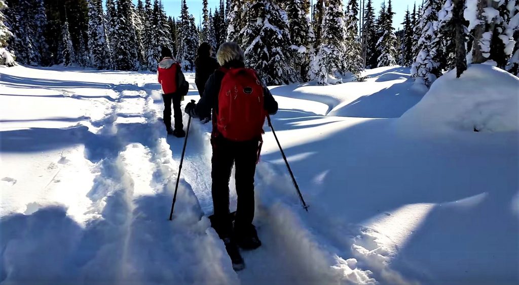
These days, I head to Mt. Washington to relax. I leave the downhill skiing aside, and instead, pack a lunch and head to the beautiful Raven Lodge just below the ski hill overlooking the valley and Paradise Meadows (and it is!). There you can rent some snowshoes and get out for a couple hours exploring the groomed trails in this stunning location.
Of course, the crisp mountain air and ‘shoeing works up an appetite, so the perfect ending is to drop off the snowshoes and sit under the massive wood beams of the lodge, and park beside the fireplace in a big comfy chair and enjoy lunch. They make fabulous, well priced lunches, or you bring your own, and just purchase a glass of wine or a hot chocolate while telling stories or dozing by the fire and enjoying the view over the valley.
Check out the video – you want to do this – and if you haven’t tried the modern snowshoes, it’s as easy as walking!
45 minutes later, you’re back down in Courtenay, and just outside of town, the tranquility of Seal Bay RV Park welcomes you home. It even has a stocked fishing pond onsite!
Visit Vancouver Island this Winter and Stay Awhile!
As I said, winter and summer sports are possible on the same day in Canada’s Mediterranean! While the rest of Canada deals with real winter, if you have an RV, you can still stay in Canada where your dollar goes farther, enjoy the lower off-season monthly RV park rates at award winning parks, and have an active lifestyle with endless adventures.
Special Places Google Map Makes it Easy
Visit my ‘Vancouver Island Special Places’ Google Map, and use your favourite digital device to find other amazing places to see and things to do on Vancouver Island. The map currently has over 60 different placemarks of ‘must see places’ and is growing.
The placemarks on the map for each location are colour-coded to indicate the activity level or fitness level needed to explore. Green ones are easy, Yellow a bit more challenging, then Blue, then Red. Clicking on a placemark will open a window of information about the spot, with a short write-up, and links to photos and videos showing you why each place is a jewel.
TIP: If you find this blog interesting why not subscribe to the enewsletter and never miss another story!
This winter, don’t hibernate—activate!
If this area interests you, check out our drive:
From Coast to Coast on Vancouver Island: Vancouver to Tofino
For other places to camp in the winter, plus more winter blogs and how-to information go to Winter Camping in British Columbia.
Share your BC travel and winter camping photos using hashtag #CampinBC
It’s always a great day to #campinbc
Osoyoos & Oliver, in the Okanagan, British Columbia – Offers Plenty To Do in the Summer

Osoyoos Oxbows
For a unique British Columbia experience, head to Canada’s only true desert destination: Osoyoos. Located at the southern end of the Okanagan Valley, Osoyoos averages over 2,039 hours of sunshine every year and temperatures regularly hit the upper 30s in July and August. Fruit and wine abound, making Osoyoos an ideal summertime vacation destination.
To maximize your time in Osoyoos, it is important to take the temperatures into consideration. Start your day early at the Nk’Mip Desert Cultural Centre to learn about the unique ecosystem that makes up the traditional territory of the Osoyoos Indian Band. After taking in the indoor exhibits, head outside (bring water and sunscreen!) and wander through over two kilometres of maintained trails complete with interpretive displays featuring everything from local flora and fauna to a reconstruction of a traditional village. Take the time to complete the upper portion of the loop through the hillside of wild sage and antelope brush – the views are spectacular.
If the heat during your walk at the Cultural Centre gets too much for you to bear, head to Osoyoos Lake which is known for being the warmest freshwater lake in Canada. Sẁiẁs (Haynes Point) Provincial Park is the perfect place to unroll your beach towel for a swim or simply to nap in the sunshine. If walking is more your speed, the park is also home to a lush wetland habitat and an interpretive trail through the marsh will delight birdwatchers of all ages.
Haynes Point Wetland
Once you have soaked up the sunshine at the beach, head for town and stop for some of the Okanagan’s best gelato at Roberto’s Gelato. Recommended flavours include Okanagan Apricot, Kulfi (Pistachio & Cardamom), Mango, and Chocolate Hazelnut.
In the afternoon, visit the Rattlesnake Canyon, a mining town themed amusement park complete with mini golf, go-karts, a rock-climbing wall, bumper boat, and the Tornado swing chair, which provides a great elevated view of Osoyoos.
If you are still seeking activity as the day goes on, consider heading to the Osoyoos Oxbows – a unique wetland ecosystem formed in the 1950s when the Okanagan River was straightened. Read about the Oxbows at the outdoor kiosk, and then meander along the trail listening for sounds of diverse migratory and resident birds. If you are really ambitious, bring your bicycle and cycle the 18-kilometre International Bike and Hike Trail heading north which runs parallel to the Okanagan River channel.

Oliver Winery
A 20 minute drive north is the town of Oliver. Described as the “Wine Capital of Canada” thanks to the more than 35 wineries that surround the town, Oliver is known for it’s abundant orchards, spectacular vineyards, and arid climate.
It is hard to speak about Oliver without speaking about wine. I am always particularly taken with wineries with unique attributes, and a few of my favourites are definitely in Oliver. Platinum Bench Estate Winery & Artisan Bread Co. forever has a place in my heart thanks to their pairing of great wine with amazing artisan bread baked on site. For me it is a toss up between their Gorgonzola & Fig and Double Cream Brie & Pear varieties. Delicious.
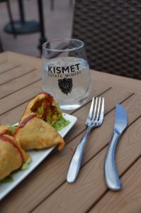
Kismet Winery, Oliver
If a laid back lunch is what you are after, without a doubt you need to visit the Masala Bistro at the Kismet Estate Winery. The location is convenient and the patio, from which you can sample very, very good Indian food, offers gorgeous views over the vineyards. I have to admit, when I was at Kismet there was a long line at the tasting bar so I skipped that part entirely and headed straight for the most perfect samosas I have ever tasted. The wine will have to wait for my next visit, I suppose!
If you have some time to spend in Oliver and you love the outdoors, a hike up McIntyre Bluff does not go amiss. Leaving from Covert Farms – a 650-acre organic farm and vineyard on a plateau north of Oliver – the McIntyre Bluff trail departs right from the wine shop. Parking is well marked and there is a trail log you can sign before you leave. The route heads through the Covert Farms property before starting uphill. The trail has a mostly gradual elevation gain over the next 2.5 kilometres, at which point you arrive at Rattlesnake Lake.
After Rattlesnake Lake, the trail first descends and then ascends more rapidly over the next few kilometres. Eventually the trail levels out and there is a short ridge walk before the view opens up and you are left breathless not from the climb but from the scenery. From the summit, views stretch south over Covert Farms, Oliver, and beyond. To the east, the cliff edge plummets over 850 feet to the valley bottom below. To the north, Vaseux Lake gleams. The entire trip took us about 3.5 hours and is perfectly rounded out with a stop at Covert Farms for wine tasting, a charcuterie board featuring farm-fresh products, and a wander around the property. With a little planning, and plenty of water and sunscreen as the trail is mostly exposed, McIntyre Bluff makes the perfect adventurous addition to any Oliver vacation.
Osoyoos and Oliver are the perfect places to kick back and relax in the sunshine for a couple of days while still offering a variety of activities that will be sure to keep the whole family entertained.
TIP: If you find this blog interesting why not subscribe to the enewsletter and never miss another story!
For places to camp in the South Okanagan and elsewhere in British Columbia go to Camping & RVing BC Camping Map.
Post your BC travel and camping photos using the hashtag #CampinBC
Exploring North Vancouver Island, British Columbia – Port McNeill & Port Hardy to Coal Harbour & Cape Scott
After a busy first-four days we moved campsites from Alder Bay RV Park and Marina to Cluxewe Resort, located just 15 minutes north of Port McNeill. Cluxewe Resort is centred on the ancestral land of the Kwakiutl First Nation and is indigenous owned and operated by the friendliest helpful staff. This resort is open year-round with lots of camping options (ocean front, full service, no service etc.) and cottages available for rent. We walked for hours on the rocky beach in each direction of the resort, enjoyed beautiful sunsets and watched campers fishing for salmon off the shore.

From our new homebase, we headed over to Coal Harbour (no, not the one in Vancouver). It was a short 30-minute drive from the campsite on paved roads. Coal Harbour is located on Quatsino Sound which provides boat access to communities such as Holberg and Port Alice. It is a busy harbour with float plane and boat traffic.
We took the mail boat over to Quatsino from the dock in Coal Harbour, a small boat-access-only community with a population of only 43. The “mail boat run” delivers mail on Mondays and Thursdays, costs $25pp, and is about a one-hour trip.
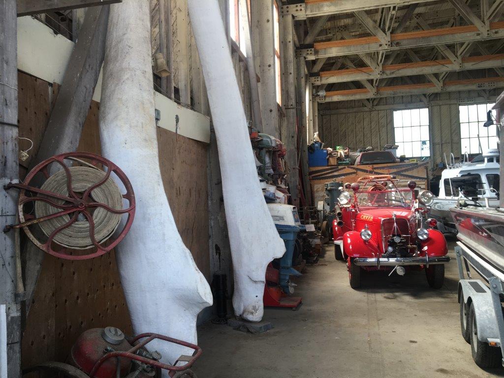
After our boat ride to Quatsino, we visited the museum in the Float Plane Hanger by the dock. We learned all about its whaling history; the industry closed in 1967 due to declining stock. It also has a history of being an air force base during World War 2, a mining town (it had a 350 metre deep open-pit copper mine which closed in 1996) and now focusing on logging, tourism and fishing. The museum has a huge 6 metre jawbone of a blue whale, apparently the largest in the world! We also checked out the chain saw display, old engines and a 1917 Ford Model T and a 1928 Ford Model A.
The next morning, at about 10:00 am, we headed off on our day-long trip to Cape Scott Park on the northern tip of the Island. Be prepared for 65km each way on a dusty, bumpy logging road. We have a 4-wheel drive truck which handled the roads well, but also passed a number of low-clearance cars which also seemed to be safely navigating the road. The road was in fairly good condition as much of it had been recently graded; but from what I had read, conditions are constantly changing. There are also lots of warning signs as this is an active logging road, and the logging trucks have the right-of-way. We were incredibly impressed by the accurate signage all the way to the parking lot at Cape Scott Park.

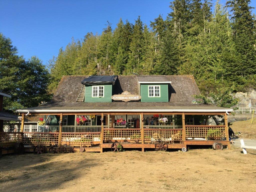
First stop on our trip was the small village of Holberg (population of 35), about 50km along the road. At one time Holberg was a floating logging camp; now, just the remnants of the old wood pilings can be seen on the inlet. A must-stop is the Holberg Pitstop; it is a general store and features lodging. You can stock up on everything from sunscreen to beer and stay overnight in one of the newly-renovated rooms. Next trip we will definitely stay overnight, so we can explore more of the west coast area.

After the “pitstop” we continued on our way to Cape Scott Provincial Park; we were impressed with the road improvement after Holberg (or maybe we were just getting used to the bumps). We arrived at the parking lot around noon with a few spots left and headed off on the trail to San Josef Bay, a 45-minute one-way hike along a well maintained crushed-gravel trail. There are pit toilets at the trail head, as well as, at San Josef Bay. There are also bear caches at the bay and a number of beach-side campsites. We planned ahead so we arrived at low tide, so we could walk from San Josef Bay to Second Beach. It was a gorgeous, sunny day and we loved walking in the shallow surf on the beautiful, soft, sand. Beach features included caves, sea stacks, and wildlife. Other hikers continued along the full 26km Cape Scott Trail.
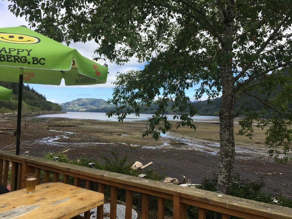
After our visit to San Josef Bay, we returned to Holberg and the Scarlet Ibis Pub for nachos and a nice, cold drink on the patio overlooking Holberg Inlet. Known for being Vancouver Island’s Most Remote Pub, we found the staff incredibly friendly and the food, good. It was great to sit on the patio with the locals and learn more about the area.
Last stop before heading back to our campsite was the car wash just south of Port McNeill to get our dusty truck cleaned up and ready for our last adventure day before heading home.
The next morning, we went to Storey’s Beach on Beaver Harbour Road just south of Port Hardy. The tide was out, and we felt like we could walk for miles on the blackish sandy beach. This is a beautiful stretch of sand that I would highly recommend. It is good for kayaking too.
TIP: If you find this blog interesting why not subscribe to the enewsletter and never miss another story!
We spent the rest of the day enjoying the beach and sunset back at Cluxewe Resort and some barbequed salmon from Scarlet Point Seafoods in Port Hardy. A great way to finish off our North Vancouver Island trip!
To read about the first half our trip go to Sayward to Port McNeill.
For camping accommodations in this area and elsewhere in British Columbia check out the Camping Map.
Share your BC travel and camping photos using hashtag #campinbc #explorebc
It’s always a great day to #campinbc
Exploring North Vancouver Island, British Columbia – Sayward to Port McNeill
After years of camping on Vancouver Island, we decided this summer we would head to the north end of the island. The furthest north we had travelled was Campbell River and we really wanted to explore more remote locations.
In 8 days, we travelled north from Campbell River to Port Hardy and west from Port Hardy to Cape Scott Park. We explored communities such as Sayward, Telegraph Cove, Port McNeil, Port Alice and Port Hardy and many smaller communities in between. If you are looking for a camping trip filled with beaches, cooler temperatures, small remote communities and abundant wildlife then keep reading, we found it all.

Our first stop was the Village of Sayward, located about an hour north of Campbell River. Sayward is home to about 350 people with logging being a very prominent industry. Locals describe Sayward as a remote hidden gem that stays green most of the year due to the high amounts of rain. Plan to spend some time at Kelsey Harbour watching the sea lions, kayakers launching their boats and the logging operations in the bay. Western Forest Products operates a dry land log sort; this was something new for me to see the logs being dumped into the bay and the tugboats moving them around. I was surprised to see how the tugboats lean way over in the water without tipping over.

Before leaving Sayward, we made a quick stop at the unique Cable Café which was unfortunately closed at that time, but it is worth having a look at as its outside walls are covered with logging cable.
If you are interested in seeing the Dry Land Log Sort in action check out this video https://www.youtube.com/watch?v=PqkI-C82I1A

Moving north from Sayward, we stopped at the Keta Lake rest stop for a picnic lunch. It was a great shady place to stop with 4-5 picnic tables, outhouses and a couple of trails down to the lake.

Next stop was the community of Woss in the Nimpkish Valley (75km north of Sayward), home to the longest working railway in North America. We visited the Woss 113 Heritage Park celebrating 100 years of railway with interpretive signs describing the history of the town, the link to the logging industry and the railway. Locomotive 113 is on display, which is a steam engine that was built in 1920 in Portland and restored in 1988. The town has cell service, as well as two different types of electric-charging stations.

Next stop and our home for the next four nights was Alder Bay RV Park and Marina. Alder Bay is located just south of Port McNeill, open year-round with over 80 sites which are suitable for big RVs, as well as campervans and tents. Positives about this RV park include the super clean bathrooms, 8-minute showers for only $1 and the beautiful sunsets.
We had four jam-packed days while we stayed at Alder Bay; we spent an evening walking the boardwalk at Telegraph Cove and enjoying the setting sun. It was the perfect time for us to avoid the daytime crowds of tourists and those arriving for whale-watching trips. The General Store (established in 1942) is a welcoming business by the boat launch with all kinds of amenities including local products and wine/beer. Along the boardwalk are many of the original cabins which have been restored and available for vacationers to rent through Telegraph Cove Resort. It was fun to walk along the boardwalk and read the historic stories in front of each of the cabins. The Whale Interpretive Centre is located at the end of the boardwalk, just past the pub and restaurant, a must see for our next visit as it had closed at 6:00 pm.

The next day we headed over to Port Alice, about an hour’s drive (paved road) from our campsite. Port Alice was named after Alice Whalen, mother of the four Whalen Brothers who founded the Whalen Pulp and Paper Company which built a pulp mill in Port Alice in 1917. After exploring the town and the 3km Sea Walk along the water we headed inland on the Alice Lake Loop to the Devil’s Bath Cenote, Canada’s largest cenote (unfortunately, no swimming access) and the Eternal Fountain, a stream with a beautiful waterfall that disappears into an underground cave. Both were accessible by logging roads and have short walks through the forest (pick up a map at the Port Alice Visitor Centre or use Backroad Maps).

After a rest day, we took the ferry from Port McNeill to Alert Bay (Cormorant Island) and Sointula (Malcolm Island). Check out the blogs written about Alert Bay – Island Hopping on Northern Vancouver Island, BC: Port McNeill to Alert Bay and Island Hopping on Northern Vancouver Island, BC: Port McNeill to Sointula.

Highlights at Alert Bay were the indigenous masks and beautiful drums at the U’mista Cultural Centre and at Sointula, the old buildings and the Beautiful Bay Trail at Bere Point Park. A little tip – you can visit both islands on the same day if you let the terminal attendant know, without double the fares!
Overall, an excellent first four days into our North Vancouver Island camping adventure!
For the second half of our trip see Port McNeill & Port Hardy to Coal Harbour & Cape Scott.
TIP: If you find this blog interesting why not subscribe to the enewsletter and never miss another story!
For camping accommodations in this area and elsewhere in British Columbia check out the Camping Map.
Share your BC travel and camping photos using hashtag #campinbc #explorebc.
Published: August 3rd, 2023
Connect With Us