Super Natural Cariboo enriched with gold, range cattle and wildlife
This exceptional RV adventure tour into the rugged Cariboo mountains in central British Columbia, traverses diverse land rich in gold, copper and vast cattle ranches. Thousands of Pacific salmon migrate to spawn in tributaries of the Upper Fraser River.
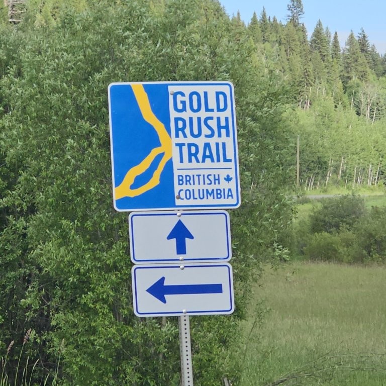
Gold discoveries in the mid-1800s lured 30,000 desperate sourdoughs (gold miners and prospectors so called because of their reliance on sourdough starter for baking) into the Cariboo in search of riches. Historic communities and ghost towns remain today. This tour explores many of those wagon train routes along the Gold Rush Trail.
The total distance of this Cariboo circle tour is 2,500 km / 1,550 mi and driven over 19 days. It is divided into four sections with helpful maps for trip planning. The tour is designed to provide ample time for wildlife viewing, exploring small communities, scenic vistas, and quiet nights in campgrounds.
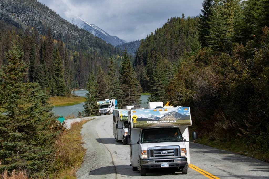
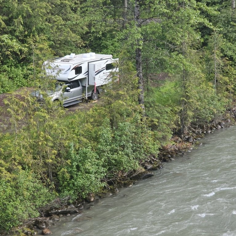
The estimated fuel cost is CAN$1,200 at an average $2/litre for diesel (approx. $1.90/litre est. for unleaded gasoline – prices are 2025). This adventure tour was undertaken in a skookum 6.7 litre turbo diesel 4×4 truck with mounted camper and the extra space of a slide-out, together weighing 8,000 lbs. Motorhomes and campers are also suitable for this trip.
The RV circle tour starts and ends in Vancouver. If renting an RV, it can also be joined from rental stations in Calgary at Kamloops, from Edmonton at Jasper, and at Prince George from Whitehorse in the Yukon.
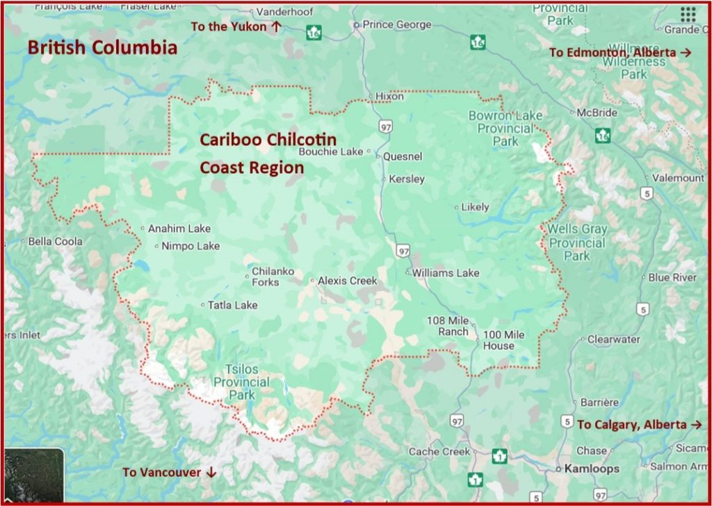
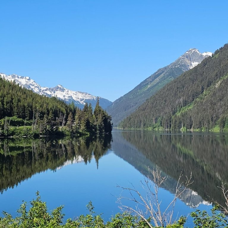
The Cariboo is part of British Columbia’s Cariboo Chilcotin Coast Region. Located in the central interior of the province, it’s bounded by the Cariboo Mountains in the east and the Coast Mountains in the west. It stretches north/south on Hwy 97 from Cache Creek in the south to Hixon in the north, and east/west along Hwy 20 from Williams Lake to the Pacific Coast. Ancient cedars grow in the Interior Rain Forest. Second generation aspen, Douglas fir and lodgepole pine thrive on the Fraser Plateau, and Ponderosa pine proliferate in the arid southern Cariboo.
The Premier Range within the Cariboo Mountains contains seven peaks over 3,050 m / 10,000 ft elevation, named after Canada’s prime ministers starting in the 1920s, including Sir Wilfred Laurier, Louis St. Laurant, Lester Pearson, and Pierre Elliot Trudeau.
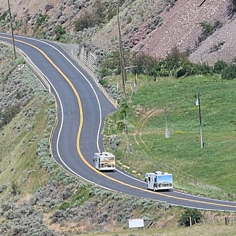
Section 1: Vancouver – Hat Creek Ranch – 150 Mile House. The tour starts on the Sea-to-Sky Hwy 99 in Vancouver as it winds along Howe Sound to Squamish and Whistler, Pemberton and Lillooet. The highway climbs through the Coast Mountains to Hat Creek Ranch historic site where the route connects to Hwy 97 and the Fraser River, and then north to Williams Lake. There is an optional side-trip along the Fishing Highway 24 in the Lake District.
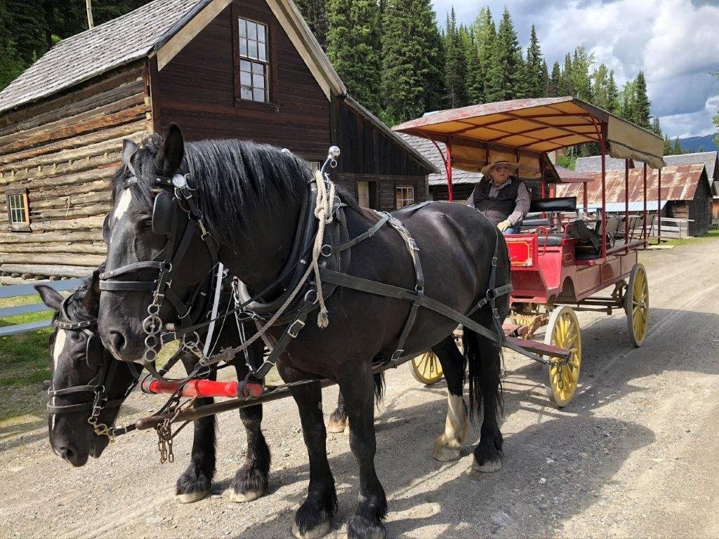
Section 2: 150 Mile House – Williams Lake – Barkerville. Section 2 wanders along secondary roads in cattle country bordered by the rugged Cariboo Mountains, overshadowing the Fraser Plateau from Williams Lake and Quesnel, and north from 150 Mile House on Hwy 97 to Prince George. Take Hwy 26 to Barkerville National Historic Site that brings the Cariboo Gold Rush fever to life through re-enactments, stagecoach rides and costumed guides. Traverse the Fraser Plateau to Prince George.
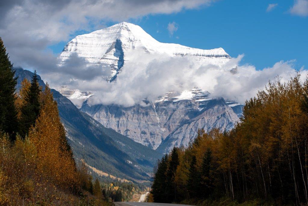
Section 3: Barkerville – Quesnel – Prince George – Jasper. Follow the Fraser River east from Prince George on the Yellowhead Hwy 16 through Robson Valley to Tête Jeune Cache. Then stand in awe at the view of Mount Robson, the highest peak in the Canadian Rockies and separated from Jasper National Park by the Continental Divide in Yellowhead Pass.
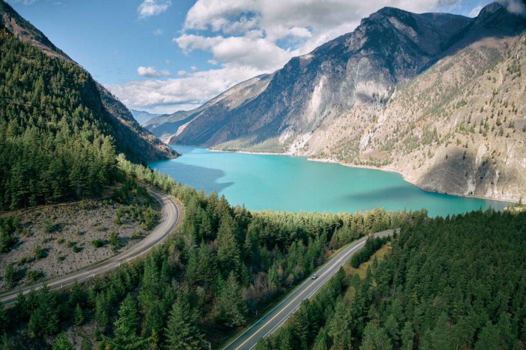
Section 4: Jasper – Kamloops – Lytton – Hope – Vancouver. The final section heads south on Hwy 5 through the North Thompson Valley to Wells Gray Provincial Park, where the North Thompson River connects to the Fraser River at Ashcroft. The return portion of the route continues on Trans Canada Hwy 1 from Kamloops through the Fraser Canyon and past treacherous Hells Gate. The Fraser River enters the Fraser Valley and the fertile farmlands of the Fraser Delta from Hope to Vancouver on the Salish Sea.
Section 1: Vancouver to Hat Creek Ranch and 150 Mile House
The Gold Rush Trail followed two different routes. The “old” wagon road traced the original fur trade trail from Lillooet, over the hump to Pavilion Mountain and on to Clinton. The second, or “new” Cariboo Road built for stagecoaches and wagons traversed from Yale to Lytton, and then to Ashcroft to connect to the old road at Clinton. The route continued to Lac La Hache and 150 Mile House to Soda Creek. As more gold was discovered, the wagon road was punched through from Quesnel to Barkerville in 1865.
The Gold Rush Trail was also called the Cariboo Wagon Road where it was carved out of the Coast Mountains to supply burgeoning settlements in the goldfields. Follow the signs along the Gold Rush Trail. Some parts are found on Forest Service Roads which may not be numbered, and even the road names can change.
Distant panoramic views of the Fraser River are seen from the bench lands at Pavilion and Fountain Meadows.
Directions & Estimated Driving Time: From Vancouver head north on the Sea-to-Sky Hwy 99 to Whistler. Continue through Pemberton and Lillooet to Hat Creek Ranch. Turn north onto Hwy 97 to 150 Mile House. Vancouver to Hat Creek Ranch 310 km / 193 mi. Hat Creek Ranch to 150 Mile House 180 km / 112 mi. Total mileage 500 km / 310 mi over four days
Where to Camp: For campgrounds and parks available in this area go to Camping & RV in BC and search under the appropriate community.
Things to see and do on the way to the Cariboo
Shannon Falls cascades 335 m / 1,100 ft and is visible from alongside Hwy 99. Take a short trail to the foot of Shannon Falls Provincial Park (no camping). Keep an eye out for climbers scaling the 700 m / 2,300 ft granite face of the famous Stawamus Chief.
Ride the Sea to Sky Gondola and cross the Sky Pilot Suspension Bridge along the ridge trail at the Summit. Step out on to cantilevered viewing platforms for a panoramic view of Howe Sound and the chain of peaks in the Coast Mountains.
Britannia Mines Museum. Go underground and experience copper mining in the early 1900s through interactive demonstrations. Britannia Mines was one of the largest copper mines in BC.

Squamish hosts the Railway Museum of British Columbia. Once the railyard for the BC-owned Pacific Great Eastern Railroad, and later BC Rail, the Squamish open-air rail museum hosts 95 vintage locomotives and heritage rail cars. The railway was built to haul lumber, pulp and copper ore from the Interior to the Coast for export to world markets.
Whistler is 59 km / 37 mi north of Squamish and was one of the hosts of the 2010 Winter Olympics and is a year-round international destination. Take the Peak-to-Peak Gondola high across Fitzsimmons Creek for a panoramic view of Whistler and Blackcomb Mountains. Whistler Museum highlights the history of the all-season resort development. The annual week-long international Crankworx festival attracts visitors to one of four world-class mountain biking events. Take the Valley of Dreams walking tour or a short hike in to the “Train Wreck” art gallery.
Lillooet. A further 131 km / 81 mi on Hwy 99, a “Mile 0” cairn marks the beginning of the Cariboo Wagon Road. The museum houses the bell from the original St. Mary’s Anglican church. Follow the local tales and politics in clippings written by Margaret “Ma” Murray, a newspaper editor and journalist for several decades that earned her the Order of Canada.
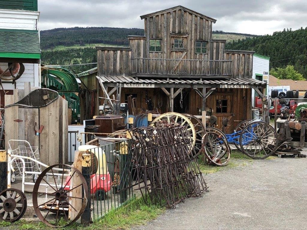
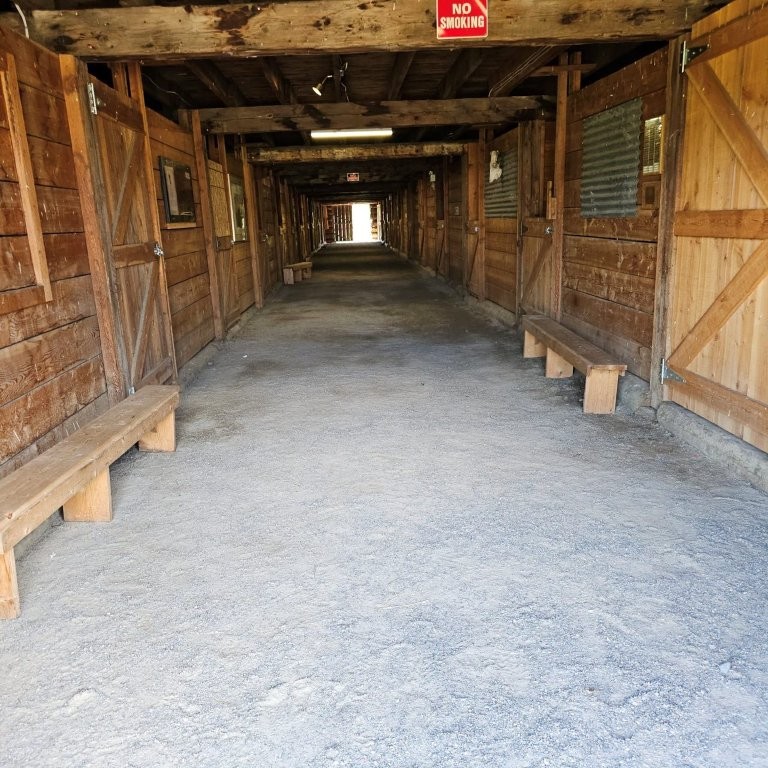
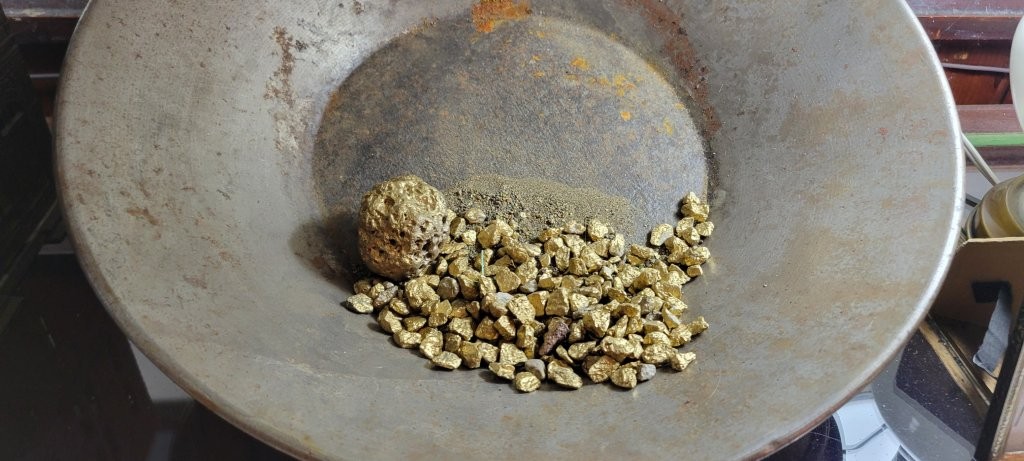
Hat Creek Ranch is 77 km / 48 mi from Lillooet and was established as a major stopover point for wagons and stagecoaches. The gold rush brought thousands of prospectors to pan the banks and tributaries of the Fraser and Thompson Rivers. The historic open-air museum offers stagecoach rides and interpretive signs outlining the history of gold mining and ranching in the area.
The first route followed the Fraser River from Yale to Lytton, Ashcroft, and Quesnel, and then by sternwheeler to Soda Creek. Wagon trains had a tough road to Wells and Barkerville. Another route followed native trails more directly and even more arduous through the backcountry from Likely.
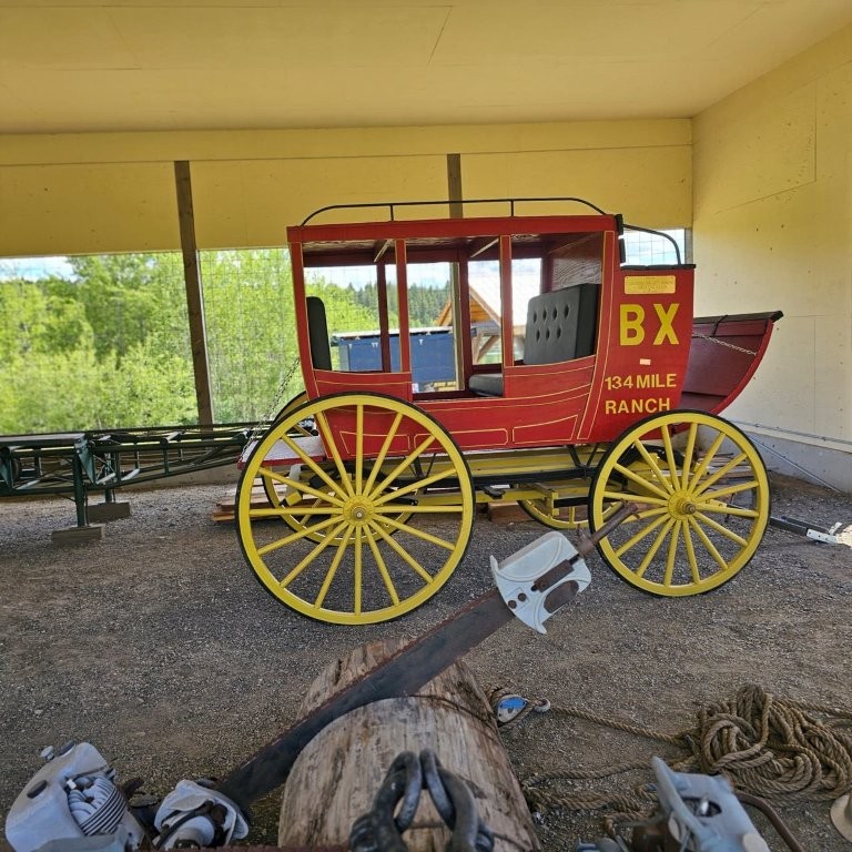
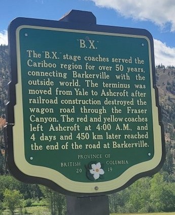
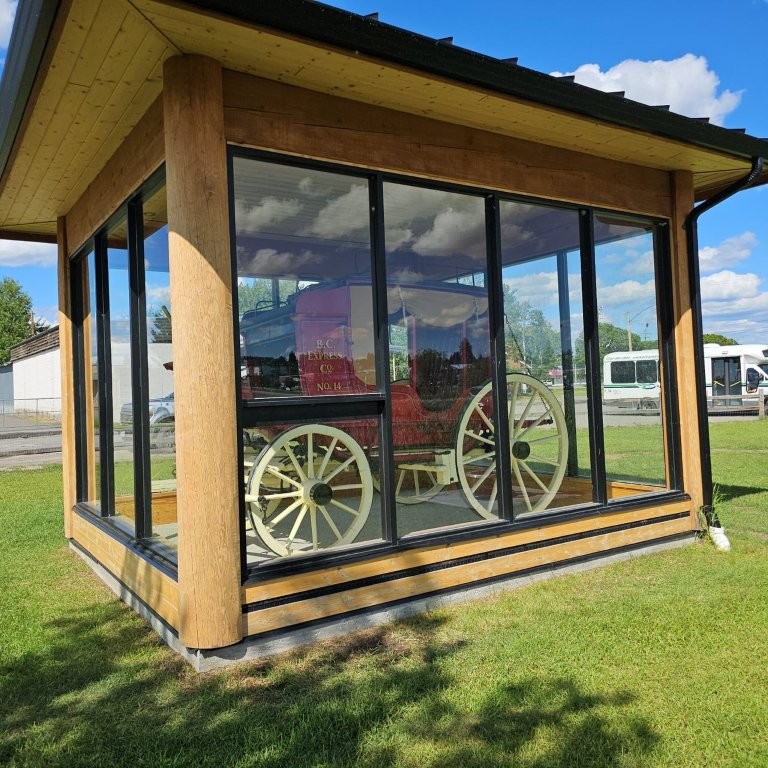
F.J. Barnard Express was founded in 1806. BX stagecoaches served the Cariboo between Yale and Barkerville for over 50 years. For many of these years only the driver guarded the gold dust and nuggets on the way out. The terminus was moved from Yale to Ashcroft after railroad construction destroyed the wagon road through the Fraser Canyon.
The building of the Pacific Great Eastern Railway (PGE) that began construction in 1916 put an end to the stagecoach era. The PGE had several monikers, best known as the “Province’s Great Expense”, or “Prince George Eventually”.
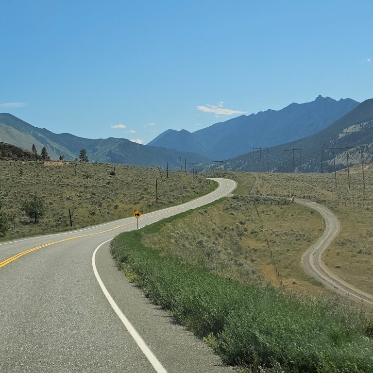
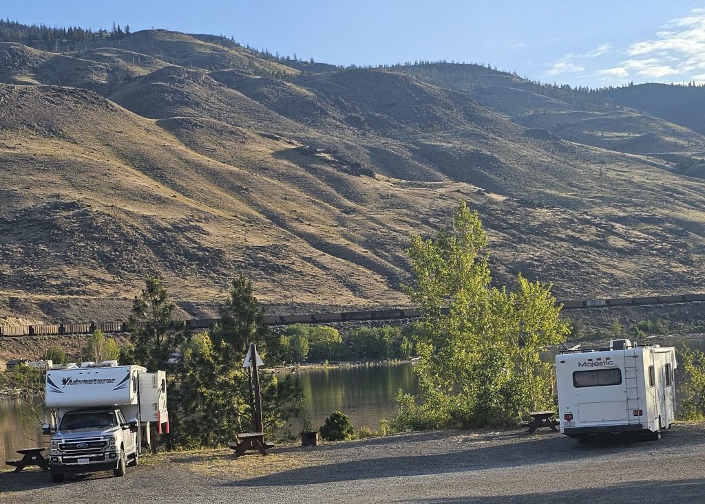
Cache Creek is in the North Okanagan region 11 km / 7 mi south of the junction of Hwy 99 and Hwy 97. The land is arid with sagebrush, tumbleweed and cactus vegetation. Temperatures can soar to 40C during summer. A good place to take a break. It is also a gathering place for vintage cars.
The climatic zone from the Coast to Interior transitions gradually where the heavily forested Coast Mountains create a rain shadow blending into the montane landscape of the Southern Cariboo Region.
Clinton. Leaving Cache Creek head north on Hwy 97 for 40 km / 25 mi to Clinton. A visitor booklet describes the Clinton historic walking tour past the government offices, jail, memorial hall, Chinatown cabins, and Palace Hotel.
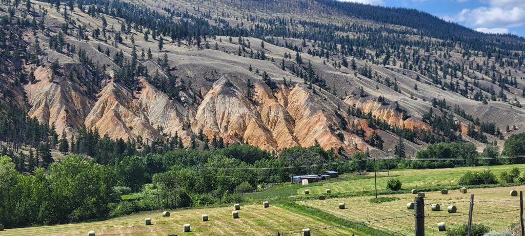
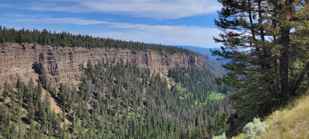
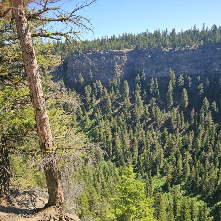
Chasm Provincial Park. Aptly named for the 300 m / 980 ft high cliffs that overlook the gorge running for 8 km / 5 mi along the Fraser Plateau. The chasm was cut through by lava flows during the Ice Age, creating the “Little Grand Canyon”. Take a loop-road to the fenced viewpoints along the western ledge.
(Read our blog and check out the video at Chasm Provincial Park – A Hidden Gem in British Columbia’s Cariboo Region).
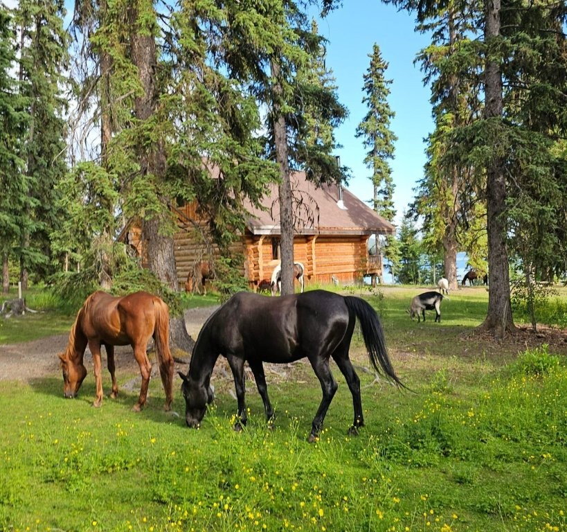
Green Lake Resort Area. Turn right at 70 Mile House. Emerald Lake in Green Lake Provincial Park has reservable campsites, an information centre and sani-dump. Flying-U is a working ranch offering trail rides through the extensive aspen groves surrounding the lake.
(Read our blog and check out the video at Green Lake Provincial Park in British Columbia’s Cariboo is a Great Destination for a Camping Holiday).
Side Trip along Hwy 24 between Hwy 97 south of 100 Mile House and Hwy 5 to Little Fort
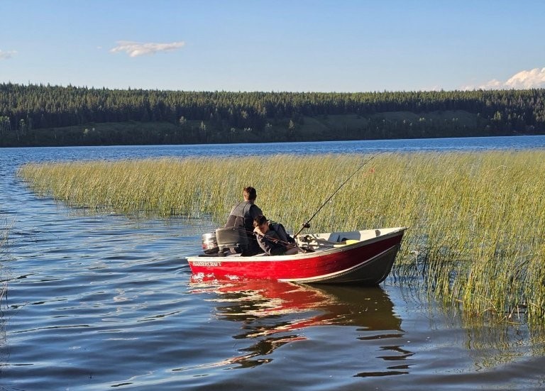
This side trip travels past a chain of lakes, known as The Fishing Highway. Also called the Interlake District, there are dozens of lakes surrounded by summer cottages and fishing resorts. Some of those lakes include Bridge, Fawn, Horse, Loon, Sheridan and Hathaway Lakes. Some private campgrounds provide RV sites for one- or two-nights to accommodate those on an RV tour that do not need a long-term stay. Distance from Hwy 97 turn-off to Hwy 5 is 97 km / 60 mi (plus return trip).
Things to See and Do on the Side Trip Along the Fishing Highway
Lone Butte. A forty-thousand-gallon water tower is all that remains in a railroad park from the heyday of steam engines when the Pacific Great Eastern Railway railroad ran to Prince George. Visit Smith’s emporium for antique lighting fixtures. A single butte just east of the village has communication towers at the end of a short climb.
Horse Lake. A long, deep lake with rainbow trout and char. The volunteer fire department, like many in villages in the Cariboo, are without central water mains and stand ready with a hose truck, pumper and a water wagon.
Bridge Lake Resort Area. Famously known for 100 fly-fishing lakes.
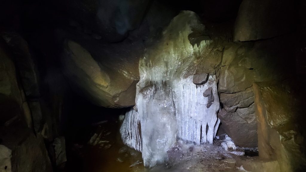
Bridge Lake Ice Caves. A unique geological feature of basalt cliffs and caves. Snow and rain seep into the crevices to refreeze into ice. They were once used for cooling produce. Outdoor fitness stations are marked by totem poles along the short trail to viewing platforms and a lookout.
(Read our blog and check out the video at Bridge Lake Ice Caves in British Columbia’s Cariboo: A Cool Place to Visit on a Hot Day).
Boat and tackle rentals are available at several short-stay RV parks in the Timothy Lake and Bridge Lake resort areas.
Mahood and Canim Falls. For an extra side trip, branch off to the north half-way between Lone Butte and Bridge Lake on Mahood Lake Road. Follow the gravel road for just over an hour to two sets of falls joining Mahood and Canim Lake on the western slopes of Wells Gray Provincial Park. Note: there are no safety fences along the canyon trail to the falls.
Note: Be sure to check fishing regulations that can differ from lake to lake. A BC recreational freshwater fishing licence is required. Contact the Freshwater Fisheries Society of BC.
Return to Hwy 97 and continue north.
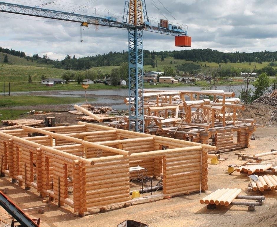
100 Mile House lays claim to the Log Home Capital of Canada where spruce and pine logs are precision cut and masterfully assembled into large luxury homes, then disassembled to be shipped across the country. The visitor centre is noted for 12 m / 40 ft long cross-country skis and 9 m / 30 ft ski poles to announce winter activities on the Fraser Plateau.
South Cariboo Visitor Centre has a pamphlet describing where pieces of the Gold Rush Trail are still visible on either side of Hwy 97. Most of the roadhouses, spaced within a day’s ride of each other, have long gone.
A brochure details the Canadian Pacific Air Lines DC-6 domestic Flight 21 that crashed into marshland near Dog Creek. It describes the location of the crumbled wreckage about 40 km / 25 mi west of 100 Mile House. A CBC podcast outlines the ominous crash site, and details of the suspects in the unsolved murder of all 52 people onboard in July 1965.
108 Mile Heritage Site. Built as a posthouse on the Cariboo Wagon Road in 1867 it became home to a championship line of Clydesdale horses when a breeding barn was erected by Captain Watson in 1908 as a stable to house the one hundred imported purebred horses. Visit the icehouse, trapper’s cabin with restored sod roof, general store and McNeil heritage home reflecting the aristocracy in those days. The ladies wore hats and lace-up boots. The gentleman’s room contains rifles and a bed pan.
Visitors can be jailed for failure to make a small donation to the Historical Society and be required to pay- up for bail money to be released from the clink! Ample RV parking and picnic sites.
There’s a tale of a murder mystery that describes a serial killer operating at the 108 Mile Ranch, who would befriend lonely miners, enticed by girls and cheap liquor, poison them and steal their gold. It could be that the grisly murders of fifty prosperous prospectors left a million-dollar treasure yet to be found around the grounds!
Lac la Hache. The town stretches along the shoreline of the lake. Take the surfaced back road east to Ten-ee-ah Wilderness Resort in the direction of Timothy Lake Resort Area. Lakeside campground with electric sites, trail rides, canoe rentals and a dining room in a Swiss-styled lodge.
Continue on the back road and turn left at junction onto Redeau Lake Road towards Hwy 97 and 150 Mile House and Williams Lake. From Lac la Hache to Williams Lake via the back road is 87 km / 54 mi. Rather than driving the back road you may choose to continue on Hwy 97 to 150 Mile House.
150 Mile House. A small ranching community on the Cariboo Wagon Road. A little Red Schoolhouse historic site still functions as a one-room classroom.
Section 2: 150 Mile House to Barkerville
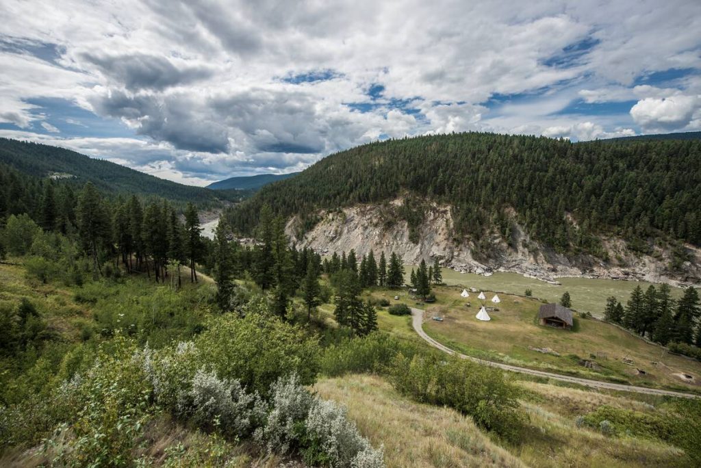
This section of the circle tour concentrates on the goldfields east of Hwy 97 and the broad Fraser Plateau between the Fraser River and the Cariboo Mountains.
Directions & Estimated Driving Time: From 150 Mile House, north-east to Likely via Likely Road 97 km / 60 mi. Return from Likely. Head north on Hwy 97 135 km / 84 mi to Quesnel and east on Hwy 26 to Barkerville 86 km / 53 mi. Total approximately 250 km / 155 mi over three days.
Where to Camp: For campgrounds and parks available in this area go to Camping & RV in BC and search under the appropriate community.
Things to See and Do:
Gold panning, canoeing on Bowron Lakes, visiting a salmon hatchery and spawning grounds plus, live theatre and sometimes whiskey tasting in Wells.
Big Lake Ranch historic site is half-way on a surfaced road between 150 Mile House and Likely. It was a stagecoach “Stopping Place” on the way to Bullion Mine. William Parker from Wisconsin pre-empted the land to establish a cattle ranch. A saddle shop, horse barn for fifty horses and a blacksmith shop have been restored. The grassy area with watering hole made it a convenient stop on the wagon road from Ashcroft to Clinton, Quesnel Forks, Bullion and Horsefly. A guest house with a saloon and gambling parlor were kept under the watchful eye of an ultra-strict housekeeper. Parker’s headstone is placed on a knoll nearby.
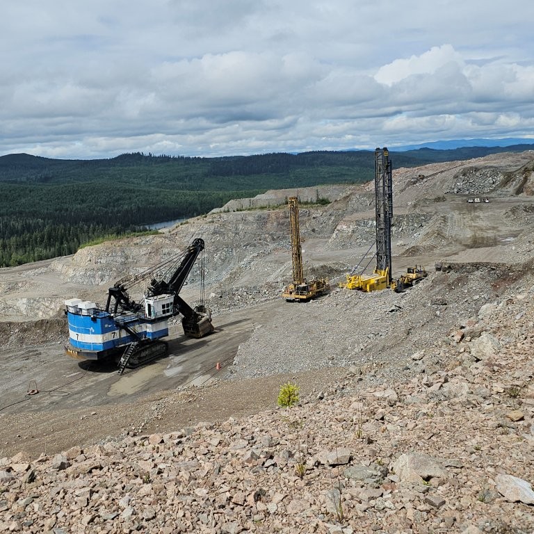
Mount Polley Mine lies west of Likely where a tailings dam failed to retain toxic waste in 2014. Rehabilitation of the stream, lake and landscape is featured in a site information map describing hydraulic seeding with a mix of native grasses and planting of 600,000 trees and shrubs. Salmon have returned to the man-made spawning channel. Peer over the lip of the mine for a close-up view of heavy equipment in the giant open pit. Be ready to vacate the area around the mine immediately when a blasting signal is given. The modern-day operation moves more than 80,000 tons of rock to process 20,000 tons of ore per day with a constant flow of gigantic ore trucks hauling from the pit to the crushing mill.
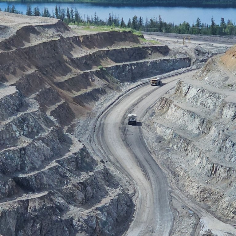
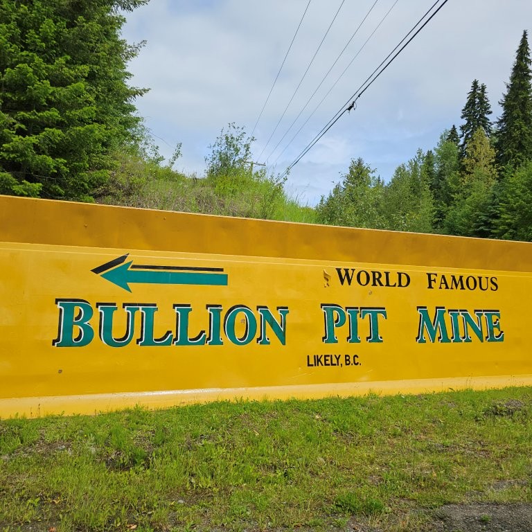
Bullion Pit Mine Historic Site. Located 5 km / 3 mi west of Likely near Quesnel Forks. Trenches were built from alpine lakes to penstocks that fed 6” nozzles on water cannons used to blast away the overburden and expose gold-bearing rock. The mining site produced 12,000 ounces of gold over thirty years. There is a short trail to mining relics from the era, and a viewpoint overlooking the enormous pit.
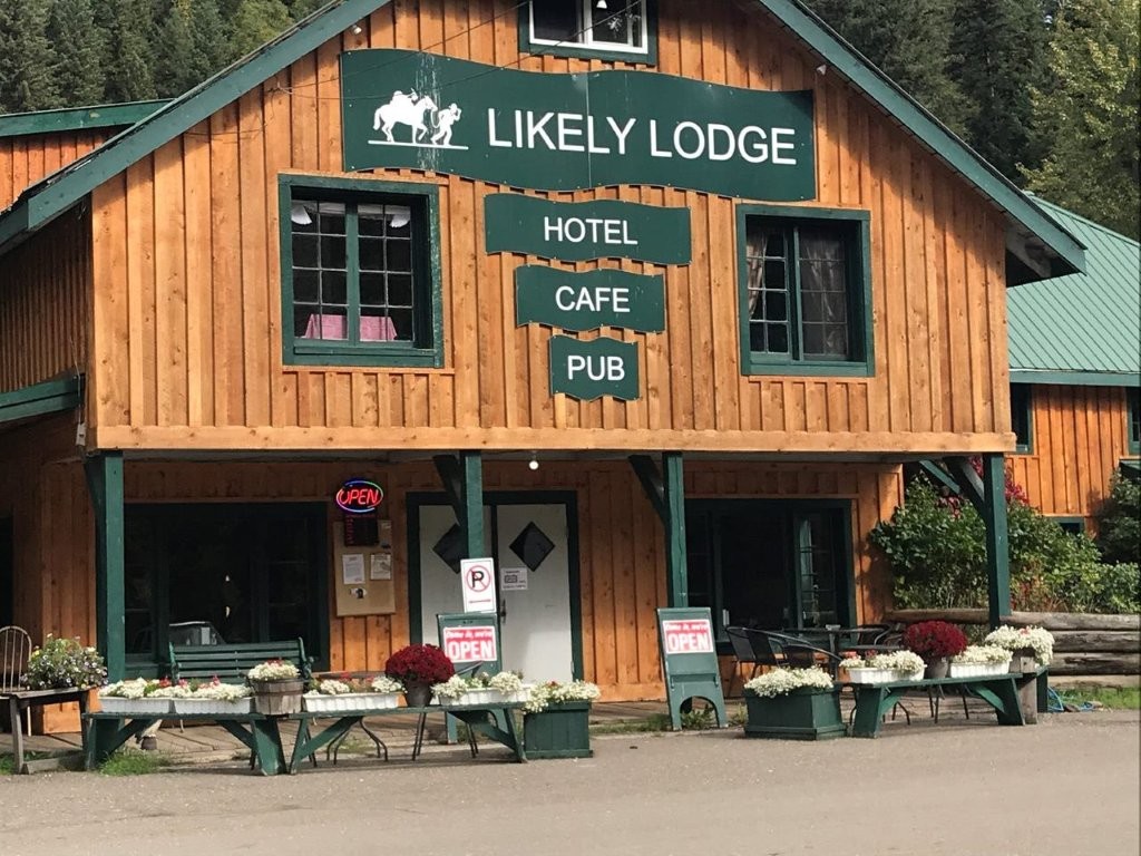
Likely. There are river-front picnic sites just above the mouth of the Quesnel River bridge crossing. A quirky pub notice asks customers to “Clean the muck off your boots because they are destroying our vacuum”. Mining relics displayed behind the pub are “Part of the Past”. Cedar City Museum in Cedar Point Provincial Park displays artifacts and photographs from Keithley and Quesnel Forks gold rush boom towns.
Quesnel Forks, historically named Quesnelle Forks, is 12 km / 7 mi north-west of Likely and at the confluence of the Cariboo and Quesnel Rivers. As a ghost town, it is one of the best preserved historic mining towns in BC. Prospectors chasing gold up the Quesnel River included the first large concentration of Chinese miners. Though only lasting a few years, the “Forks” grew to have four general stores, a few hotels, saloons, pharmacist, doctors, and later housed men working at the Bullion Pit. It became a supply base for mines at Antler, Keithley Creek and Williams Creek.
Side Trip to Horsefly & Area from Likely
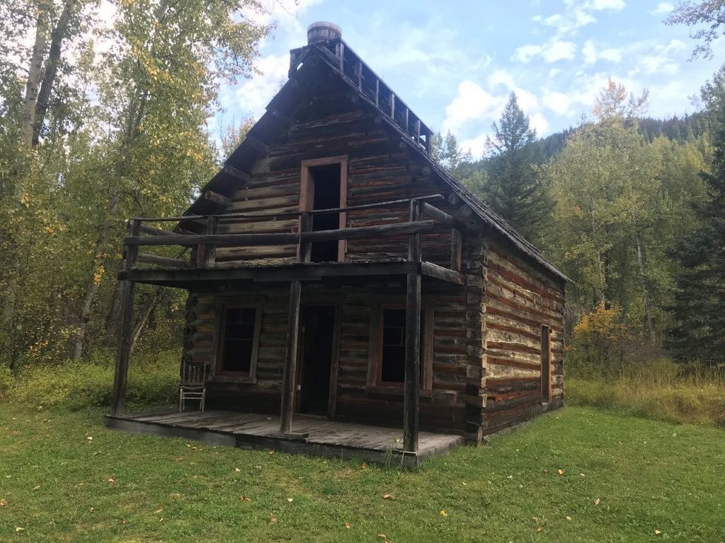
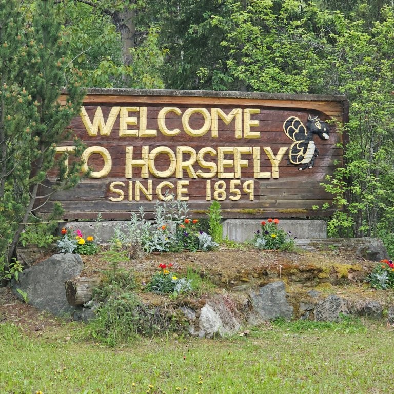
Horsefly is 50 km / 31 mi south of Likely. The first Cariboo gold was discovered here in 1859. Jack Lynn Pioneer Museum houses gadgets, a side-fastened corset, gramophone, pump organ and Eaton’s catalogues. An open-air display with a trapper’s cabin and farm implements signifies diverse economic activity in the area. The Historical Society runs a fund-raising lottery for a unique home-made quilt embedded with historic black and white photos.
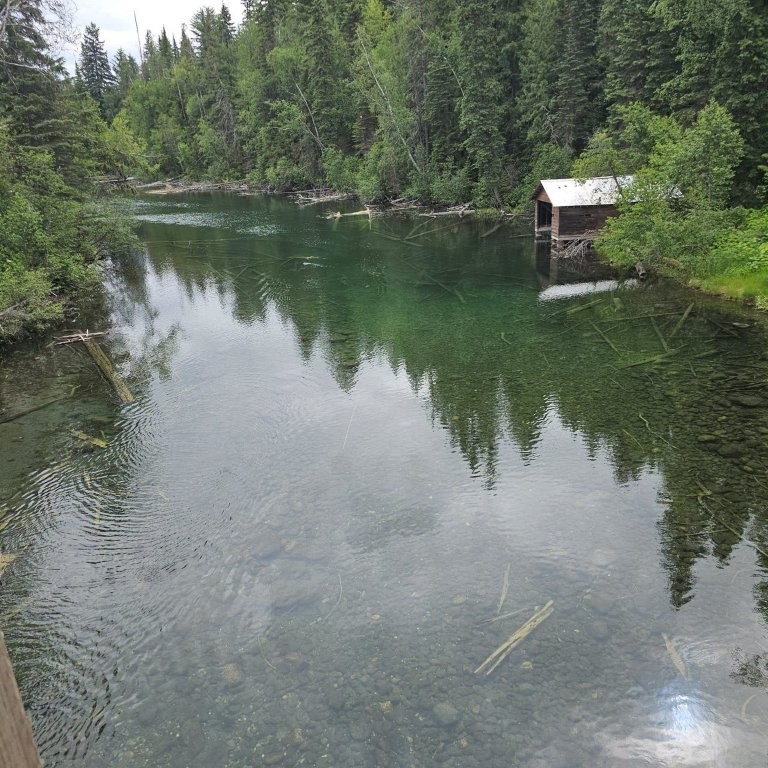
Horsefly River, a spawning channel for sockeye, chinook and coho salmon, is a further 36 km / 22 mi east of Horsefly. It can take up to a month for salmon to reach the spawning channels, nearly 800 km / 497 mi upstream from the mouth of the Fraser River, first passing the mouths of the Thompson and Chilko Rivers, and with sheer determination, to the spawning channels at Horsefly River. There are picnic tables near the totem poles. An early run of chinook can be seen building spawning nests in the crystal-clear waters from the narrow bridge at Horsefly River.
Chinook spawn in the Upper Bowron from mid-July to August, and sockeye in early September.
Head back to Horsefly and then travel north-west on Beaver Valley Road which is near Quesnel Lake. The road skirts the forestry concession granted to the University of British Columbia Faculty of Forestry to conduct research on multiple-use forest management in mixed stands of Douglas fir, lodgepole pine and trembling aspen, including timber harvest, range land management for cattle grazing, water resources and recreational uses.
Dugan Lake Recreation Site is 44 km / 27 mi south-west from Horsefly. Loon Alert advisory is common on many lakes. Loons are a protected species. Do not disturb nests. Listen to their crazy laugh, called a tremolo. Their echoing calls are often the only sound at dusk.
Continue on to Hwy 97 north.
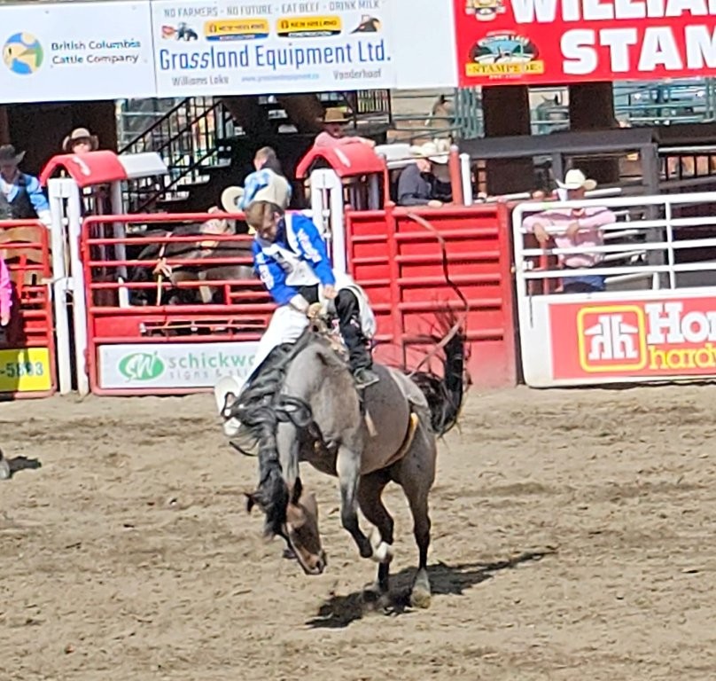
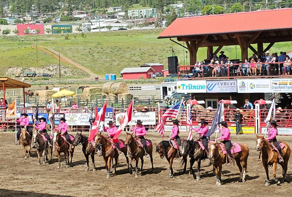
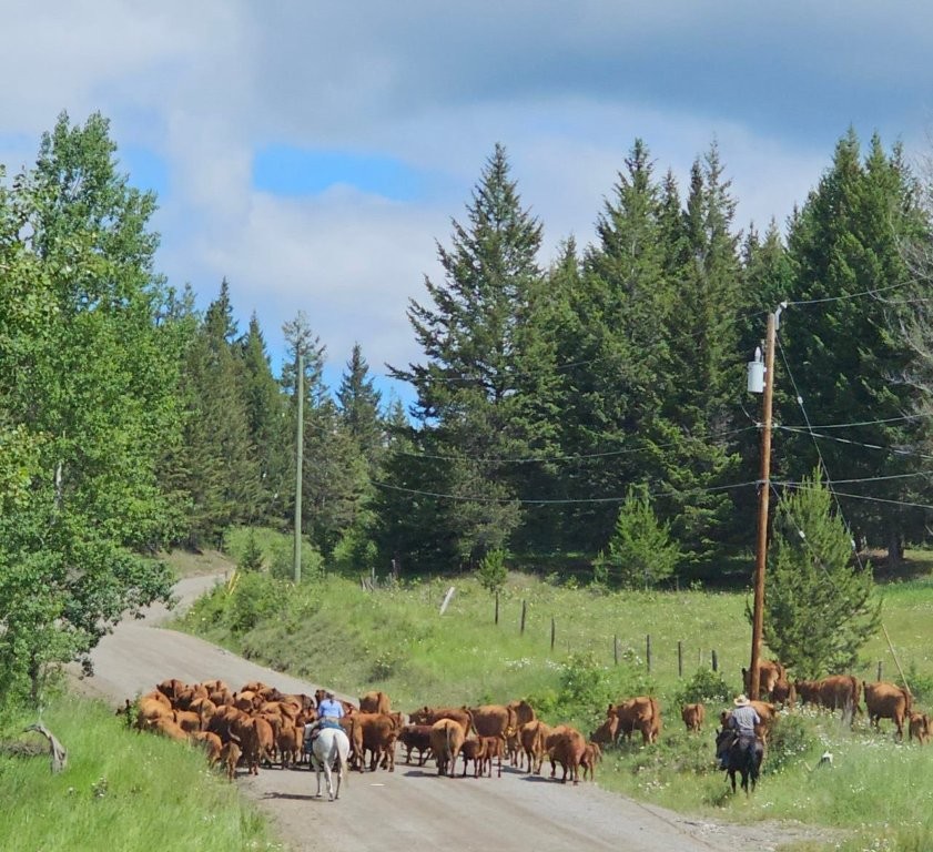
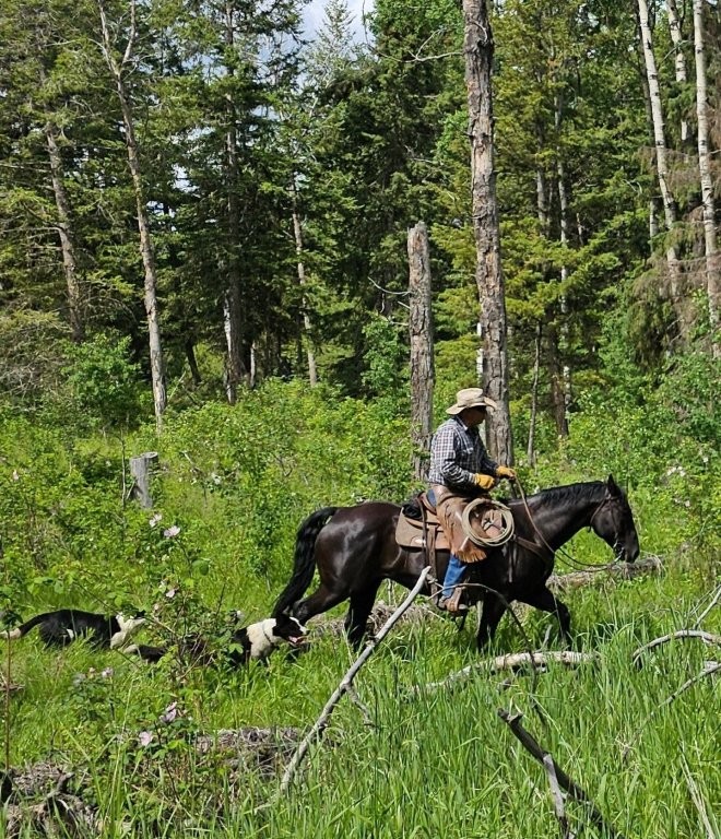
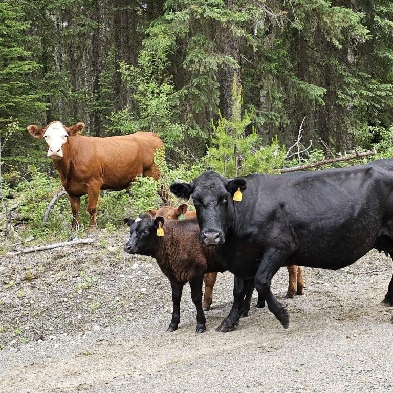
Williams Lake was bypassed on the Cariboo Wagon Road, but its fame was revived by cattle ranching. The Williams Lake Stampede is nearing one hundred years of events including bull bucking, bronco riding, steer wrestling, barrel racing and wild horse busting during the Canada Day (July 1) holiday weekend.
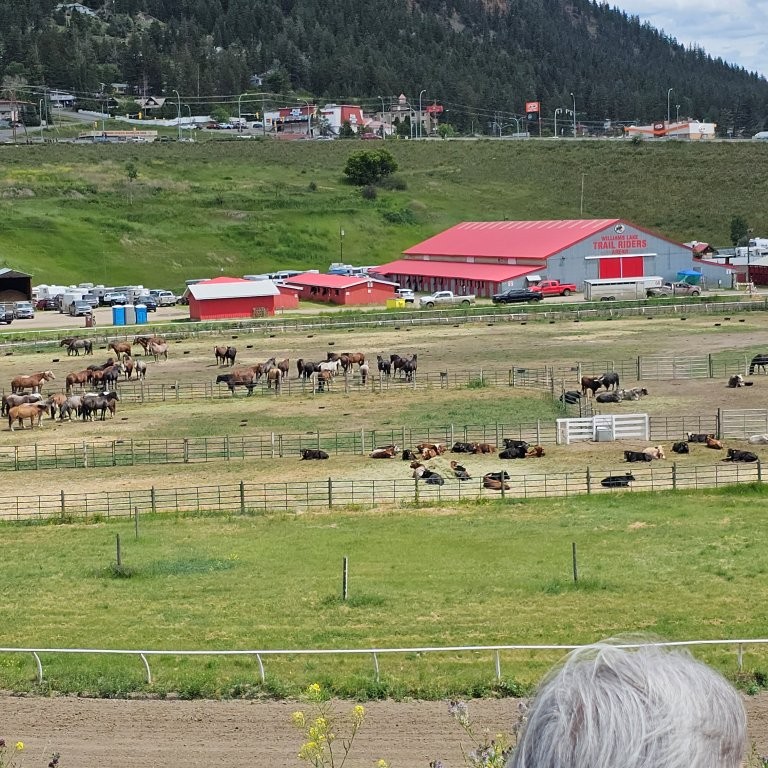
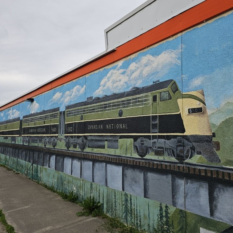
There is a wildlife viewing and interpretive centre at Scout Island Nature Centre which has a boardwalk situated on the marshland within the city. Visit the Station House Gallery with 3-D murals depicting train travel in the early days. Several large lumber mills provide unmerchantable wood waste to power a 66 MW biomass fuel plant.
The Museum of the Cariboo Chilcotin houses the BC Cowboy Hall of Fame, and a history of ranching and rodeos. Jet boat tours are based where Hwy 20 crosses the Fraser.
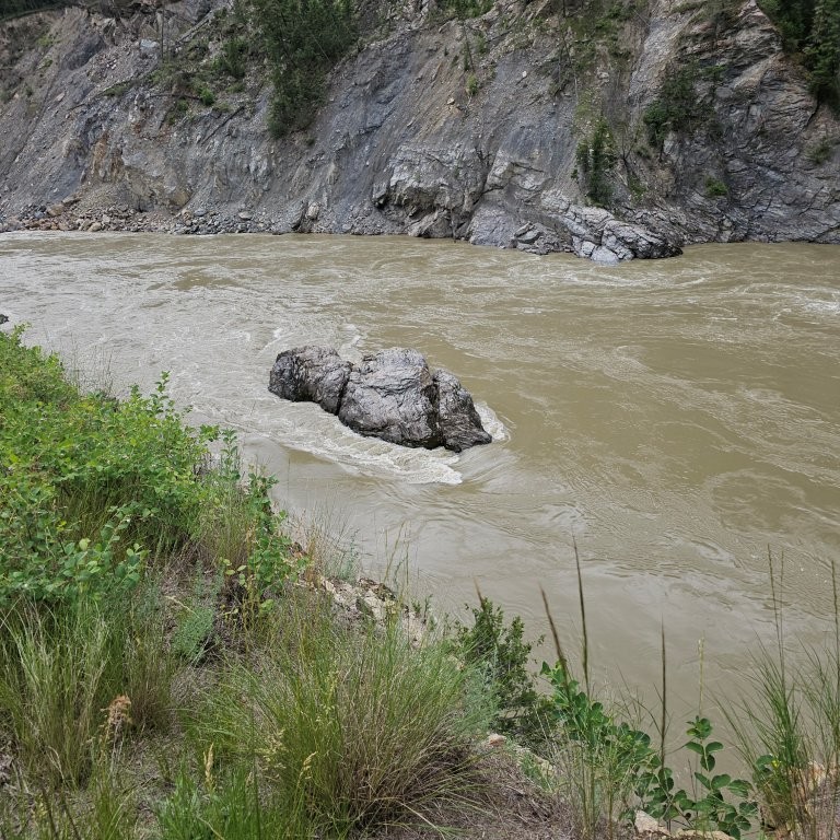
Soda Creek, or Xatśūll (Hat’sooth), 38 km / 24 mi north of Williams Lake on Hwy 97,served as the terminus of the SS Enterprise, the first steamboat on the Upper Fraser River where sourdoughs then struggled overland to the goldfields around Barkerville. There is a viewing platform overlooking cliff canyons on the Fraser River. A Heritage Village includes a pit house, drying racks and sweat lodge. Mattresses and bedding are not supplied for overnighting in a teepee.
In 1862, Peter Dunlevy pre-empted, as was common in those days, and purchased a large tract of ranch land north of town where he built a hotel with saloon, general store and offices for the BX stage line. He went on to own mining interests throughout BC and is buried in Soda Creek cemetery.
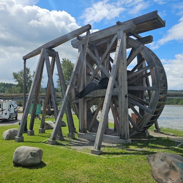
Quesnel. 87 km / 54 mi north of Soda Creek. At Heritage Corner there is a steam shovel from the gold mines, and a boiler from the first sternwheeler to serve the Upper Fraser River. Quesnel Museum & Visitor Centre hosts a significant collection of rare Chinese artifacts, general store, hospital and dentist’s office with medical instruments. A gallery of C.S. Wang black and white portraits records the assimilation of Chinese settlers to the region. “Quesnel Little People” are connected on a walking tour to 23 painted fire hydrants around town including a “Can Can Girl”, a “Bandit”, and “Voyageur”, symbolic of the occupations of those robust days. Join in the Billy Barker Days festival celebrating the Gold Rush heydays during the third week of July.
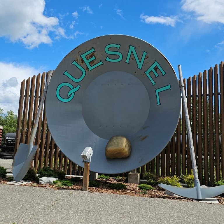
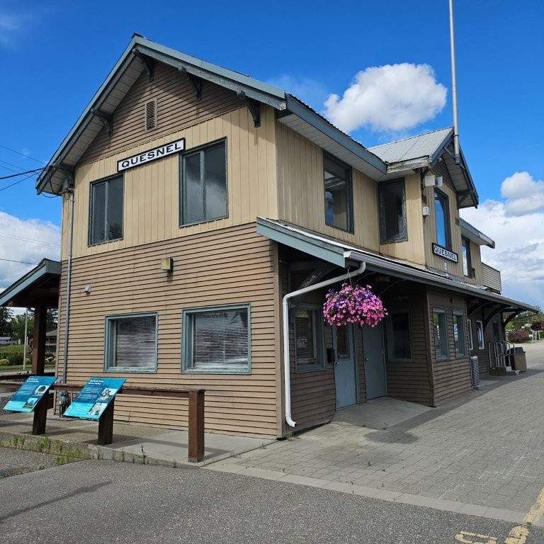
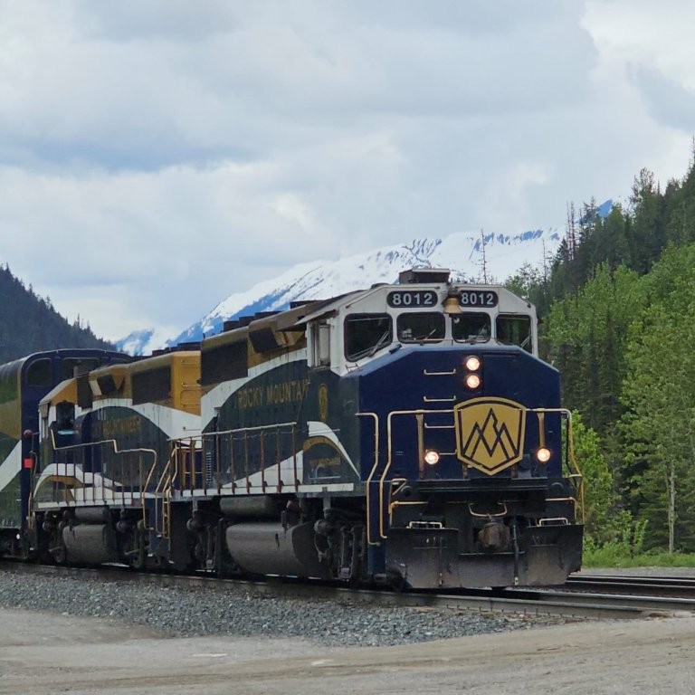
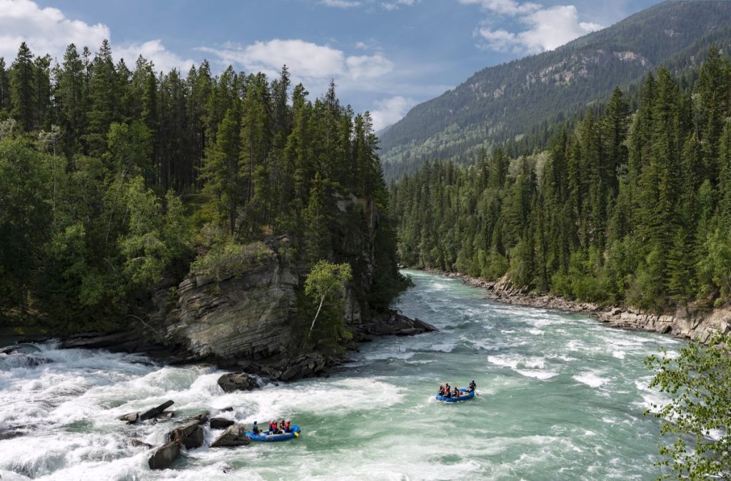
Quesnel is an overnight stop for the Rocky Mountaineer scenic train. The CNR train station provides information boards explaining the gold rush history. The world’s largest gold pan located here measures 5 m / 16 ft in diameter. There is whitewater rafting on the Upper Quesnel (class IV rapids), and on the Lower Quesnel River (class lll rapids). Local arts and crafts at Keepsakes is located in a restored Hudson’s Bay trading post.
5 km / 3 mi further north on Hwy 97 is the turn off onto Hwy 26 to Barkerville.
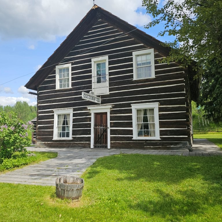
Cottonwood. 27 km / 17 mi east of the turn off, Cottonwood is a national historic site built in 1884 and is one of the last remaining waystations on the stagecoach line to the goldfields between Quesnel and Barkerville. A beat-up camper van half-buried behind the community hall, serves as a lasting impression of the American draft dodgers and hippies who settled in the area during the Vietnam War in the 1970s.
Stanley. Pioneer cemetery records show the history of financiers, mill men and experienced Welsh tin miners brought to the goldfields. Like many places, the towns were abandoned once the gold had been exhausted.
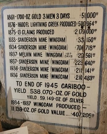
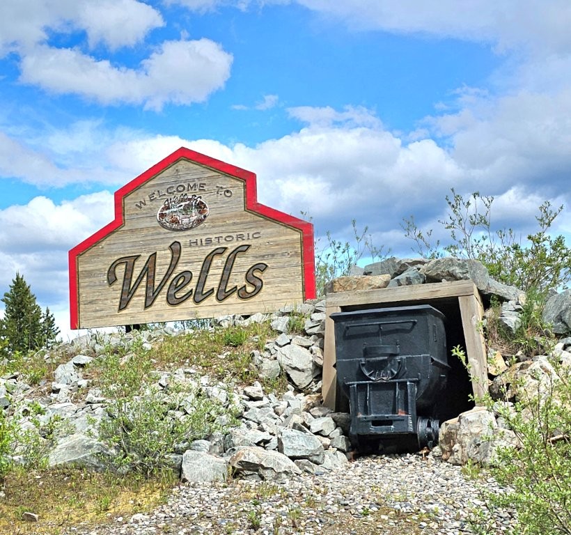
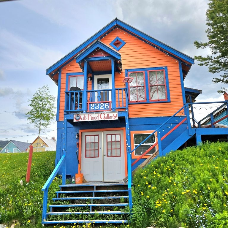
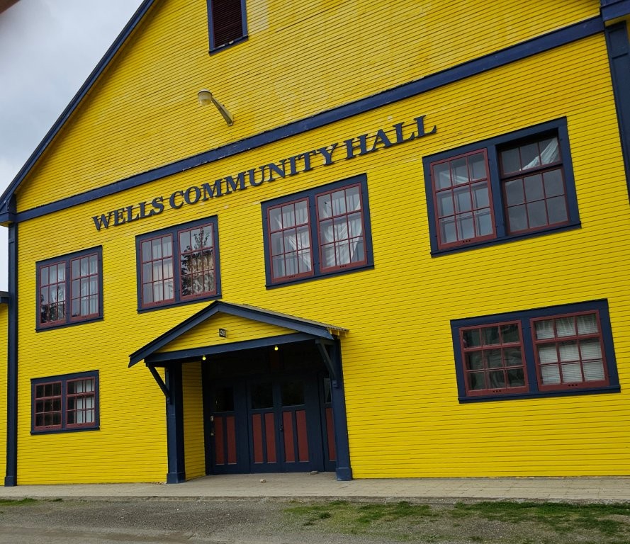
Wells. 47 km / 29 mi east from Cottonwood dozens of colorful historic buildings were built during a secondary gold rush in the 1930s. There is a museum, live performances at Sunset Theatre, artists and occasional whiskey tasting.
Decades after the mines of nearby Barkerville were exhausted, another discovery of hard rock ore sparked the development of two more gold mines. In the 1930s, the town became a beacon of hope and prosperity for thousands of miners from around the world when the population soared to 4,500 and schools, a hospital, and shops were built here and in Richfield.
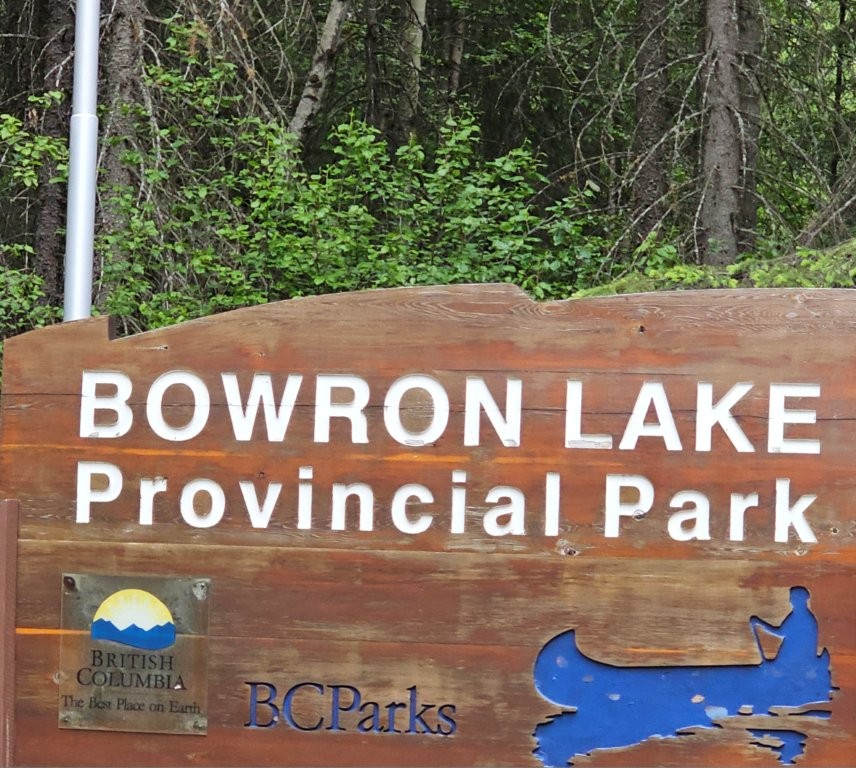
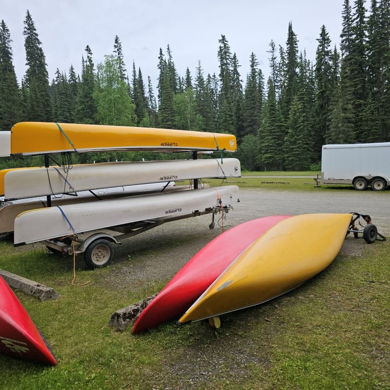
Bowron Lakes. 116 km / 72 mi canoe circuit takes 7- to 10-days to paddle the chain of four backcountry lakes, advisable in a clockwise direction. Backpacks must be weighed and cannot exceed 50 kilos / 110 lbs for backpacking on several long portages. Canoe rentals are available at Beckers and Bowron Lake Resort. The lodges offer one-hour canoeing lessons, and 4–8-hour day trips. Watch for moose and bears along the shoreline.
(Read our blog and check out the video at Bowron Lakes, BC: Not Just a Place to Portage!)
Refer to the Super Camping BC Guide for private campgrounds and the Provincial Parks Visitor’s Guide for provincial parks in the Cariboo region.
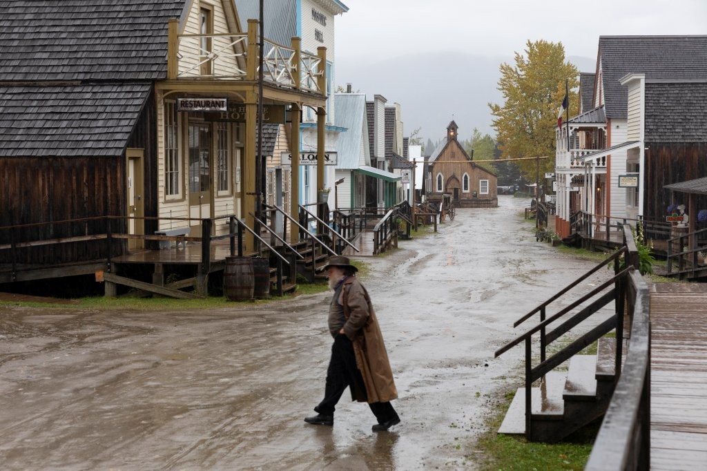
Barkerville. 7 km / 4 mi from Wells, the major drawing card of the Cariboo, and a National Historic Site that sprang up during the gold rush, Barkerville is a living history museum with costumed staff, stagecoach rides, live theatre, re-enactments and interactive displays. A national historic plaque describes the search for the source of placer gold on the lower parts of the Fraser River that led to discovery of the motherlode further upstream in the Cariboo. Williams Creek is said to have yielded the largest ore deposit when Billy Barker struck pay dirt at the bottom of a shaft twelve meters below the surface.
A town of tents, hotels and saloons sprang up, becoming the largest city west of Chicago. Take a guided tour through the main street to historic Chinatown, general store, post office, and baker. The Waggon Road, as it was sometimes spelled, to Richfield was a nearby miner settlement. A cairn marks the location of the wooden courthouse, built in 1882 to mete out justice during the colonial period.
Return along Hwy 26, 81 km / 50 mi to Hwy 97 and continue the tour north.
Section 3: Barkerville to Quesnel and Prince George to Jasper
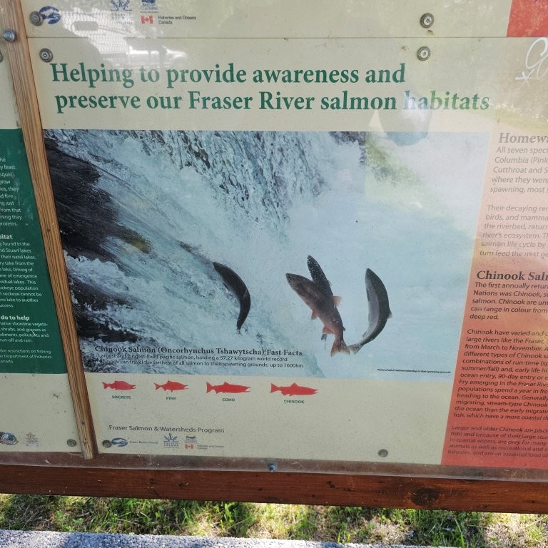
The Upper Fraser River system supports one of the world’s richest salmon runs. The annual spectacle of the Pacific salmon migration is best viewed in late summer and the fall when literally thousands of salmon are jumping waterfalls and fish ladders, where native fishermen cling to rocks with dip nets on long poles, and in the spawning grounds of the tributaries where the nesting frenzy stirs up the gravel beds. Spent carcasses line the shoreline, and the lifecycle is renewed. This miraculous journey to the Upper Fraser River occurs annually starting with early runs in July to late September.
Annual runs average 9 million sockeye during the odd-year cycle. Adults grow to full size in the Pacific Ocean, then schooling at the mouth of the Lower Fraser in summer and fall, to begin their long migration to their birth streams. Annual runs vary with the type of salmon, the species cycle, river and climatic conditions, as well, year over year there is unpredictability of the size and timing of runs.
Some travel nearly as far as 1,200 km / 750 mi from the ocean to Mount Robson Provincial Park. Protecting the river and salmon runs during catastrophic rockslides and floods, pollution and riverbank erosion is a constant challenge in the Cariboo.
Ask at Tourist Information Centres where to view the spawning grounds and fish hatcheries.
The best-known Salute to the Salmon is held during dominant runs every four years on the Adams River in Roderick Haig Brown Provincial Park, now named Tsútswecw Provincial Park.
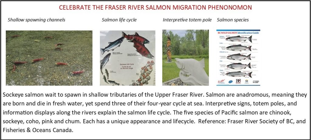
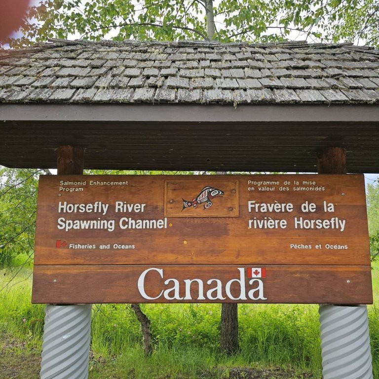
One of the largest of the Fraser River’s primary watersheds is the Quesnel River. Fisheries & Oceans Canada maintains fish hatcheries and rearing channels to boost survival rates of sockeye salmon. The channels and holding area provide ideal spawning conditions for adult sockeye. These channels are not operated in peak cycle years when returns can amount to one million fish.
Quesnel River Salmon Research Centre, located at the outlet from Quesnel Lake, monitors salmon migration upstream to spawning beds in the Mitchell and Horsefly watersheds. Quesnel Lake is deemed a nursery lake due to all the spawning beds on its tributaries. The fry feed for a year before migrating to the ocean.
Chinook salmon is the largest species that navigates British Columbia rivers. There are viewing platforms at George Hicks Regional Park in Valemount on the North Thompson River, and Tête Jaune Cache Spawning Grounds, 20 km / 12 mi further upriver.
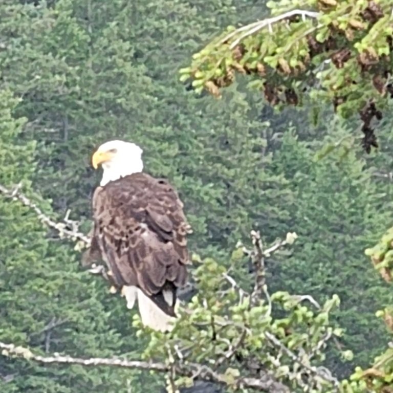
Bears are attracted to the waters to feed on salmon before hibernation. Be Bear Aware at all times.
Directions & Estimated Driving Time: Return from Barkerville to Quesnel 86 km / 53 mi and then north on Hwy 97 to Prince George 121 km / 75 mi. Take Hwy 16 south-east from Prince George to Tête Jaune Cache and Mount Robson Provincial Park 350 km / 217 mi. The park borders Jasper National Park on the Alberta side of the Continental Divide. Total mileage 600 km / 375 mi over six days.
Where to Camp: For campgrounds and parks available in this area go to Camping & RV in BC and search under the appropriate community.
Things to See and Do:
Side trip to Hixon
59 km / 37 mi north of Quesnel is Hixon. Ignore the roadside marker on Hwy 97 pointing to High Falls. The gravel road past the land fill is not accessible to RVs.
Prince George in the Northern British Columbia region is 61 km / 38 mi north of Hixon. It straddles the Fraser River and is known as the geographical centre of the province. Places to visit include The Exploration Place, Central BC Railway & Forestry Museum, and Huble Homestead.
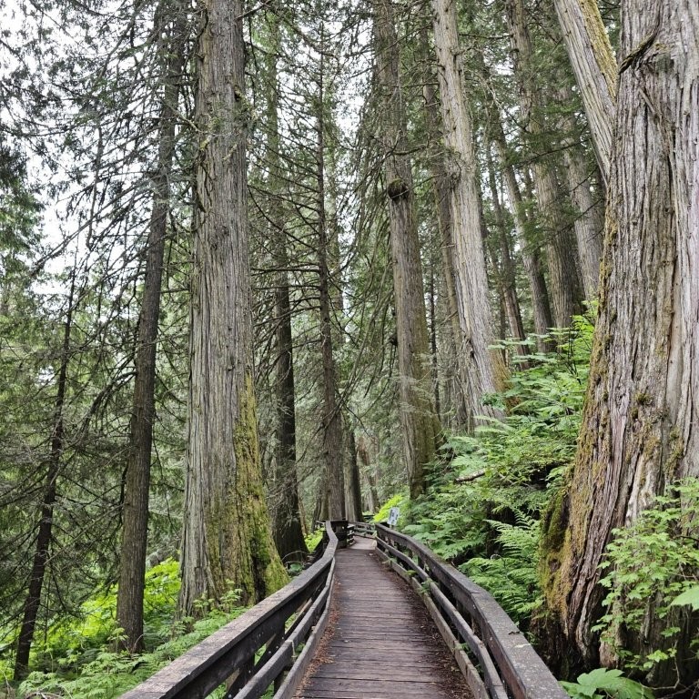
Ancient Forest/Chun T’oh Whudujut Park located mid-way between Prince George and McBride is accessible by boardwalk leading into the Interior temperate rain forest where giant old growth western red cedar trees stand up to 4.8 m / 16 ft in diameter. Ample RV parking.
Goat River bridge crossing and rest area allows limited space for RV parking. The historic Upper Goat Trail is a 49 km / 30 mi challenging hike, fording streams and use of a cable car ferry over Milk River to reach alpine meadows. Refer to the Robson Valley Recreation Guide.
Loos and Cresent Spur. A row of red mailboxes suggests that there are cabins and houses tucked away in the woods beyond the rail line. A Mennonite Church was built during the colonization of Northern BC.
McBride. There is a service centre in the Robson Valley, midway on the 250 km / 155 mi stretch between Prince George and Tête Jaune Cache junction. Also, the divisional headquarters of the Grand Trunk Pacific Railway which ran from Winnipeg to Prince Rupert. A heritage railway station houses the Visitor Centre and features a beanery restaurant, and the Whistle Stop Gallery. The Empress Theatre is one of several vintage buildings remaining from the 1920s. St. Patrick’s Catholic Church posts times of services, but parishioners are advised to call ahead to confirm the priest will arrive!
Dunster. Once a divisional point during railroad construction, the retired station is now a district museum, offering workshops in cheese-making, soapstone carving, and pine needle baskets. Don’t miss the general store and gathering place that stocks some vegetables and frozen meat, and even chocolate Ritter bars from Germany, and Vegemite food spread from Australia.
The VIA Rail Skeena makes flag stops on the mainline between Jasper and Prince George. A history of the CNR Colonization Service posters and booklet describe how farmland in Canada was granted. Railways were part of the integrated passenger steamship services to promote immigration from the UK.
Terracana Ranch Resort attracts European RV renters to overnight at six electric sites. An open-air “cookhouse” has two barbeques. A buckboard is on display at the timbered-style entrance.
Side Trip to Mount Robson and Yellowhead Pass
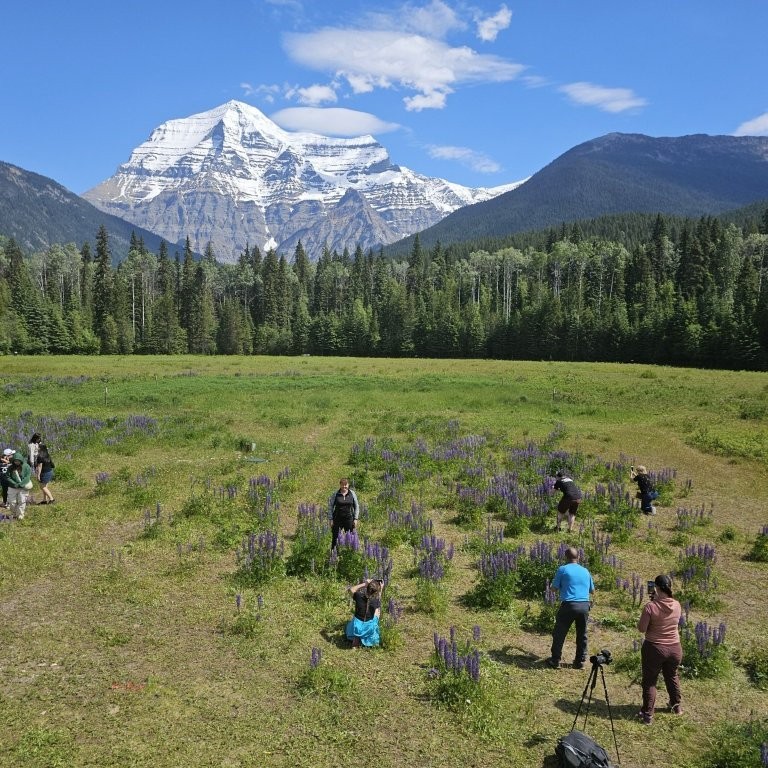
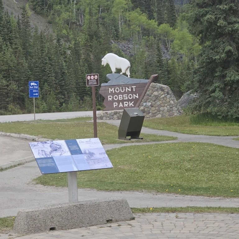
Mount Robson is 40 km / 25 mi east of the Tête Jaune junction on Hwy 16. There is a direct view across meadows to the full vertical face of the highest peak in Canada 3,934 m / 12,905 ft. Only eleven summit attempts were accomplished out of forty in one recent season. There is a hiking trail to Berg Lake. Visitor Centre and gift shop.
Mount Terry Fox Rest Area is near the west entrance to Mount Robson Provincial Park. The mountain name is dedicated to the memory of Terry Fox who began the Marathon of Hope by hop-stepping 5,373 km / 3,340 mi for 143 days across Canada to raise money for cancer research. Terry was forced to cancel his Trans Canada run when cancer reappeared in his lungs. Hundreds of millions of dollars for cancer research and treatment have been raised worldwide.
Lucerne. Just inside the BC/Alberta border, only a few cabins remain of a major railroad construction camp. Chosen as a divisional point for the Grand Trunk Pacific Railway on the Continental Divide, Yellowhead Pass offered a lower elevation and gentler grade through the Northern Rockies west of Jasper, than the Kicking Horse Pass to the south taken by Canadian Pacific Railway who built the first transcontinental rail line in 1883.
Yellowhead Pass divides the BC/Alberta border and is 77 km / 48 mi from Tête Jaune Cache. Information panels in the Yellowhead Pass explain that it wasn’t only American and Chinese prospectors seeking the motherlode. A hundred Overlanders left Ontario with hopes to strike it rich in the Cariboo goldfields. They crossed the vast Canadian prairies and traversed the Yellowhead Pass to the goldfields in the central Cariboo. It was one of the most difficult treks with wagon trains and horse-drawn carts through the Northern Rockies.
There are numerous points of interest in the Yellowhead Pass.
Yellowhead Lake is the headwaters of the Fraser River that begins as a stream and gathers big tributaries for 1,400 km / 870 mi to the coast. A national historic site describes the contest to build two lines through the Yellowhead Pass, but these were merged into the Canadian National Railway when the freight traffic failed to materialize. Lucerne recreation site has no services and is close to the rail tracks.
Section 4: Jasper to Vancouver
Directions & Estimated Driving Time: Return from Jasper to Hwy 5. Continue on Hwy 5 south towards Kamloops via Blue River and Clearwater. From Kamloops follow Hwy 1 through the city and continue on Hwy 1 to Lytton 550 km / 340 mi. Lytton to Vancouver 300 km / 180 mi. Total mileage 850 km / 525 mi over six days.
Where to Camp: For campgrounds and parks available in this area go to Camping & RV in BC and search under the appropriate community.
Things to See and Do:
Tête Juane Cache. Named after an Iroquois fur trapper Pierre Bostonais who worked for the Hudson Bay Company in the late 1800s. He was called “Yellowhead” for his unusually blonde hair. Yellowhead Pass still bears his name.
Valemount. 20 km / 8 mi south from Tête Jaune Cache in the Thompson Okanagan Region. Located in the Robson Valley on the Fraser River, famous for whitewater rafting (Class I to IV rapids). Valemount provides access to George Hicks Regional Park where salmon spawn.
(Read our blog Summer in Valemount, British Columbia: Where the Mountains Move You).
Blue River. A luxurious resort base for Mike Wiegle Helicopter Skiing. Known for dry powder snow, and typical of the Interior Temperate Rain Forest that also brings storm clouds and lightning during the summer months in the Monashee Mountains. There are jet boat tours to Grizzly Bear Valley for a close-up look at grizzly bears feeding along the river.
Little Hells Gate. An unmanned regional park between Blue River and Avola that provides a viewing platform over a turbulent gorge on the North Thompson River. Road access is over a 3 km / 2 mi bumpy road to the parking lot.
Clearwater. Located on the Clearwater River and surrounded by the Trophy Mountains, Clearwater is the gateway to Wells Gray Provincial Park, 130 km / 80 mi to the north of Hwy 5. The town offers a service centre for fuel, groceries, and adventure tours in Wells Gray Provincial Park.
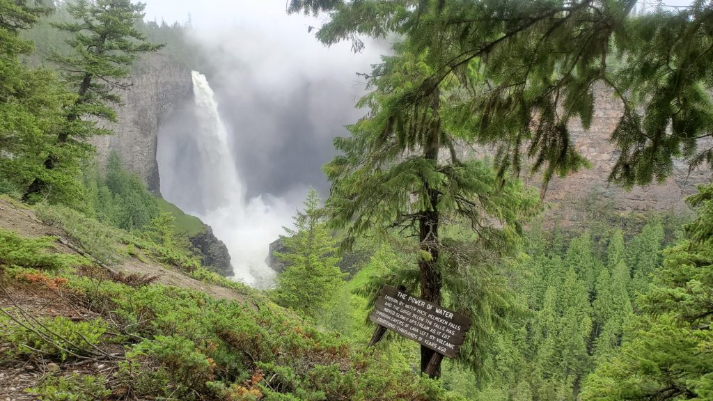
Wells Gray Provincial Park. One of BC’s largest and most diverse parks, there is a large topographic map in the Visitor Centre showing locations of waterfalls, rivers and lakes. Helmcken Falls is three times the height of Niagara Falls. Clearwater Lake offers canoe rentals. There are numerous campgrounds in the area.
(Read our blog and check out the video at Experience Clearwater Lake, Wells Gray Provincial Park, British Columbia).
Kamloops. This bustling city is located at the confluence of the North and South Thompson Rivers, which join to become the Thompson River entering the Fraser River at Lytton. Visit the Secwėpemc Museum and Heritage Village. A guided tour of the Kamloops Residential School is available on request. The KRS is designated to become a national historic site.
New Afton Mine operation is visible to the south from the junction of Hwy 1 and Hwy 5, approximately 17 km / 11 mi west of Kamloops. A tour includes a walk-through of the processing mill and a visit to the research reclamation area on the historic site. Company policy states that Participants must supply their own steel-toe boots and must adhere to a clean-shaven policy to enter the mine area. The Highland Valley in the BC Central Interior is famous for a series of large open-pit copper mines.
Steelhead Provincial Park is located at the west end of Kamloops Lake where it flows into the South Thompson River. Visit a small rail museum tucked away in a corner of the park and watch anglers casting for rainbow trout.
Ashcroft situated at the 84 km / 52 mi point from Kamloops, has a museum and manor that are reminders of the glory days of the gold rush. A Heritage BX stagecoach station now serves as a gallery and craft market. The red and yellow coaches left Ashcroft at 4:00am, and in 4 days and 450 km / 280 mi later, reached the end of the road in Barkerville.
From Lytton, the Fraser River enters its most treacherous sections carved through vertical canyon walls and narrow gorges as it descends rapidly between Lytton and Hope. This 200 km / 120 mi stretch is deceptively tranquil from viewpoints on the plateau far above, but dangerously fast whirlpools and rapids when viewed up close. Here the Gold Rush Trail was built inland when the mule trail could no longer handle the wagon trains along the cliffs.
Super-powered 4,000 hp diesel engines haul CPR and CNR freight trains along both sides of the Fraser Canyon. Miles of colorful containers, tanker cars, grain trains, bright yellow potash and coal unit trains headed for export can be seen from several vantage points close to the Trans Canada Hwy.

Lytton sits at the confluence of the Thompson and Fraser Rivers. The village was destroyed by a raging wildfire in 2021. Fire claimed the bank, health clinic, and many of the one hundred houses. The village continues to be rebuilt with community support. Lytton Chinese History Museum has reopened after replacing many burned artifacts. Lytton on the Thompson, is known as the Whitewater Rafting Capital of Canada and notorious for the Devil’s Gorge and the Jaws of Death.
Side trip to the Lytton Reaction Ferry that crosses the Fraser to the Stein Valley. Just a 5 min drive north on Hwy 12 and Lytton Ferry Rd. The ferry takes about 18 passengers and two vehicles.
Boston Bar and North Bend. 44 km / 27 mi south from Lytton. A series of interpretive signs explain the history of an aerial ferry that is now replaced by the Cog Harrington Bridge connecting the two villages.
Tuckkwiohum Village offers guided tours at a First Nations heritage site, 5 km / 3 mi south of Boston Bar. Visit a smoke house, food cache, sweat lodge and pit house. A gas station, convenience store, gift shop and campground can be found there.
Hell’s Gate Canyon. 11 km / 7 mi further on from Boston Bar. An Airtram sits 240 m / 787 ft above the lower terminal where the equivalent of 3,500 basketballs per second roar through a narrow gorge. A series of fish ladders enable salmon to power upstream against the 40 km / 25 mi per hour current. Exhibits feature the lifecycle of salmon and gold rush history. There is ample RV parking with a pedestrian overpass to the entrance on Hwy 1.

Yale 31 km / 19 mi from Hell’s Gate, Yale was established at the head of navigation by Hudson Bay Company in 1848. Known for lawlessness during the gold rush, it served as the start of the Cariboo Wagon Road where the Fraser River was too treacherous for sternwheelers. Historic sites include St. John the Divine Church built by Royal Engineers in 1859, and the restored Creighton House. A national monument stands as a tribute to Chinese construction workers. On Lee store and garden is maintained as a further recognition of the Chinese community.
A section of the old Wagon Trail is visible at Alexandra Bridge Provincial Park. Alexandra Bridge is one of several crossings built from 1863 on as part of the Cariboo Wagon Road.
A series of rock tunnels on Hwy 1 are carved above the banks of the Fraser near Hope.
Hope. 24 km / 15 mi south from Yale. A self-guided walking tour leads to over 70 chainsaw carvings in Memorial Park. The adjacent Japanese Friendship Garden is dedicated to 2,800 Japanese Canadians who were interned in Sunshine Valley during WW ll. Christ Church National Historic Site illustrates an Anglican Church in Gothic Revival style, consecrated at the beginning of the gold rush in 1861.
Hope was named Hollywood North where Rambo First Blood was filmed with extensive use of pyrotechnics. Take a self-guided walking tour to see the shooting locations that were used more than forty years ago. John Rambo was played by Sylvester Stallone and still draws movie buffs to the mountain town.

A trail leads to the Othello Tunnels built by the Kettle Valley Railway through metamorphic rock in an era of intense railroad development. The quadruple tunnels are joined by a series of trestles forming a hiking trail located in Coquihalla Canyon Park.
Vancouver. If you rented an RV, get ready to return the unit. It is advisable to stay reasonably close to the RV rental station on the last night. Clean-up, empty tanks and refuel before drop-off. Pack up, and be ready to vacate the vehicle upon arrival at the station.
Read more about the Gold Rush Trail in the Cariboo at Following the BC Gold Rush Trail through the Cariboo & Beyond