It’s no surprise that most people in the Vancouver area have never been to British Columbia’s far North. It takes time and planning to travel a long way. This is the far north, beyond the Yellowhead Highway (Hwy 16) between Prince Rupert and Prince George that connects the Great Northern Circle Route to Watson Lake on the Alaska Hwy in the Yukon. This Go North touring adventure follows Hwy 37 from Kitwanga Junction in the Hazeltons to Meziadin Junction and the Yukon border. The itinerary then explores the Southern Lakes Region before reaching Whitehorse, capital city of the Yukon. But first, it begins on Vancouver Island and crosses to the North via BC Ferries.
Once you reach Prince Rupert, this is a one-way RV journey of 4,200 km / 2,600 mi in 21 days which is a normal pace allowing you to do some side trips and check out the many remote communities along the way – native villages like Gingolx, Gitanyow, Kitimaat, and Kispiox that are off the beaten path. It means driving an RV rental to Whitehorse. If using your own rig add two or three weeks and at least another 3,500 km / 2,200 mi to return to Vancouver via the Go North RV drive RVing Along the Alaska Highway in Northern British Columbia. Straight-line distance to the Yukon border is less than 2,000 km / 1,240 mi but there are many side trips that can double the mileage while exploring the North. Air Canada and Yukon Air offer non-stop service out of Whitehorse to the south for those on a one-way tour.
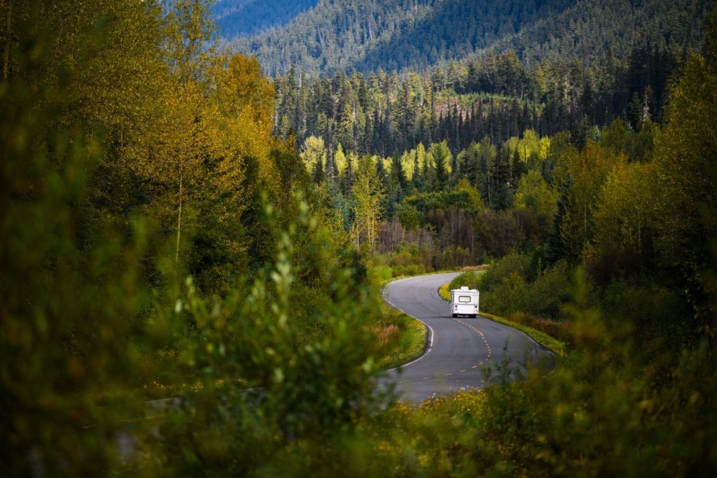
RV Touring Made Easy
A turbo diesel-powered Truck for a two-person-Camper is the ideal choice for the ease of handling. The power, visibility, spacious camper with slide-out, all add to the comfort.
Start with a BC Ferry crossing from Horseshoe Bay near Vancouver to Nanaimo and spend four days traveling north to Port Hardy on Vancouver Island. (Note: watch for specials for over-height RVs on select sailings that are sometimes offered by BC Ferries on Mainland Routes to Victoria and Nanaimo).
BC Ferries operates the Inside Passage route from Port Hardy to Prince Rupert in Northern British Columbia. Once in Prince Rupert spend three days around the Hazeltons and then start the drive straight north up the Stewart-Cassiar Hwy 37 to the Yukon.
Exploring the North needs time to plan and a substantial budget. A three-week rental with 4,000 km / 2,500 mi could be $5,000 plus $1,500 for diesel, another $1,200 for ferries, and about $1,000 for camping in private and provincial parks. Add $250/person for airfare if you drop off the RV in Whitehorse. You save on hotels and motels as well as restaurants which are few and far between on remote routes in the far north. This is not a cheap trip. However, if four people went on the trip they could share a 4-berth Motorhome which would reduce the cost per person for the rental, fuel and campgrounds. (Note: all prices are approximate, based on 2021 prices, and in Canadian dollars).
The route is outlined in five sections: Vancouver Island North; the three commercial centres of Prince Rupert, Terrace and Kitimat; the three Hazeltons; the Stewart-Cassiar highway; and the Southern Lakes Region in the Yukon.
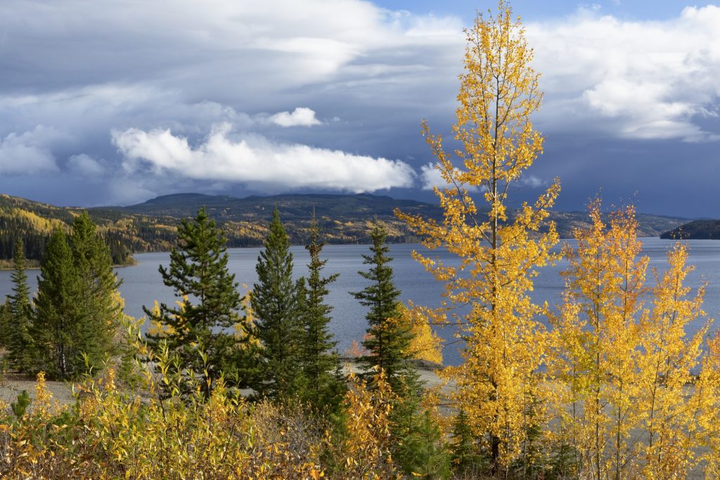
The journey north includes a vast array of First Nation communities with many tribes and cultures, and a history of economic development that is changing with the times. RV touring is a different form of soft adventure travel that allows you time to stop, look and listen. It provides time to hike, paddle and cycle when it suits you. The shoulder seasons are less busy. Spring offers more roadside wildlife and wildflowers during longer days, and the fall presents a dazzling display of autumn colours with the chance of new snow on mountain peaks.
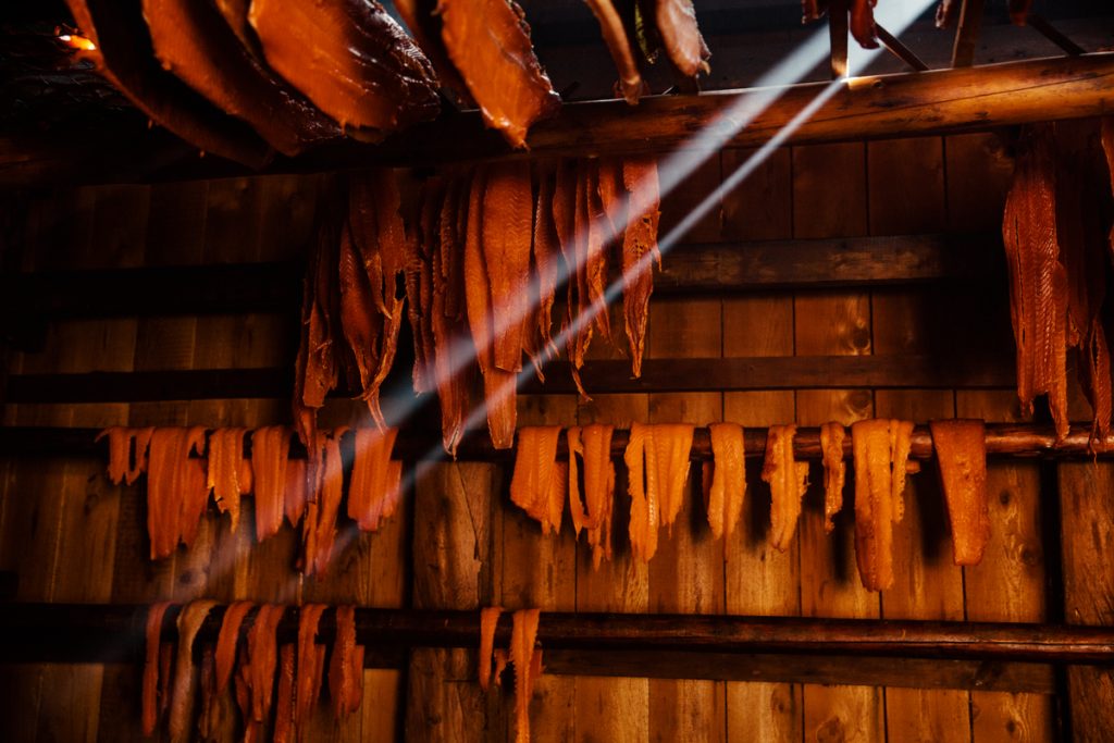
Indigenous peoples of the Northwest include the Tlingit further north in the Atlin area near the Alaska border; the Tsimshan around Terrace and Prince Rupert; Gitxsan were known to be with the Nisga’a in the Hazelton area; and the Haisla near Kitimat. Pacific salmon plays a central role in their diet and culture.
Section 1: Nanaimo to Port Hardy
Directions & Estimated Driving Time: The first leg of the trip takes 4 days over 800 km / 500 mi and heads north on Vancouver Island’s Hwy 19 from Nanaimo to Port Hardy. An alternate (and preferred) route from Parksville to Campbell River is Hwy 19A known as Oceanside Route and passes through many delightful seaside communities such as Parksville, Qualicum Beach, Bowser, Fanny Bay and Royston. Don’t dawdle too long though as your destination is still two thousand kilometers away and you have a ferry to catch.
Where to Camp: For campgrounds and parks available in this area go to Camping & RV in BC and search under the appropriate community.
Things to do:
As you make your way up Island the seaside communities give way to the North Island’s vast wilderness beauty that runs parallel to the Inside Passage from the Salish Sea to Johnstone and Queen Charlotte Straits.
Comox – is home to CFB Comox Aviation Museum and a Search & Rescue base. It serves as the terminus for BC Ferries to Powell River on the Sunshine Coast. Comox Valley Marina has picnic spots with a view over the straits.
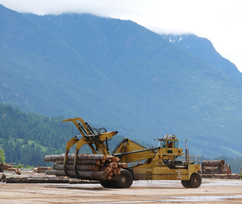
Campbell River – view panels describing the history of discovery back to Sir Frances Drake in the 1500s. Study the image map of Vancouver Island taken from space from the Landsat satellite at an altitude of 700 km / 435 mi along the Rotary Seawalk. It provides an outline of tides, wind and currents on the treacherous waters through Seymour Narrows where spring tides reach up to 18 knots. Campbell River Museum has logging displays from the days of truck logging and high rigging on steep hillsides that logging railroads were not able to reach.
Side trip to Sayward. Turn right off Hwy 19 on to Saywards Road and drive approximately 20 km / 12 mi. This is a bustling dryland sorting area of logs hauled in from productive second growth and grouped in to log booms to be towed to mills farther south. Information panels describe the history that was once MacMillan Bloedell’s Kelsey Bay logging camp. Stroll out to the town wharf where sounds of whales can be heard on the exterior speakers.
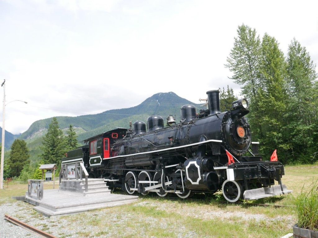
Woss – sometimes still referred to as Woss Camp, lies in the “Heart of the Nimpkish Valley”. It is home to the newly developed Nimpkish Valley Heritage Park and showcases its logging history which includes a display of logging locomotives and explanations of forest management on the North Island. Hike the strenuous trail to the restored Woss Fire Lookout.
While all of Vancouver Island has yielded decades of old-growth forest and hosted several notorious logging protests against the harvesting of trees, the North Island is a treasure trove of logging history from truck logging, logging camps and specialized railroads, and development of high-lead logging methods of extraction from towering spar trees that are now replaced by mobile steel spars that can be driven to the next setting. Logging trucks with extra wide bunks are still hauling on industrial roads that cross the main highway in places where there are not special overpasses.
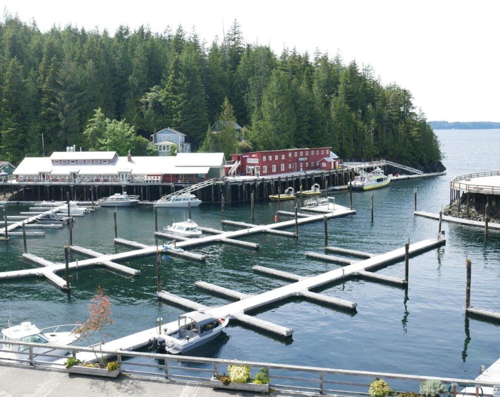
Telegraph Cove – this little slice of heaven has been overpowered by development however it still retains some of its original character as one of the West Coast’s last remaining boardwalk communities. Built on pilings with the old cannery still at its base you have a very good chance of seeing orcas in Johnstone Strait. There is also the Whale Interpretive Centre which is worth a look.
Port McNeill – Fi-Mi-Fo is the local slogan for Port McNeill built on fishing, mining, and forestry. The Harbour Info Centre is on the downtown waterfront. Its quirky 30-ton burl from a Sitka spruce is a point of interest. A good place to reprovision before heading further north.
Side trip to Alert Bay. Allow a day to make the round trip via ferry (45 minutes one way) from Port McNeill to Alert Bay on Cormorant Island and visit the U’mista Cultural Centre plus the world’s tallest totem pole. Be sure to verify the ferry schedules before leaving as some runs call at Sointula on Malcolm Island which is a circuitous route.
Side trip to Port Alice and Coal Harbour. Located on Quatsino Sound that pierces the rugged west coast as an inlet accessible from the open ocean. At the Junction of Hwy 19 and Hwy 30, take Hwy 30 south and drive 31 km / 19 mi. Note: RV travel on logging roads to the outer coast is not advised. See the historic Port Alice display showing one of the first pulp mills in BC. Coal Harbour Museum is home to an overstocked collection of logging memorabilia in a run-down RCAF hanger built to operate surveillance on the outer coast during WWII. Its time as a mine produced coal of inferior quality, and protests against whaling led to closure of the station.
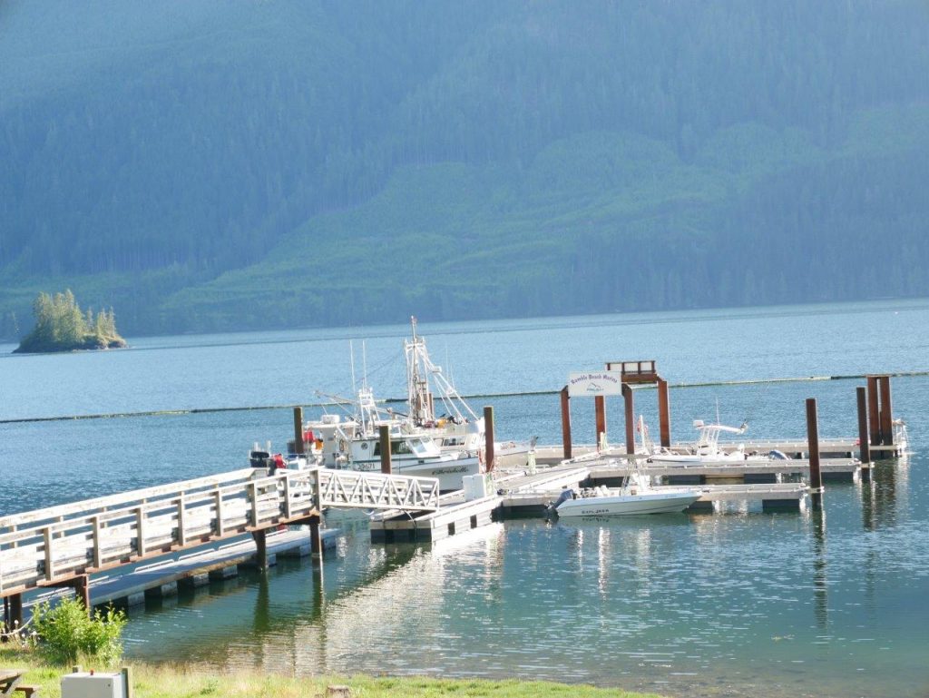
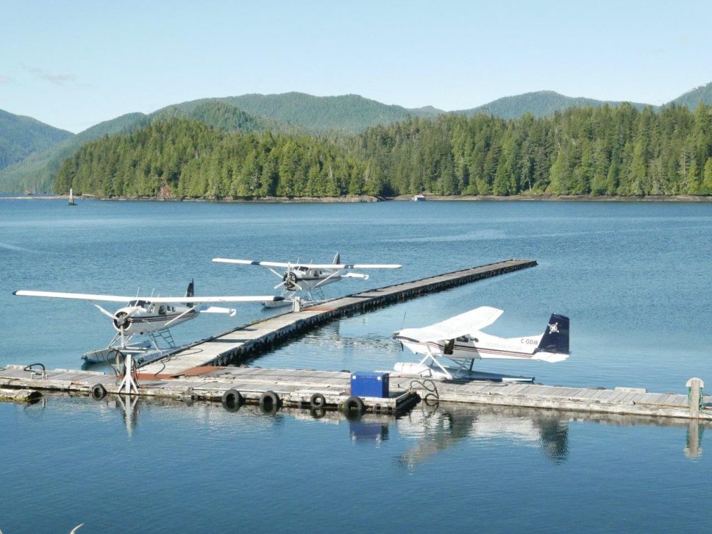
Port Hardy – visit the Quatse Salmon Stewardship Centre with interpretive gallery to learn all about Pacific salmon. Explore the Hardy Bay Seawall, the docks and marina while waiting to line up for the ferry. The terminal is located at Bear Cove, about half an hour from downtown.
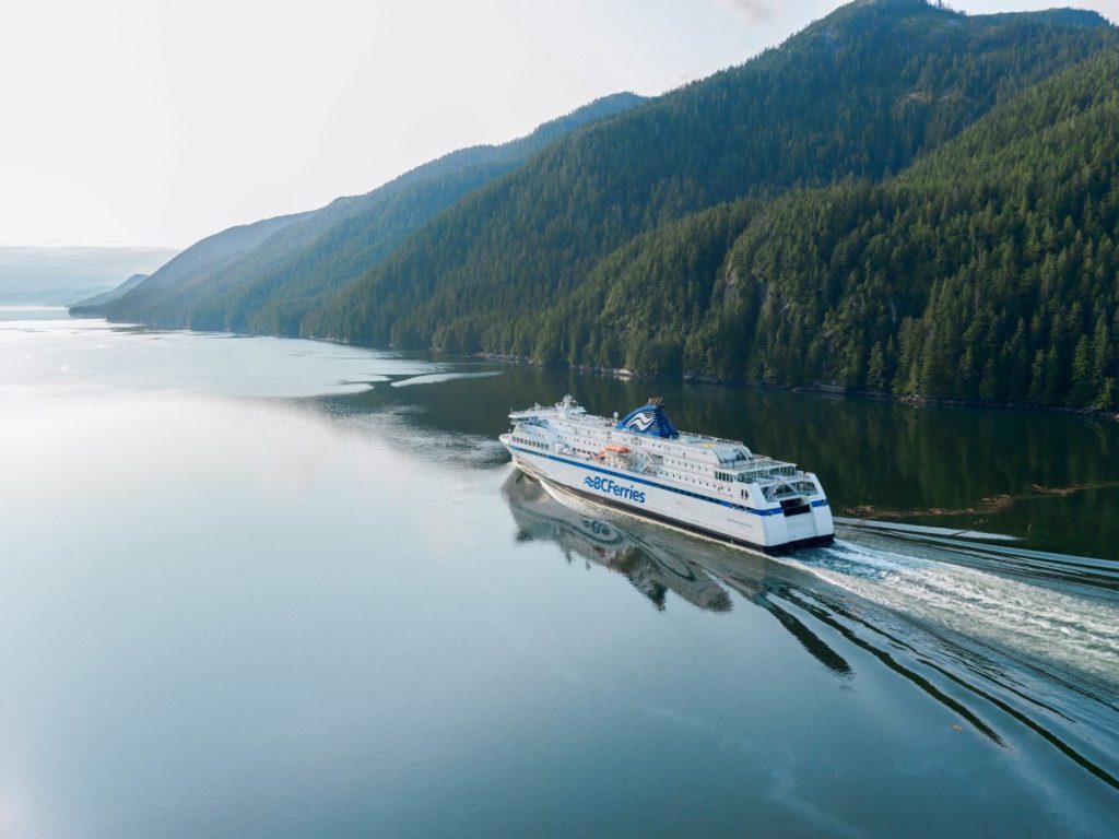
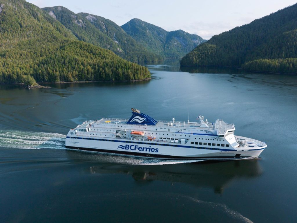
A Mini Cruise by Ferry on the Inside Passage
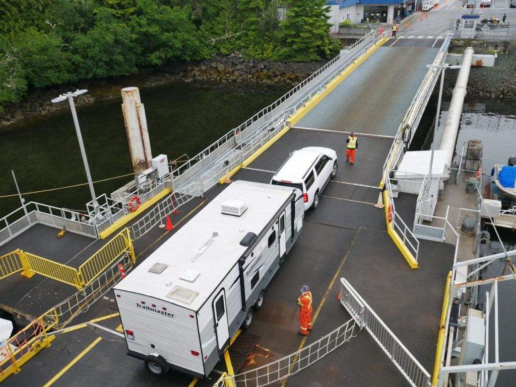
This ferry trip has been hailed as one of the world’s great ferry rides by Travel + Leisure magazine and a primary reason to Go North via Vancouver Island. The beauty and stunning views of the Inside Passage you will experience on the twenty hours of sailing between Port Hardy and Prince Rupert. The voyage on the MV Northern Adventure is a 6.00 pm departure from Bear Cove, with overnight stops in Bella Bella and Klemtu to arrive the next day at 2.00 pm. Be at the terminal at least an hour before sailing, as the ship has a one-way entry that requires backing up RVs on loading ramps at either port. With a capacity of 600 passengers and 87 cars or RV/truck equivalents, this vessel handles up to 3.3 m / 11 ft maximum gentle swells and rollers through Queen Charlotte and Hecate Straits north of Cape Scott before entering the sheltered waters of the Inside Passage between islands and the coastal mainland.
Cabins are air-conditioned with ensuite bathroom and shower. (Note: Buffet service has limited operating hours and menu during COVID-19). The gift shop opens only an hour before disembarking.
While an overnight sailing, there is plenty of daylight throughout the summer to gaze at the Coast peaks through the narrow Grenville Channel. Fog banks can lift to see fish farms, lighthouses, and light markers on exposed reefs. Watch for whales, dolphins and sea lions.
The ferry trip from Vancouver Island is about 500 km / 310 mi shorter than the direct driving distance from Vancouver via Hwy 97 to Prince George and west on the Yellowhead Hwy 16 to Kitwanga Junction.
Section 2: Prince Rupert to Terrace
Directions & Estimated Driving Time: The second leg of the trip takes 4 days over 1,100 km / 685 mi on BC’s Yellowhead Hwy 16. This segment includes the cities of Prince Rupert and Terrace on the Skeena River, and Kitimat located at the head of Douglas Channel. There is also a side trip to the Lava Memorial Park on the way to remote indigenous communities dotted along the Nass River shoreline to the coast.
Where to Camp: For campgrounds and parks available in this area go to Camping & RV in BC and search under the appropriate community.
Things to do:
Provincial parks on the Lower Skeena present steep granite faces looming over both sides of the valley in the Skeena River Ecological Reserve along the Skeena Corridor. The Kalum River feeds in from the Kitimat Ranges, along with the other big tributaries including the Bulkley, Babine, Kispiox, Copper and Kleanza Rivers in the Upper Skeena that drains the Coast Mountains.
Prince Rupert – Northern Pacific Cannery is BC’s oldest standing salmon cannery which is the last of 14 that operated at the mouth of the Skeena River. The Port of Prince Rupert Interpretive Centre provides working displays of commodity exports and inbound container ships that connect unit trains to markets east of the Continental Divide. It is the western terminus of the Via Rail “Skeena” that operates with a dome car and day coach on the CNR line to Jasper.
Terrace – this is the retail and service centre for northwestern BC and the Kitimat-Stikine Regional District. Intersected by Hwy 16 and 37A south to Kitimat. Once a major forestry town which is marked by “Big Bertha” the base of a 50-ton bright yellow portable spar tree at the east entrance to town. From the Visitor Centre next to the Grand Trunk Pathway with interpretive panels that ends at the Chill Soda Shop in the old Kwinitsa rail station. Here they serve the largest double-scoop ice cream cones you have probably ever seen.
Side trip to Kitimat. From Terrace drive south 63 km / 39 mi on Hwy 37. Kitimat was BC’s first planned community when it was laid out at the start of the massive Kitimat-Kemano Project in the 1950s by a famous town planner and architect from New York. To establish the aluminum industry with huge requirements for hydro power, the Kenney Dam was built with a spillway, 16 km / 10 mi of tunnel as wide as a two-lane highway, and penstocks sixteen times the height of Niagara Falls. Power is fed by 82 km / 50 mi of transmission line to the aluminum smelter now operated by Rio Tinto Mining. The plant sits on one of the few wide, flat valleys on the BC coast.
The town is now adding a massive LNG plant and a new wharf with a huge onsite work force for completion in 2025. Visit Hospital Beach for an evening BBQ, and Giant Spruce Park.
First Nation Culture
Side trip extension to Kitimaat Village. Drive several kilometers to the end of the road past Kitimat to a native fishing harbour which serves as home to the Haisla people who settled on Douglas Channel.
Side trip to New Aiyanish now known as Gitlaxt’aamiks. This is a 300 km / 185 mi return trip on Hwy 113 (off Hwy 16) that takes you to the Nisga’a Memorial Lava Bed Provincial Park and native communities situated along the Nass River. The highway is so numbered to account for the number of years it took to negotiate the precedent-setting Nass Treaty in the Calder Case that established the Nisga’a’s right to self-government and the authority to manage their lands and resources.
There are four native villages along the lower Nass River. The Nisga’a Memorial Lava Bed Park has plaques describing the volcanic activity in the area, and the violent explosion and lava flow when it erupted 250 years ago.
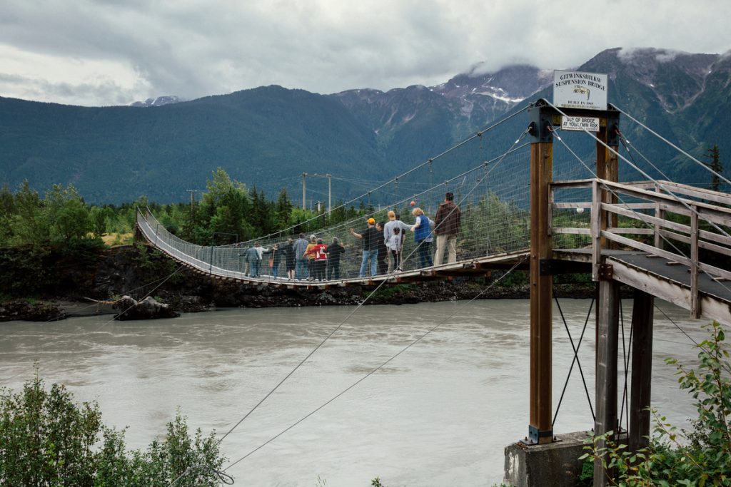
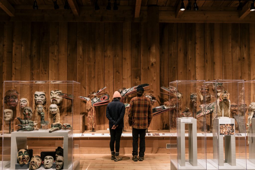
Gingolx is referred to as the “Seafood Capital of the Nass”, Laxgalts’ap has the outstanding Nisga’a Museum and Ancestor Collection which contains repatriation of priceless artifacts from abroad. Gitwinksihlikw. A suspension footbridge spans the Nass River which was once the only access to the village. Fish wheels on the riverbanks are in use during the salmon harvest as they struggle upstream to spawn.
Section 3: The Three Hazeltons
Directions & Estimated Driving Time: It is a short drive of 144 km / 90 mi from Terrace to Hazelton on BC’s Yellowhead Hwy 16, however total driving time for this segment is 700 km / 435 mi over 3 days. This area is home to multitudes of First Nation villages with new names and historic landmarks.
Where to Camp: For campgrounds and parks available in this area go to Camping & RV in BC and search under the appropriate community.
Things to do:
Three BC provincial parks on Hwy 37 provide spacing for easy driving and adequate time for points of interest.
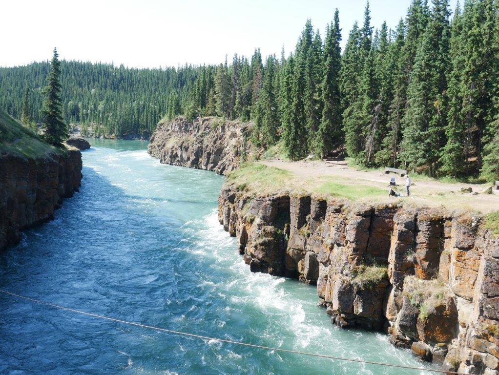
This is a complicated part of the trip to navigate. Several native villages are scattered in all directions. The three Hazeltons are entwined by native legends marked by totem poles preserving the Indigenous culture from K’san National Historic Site. The steel single-lane Hagwilget Suspension Bridge towers 75 m / 250 ft above where the Bulkley River surges into the Skeena.
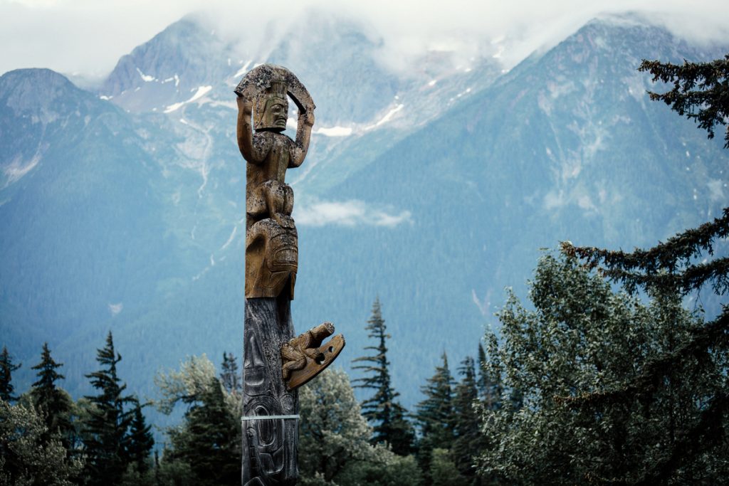
The Land of Totems
The Hazelton area on the Skeena River, from Kispiox to Moricetown is the centre of totem pole collections on the Northwest coast. A totem pole carved out of a western red cedar log serves as a genealogy record, memorial and maybe conveying rights to certain territories. First Nations are credited with making some of the earliest totem poles include the Haida, Tsimshian and Klingit. Bright paint is commonly used today to dramatize the design. Poles are generally facing the shores of a river.

Emily Carr was one of the first artists to grasp the compelling power of totem poles as a form of art.
South Hazelton – is the service centre for the Kispiox Valley and closest to Hwy 16 with fuel and some shopping.
Historic “Old Hazelton” – remains much like the original settlement, founded in 1866 when it was the main staging area for the Omineca Gold Rush. The Hazelton sternwheeler serves as a reminder of the sourdoughs who scoured the Skeena River tributaries. Its days were numbered after the Grand Trunk Pacific Railway punched a line through to the coast in 1912. Visit the Hazelton Pioneer Museum and St. Peter’s Anglican Church marked on the way round the village.
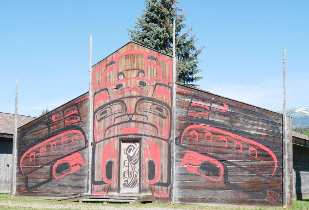
K’san Historical Village and Museum – in Hazelton, home of the Gitxsan people, is in the ancient village of Gitanmaax near the confluence of the Skeena and Bulkley Rivers. Visit the carving house to observe the delicate art of chiseling and whittling totem poles dedicated to preserving native culture.
New Hazelton/Hagwilget – originated in the early 1900s as work crews flooded into the area to build the Grand Trunk Pacific Railway.
Mount Rocher Deboule dominates the Coast Mountain ranges in front of the Seven Sister Peaks so named in a provincial park to the south of Hazelton.
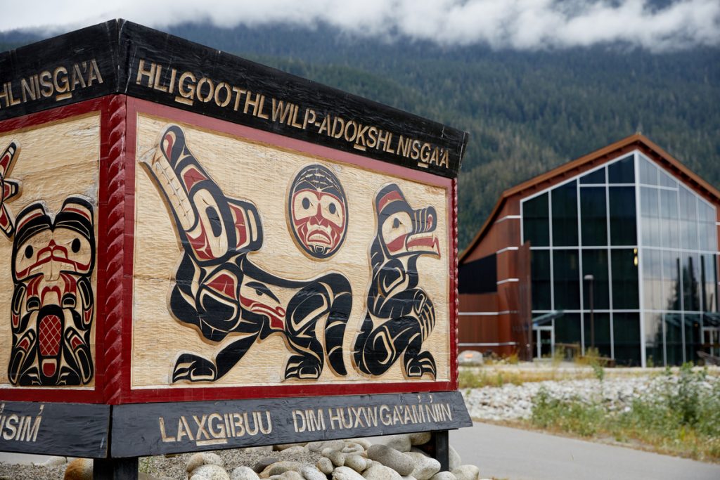
Kitwanga/Gitwangak – is the location of Battle Hill National Historic Site where the native families are divided into four clans known as the Frog, Raven, Wolf and Fireweed. Totem poles continued to be erected at potlatches up to the 1950s. They represent the oldest collection of carved poles to be found in their original village anywhere in BC. Xsi T’ax T’in Salmon Enumeration Facility has all five species of salmon at the same time on the Kitwanga River just off Hwy 37.
Follow the “Hands of History Tour” that leads to totem poles, Indian villages, and frontier towns in the Upper Skeena.
Side trip to Kispiox. 15 km / 10 mi north of Hazelton via River Rd (Hwy 62) east then left onto Kispiox Valley Road. A premier showcase of totem poles. Small general store and gas bar. Kispiox salmon hatchery.
Side trip to Usk. Drive west past New Hazelton on Hwy 16 back towards Terrace 117 km / 72 mi. Experience the reaction ferry across the Skeena. A wayside pioneer chapel with a slender steeple salutes the settlers who arrived with the Grand Trunk Pacific Railroad around 1912. Pause at the Logger Memorial to view the growing list of names of many tree fallers, chokermen, boom boat operators and truck drivers who died on the job in the area.
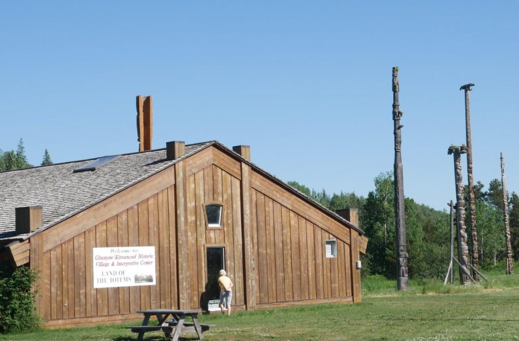
Gitanyow/Kitwancool – this historic village is located on Hwy 37 north of Kitwanga. Totem poles stand alongside the museum on the Kitwanga River. Convenience store and gas bar.
Section 4: The Stewart-Cassiar Highway
Directions & Estimated Driving Time: The Stewart-Cassiar Hwy 37 stretches approximately 720 km / 445 mi north from the junction of Hwy 16 to the Yukon border where it changes to Dease Lake Hwy connecting with the Alaska Hwy (Hwy 1) east to Watson Lake, Yukon. Total distance including side trips is 1,300 km / 800 mi over 5 days.
Where to Camp: For campgrounds and parks available in this area go to Camping & RV in BC and search under the appropriate community. There is some concern by RVers that there are few campgrounds in this stretch. Meziadin Lake, Kinaskin Lake and Boya Lake Provincial Parks offer good campsites although services are limited. The Grand Canyon of the Stikine River lies within Stikine River Provincial Park where only back country camping is allowed.
Things to do:
Although this segment looks like the longest, loneliest stretch of highway its vast ruggedness yields many points of interest. A key highlight is the side trip to Stewart through the walled canyon and viewpoints looking toward the toe of Bear Glacier at your feet. Carry on to Hyder, Alaska.

Meziadin Junction – fuel and propane are available here. This is a tricky corner that gives through traffic from Stewart the right-of-way onto the highway. Refuel and ask for directions to the sani-dump in the back corner.
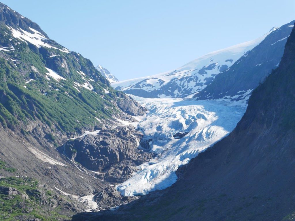
Side trip to Stewart and Hyder, Alaska. Take the Glacier Hwy 37A from Meziadin Junction 66 km / 41 mi. To get into Alaska you will need your passport. Watch for the frontal view of Bear Glacier across the turquoise lake from the highway, and past the Wall of Tears where waterfalls cascade in a series from great heights. Hyder is not a ghost town but is certainly overshadowed by services available in Stewart. Highlight is the bear viewing at Fish Creek Wildlife Observation Site, estuary boardwalk at Stewart and the rough road to Salmon Glacier. The US border crossing is known as Check Point Charlie.
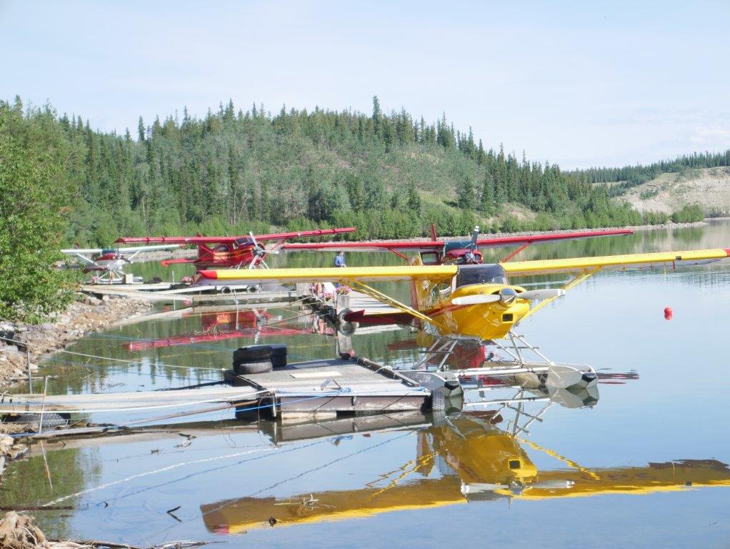
Golden Triangle – back on Hwy 37, travel north and through several villages with limited services. Bell II helicopter base services the remote mines and exploration sites with liftoff with slings of supplies right next to the highway. Tatogga, Iskut and Dease Lake all have float plane bases to serve BC’s Golden Triangle with a proliferation of gold and copper discoveries financed by the current high price of minerals.
Gnat Pass – at 4,071 ft / 1,240 m has views of the abandoned BC Railway grade and is the height of land of the Arctic/Pacific divide, with the Liard River system running to the north and the Stikine drainage to the west.
Bell II – (not Bell 2 or Bell Two) is a rustic wilderness lodge with deluxe chalets alongside Hwy 37, 96 km / 60 mi north of Meziadin Junction. Situated in the Skeena Mountain Range on the Bell-Irving River.
Bob Quinn Lake – is essentially an unstaffed aerodrome with a 4,000 ft / 1,220 m gravel runway carved out of the wilderness in 1990 to provide air service to mines, as well as for recreational purposes and to provide safety access for medivac requirements along the Hwy 37 corridor.
Once in the Yukon, connect to the Alaska Hwy 1 at a non-descript junction at the north end of Hwy 37. Head east for 22 km / 14 mi to Watson Lake to re-provision before turning back to Jakes’ Corner (355 km / 220 mi).
Section 5: Southwest Yukon
Directions & Estimated Driving Time: The distance from Watson Lake to Carcross and Whitehorse is approximately 485 km / 300 mi. Including side trips it takes some 1,100 km / 685 mi over 5 days. This segment includes the southern edge of the Yukon and is worth seeing for a few days before arriving in Whitehorse.
Where to Camp: For campgrounds and parks available in the Yukon please check the website https://yukon.ca/en/find-campground-or-recreation-site.
Things to do:
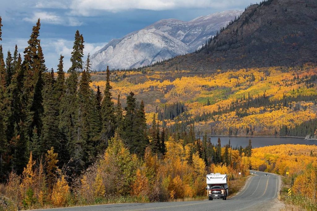
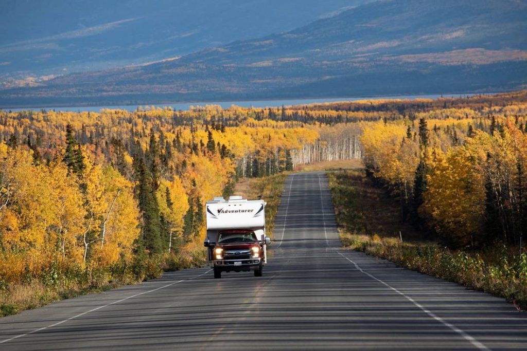
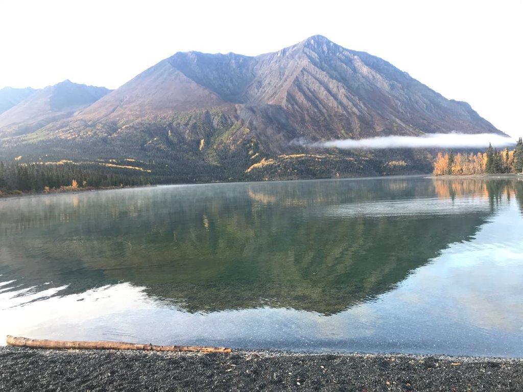
The Southern Lakes region includes Teslin, Tagish, Atlin, Carcross and an extension to Kluane National Park at Haines Junction on the Alaska Hwy from Watson Lake to Whitehorse. The Land of the Midnight Sun brings to life the stories from the literary giants Robert Service, Jack London and Pierre Burton when exploring the North.

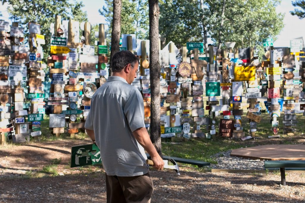
Watson Lake – the eastward turning point for a return to Northern BC on Hwy 97 forms part of the Alaska Hwy drive. Or carry on westward on the Alaska Hwy as it wends its way through the south-west Yukon. There is a Travel Information Centre with a history of the Alaska Hwy located behind the Sign Post Forest. A good spot to re-provision and refuel.
Teslin – 260 km / 162 mi from Watson Lake an unexpected attraction visible from the Alaska Hwy is the George Johnson Museum & Heritage Park that features traditional Tlingit life and trade routes between the Coast and the Yukon interior. Johnson was a Tlingit man, and a unique businessman in many ways. There is an immaculately restored 1928 Chevy that he had barged from Whitehorse by sternwheeler to Teslin before there were roads. It was repainted in white house paint to be disguised from hunting wolves on the frozen lakes. For such a remote area, the museum is proud of the rebuilt Teslin Radio Range with insulated towers to aid delivery of lend-lease aircraft to Russia in 1940 and guided planes throughout the North until the late 1960s.
Approaching Teslin from the south, the 7-span 584-metre / 1,900-foot long Nisutlin Bay Bridge, built by the US Army Corps and replaced in 1955, is destined to be replaced again. Information panels at both ends of the long river crossing are a tribute to the Pacific salmon.
Teslin Tlingit Heritage Centre is located 5 km / 3 mi north of Teslin on the Alaska Hwy.
Jakes Corner – 96 km / 60 mi from Teslin this is a major Intersection with gas station on the Alaska Hwy with Hwy 8 southward back into BC, and westward to Tagish, Carcross, and Skagway.
Tagish – village located on the Yukon side of the Alaska Hwy. Six Mile River Resort at Tagish Bridge is a worthwhile point of interest. Various collections and amusing signage like a subtle warning that violators will be shot, and survivors will be shot again. Local entertainment on weekends. RV sites.
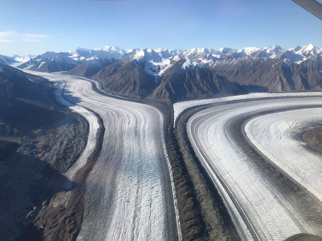
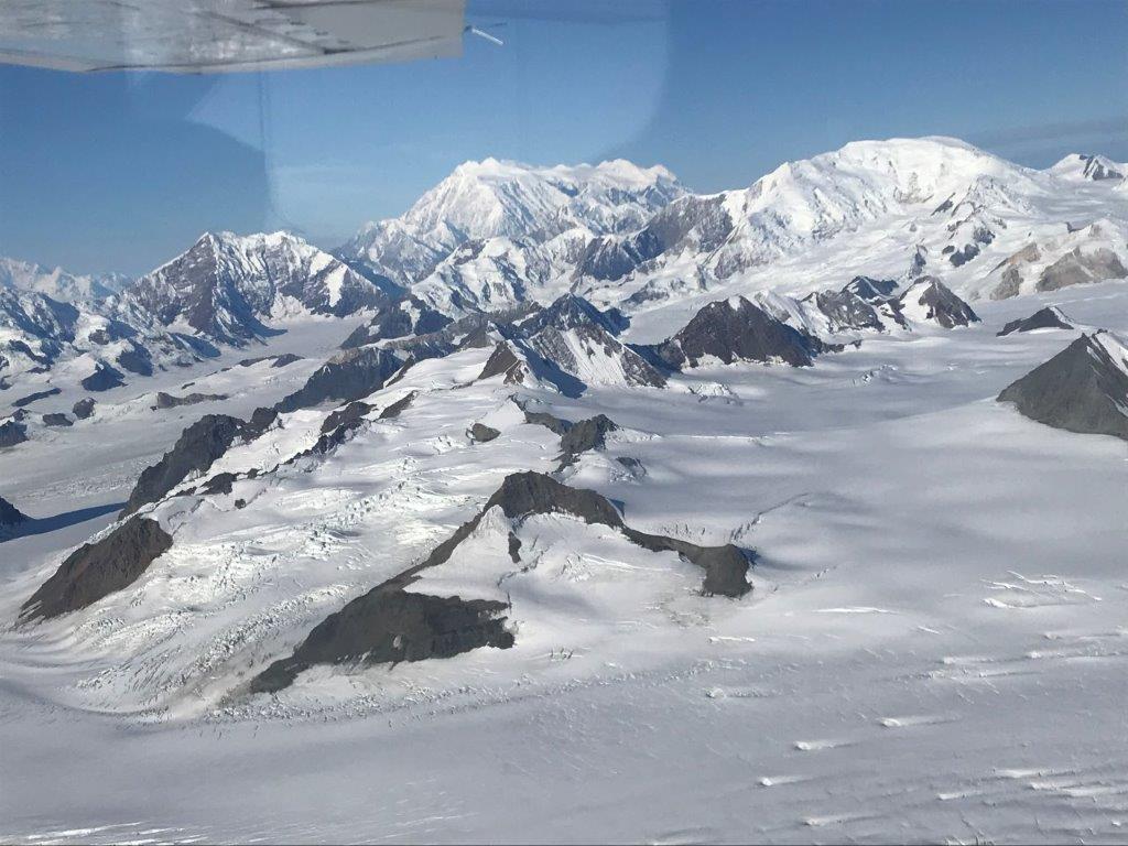
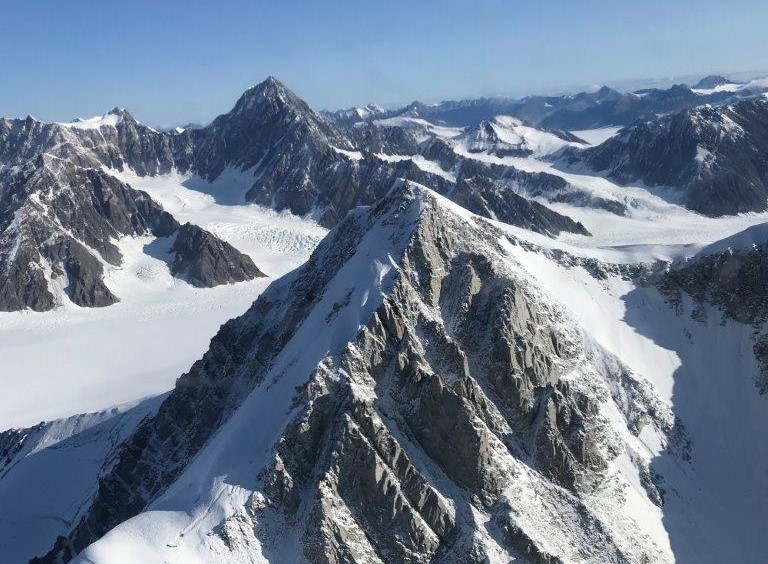
Side trip to Haines Junction. Gateway to Kluane National Park. Haines Junction is 234 km / 145 mi west from Jakes Corner beyond Whitehorse. The National Parks Service operates the Da Ku Cultural Centre that presents a scale model of the St. Elias Icefields and glaciers topped off by Mount Logan at 5,959 m / 19,545 ft as Canada’s highest peak. This is the greatest concentration of surging glaciers in North America. A display tracks collared grizzly sow and her cub throughout her range during the four seasons, crossing the busy highway numerous times in search of food or avoiding large male bears that would kill her cub. Spectacular glacier flights operate from the local air strip and are well worth the cost. Be sure to book ahead.
Carcross – located south-west on Hwy 8, 55 km / 34 mi from Jakes Corner. Leads to the Trail of ’98 at the terminus of the White Pass & Yukon Railway from Skagway in Alaska where the hopeful stampeders travelled the length of Bennett Lake to Carcross, and on to Marsh Lake as part of the Yukon River. Visit sternwheeler Tutshi, historic general story and the newly reopened Cariboo Hotel. Carcross Commons has the Visitor Centre and kiosks with a carving shed and a selection of native crafts. The tiny locomotive nearby is the “Duchess” which ran on 6 km / 4 mi of track during the gold rush between Tagish and Atlin Lakes. Carcross Desert is the world’s smallest desert.
From Carcross, Hwy 2 continues south to Fraser, BC and Canada Customs at the port of entry to Alaska before ending in Skagway, Alaska. Pull over for many of the viewpoints on the way as time permits.
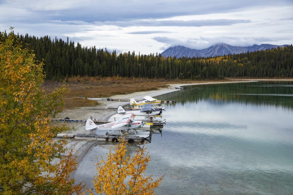
Side trip to Atlin, BC. Hwy 7 is the only access, and only from the Yukon side. Turn south just west of Jakes Corner and drive 94 km / 58 mi. More information can be found at RV Adventures in Northern BC – Road to Atlin. Also, the book Road to Atlin published June 17/20. The easy Mount White Trail off Hwy 7 offers wonderful views of Atlin Lake. The views alone from the Atlin waterfront are worth taking this side-trip.
One-way rentals must proceed to Whitehorse for the return flight home.
Whitehorse – the capital of the Yukon lies 1,200 km north of Kitwanga. The terminus of a one-way journey to the gateway city that needs at least a day or two to explore. The MacBride Museum of Yukon History starts with a display of the Indigenous migration on the ice bridge across the Bering Sea. The rattle of hammers fill the air as a reminder of the Klondike Gold Rush, and all the hardships incurred by the sourdoughs as the clawed their way up the Trail of ‘98 to reach Atlin and Dawson City.
Treacherous rapids through Miles Canyon are visible from a bridge crossing over the Yukon River. Watch your step along the edges of unfenced bluffs. The Millennium Trail weaves its way along the river from downtown to the Whitehorse Fishway, built to aid the migration of Chinook past the dam. Salmon migrate some 2,500 km from the Bering Sea. There are viewing platforms and a footbridge.
Single and multi-day canoe rentals are available near the Visitor Centre on the smooth but fast flowing Yukon River below Miles Canyon.
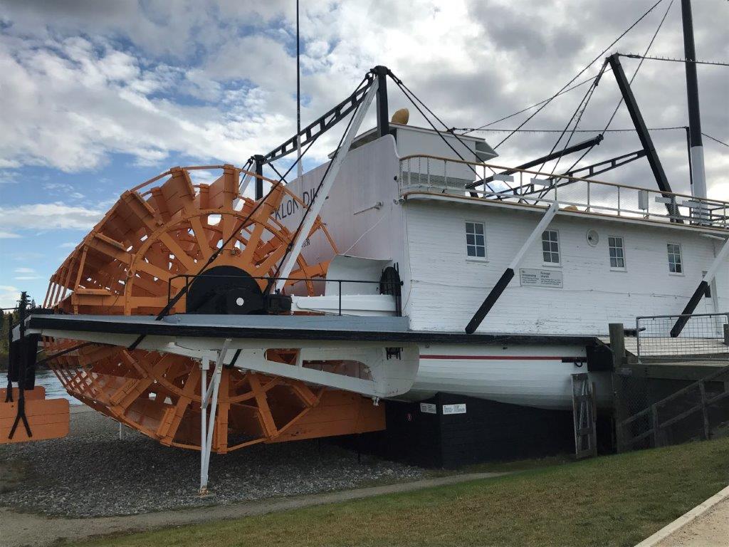
Visit the S.S. Klondike National Historic Site, and Yukon Transportation Museum that explains the importance of aviation, dog sled travel, canoeing, and highway development in the Yukon. A display features EV charging stations, although there are not many Teslas far north.
Busts of some of Canada’s most notable literary celebrities line the main streets that include Jack London (author of Never Cry Wolf), Robert Service (poet that wrote The Shooting of Dan McGrew, The Cremation of Sam McGee and many others, and Pierre Burton who was born in the Yukon and famous as the historic author of The Last Spike. Fireweed Books displays a large selection of Yukon literature.
Various services are available including: laundromats and RV wash, tire service, diesel, propane, sani-dump.
One-way Rentals – Go North
RV rentals are the best way to explore the North. Either by flying into Whitehorse for a round trip back through Northern BC, or a one-way RV rental from Calgary to Vancouver and a drop-off in Whitehorse.
Air North and Air Canada offer flights to Calgary and Vancouver. European carriers offer weekly flights between May and September.
The Great Northern Circle Route runs back through BC to Terrace and Prince Rupert. Then east along the Yellowhead Hwy, and back up the Alaska Hwy via Prince George, Dawson Creek, Fort St. John, Fort Nelson, Muncho Lake, Liard Hot Springs to Watson Lake and on to Whitehorse. Or continue south to Calgary or Vancouver as part of a one-way journey. Check out RVing Along the Alaska Hwy and Wilderness Adventure Along the Stewart-Cassiar Hwy.; also Road to Atlin and Kitwanga Junction.
Other Northern BC drives/itineraries to explore include:
Exploring Northern British Columbia – A Circle Tour Adventure: Tour 1 Alaska Hwy; Tour 2 Stewart-Cassiar Hwy; Tour 3 Yellowhead Hwy.
CanaDream and Fraserway RV operate rental stations in Calgary, Edmonton, Vancouver and Whitehorse.