The rugged beauty of British Columbia’s north offers the traveler once-in-a-lifetime views of staggering and drop-dead stunning landscapes that cannot be matched. Snow-covered mountains marching across the landscape, glaciers, rivers and lakes, forests and plateaus. This is the wild north of a great land. Plan not to miss it.
The Northern BC Adventure Tours encompass four separate tours: The Road to Atlin; Wilderness Adventure Along the Stewart-Cassiar Hwy; Kitwanga Junction; Following the Yellowhead Hwy to Prince George. If you were to do them all in one trip you would need about four weeks to appreciate it all. It also assumes that you will start your trip in the north and head south, perhaps picking up a rental motor home in Whitehorse, Yukon and starting from there.

Tour 2: Wilderness Adventure Along the Stewart-Cassiar Hwy
This long segment of the most northern route on Hwy 37 between Watson Lake in the Yukon and the cluster of Indigenous communities around Kitwanga, is famous for remoteness, wildlife viewing and extreme adventures. It includes options to visit Spatsizi Plateau, Telegraph Creek and the massive Salmon Glacier at Hyder on the US side of the Alaska Panhandle.
Rental RVs offer opportunities for circle routes from Whitehorse stations, or one-way trips between Whitehorse and Vancouver which require nearly four weeks to cover some 7,000 km / 4,400 mi.
Wilderness adventure abounds on this tour. Hiking, canoe and kayak rentals, as well as ATVs are offered in many towns. Big game viewing happens frequently and unexpectedly along the way.
Directions & Estimated Driving Time: 750 km / 460 mi from Watson Lake, Yukon to Kitwanga, BC for a total of 11 hrs driving time. Allow two or three nights to cover the trip and more to include side trips. The one-way southbound wilderness route forms part of the Great Northern Circle Tour that returns to Whitehorse via the Alaska Hwy from Dawson Creek through Fort Nelson and Liard Hot Springs to Watson Lake.
Where to Camp: For campgrounds and parks available in this area go to Camping & RV in BC and search under the appropriate community.
Things to do
Watson Lake & the Drive South. Re-stock provisions in Watson Lake before heading south on to the Stewart-Cassiar Hwy 37 towards Meziadin Junction. While supplies and fuel are available at intervals, there is a better selection of goods at the head of the route.

The stretch south from the Yukon border passes through areas where small operators are still scratching the surface and panning creeks in search of the elusive placer gold. Gypo miners operate a lot of re-cycled tractors, trucks and earth movers at mining sites used to push alluvial dirt towards sluice boxes where they might extract bits of gold. The creeks have all been worked several times before the latest attempts to strike it rich.

The northern section of Hwy 37 has a rough surface, narrow shoulders and steep grades. Gnat Pass is the highest point on the Stewart-Cassiar Highway at 1,240 m / 4,071 ft elevation.
Jade City. 141 km / 87 mi from Watson Lake this tiny place is named for the extensive jade deposits found nearby. Famous for locally mined jade, the store offers a vast collection of jade stone carvings, from trinkets to collector pieces.

Dease Lake. 116 km / 72 mi from Jade City, Dease Lake is located on the south end of the lake. Once a Hudson’s Bay trading post established in 1838, and centre for the 1873 gold rush.
The Arctic/Pacific Divide. The Tanzilla River to the south of Dease Lake flows into the Stikine River and then on to the Pacific Ocean, and north Dease Lake empties into the Dease and Liard Rivers that flow north into the Arctic Ocean. This point is known as the Arctic/Pacific Divide.
Side Trip to Telegraph Creek. Pass through the Grand Canyon of the Stikine for about 100 km / 62 mi west of Dease Lake. Once the head of navigation for paddle-wheelers serving the gold rush trail to the Yukon. This historic town site has limited guest services. Difficult access by gravel road with 20% grades on a narrow ridge. The road is not recommended for everybody and may be restricted for some large vehicles.

Pass through the Grand Canyon of the Stikine for about 100 km / 62 mi west of Dease Lake. Once the head of navigation for paddle wheelers serving the gold rush trail to the Yukon. This historic town site has limited guest services. Difficult access by gravel road with 20% grades on a narrow ridge. The road is not recommended for everybody and may be restricted for some large vehicles.
Stikine River. Further south from Dease Lake you will cross a bridge over the Stikine River. Just downstream from the bridge crossing, the river enters 80 km / 50 mi of dangerously unnavigable rapids through a narrow canyon. The volcanic walls tower 300 m / 990 ft high on both sides. The Stikine River drainage is one of the largest in BC that winds through the Coast Mountains to its outlet into the Pacific Ocean at Wrangell on the Alaska Pan Handle.

Spatsizi Plateau Wilderness Provincial Park. This is one of Canada’s largest and rugged parks. Exceptional wilderness abounds with large wildlife populations including woodland caribou, bears and mountain goats. Spatsizi is Tahitan for “Land of the Red Goat”. Mountain goats roll in iron oxide and color their white coats. The glaciated regions are characterized by barren alpine mountains. Gladys Lake ecological reserve has been established for the study of Stone sheep and mountain goats. There is no camping here and the best way to see the park is to take a sightseeing plane from Iskut.
Iskut. A small community 83 km / 52 mi south of Dease Lake and home of the Iskut First Nation in the Tahitan territory. You can stop here to get gas and stock up on supplies at the convenience store.

Tatogga Lake. 16 km / 10 mi further south is Tatogga Lake, the oldest resort on Hwy 37 and it also provides fuel and good food. A collection of old vehicle relics are on hand and include a fire truck, crawler tractor and dump truck. Inside displays include details of construction of the telegraph line through the north from whence Telegraph Creek got its name. Stuffed moose, bears, wolves and caribou highlight the hunting in the area. Flight-seeing and canoe rentals are available. Tatogga means “small lake between two lakes” which forms a string of lakes that are all part of the south-flowing Iskut River.
Stikine River Recreation Area encompasses 217,000 ha of the Stikine River Valley which includes parts of two regional landscapes. The Stikine-Yukon Plateau consists of rolling glaciated lands with numerous volcanic centres. The Spatsizi Uplands are characterized by large plateau areas cut by steep-sided valleys. The Recreation Area is dominated by the spectacular Grand Canyon of the Stikine. The canyon in places is no more than a few hundred meters wide with vertical walls over 300 m / 1,000 ft deep.

Mount Edziza Provincial Park is located across the Stikine River from Telegraph Creek. The park protects Canada’s most spectacular volcanic landscapes. The large, dormant volcanoes were created 4 million years ago when a major eruption formed a volcanic cinder cone that measures 40 km / 25 mi around its base. It exposed many brilliant hues of reds, orange and yellow lava soils. This remote park is best seen on a sightseeing plane tour.
Bell Irving River (Bell II). Resort with restaurant, general store, fuel and RV park where Hwy 37 makes a second crossing of the Bell Irving River. There is access to exceptional wilderness scenery.

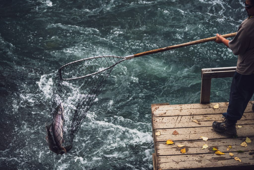
Meziadin Junction. 42 km / 26 mi from Bell River is the major intersection of Hwy 37 and 37A heading west to Stewart and Hyder. Fuel and repairs are available here. Meziadin Lake and surrounding creeks are a favorite feeding ground for grizzlies during spawning season. Just downstream from Meziadin Lake, the Meziadin River Fish Ladder is a popular stop for fish and wildlife viewing.
Known as the Glacier Highway to Stewart, the Bear Glacier and more than twenty hanging glaciers are visible above the road.

Side Trip to Stewart and Hyder. Head west on Hwy 37A from Meziadin Junction past Bear Glacier to Stewart on the Portland Canal. 61 km / 38 mi along the highway is the small community of Stewart with all the amenities of bigger towns, including groceries, fuel and post office. The Historical Museum forges the past that featured huge deposits of gold and silver. An Estuary Boardwalk offers a spectacular view of the Portland Canal.

From Stewart venture into the USA to reach Hyder in 3 km / 2 mi, and then 6 km / 4 mi to the observation boardwalk where the US Forest Service maintains vigilance over the grizzly bears fishing for salmon during the annual fall runs. An unmarked bush road heads 37 km / 23 mi to the Salmon Glacier. The Summit viewpoint provides a vast unobstructed view of the area. Note that the border between BC and Alaska closes at 5pm. Don’t drink and drive after getting “Hyderized”.
Return to Hwy 37 at Meziadin Junction. Be sure to refuel.

Side Trip to the Nass Valley. At Cranberry Junction on Hwy 37 turn west onto the Nass or Cranberry Road (BC Hwy 113). The road is rough in parts. 62 km / 38 mi you arrive at the Nisga’a Memorial Lava Bed Park at New Aiyansh. This is the headquarters of four Nisga’a villages. Take a self-guided tour of the Nisga’a Lisims Government Building. Visit Aiyansh hot springs and spectacular suspension bridge over the Nass River, and the new Nisga’a Museum in Greenville. Participate in preparation of traditional foods. This trip might be best accessed from Hwy 16 in Terrace. The road is in better condition. See Tour 3 Kitwanga Junction for information from this access point.
Return to Hwy 37 and continue south for 53 km / 33 mi to Gitanyow and a further 20 km / 12 mi to Kitwanga close to Hwy 16.