Journey north to truly experience the vastness and beauty of British Columbia’s great northern wilderness. Absorb the majesty of the mountains, the lush valleys and raging rivers as the land unfolds around you. Soak in the history and imagine the explorers discovering this vast land over 200 years ago as they made their way through the Rocky Mountains in search of the Northwest passage.

In the early 1800s, forts and trading posts were built along the route and furs were transported by canoe through the Peace River all the way to Ontario and Montreal for shipment to Europe. Today, many historic landmarks mark the route.
Following the bombing of Pearl Harbour in 1941 construction of the highway was deemed a military necessity as a supply road to defend North America against the Japanese. Construction started in the winter of 1942 from Dawson Creek and was completed eight months later. In 1996 the American Society of Civil Engineers designated the Alaska Highway as the 16th International Historic Civil Engineering Landmark in the world.

Driving the Alaska Highway
Explore Northern British Columbia by starting in Vancouver or Calgary. Allow a minimum of fourteen days to cover 2,500 km / 1,550 mi on the Alaska Highway via Hwy 97 to Prince George, Dawson Creek, Fort Nelson, Watson Lake in the Yukon and on to Whitehorse for a return flight home.
A round trip, returning via the Stewart-Cassiar Hwy 37 would require another two or three weeks. This vast wilderness experience takes at least a month to drive.
The drive from Vancouver connects to Hwy 97 at Cache Creek and becomes the Cariboo Highway, through cattle country to Prince George and the John Hart Highway, and beyond to Dawson Creek. The rolling farmlands in the foothills of the Peace River Valley then give way to the sandstone walls and grandeur of the Northern Rockies that trail off to the Yukon frontier.
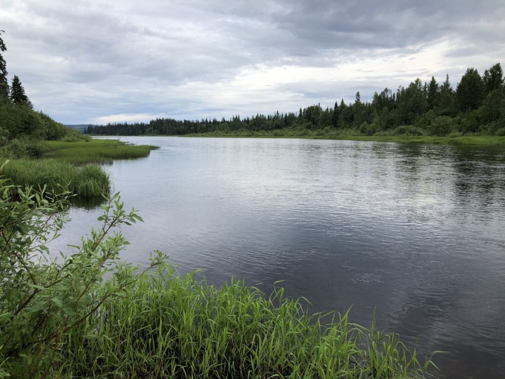
Boxed in by the Coast, Cariboo and Rocky Mountains, the entire route is directed by the flow of rivers that emerge from the alpine regions, starting with the mighty Fraser, and then the Murray, Peace, Liard Rivers and all the tributaries. The Arctic divide separates water destined for the north into great rivers like the Liard and Mackenzie, or the Stikine, Skeena and Yukon flowing west into the Pacific.

This RV route is designed in three contiguous segments of the Alaska Highway. The journey north starts on the John Hart Hwy in Prince George to Dawson Creek, followed by the Alaska Highway to Fort Nelson and eventually to Watson Lake past the BC/Yukon border.
(Note: please check with individual businesses and Visitor Information Centres as to whether they are open when you plan to travel, especially during the COVID-19 pandemic).
Section 1: Prince George to Dawson Creek
Directions & Estimated Driving Time: Following Hwy 97 north this segment of the trip is 403 km / 250 mi with side trips and takes 5 days. It passes through Prince George, Mackenzie, Chetwynd, Hudson’s Hope, Tumbler Ridge, Dawson Creek.
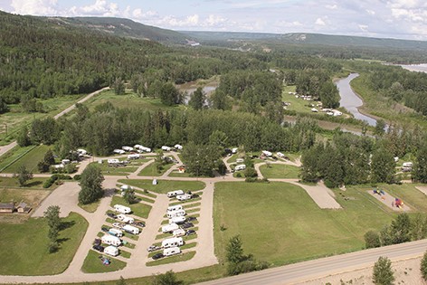
Where to Camp: For campgrounds and parks available in this area go to Camping & RV in BC and search under the appropriate community.
Things to Do:
Prince George – known for the mass production of high-grade pulp and lumber, the “Spruce Capital of BC” is located at the confluence of the Fraser and Nechako Rivers near the geographical centre of BC. The city sits at the crossroads of the Yellowhead Hwy 16 mid-way between Jasper in the Canadian Rockies, and Prince Rupert on the BC coast.
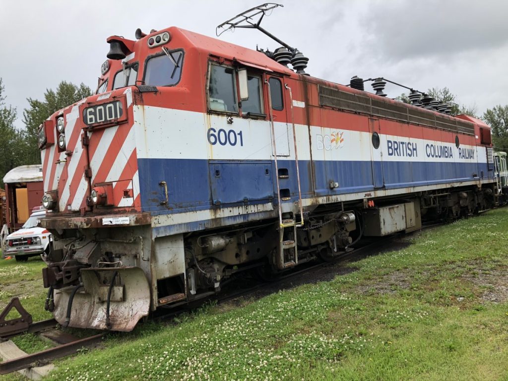
The Central BC Railroad and Forestry Museum features BC Rail history during the challenges of developing the natural resources in the North. Vintage steam and diesel locomotives, railway turn table, skooters, passenger coaches and vintage snowplows are housed in a dual-track shed. Sawmill relics include a massive gang saw and edger used to spew out 2x4s for use in American housing. An industrial art gallery features many acrylic paintings of the beehive burners that operated at sawmills in the area.
The Huble Homestead and trading post in the original log building is a heritage site that has been restored to its 1915 condition as the oldest home in the region.
Summit Lake, Bear Lake and McLeod Lake lie alongside the highway with overviews towards the mountains.
McLeod Lake – was the first European settlement that was established west of the Rockies. It is marked by a cairn in front of the general store. Simon Fraser set up camp here in 1805.
Side Trip to Mackenzie. Take Hwy 39 off Hwy 97 north for 30 km / 19 mi. This is the Southern Gateway to the Muskwa-Kechika, also known locally as the M-K. An “instant town” was built in the mid-1960s to house workers on the W.A.C Bennett Dam on the Peace River. A frantic effort was made to harvest timber in the bottom lands of the Peace tributaries before the valleys were flooded to create Williston Lake. Whilst there visit the Mackenzie museum.


In 1793, the famous explorer Sir Alexander Mackenzie, the earliest known explorer and surveyor of Canada west of the Rocky Mountains, travelled the region in search for an overland route to the Pacific, and was followed by fur traders, prospectors and missionaries and Hudson’s Bay Company personnel.
Bijoux Falls Provincial Park lies next to Hwy 97 and offers day use parking and a hike to view the cascading falls.
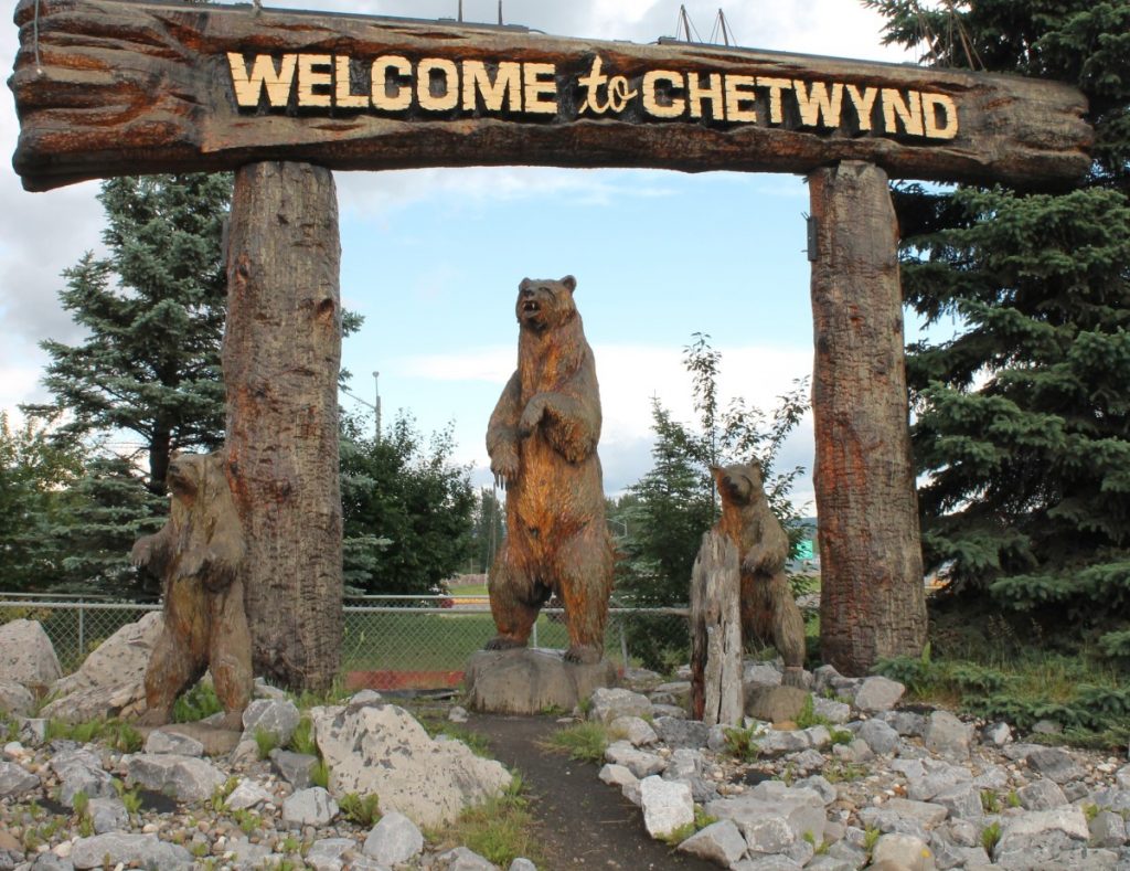
Chetwynd – has no shortage of slogans. It proudly calls itself the ‘Forestry Capital of Canada’ and “A community carved by success” but is better known as the ‘Chainsaw Capital’, showcased by an event that is held annually in the 2nd week of June. Take a self-guided walking tour from the gateway exhibit with three bears to more than 150 detailed sculptures carved from massive red cedar logs, including Spider Man and Lady Gaga, that line the main street. Visit the Little Prairie Heritage Museum that was originally a general store and post office.
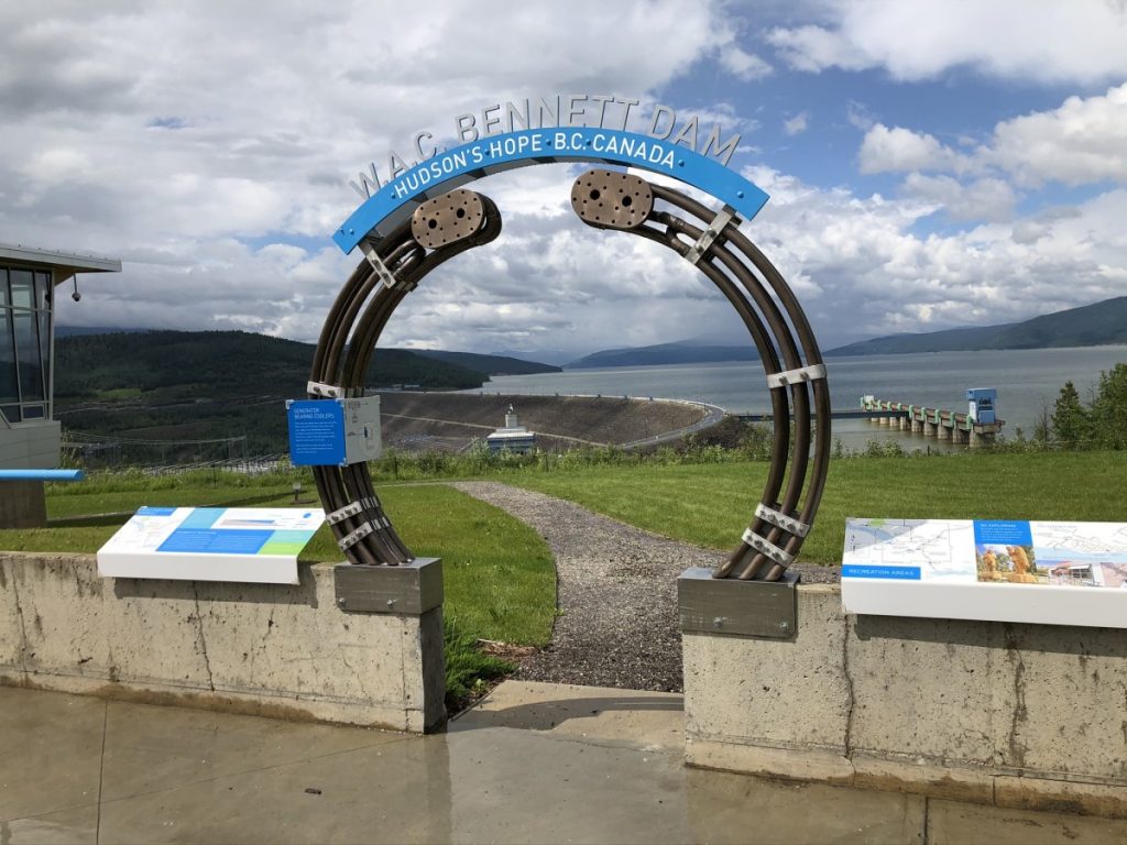
Side Trip to Hudson’s Hope. Take Hwy 29 north from Chetwynd for about 67 km / 42 mi. Experience a drive across the W.A.C Bennett Dam to the lookout over the spillway and Peace River. The largest earth-filled dam in North America generates 2,730 megawatts from its 250 km / 155 mi long reservoir. A historical museum and Visitor Centre is housed in an old Hudson’s Bay trading post overlooking the river and Peace Valley. The town is proud of its 53 kw solar energy array supplied to schools and public buildings.
Peace Canyon Dam is referred to as Site A dam and has a viewpoint. A self-guided tour includes a display of Alexander Mackenzie’s discovery of the Peace River canyon.
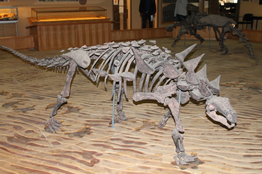
Side Trip to Tumbler Ridge. Head south from Chetwynd on Hwy 29 to Tumbler Ridge to complete a 200 km / 125 mi circle loop from Chetwynd to Dawson Creek. Most famous for the UNESCO Global Geopark. The coal mines led to unearthing dinosaur remains from the Cretaceous Period that are now housed in the Dinosaur Discovery Gallery. Take time to explore the extensive trail networks with guided descriptions with exotic names like Nesbitt’s Knee Falls, the Boulder Garden and Quality Falls. Jet boat tours are offered to the famous 60-metre / 200 ft Kinuseo Falls on the Murray River that tumble out of the Peace River Foothills. Wind farms surround the village on hills near the remains of Bull Moose Mine.
Dawson Creek – a famous cairn at Mile 0 marks the exact spot from where all mileages on the Alaska Hwy are measured. The Northern Alberta Railway Park houses the Station Museum & Visitor Centre as well as the Grain Elevator Art Gallery . The Iron Surveyor statue stands as a reminder of the amazing feat of constructing the highway for 2,450 kms / 1,522 mi with 133 bridges and 11,000 pieces of equipment in 8 months and 12 days.
Emergence is a salute to public art sculpture established by the Peace Liard Regional Art Council. Some of the collection includes remnants of equipment from construction of the Alaska Hwy. Fuel tanks and a Caterpillar Trencher are transformed into works of art in recognition of the 75th Anniversary.

Section 2: Dawson Creek to Fort Nelson
Directions & Estimated Driving Time: Continuing on Hwy 97 north this segment of the trip is 453 km / 282 mi with side trips and takes 4 days. It passes through Taylor, Fort St. John, Fort Nelson.
Where to Camp: For campgrounds and parks available in this area go to Camping & RV in BC and search under the appropriate community.


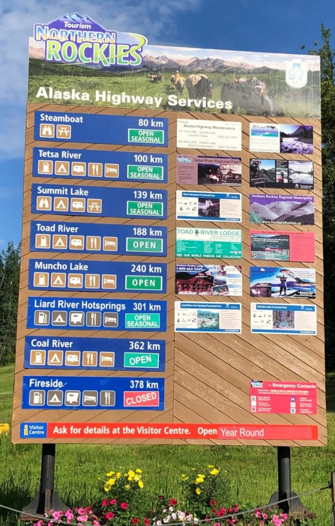
Mile posts remain a tradition as distance markers, and names and addresses for lodges and communities, although the signs no longer accurately measure actual distances.
Things to Do:
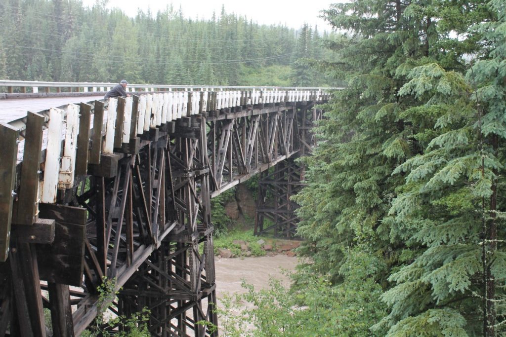
Kiskatinaw Bridge – seldom does a bridge on an isolated stretch of highway receive so much attention. Located at Mile 21 on one of the few remaining sections of the old Alaska Hwy, the 3-span historical bridge was the first and longest curved wooden bridge in North America. It is still load bearing and can be driven across today.

Taylor – completion of Canada’s first natural gas pipeline began shipment of gas along the 1,046 km / 650 mi to the US border. The District offers a self-guided historical tour, including Rocky Mountain Fort Museum located in Peace Island Park. The 693 m / 2,275 ft Peace River Suspension Bridge was the most difficult to build and is the longest bridge on the Alaska Hwy. It collapsed in 1957 and was replaced by a new cantilever and truss bridge.
Fort St. John – the Fort St. John North Peace Museum provides an outstanding historical account of the fur trade settlements and all industry in the Peace River Valley. Industrial diversity is represented by a trapper’s cabin, a towering oil derrick, coal mining, lumber displays, and farming relics. A large influx of people came from the Prairies in the “dirty 30s” to find new opportunities when the Peace River area was opened to homesteading. Farming replaced trapping as the main industry at the time.
Site C Dam – this $12 billion project is a run-of-river hydroelectric dam on the Peace River just west of Fort St. John, about 80 km / 50 mi downstream from the W.A.C. Bennett Dam. When completed in 2024, it will become the 4th largest in BC, with 123 km / 78 mi long reservoir flooding Indigenous lands. Viewpoint and information panels explain the construction site fueled by a 3,500-man work camp. The road east from Hudson’s Hope is decommissioned to allow for the reservoir behind the new Site C dam that is accessible from Fort St. John. Delivery of massive 10 m / 33 ft diameter penstock sections brought down the winding road for the dam powerhouse, and river diversion with the limited construction season, were major challenges.

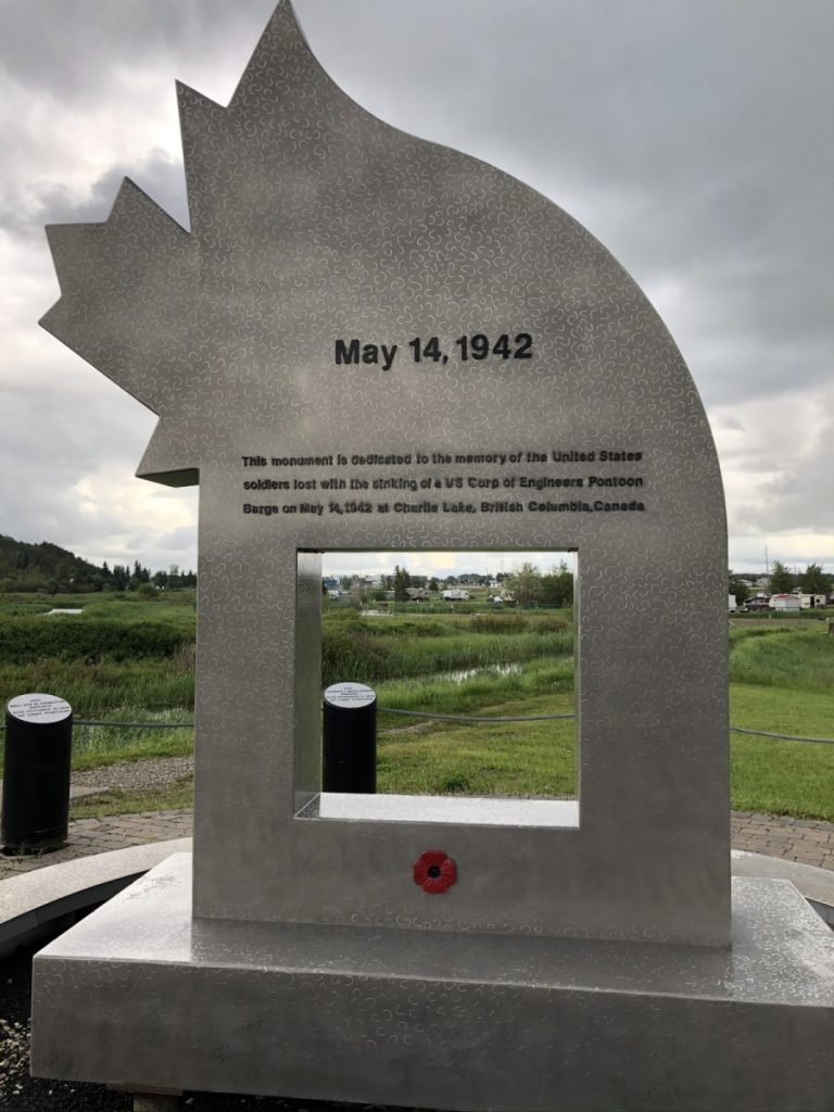
Charlie Lake – a stainless steel monument stands on the shoreline to commemorate the loss of twelve US Army soldiers during construction of the Alaska Hwy who were swamped on a barge during a sudden storm.

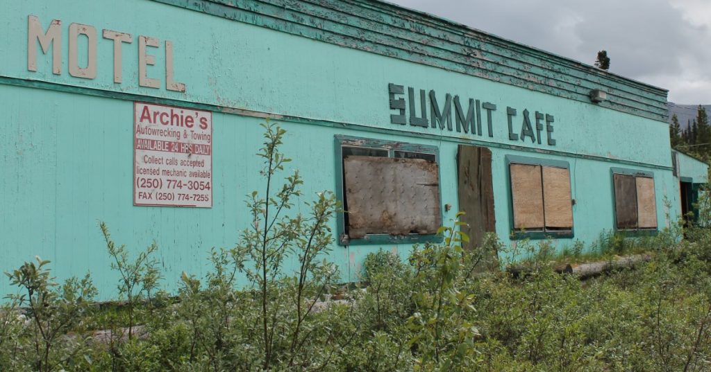
There are numerous stunning viewpoints and wildlife sightings on the long stretch of highway between Fort St. John and Fort Nelson. It is a reminder of US Route 66 with abandoned service stations, ‘50s motels and construction camps lining the route for 400 kms / 248 mi through Wonowon, Pink Mountain, Sikanni Chief, Buckinghorse River and Prophet River.


Allow sufficient time to visit historic museums in Fort St. John and Fort Nelson to really get a sense of the history development in the wilderness of the North.


Fort Nelson – was named after Admiral Nelson and established as a fur trading post in 1805. An unexpected treasure awaits at the Fort Nelson Heritage Museum where WWII and industrial relics have been collected by Marl Brown, who as a mechanic for the Canadian Army began to collect and preserve the history of items abandoned by the roadside. A car shed houses dozens of vintage cars and trucks.
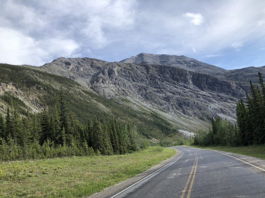
Summit Pass – Mile 392. At 1,295 m / 4,248 ft it is the highest elevation on the Alaska Hwy. It is another 30 km / 19 mi to Toad River. The highway winds through a rocky gorge before descending into the MacDonald River Valley, so named for a Cree Indian credited with finding the pass through the Northern Rockies.
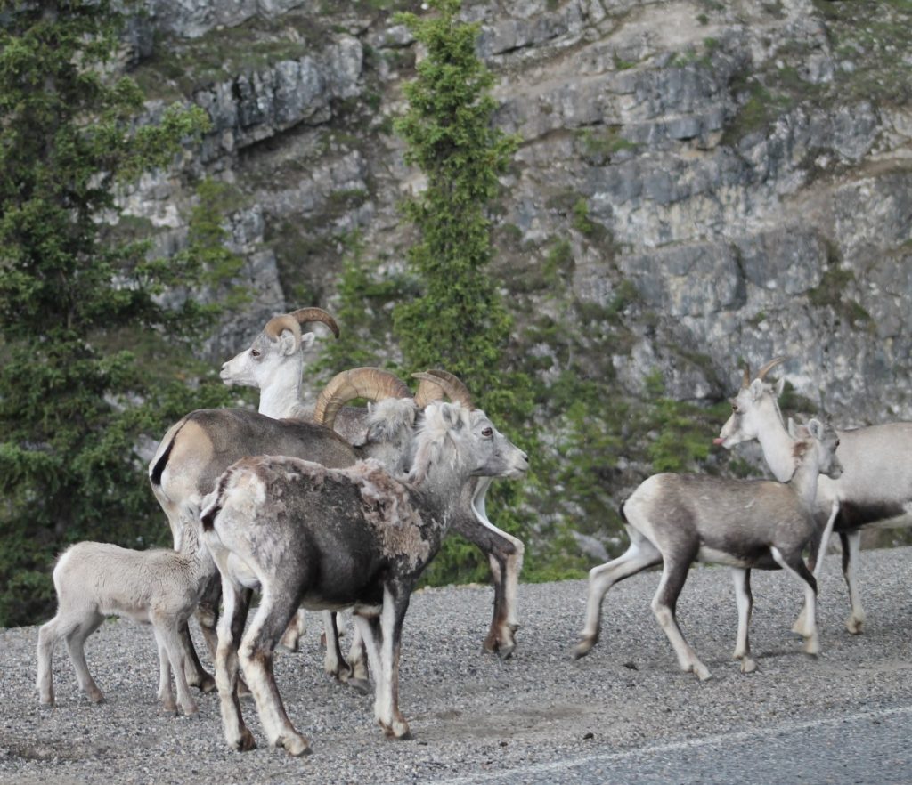
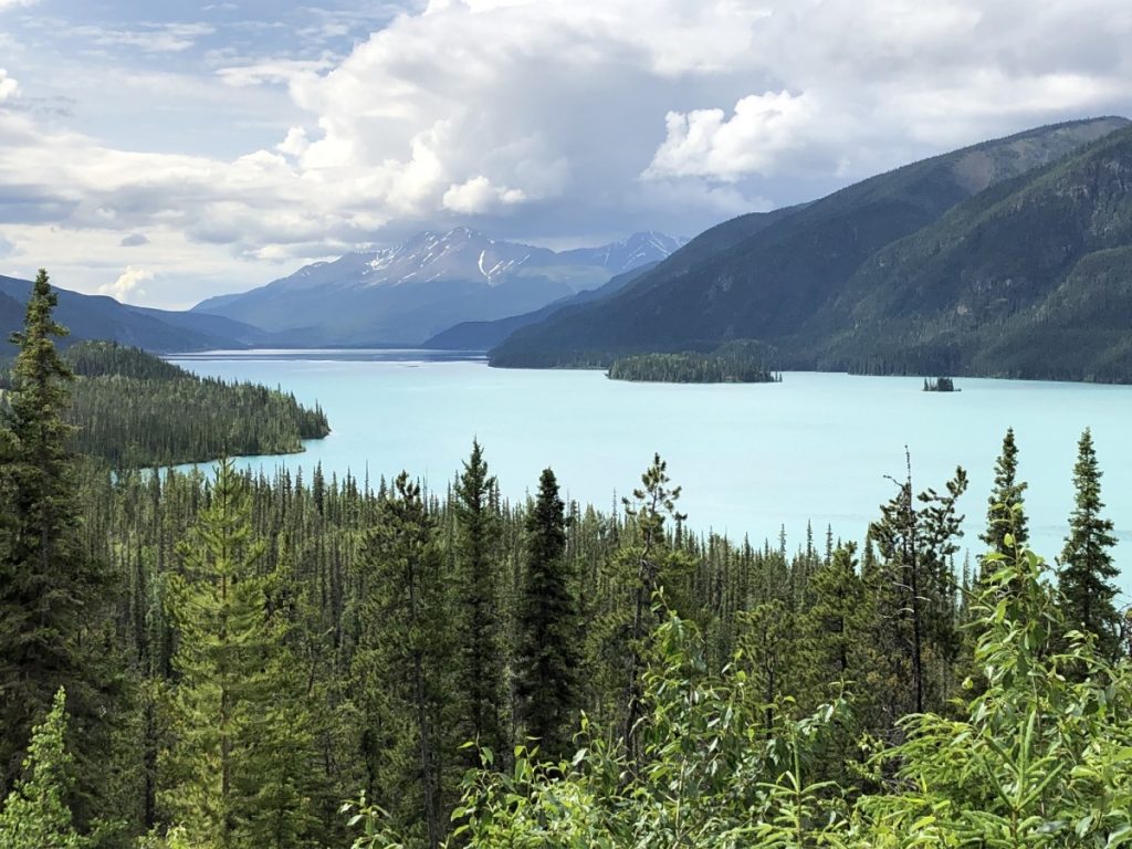
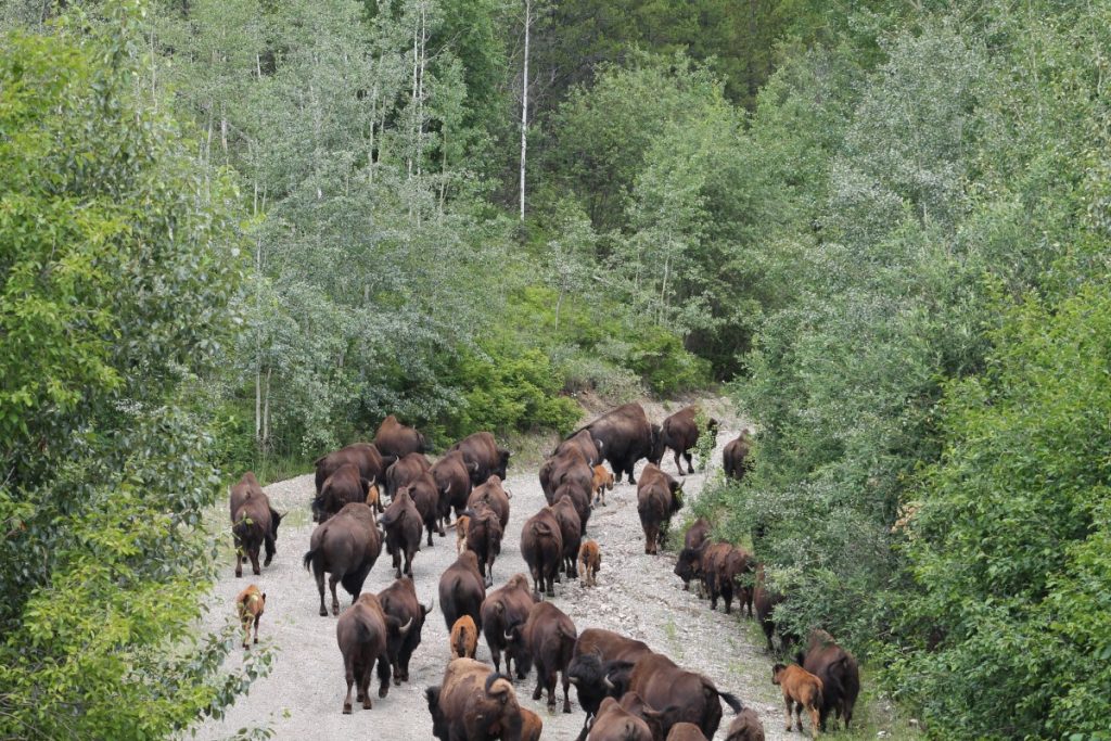
Muncho Lake – this is one of the remotest locations on the Alaska Hwy half-way between Fort Nelson and Watson Lake. Known for its own herd of Stone sheep who browse on the rich grasses along the right-of-way and lick salt on the highway. Note to RVers it requires due attention when driving to avoid collision as their grey coats blend into the granite rocks. The Northern Rockies Lodge offers float plane tours into the back country, European cuisine, and lake-front RV sites.
Be bear aware when hiking the many trails that lead off from the route.
Section 3: Fort Nelson to Whitehorse
Directions & Estimated Driving Time: Continuing along Hwy 97 north this segment of the trip is 513 km / 319 mi with side trips and takes 5 days. It passes through Muncho Lake, Liard Hot Springs, Whitehorse.
Where to Camp: For campgrounds and parks available in this area go to Camping & RV in BC and search under the appropriate community.
This last leg of the Northern BC trip transits the Northern Rockies for 1,000 km / 620 mi through some of the wildest country in BC. The Muskwa-Kechika Management Area includes fifteen provincial parks and fifty river watersheds that provides habitat for two thousand grizzlies and seven thousand mountain sheep on the western edge of the Rocky Mountain Trench. Access is limited.
Things to do:
Liard Hot Springs Provincial Park – one of the magical stops on the Alaska Hwy. A boardwalk leads to the warm pools through the boreal forest draped in the wafting steam from the hot springs. Watch for moose and bears.
The Liard River parallels the Alaska Hwy to the Yukon border as it flows eastward towards the Fort Nelson River.

Smith River Falls – this is another natural gem for a lunch break, not far on a dirt road to the roaring falls.

Contact Creek – appropriately named for the meeting of bulldozers at the southern section of the Alaska Highway, 900 km / 559 mi from Dawson Creek. The first truck to complete the grueling journey took 71 hours at an average speed of 15 mph. The highway weaves in and out of BC and then it is another 66 km / 41 mi to Watson Lake in the Yukon.
Watson Lake – The Gateway to the Yukon. The Sign Post Forest is known around the world for signs that now number 83,000 at last count. The phenomena was started by a homesick US soldier who painted the name of his home town and nailed it to a tree during construction of the highway through Watson Lake. Look for family names, streets and towns from Germany, Indonesia, Australia and beyond. Many signs were likely “borrowed” from home-towns and lugged to the far north landmark.
The Northern Lights Space & Science Centre is dedicated to the folklore and science surrounding the phenomenon of the Aurora borealis.


Haines Junction – while not on the direct route to Whitehorse, it is a short distance to visit Kluane National Park and Reserve that encompasses 9.8 million hectares in the largest UNESCO World Heritage Site. Take a scenic flight over the world’s second largest non-Polar ice field in the neighbourhood of Mount Logan which at 5,959 m / 19,545 ft and is Canada’s highest mountain.
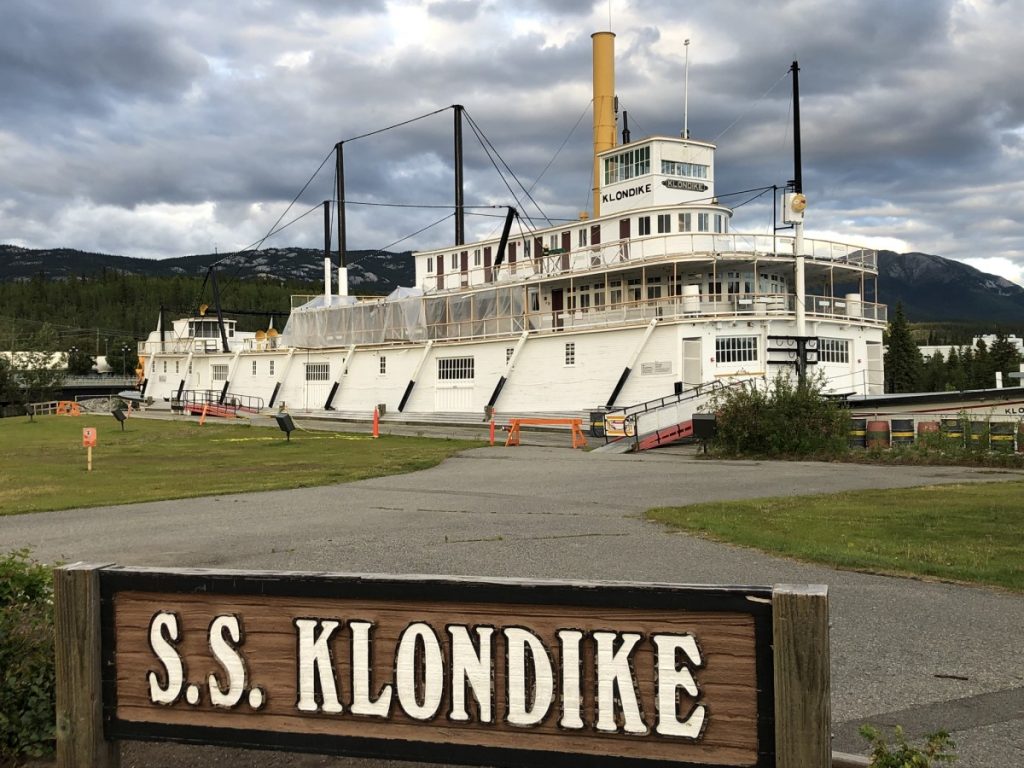
Whitehorse – Mile 918 lies 1,470 km / 913 mi from Dawson Creek. Situated on the Yukon River, the pioneer town sprang up as a transportation hub during the Klondike Gold Rush when sourdoughs sought sternwheelers to shoot the Miles Canyon downstream to Dawson City. The SS Klondike is a fully restored stern wheeler and a National Historic Site. The Yukon Beringia Interpretive Centre explains the vastness and diversity of the Boreal Forest that surrounds the northern hemisphere.