
Travel Scenic Highway 23 North of Revelstoke, BC to Mica Dam & Begbie Falls
In 2020, we decided to explore a region of British Columbia which was new to us. We have camped extensively throughout Vancouver Island, the Interior, Okanagan and the Kootenays but had not camped in the area north of Revelstoke.
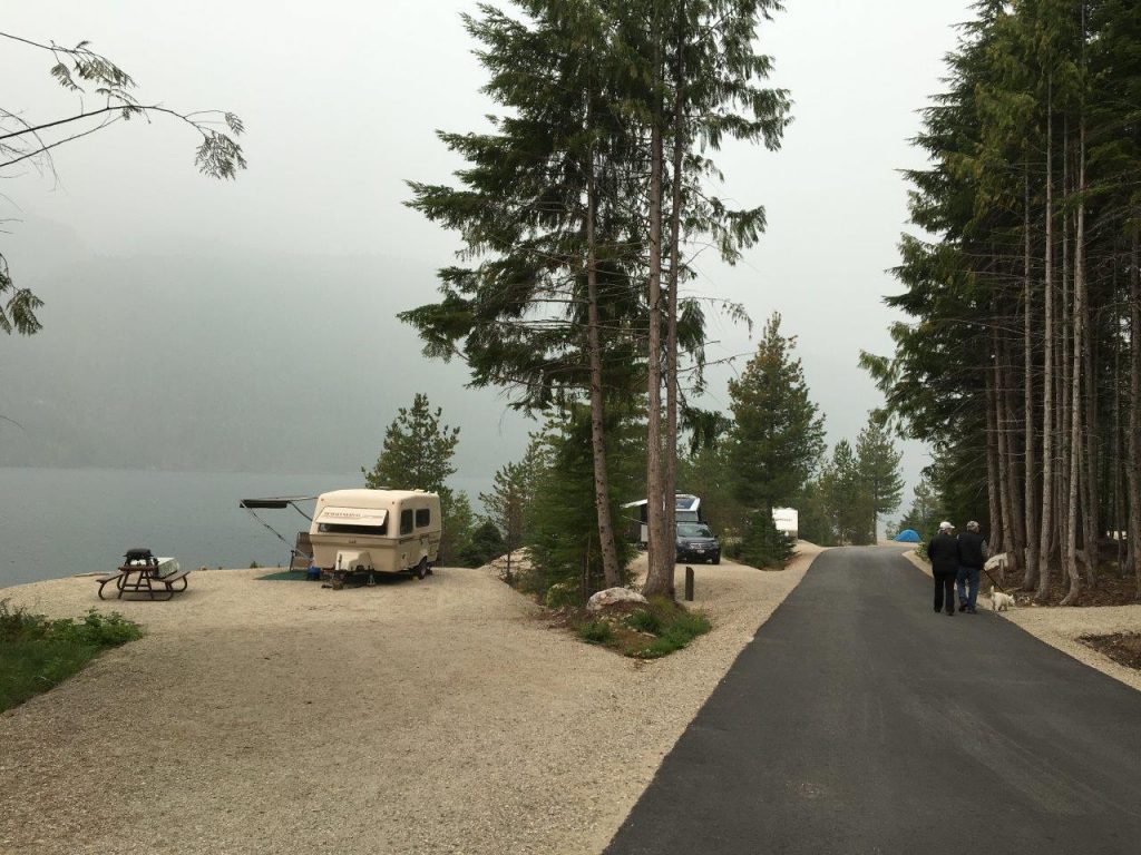
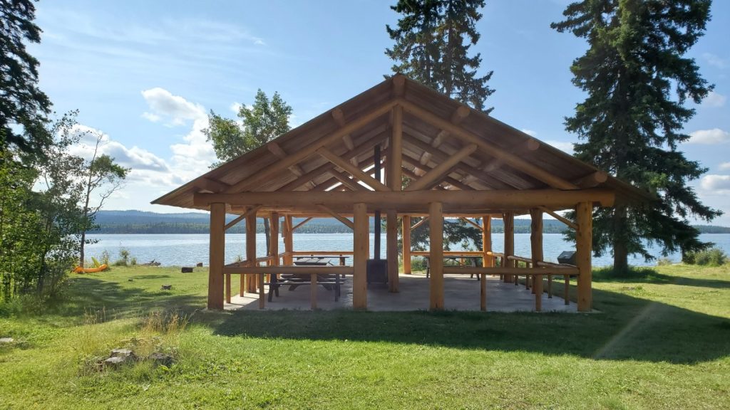
Highway 23, north of the city, was the start of our adventure. With no camping reservations this time, our first two nights were at BC Forest Recreation sites on the shores of Lake Revelstoke. Our first night was at Wadey which has 30 sites and is located about 25 kilometres north of Revelstoke, and then our second night was at Carnes Creek (the south campsite), 11 kilometres further north. Carnes Creek was my favourite, probably because I really liked our site which was overlooking the lake. Carnes Creek has two campgrounds, the south location which has 27 sites and the north with 19 sites and a boat launch.

From Carnes Creek, we did a day trip north up the scenic Highway 23 for about an hour to the Mica Dam. It was such a beautiful paved road, winding its way along the lake and very little traffic. Being married to a retired Socials Studies teacher always proves to be educational! My personal tour guide was quick to educate me about the dam and its history. Located 135 kilometres north of Revelstoke, its water flows from Kinbasket Lake south through the dam into Revelstoke Lake. It took six years to build and opened in 1973 as part of the 1964 Columbia River Treaty; it is the tallest dam in Canada and is operated by BC Hydro.
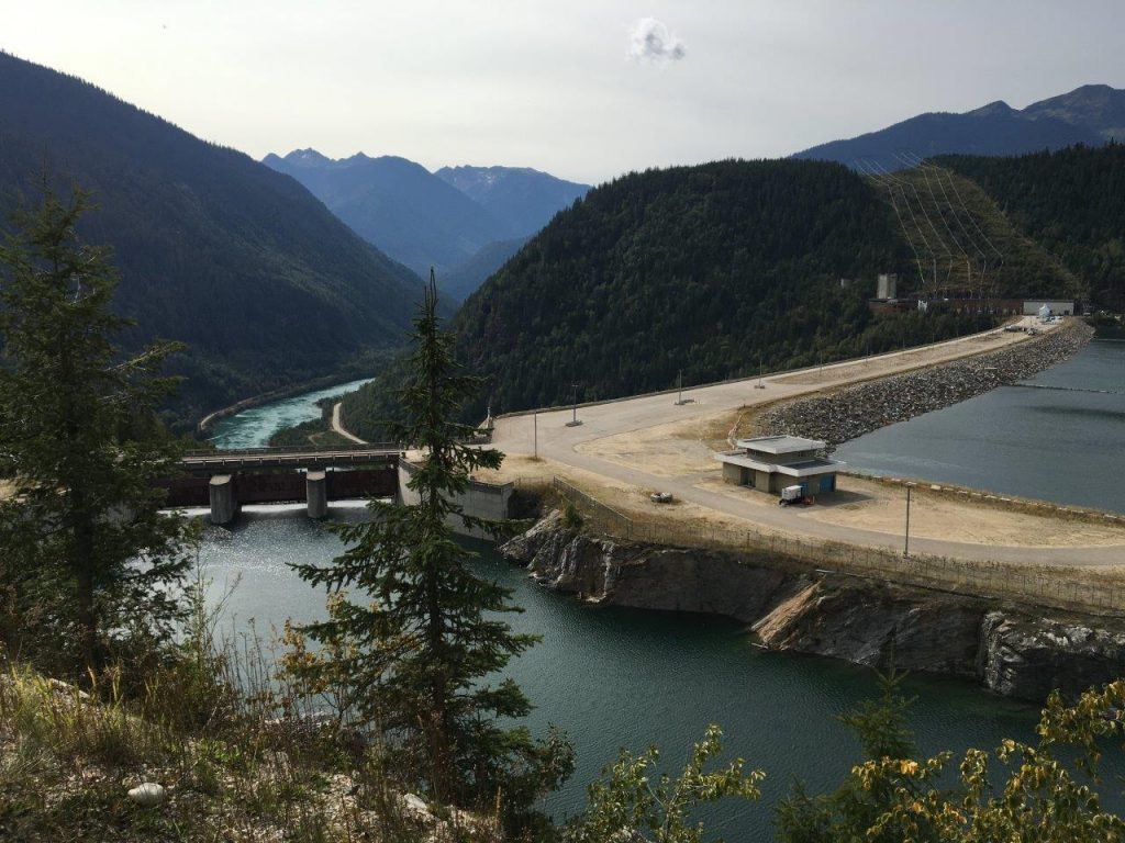
Just before you reach the dam, you will see the old village of Mica Creek which had a population of 4,000 workers and their families when the dam opened. It is a pretty impressive, lake-view site which even includes a swimming pool, golf course, curling rink and an old ski chalet. It also had a high school which closed shortly after the dam was built. Most of the buildings of the old town site are still being used by the dam maintenance employees.

Before we left Carnes Creek, we paddled our kayaks along Revelstoke Lake, under the bridge and up the actual creek. It was a beautiful, calming paddle with the current gently pushing us back down when we were done.
After camping at Carnes Creek, we packed up and moved to Martha Creek Provincial Park (18 kilometres north of Revelstoke). This is a very popular and impressive park; it has lots of sites; 29 of them were new in 2019. It has a very large picnic area, great beach and is attractive to anglers.

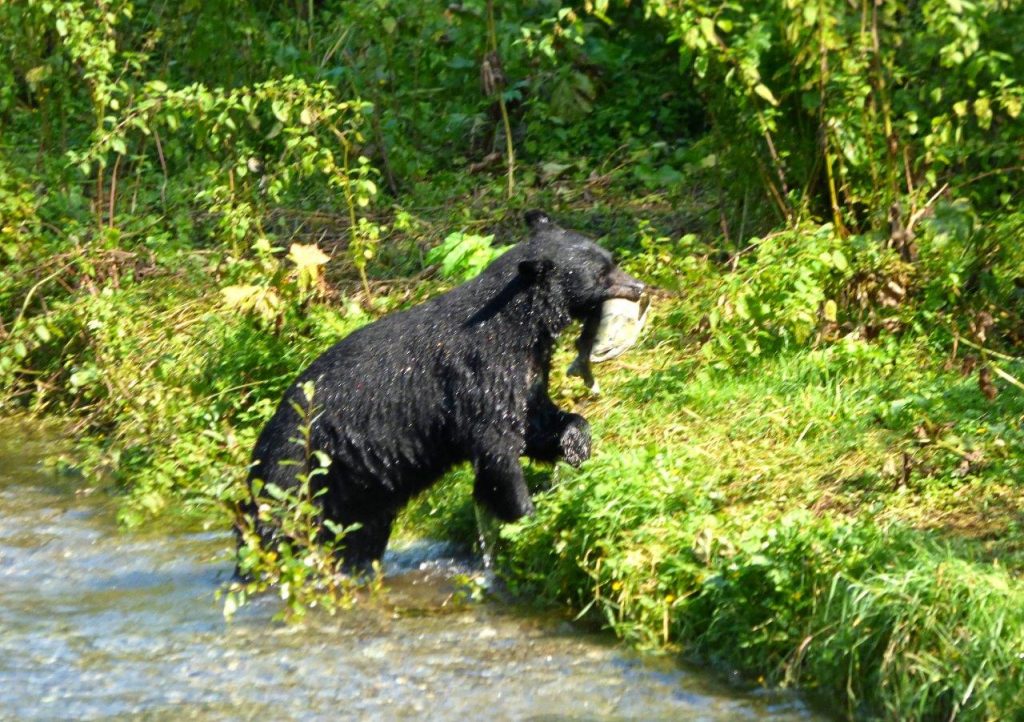
On our way home we stopped for a hike at Begbie Falls (about 10 minutes south of Revelstoke on Highway 23). What a lovely hike! The trail winds its way through the trees down to the falls and to Upper Arrow Lake. Not only did we get to see the falls and the beach, but the salmon were also spawning (September). There are different trails you can use but we accessed the trail-head through the Begbie Falls Recreation Site, located at the end of the Begbie Falls Forest Service Road. This access point was a gentle downhill to the beach and falls and not too long.
TIP: If you find this blog interesting why not subscribe to the enewsletter and never miss another story!
We are definitely looking forward to our next camping trip anywhere along Highway 23, such a beautiful part of our province!
For camping accommodations in this area and elsewhere in British Columbia check out the Camping Map.
Share your BC travel and camping photos using hashtag #campinbc #explorebc #bcnice.
Bridge Lake Ice Caves in British Columbia’s Cariboo: A Cool Place to Visit on a Hot Day
On a recent trip to Bridge Lake Provincial Park (read our blog), we took a day trip to a nearby destination we had read about that seemed too good to be true on a sweltering Cariboo day – the Bridge Lake Ice Caves.
Now, if you are picturing ice caves in the traditional sense, a glistening and icy blue arch, you will be disappointed. But the Bridge Lake Ice Caves have an even more interesting heritage. A Recreation Sites and Trails BC location in partnership with numerous local organizations, the Bridge Lake Ice Caves highlight a unique geological feature of the Bridge Lake shoreline. The annual freeze/thaw process, coupled with ongoing erosion, has created a shoreline full of crevices into which the annual snowfall melts and refreezes into ice. In the bottom of these caves and crevices, the ice remains cold and persists well into the summer, if not year round.
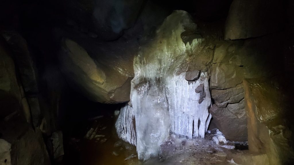
When we visited in mid August, it was plenty hot walking the trails around the rec site, but when we descended towards the ice caves the air became cooler and cooler the further we descended. Several of the crevices we looked in contained nothing more than moist rock walls and cool temperatures, but in two areas in particular we were able to find actual ice.
According to the interpretive signage and the Recreations Sites and Trails BC website, local historians and storytellers have shared that the ice caves were used by both local First Nations and early European settlers to harvest ice to preserve food and to keep cool.

While the ice caves themselves are cool (both literally and figuratively!), the government of BC and local community organizations have done an excellent job of developing a family-friendly rec site in the heart of the Cariboo. The site has several trails named after local wildlife. On our trip we walked the Low Mobility Wolf Trail, the Beaver Trail, the Coyote Trail, and the Owl Trail. The trails are marked with totems, and represent the animal on whose trail you are travelling.

The low mobility Wolf Trail is a 0.5 kilometre, hard packed, low-grade, gravel nature trail leading from the parking lot to two viewing platforms (one of which is wheelchair accessible) overlooking the ice caves and Bridge Lake. Along the trail there are several outdoor workout facilities, including a balance beam to hop over, a push up/pull up station, and a zig-zag balance walk. At the end of the Wolf Trail there is a serious flight of stairs to run up and down for those looking for more cardio. The workout stations along the Wolf Trail are called Otter, Raven, Loon, and Eagle and each is marked with a totem.

From the end of the Wolf Trail we descended the stairs to the Beaver Trail. The Beaver Trail hugs the lakeshore and is a much rougher trail than the Wolf Trail. Next, we headed up the Coyote Trail, which was very steep and rough. This brought us to the ice caves area where we enjoyed the view and explored. To head back to the parking lot, we took the Owl Trail, which was again wide, flat, and hard packed. Along the trail there were excellent viewpoints of Bridge Lake and plenty of benches to take a break if needed.

When I first heard about the ice caves, the picture that popped into my head turned out to be completely inaccurate to what we experienced. In reality, the Bridge Lake Ice Caves recreation site provides an excellent series of walking and hiking trails. There are beautiful views over Bridge Lake and the ice caves themselves are fascinating both geologically and historically.
TIP: If you find this blog interesting why not subscribe to the enewsletter and never miss another story!
For campgrounds in this area and elsewhere in British Columbia check out the Camping Map.
Share your BC travel and camping photos using hashtag #campinbc #explorebc
It’s always a great day to #CampInBC
Green Lake Provincial Park in British Columbia’s Cariboo is a Great Destination for a Camping Holiday
Green Lake Provincial Park is a series of sites surrounding 14-kilometre long Green Lake in British Columbia’s South Cariboo. Of the park’s eleven locations, six have facilities for visitors.
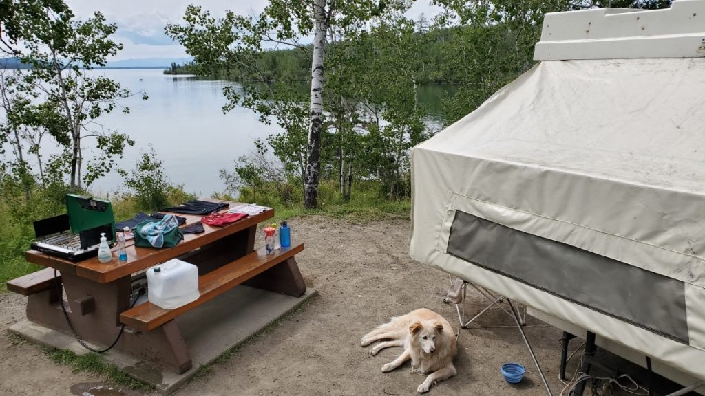
The park contains three vehicle accessible campgrounds: Arrowhead, Sunset View, and Emerald Bay. On our most recent trip to Green Lake Provincial Park, we stayed at the Emerald Bay campground, which offers a mix of single and double campsites. We were very fortunate to get one of the waterfront sites, which was lovely as we almost always travel with our kayaks and we were able to keep our kayaks on our own little beach! The 51 sites at Emerald Bay are spacious and generally private, but there are a limited number of waterfront sites, and those that do have direct access to the water often have a steep trail as the access. The Arrowhead campsite, in contrast, contains 16 high-density sites. While you are undeniably close to your neighbours, your site will also be directly on the water with extremely easy access.
The Emerald Bay and Sunset View campgrounds, in addition to two other sites, Blue Spring and Little Arrowhead, all have day use facilities. Emerald Bay and Sunset View have lovely picnic shelters and all sites have picnic tables. These sites are all great options for a day at the beach!
Green Lake is known for its warm, greenish coloured water. Despite only being 14 kilometres long, Green Lake has about 57 kilometres of shoreline. The lake contains numerous small islands and peninsulas, which makes it a perfect destination to explore by kayak. Paddling from the Emerald Bay campground to the Arrowhead Campground is a nice day trip of about 17 kilometres round trip. Along the way, paddlers will pass by the Black Bear and Little Arrowhead sites. Another lovely paddle is from the Emerald Bay campsite across the lake to the Nolan Creek site, then down to the Green Lake Islands site. When paddling on Green Lake, it is important to be prepared for rough conditions, as the lake tends to get very windy in the afternoon. A life jacket is a must and all paddlers should be prepared in case of an unexpected swim.
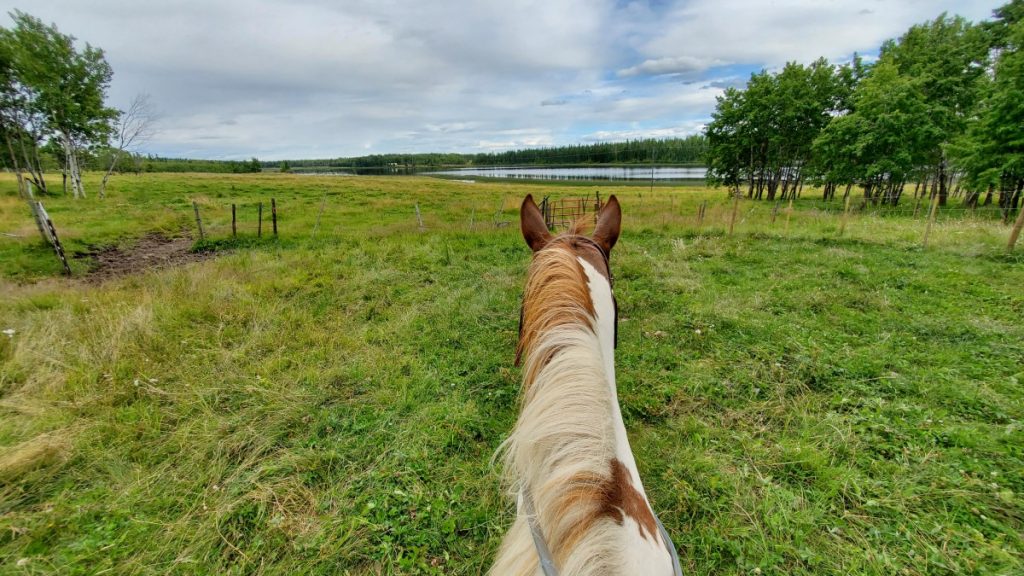
The area surrounding Green Lake is excellent terrain for cycling and horseback riding. On our trip, we did a guided horseback trail ride at a nearby lodge and guest ranch, which was a great experience for this nervous rider. My dad, on the other hand, prefers to cover his distance in the South Cariboo by bicycle, and enjoys nice long road rides while camped at Green Lake.

Green Lake Provincial Park makes a great basecamp for exploring the region, and a few highlights include nearby Chasm Provincial Park, the Bridge Lake Ice Caves, driving to Lone Butte to see the historic water tower, and checking out the many other lakes in the area, including Bridge Lake .
Visiting Green Lake Provincial Park each summer is a tradition for many families. The park offers perfect beachfront relaxation with excellent recreation opportunities both on and off the water.
TIP: If you find this blog interesting why not subscribe to the enewsletter and never miss another story!
For campgrounds in this area and elsewhere in British Columbia check out the Camping Map.
Share your BC travel and camping photos using hashtag #campinbc #explorebc
It’s always a great day to #CampInBC
Summer in Valemount, British Columbia: Where the Mountains Move You
Imagine standing in the middle of a town with a view of three snow-capped mountain ranges. Welcome to Valemount in east-central British Columbia, a village with stand-out summer adventures and activities.
Just over an hour west of Jasper, Alberta, Valemount is in the Robson Valley, situated along and east of Highway 5 (Yellowhead Hwy) and nestled between the Rocky, Monashee and Cariboo mountains (to the east, south and west). It’s a municipality with a big heart – and venturesome residents eager to show visitors what their playground is all about.
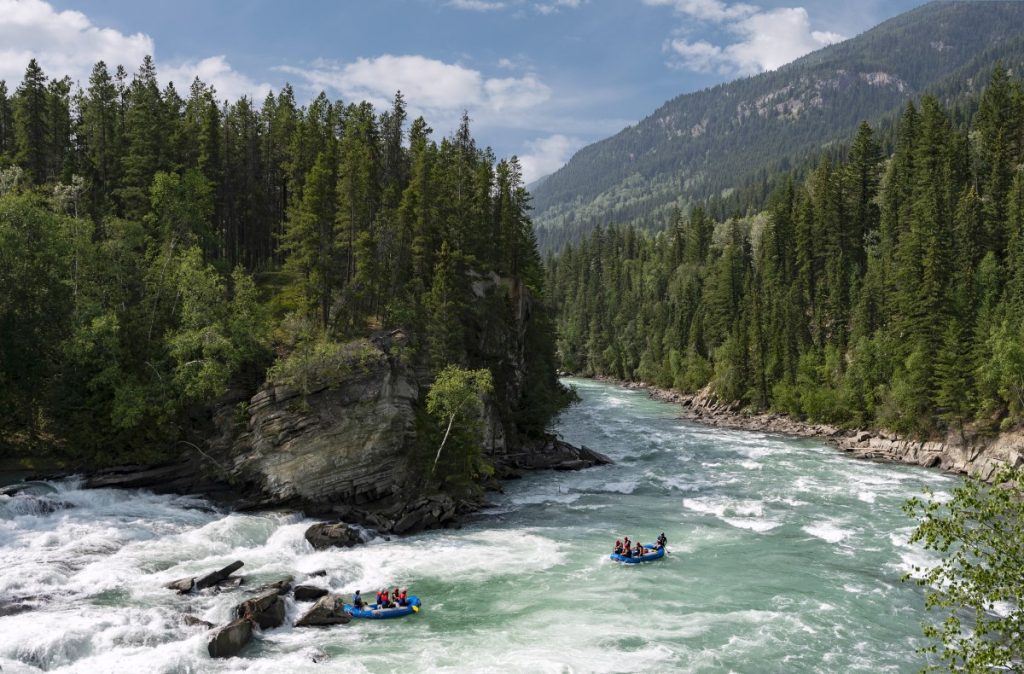
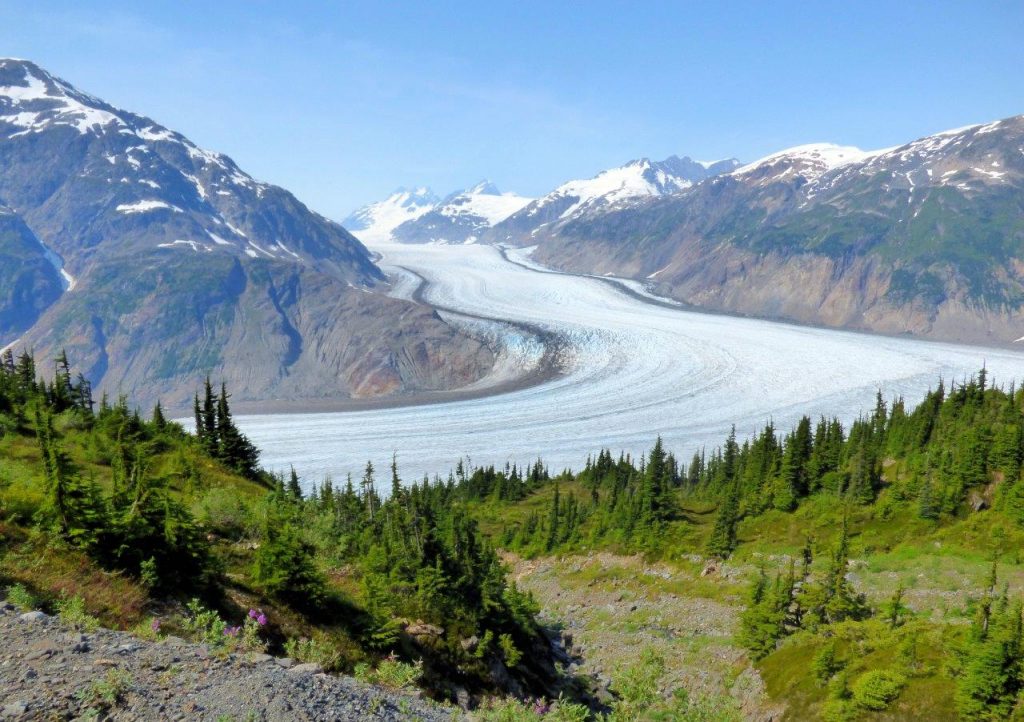
The land that would become Valemount is in the traditional territory of the Secwepemc Nation, Simpcw territory. The name Valemount was coined for the Canadian National Railway station there in 1927, and to this day it has a ViaRail station. It’s the nearest community to BC’s Mount Robson Provincial Park and its namesake, the highest peak in the Canadian Rockies. Choose from three campgrounds here: Lucerne, Robson River and Robson Meadows. From gentle meadows to alpine lookouts, there are hundreds of kilometres of trails to explore. (Note that the popular Berg Lake Trail will be open this summer to Kinney Lake only.) While in the area make a splash whitewater rafting on Class I to Class V rapids, or paddling or floating along the Fraser River (a clear, beautiful blue/green in this part of the province) or on the long and narrow Kinbasket Lake. Amidst the Rocky and Cariboo mountains it’s actually a reservoir created by the construction of the Mica Dam; water levels can vary.

The viewpoint at Rearguard Falls Provincial Park provides an excellent opportunity to witness the end of a long journey for the mighty Chinook, the largest of the Pacific salmon. From the Fraser estuary in the province’s lower mainland to this point, the fish travel upstream for over 1,200 km, though not all make it this far. George Hicks Regional Park also has a viewing platform for the salmon as they enter Swift Creek. Spawning season is generally August to September.
For other camping and RV options search via the Camping and RVing BC Coalition’s campground webpage; Visit Valemount also has RV and camping information. The Valemount Visitor Centre can be found at 785 Cranberry Lake Rd (summer hours June-Sept, Mon-Fri 8:30 am-4:30 pm).

Mountain biking is a way of life in this part of BC. Be sure to check out the Valemount Bike Park. Minutes from the town core, it’s a system of trails ranging from easy cross-country pedals and smooth and flowy downhills to steep and ‘rooty’ adrenaline-filled singletrack options. Cruise the trail and boardwalk along Cranberry Marsh (the Starratt Wildlife Management Area) where you can stop for birdwatching along the 6-km loop. Should you wish to rent a mountain bike or ebike swing by or call District Bike Co. or Bike & Bites; both shops service bikes too. Hiking trails in Valemount range from easy-medium-challenging; it’s best to verify openings with the Visitor Centre before heading out as some trails may be closed for repairs or due to inclement weather. Perhaps you’ll see Sasquatch near Mica Mountain (as sighted in 1955!) as you hike the Mica Mine Trail, the same trail where, in the 1890s, horses and mules hauled minerals down the mountain.
Three kilometres south of Valemount is Cedarside Regional Park on Little Cranberry Lake, a swimming spot with a sandy beach where dogs on leashes are welcome. There are toilets, picnic tables and fire pits; camping is not permitted.
Slow the pace down with some horseback riding or try fly, troll or spin cast fishing. Various species of trout fill nearby rivers and lakes (such as Moose and Shere lakes), as do Rocky Mountain whitefish. Valemount Pines Campground boasts a nine-hole golf course and grassy tent and RV campsites with spacious long-level pull-throughs and private back-in sites near a mountain.

Complement your fish dinner with a trip to the Valemount Farmers’ Market, which runs every Thursday afternoon from late June to September. Along with regional produce you’ll find arts and crafts. For other art options visit Mountain Driftwood Gallery & Gift. Many artisans sell in the area so check with the Visitor Centre for info on pottery, jewelry and antiques and collectibles. The Valemount Museum & Archive is located in an old railway station built in 1914. Learn about local pioneers, historic regional railroad towns and WWII Japanese internment camps. There are community events and summer festivals in and around Valemount such as the Annual Valemountain Days (June 9-11 this year), the annual Bike Fest (June 17) and Canada Day celebrations (July 1). Robson Valley Music Festival in the farming community of Dunster, 60km to the northeast, takes place on August 11-13.
Restaurant options include the Summit Grill and Cranberry Lounge in the Best Western Plus hotel and Cariboo Grill with fine comfort fare and an ample wine list in a cabin-like setting. The Gathering Tree specializes in breakfast and lunch and Valemount Swiss Bakery is known for its scrumptious sourdough breads. Get your mojo fix at Vale Coffee, a small batch roastery and takeaway café and if you’re craving a pint head to Three Ranges Brewing Company for craft-brewed beer in their cozy tasting room or on the patio. The establishment is part of the BC Ale Trail, which lists over 220 craft breweries.
Whatever the outing or adrenaline rush – whether strolling past mountain wildflowers or chuting down rapids – summer in Valemount is bound to please all nature lovers.
For more information on Valemount go to the website at www.visitvalemount.ca, check out the Facebook and Instagram pages or if you are already in the area go to the Valemount Visitor Centre at 785 Cranberry Lake Rd, (250) 566-9893 visitorcentre@valemount.ca.
TIP: If you find this blog interesting why not subscribe to the enewsletter and never miss another story!
For campgrounds in this area and elsewhere in British Columbia check out the Camping Map.
Share your BC travel and camping photos using hashtag #campinbc #explorebc
It’s always a great day to #CampInBC
Bridge Lake Provincial Park Nestled in the Interlakes Region of British Columbia’s Cariboo
When planning a family camping trip for family stretching from Vancouver Island to the far north of BC, we recently settled on meeting in the middle, so to speak, and packed up for a week in the Cariboo.
Bridge Lake is one of many, many lakes in the Interlakes District, a region known for fishing. In fact, Highway 24, stretching from 100 Mile House to Little Fort, is often referred to as the Fishing Highway and Bridge Lake is situated smack dab in the centre.
Bridge Lake Provincial Park is quite large, at just over 400 hectares, and protects undeveloped shoreline and numerous islands within Bridge Lake itself. A small campground is located just three kilometres from the community of Bridge Lake at the south end of the lake. The Bridge Lake Provincial Park campground has 13 vehicle accessible campsites, and 3 “walk in” campsites right along the water, perfect for those willing to walk the extra 50 feet down the wide, well maintained trail.

As we were travelling with our tent trailer, we opted for one of the vehicle accessible campsites and were pleased to find our site to have a nice mix of sun and shade and lots of privacy. There is one set of outhouses in the campground loop, and one additional outhouse near the day use boat launch and walk in tenting area. There is no water available at the campsite as the previous well has been decommissioned, so it is important to plan ahead and either bring the water you need with you or be prepared to buy small bottles at one of the nearby general stores. Cell service was spotty in the campground, but several places in the park, including the boat launch, had improved reception.

Bridge Lake Provincial Park campground is located on a little peninsula that sticks out into Bridge Lake. The peninsula is criss-crossed by trails, and it is easy to walk for a kilometre or two just by following the obvious trail leaving near campsite number three and then exploring the various trails that branch down to the water. Stick to the main path and eventually you will circle back to the boat launch and walk in camping area.

Bridge Lake is an excellent water destination. During our trip we spent lots of time exploring the bay near the boat launch by paddleboard. A short paddle out of the bay brought us to a white buoy marking an unexpected shallow spot where stacked boulders littered the lake bottom making the water in which we were paddling sometimes less than a foot deep. The rocks were a bit slippery, but with caution you can have your very own walking on water moment!

For those looking for a longer paddle, there are plenty of options as well. We explored the south-east portion of the lake’s shoreline as an 8 kilometre paddle which included several blue herons, lots of daydreaming about owning one of the many waterfront recreational properties, a stream flowing into the lake, and a number of small islands including one rocky outcrop that I nicknamed Seagull Island for obvious reasons.

In true Cariboo form, our trip was complete with both spectacular sunsets and spectacular thunderstorms.
Throughout the course of our trip, it seems that the campsite had 3 or 4 vehicle accessible spaces that remained empty each night. That being said, the camper turnover was nearly 100%, and we had different campsite neighbours every night of our trip. My impression is that many people used Bridge Lake Provincial Park as a stopping off point between two other destinations, but having spent the better part of a week there, I still feel like we have only scratched the surface of what the region offers and we will certainly be back!
TIP: If you find this blog interesting why not subscribe to the enewsletter and never miss another story!
Check out the blog on the Bridge Lake Ice Caves! There is an excellent series of walking and hiking trails at the Recreation Site as well as beautiful views over Bridge Lake and the ice caves themselves are fascinating both geologically and historically.
For campgrounds in this area and elsewhere in British Columbia check out the Camping Map.
Share your BC travel and camping photos using hashtag #campinbc #explorebc
It’s always a great day to #CampInBC
RV Security Tips to Prevent Break-Ins and Minimize Camping Theft
Whether people RV for months on end or a couple of times a year their unit is their home on wheels for as long as they make it. Just as you protect yourself on the homefront it’s smart to do so while on the road or at a campsite as break-ins and gear theft do happen.
Here are some tips to help prevent RV burglary and camping gear theft.

Situational Awareness
Be aware of your surroundings and follow that gut instinct. If something doesn’t feel right, it’s likely not. If the park is not sufficiently well-lit at night walk about with a headlamp or flashlight; untrustworthy humans aside, you never know what type of animal you might encounter. While afoot, be on the lookout for tripping hazards such as tent pegs and tree root systems.
Ask the park or campground management about security such as nighttime patrols and what their rules for visitors are. Try to obtain a site in the heart of the campground if being on the periphery or near a road or highway makes you feel uneasy. Report any unsavory incidents to the office. BC Parks encourages all campers to report any security issues to park rangers, park operators and the RCMP to “ensure BC Parks and campgrounds are a safe and welcoming space for everyone”, a spokesperson for the Ministry of Environment and Climate Change Strategy said.

If stopping for the night outside of a designated campground, find a well-lit spot where you’re allowed to park and RV. When driving in and around new cities do some research and avoid high-crime neighbourhoods and don’t flash cash or valuables when out and about.
Verify your location in case of emergency – such as the closest highway exit – and know where the local hospitals are. A camper recalls, “When I was young my father badly injured his thumb while chopping firewood. These were pre-Internet days but thankfully my mother knew where the closest hospital was as it certainly was a chaotic moment!”
When at a campground or park for an extended period get to know the neighbours should either party need to watch the campsite in case of an emergency. Also, know where the fire extinguisher is. One RVer’s suggestion is to keep a couple of metal extinguishers in strategic places around the rig to double as a safety device against intruders and bee and wasp swarms.
Lock It Up
Lock car and RV doors and windows and close shades when leaving the campsite and invest in locking systems for high-value items such as bicycles, surge protectors and trailer hitches. When away for a few hours or a day-trip store items that you don’t want stolen in a cargo box or storage area and don’t leave cool camping gadgets, electronics, speakers or phones out when away from the site. Stash and secure smaller valuables such as jewellery or cameras inside the RV or leave them at home if grandma’s pearls are not a camping necessity.
A BC Parks’ spokesperson said: “BC Parks and our park operators take public safety and security very seriously – it’s our highest priority. Because parks are public spaces, we encourage all campers to secure their campsites, vehicles and valuables, especially when unattended.”
If the RV’s locks, including the window locks, are rusting or aren’t closing properly it’s time to change them. Door locks can be upgraded to keyless locks with code pads for added security.
Light It Up
Motion-detector lights, including solar and LED options, are a smart choice to scare off furry or unfriendly intruders and see what’s going on at night. Be considerate of nearby campers if using motion-detector lights as no one wants lights flashing on and off in the dark when they’re trying to sleep. Use a solar light to illuminate the RV’s interior when out in the evening or as a night-light for the kids.
Smile, You’re On Camera
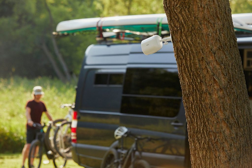
Camera and audio security systems are a good investment to make campers feel at ease and sleep more soundly at night. Plug-and-play and battery-operated options with wireless smart-device monitoring and real-time alerts are popular as are systems with on-site camera angle flexibility; some systems even monitor for leaks or water damage. With many RVers working from their units post-Covid-19, security systems are a good way to protect computer and audiovisual gear. Arlo offers a suite of security systems including ones specifically for the RV. Arlo also indicates that the GO 2 is the best camera for RVs due to its WiFi and Cellular connectivity. Note that different parks and campgrounds may have different rules about the use of personal cameras and security systems. BC Parks, for instance, does not allow individual security cameras if they collect images outside of campsites.
Theft-recovery tracking devices also exist. The Recreation Vehicle Dealers Association of Canada (RVDA) has partnered with KYCS Locate to educate dealers on vehicle theft, enhance lot protection and assist with inventory management and theft recovery. KYCS Locate is sold to new RV owners as peace of mind to safeguard their purchase. KYCS is partnered with Crime Stoppers in Canada and the US and has a number of solutions for the identification of assets and equipment.

Overall, RVing and camping are very safe activities when it comes to personal theft and campers are respectful of their ‘neighbours’, but it doesn’t mean bad things won’t happen to good people. Be aware and cautious of your surroundings and educate young campers to do the same. Stay safe and have a fantastic camping season!
While you keep camping security in mind also think of camping safety. Take the Campers Pledge to follow the nine rules to making camping an awesome experience for everyone: Respect Wildlife, Take Only Photos, Control Your Pets, Store Food Safely, Don’t Litter, Practice Fire Safety and Plan Ahead and Be Prepared, Respect Others and Respect Staff and Signs. Check out the blogs below.
Be a Respectful Camper and Practice the Camper’s Code
Follow the Camper’s Code and be a Responsible and Safe Camper
TIP: If you find this blog interesting why not subscribe to the enewsletter and never miss another story!
For campgrounds and RV parks in BC go to the BC Camping Map.
Share your BC camping and travel photos using hashtags #CampinBC #explorebc
It’s always a great day to #CampinBC
Hiking to French Mine Near Hedley in British Columbia’s Okanagan
While recently camped at Stemwinder Provincial Park we were searching for a hike in the region. A quick search on AllTrails brought up the Nickelplate French Mine Loop, a 6.3km circular trail near Hedley BC.
We departed Stemwinder early in the day to avoid the heat as best we could and headed east to Hedley. Hedley is a very small community located between Princeton and Keremeos along Highway 3. Hedley has a rich mining history, and from the highway you can see the remains of the old Mascot Gold Mine stretching up the mountainside. Visiting the Mascot Gold Mine has long been on my bucket list, and thanks to an $800,000 grant from the province as part of a COVID relief program, the mine is slated to reopen to visitors in 2023. In the meantime, however, we thought we would head into the backcountry to explore the French Mine.

To access the French Mine site, head east past Hedley and turn off on the Hedley Nickel Plate Road after about 3 kilometres. The Nickel Plate Road, sometimes called the Corkscrew Road, is aptly named. As we wound our way up the mountainside, we enjoyed spectacular views of the valley below.
Eventually we reached our designated start point and parked our truck and headed out on foot. We chose to hike to the Lower French Mine site first, which turned out to be a beautiful walk along an old road. As it turned out, the access road to the lower French Mine could probably be considered vehicle accessible. However, I was happy we decided to park the truck and walk in as it gave us the opportunity to really enjoy the views.
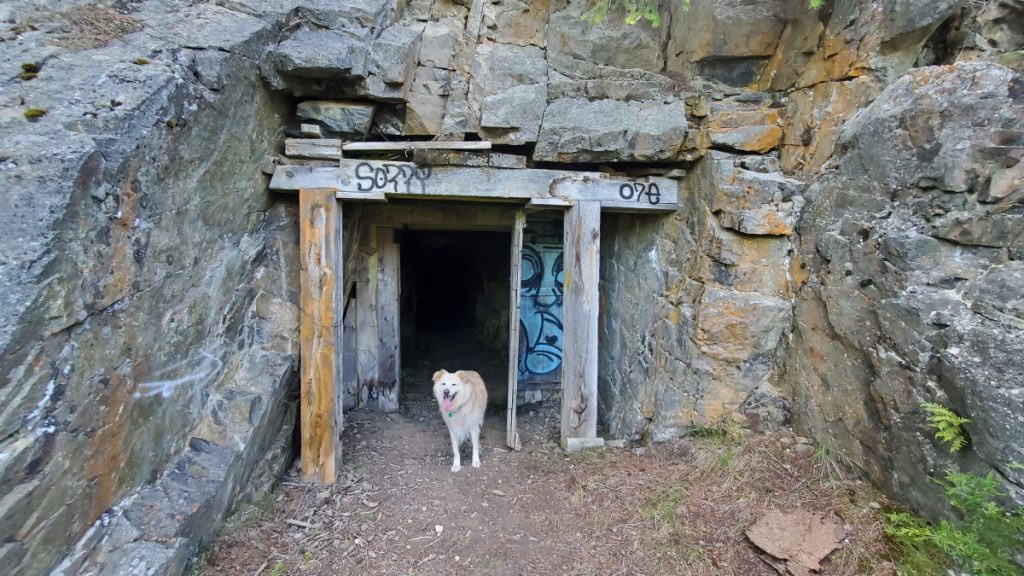
When we arrived at the Lower French Mine site we spent some time looking at the old mining infrastructure. An old ore chute and a concentrator are on the main level, and a short walk up a trail just past the concentrator takes hikers to an open shaft that heads back into the mountainside. When we visited, I was shocked by the serious wind tunnel effect when I stood in front of the mineshaft as ice-cold air poured out of the tunnel around me.
AllTrails indicates that there is a loop hike, and all we needed to do was head uphill and we would come to the Upper French Mine. I 100% do not recommend the scramble between the two mine sites unless you are an experienced scrambler or are part mountain goat. Alas, we did not know this, so as we climbed upwards, I was crossing everything I have that this was the correct trail, and I wouldn’t have to turn around and go back the way we had come up.

Fortunately for me, after 20 or so tense moments, we re-emerged on level ground, scooted along a couple narrow ledges, jumped down a small cliff, and arrived at the Upper French Mine Site. As it turns out, this site is also vehicle accessible. Seriously – skip the scramble linking the two sites and from the Lower French Mine, just walk back the way you came then drive up to the Upper French Mine and save yourself the stress!
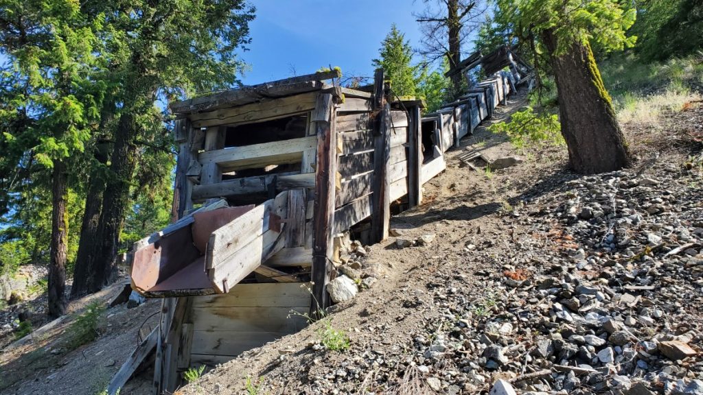
Anyway, at the Upper French Mine I was amazed to discover a massive network of tunnels and mineshafts in the mountainside. These shafts have a completely different feel than the one at the lower mine site. The main entrance is enormous, and shafts branch off in every direction imaginable. We stayed in the enormous central cavern, but I’m sure people more adventurous and better equipped than us could spend a lot of time exploring the area.

Since we were parked at the bottom and there was no way I was going back the way we arrived, we returned to our vehicle by hiking out the access road to the Upper French Mine, then down a portion of the Hedley Nickel Plate Road. All in all, our hike was around 7km and took about two hours. Both the Lower and Upper portions of French Mine are worth visiting, but as I have emphasized above, I would do it as two separate trips and not try to link them via the scramble described online.
I am always fascinated by the marks humans leave on the landscape and the French Mine area is a perfect example of this, making it a worthwhile daytrip in the Similkameen area.
TIP: If you find this blog interesting why not subscribe to the enewsletter and never miss another story!
For camping accommodations in British Columbia check out the Camping Map.
Share your BC travel and camping photos using hashtag #campinbc, explorebc
It’s always a great day to #campinbc
Plan a Camping Trip to British Columbia’s Similkameen Valley
BC Parks reservations can be tricky to come by for a summer weekend, so when we snagged a last minute reservation for Stemwinder Provincial Park in BC’s Similkameen Valley we were excited to get out and try a new campsite.
Previously we have camped at nearby Bromley Rock Provincial Park (see our blog) so we had an idea of what the area would be like. The campsite at Stemwinder consists of 28 vehicle accessible campsites sandwiched between Highway 3 and the Similkameen River. The campground is generally laid out on two levels, the top level is right beside the highway and the sites are fairly open. The lower level, beside the river, is more treed. Our site was located right on the corner where you drive from the upper bench to the lower bench, so while it was surrounded on three sides by the campground road it still managed to be decently private since we really only had one neighbour.

The campsite at Stemwinder has pit toilets and one hand pump (on the lower level) for water. There are two short trails leading from near campsites 12 and 13 to access the river. Caution is advised, though, as Poison Ivy lurks just off the established trail! When we visited it was still quite early in the season and the Similkameen River was high. Later in the season the water would be lower and exploring the shoreline would be an option, although BC Parks cautions that the river runs fast and excellent swimming skills are required for anyone venturing into the water at this location. For a more relaxing swimming destination, head to Bromley Rock.

Stemwinder Provincial Park makes an excellent location to use as a base to explore the surrounding area. On our trip, we spent our first day visiting nearby Keremeos. Keremeos offers a huge selection of orchards and vineyards. Pick up a winery and cidery passport at your first stop of the day, and then visit a total of either three or five locations in order to be entered to win a Similkameen Wine Lovers Package. On our visit we focused on the Similkameen cideries and had a great time visiting each location and sampling their offerings.

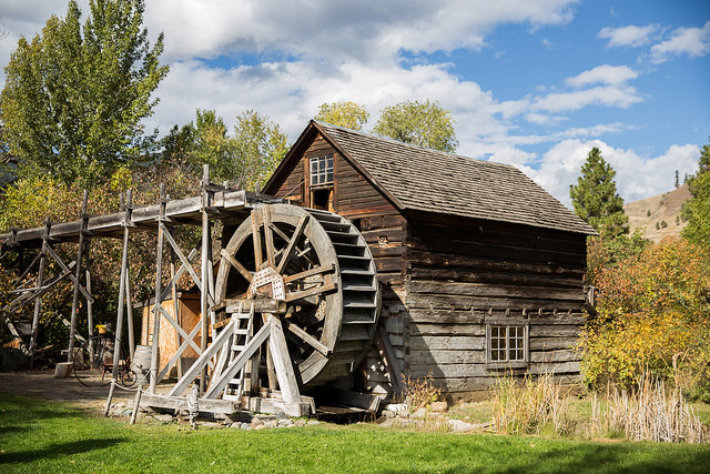
There are plenty of opportunities to travel back in time in Keremeos. The Red Bridge, originally built in 1907 as a railway bridge, is one of the only covered bridges left on the west coast. Keremeos Grist Mill and Gardens is a provincial heritage site home to a functional water wheel from 1877. The site offers workshops, a restaurant, heritage gardens, an RV campground, and lots more.
Before heading back to our campsite, we made sure to pop in at some of the many fruit stands in Keremeos. Fresh fruit and samosas were on the menu for us and both were delightful!
Stemwinder Provincial Park is a great weekend or stopover destination when travelling through the Similkameen region. There is a lot to experience, whether you prefer sampling from vineyards and orchards, exploring a heritage site, or getting out for a hike such as the one at nearby French Mine (see blog).
TIP: If you find this blog interesting why not subscribe to the enewsletter and never miss another story!
Share your BC travel and camping photos using hashtag #campinbc, explorebc
It’s always a great day to #campinbc
Jesmond Fire Lookout – Part of British Columbia’s History
Just a hop, skip, and a big uphill jump away from Big Bar Lake Provincial Park is a piece of British Columbia’s wildfire history.

Located in BC’s Cariboo region, the Jesmond Fire Lookout, maintained by Recreation Sites and Trails BC, preserves one of the still-remaining historic fire watch towers in British Columbia. From 1972 to 1999 wildfire observers were stationed at the Jesmond Lookout tower for three weeks at a time from early May to late September. The observer lived in the tower and was responsible for detecting and reporting early signs of wildfires. Historically, approximately 12 fires per year were detected from the Jesmond Lookout.
BC has a rich history of fire lookouts. Starting in the early 1900s, men were sent to mountaintops with unobstructed views in order to provide early detection of wildfires. The BC Forest Branch was created in February 1912 and to celebrate 100 years of the BC Forest Service in 2012, the 1957 documentary The Man in the Tower was digitized and shared online (https://youtu.be/U8Pi8CF_NT4) and provides a fascinating look at forest management practices of the time and the day to day tasks and equipment of the fire lookout observer.

The Jesmond Lookout is accessible by a rough 4WD road. When we visited, we were able to drive most of the way up the road in our truck. If I were to do the trip again, I would plan for a much longer hike and park much further down the steep and narrow access road. If you plan on hiking the final six kilometres up the Jesmond Lookout Road, as I would do, you will be climbing just under 800 metres – no small feat! Most of the road is treed, but the final kilometre opens up and the road passes through beautiful open country with spectacular views in all directions.

We visited in late June and it started snowing when we were at the lookout. At an elevation of 1970 metres, it is important to be prepared for unpredictable weather and high winds. Winds over 120 km/h have been recorded at the lookout, and the building itself is tethered to the bedrock with metal cables.

Unfortunately, over the years many of the hundreds of primary fire lookout towers in the province have been vandalized or destroyed. In recent years, increased attention has been given to restoring and protecting these sites, which is certainly a valuable endeavour. Other intact fire towers include the Cornwall Fire Lookout near Ashcroft, the Windy Joe Lookout in Manning Park, the Harrison Fire Lookout on the west side of Harrison Lake, and the Nahatlatch Lookout near Boston Bar. The restoration and maintenance of these sites is made possible by partnerships with groups such as the Four Wheel Drive Association of British Columbia and through countless volunteer hours.

Visiting the Jesmond Fire Lookout is an excellent day trip when camping at Big Bar Lake Provincial Park. The Rec Sites and Trails site offers a picnic table and a pit toilet in addition to the historic fire lookout. The journey to get to the Jesmond Lookout is neither short nor simple, but for those well prepared, the trip is well worth the effort.
TIP: If you find this blog interesting why not subscribe to the enewsletter and never miss another story!
See the blog Big Bar Lake Provincial Park in BC’s Cariboo.
For camping accommodations in British Columbia check out the Camping Map.
Share your BC travel and camping photos using hashtag #campinbc #explorebc
It’s always a great day to #campinbc
Travel the Stunning Stewart-Cassiar/Highway 37 in Northern BC
The Stewart-Cassiar Highway is 724 km of stunning scenery in British Columbia’s north. My husband and I took our time exploring this amazing area from the Yukon border in the north, to Kitwanga in the south and over to Stewart and Hyder, Alaska.
Our favourite provincial park on the entire trip was Boya Lake, 87 km from the Yukon border. It’s far away from traffic noise, WIFI, and when it’s full it’s still quiet. Boya Lake itself is clear aquamarine with a white glacial silt bottom and 24 of the 44 sites are snugged up to its shore. Even so we didn’t expect to find a lakefront site so I could hardly contain my excitement before jumping out with the dogs and yelling, “Honey, I’m home.” A loon added its mournful call. Aah, four days of being lost in nature.
A stay at Boya wouldn’t be complete without canoeing. No motors are allowed on the lake but canoes are available. With the first dip of the paddle, all my cares disappeared. For me, this is a spiritual place. My days began with tea in a china teacup, watching the squirrels and listening to the loons. They ended with the Master painter sweeping peach and mauve sunsets over the lake. If you want a true getaway, this is the place to go and the only thing wrong with Boya Lake …the stay is never long enough.
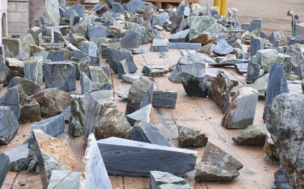
Jade City is a fascinating place to stop. They offer travellers free overnight camping, WIFI, and coffee. The family that runs it has been mining jade since the 70s and it’s part of the reality show, “Jade Fever.” Watch them cutting jade outside for sale. I bought a small slab for an RV cutting board. The store has a dizzying selection of jade, rocks and gems.
The main hub for travellers fueling up and getting supplies is Dease Lake. It’s also the jumping-off point for paddlers on the Dease River or adventurers going to Telegraph Creek.
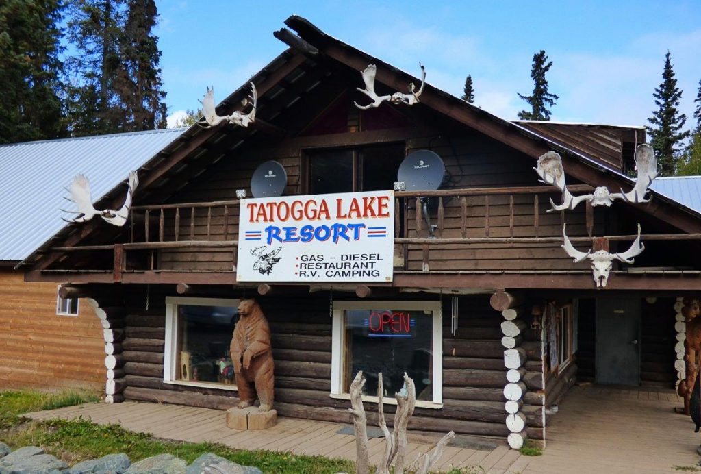
We were welcomed by a stuffed moose in the dining room of the Tatogga Lake Resort, an interesting log building that resembles a museum inside. There’s a one-ton jade boulder by the fuel pumps although they aren’t always open. It’s mainly a seaplane base for tours into the mountains.
South of Tatogga is Kinaskan Lake Provincial Park with 50 sites in a well-looked-after park beside the lake.
We followed the glacial blue waters of the Nigunsaw River before crossing the Bell Irving River bridge to stop at Bell 2 Lodge. Though they principally cater to heliskiers in the winter, during the summer travellers can stay in chalets, the lodge or at the campground. It has 10 full-service sites plus 3 dry camps. There is a restaurant and fuel.
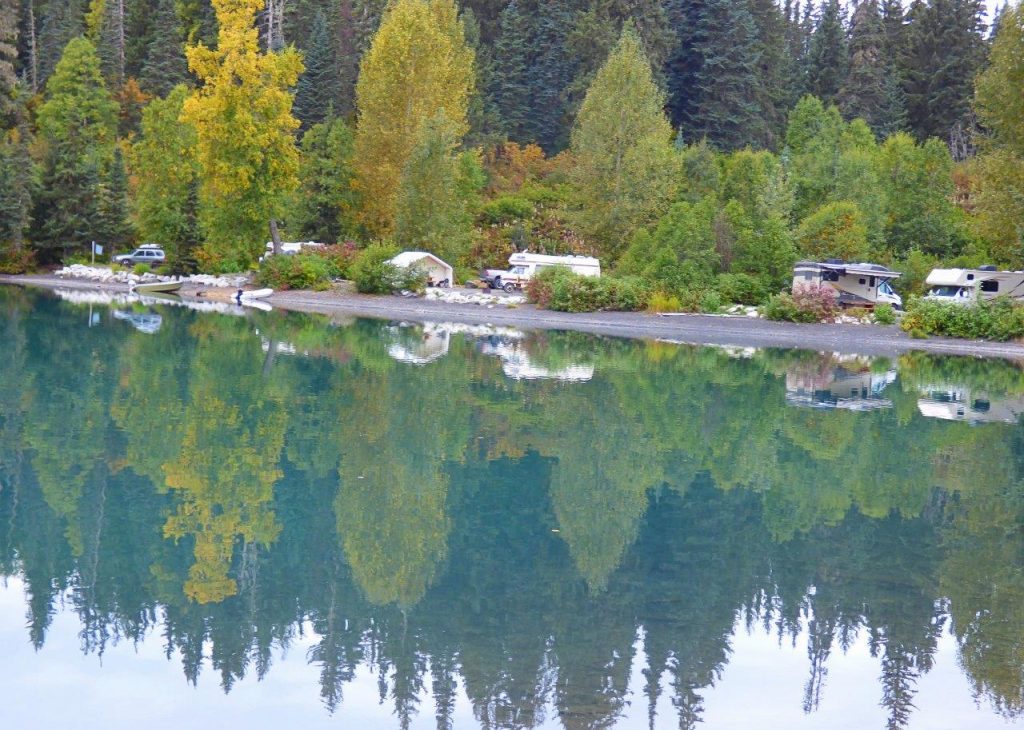
A gorgeous green lake welcomed us to Meziadin Lake Provincial Park where we camped overnight. They have 66 sites, some with power but no sani-dump and we were lucky to get a spot.
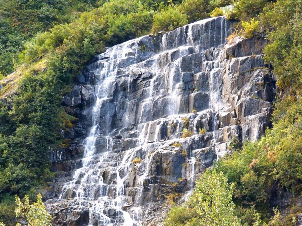
No trip would be complete without taking the road from the Meziadian junction to Stewart and Hyder, Alaska. It’s a photographer’s dream. Prepare to be wowed as glaciers drape the towering mountains, and waterfalls plunge from the tops. We pulled in where a waterfall broke up into a myriad of veils. Bear Glacier flows blue from the mountain to a lake beside the road.
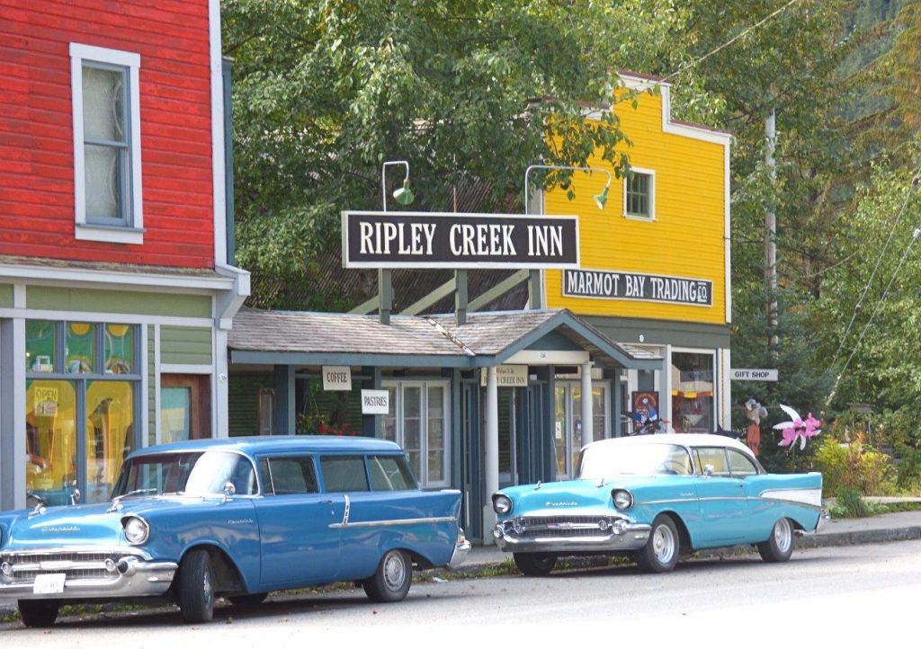
Stewart is nestled at the foot of glacier-topped Stewart Mountain, on Portland Canal. We stayed in full-service Bear River RV Park. There is a beautiful boardwalk over the estuary. Heritage buildings and funky storefronts make up the main street. Stay a few days and take a trip to Hyder, Alaska.
Crossing an unguarded border we drove into Hyder that looks like the old west. Remember, just because you crossed into the USA without being questioned, you still deal with the border guards coming back into Canada. Get Hyderized at the old Glacier Inn. Visit Fish Creek Wildlife Observation Site for safe bear watching from the boardwalk. We went along 25 km of rough gravel road, sometimes one-lane, up the mountains to see Salmon Glacier. What a breathtaking sight but it cost us a tire. A tire guy drives around Stewart in his truck fixing tires!
After we left Meziadin we stopped at Gitanyow – the Land of the Totems. At one time they had more original totems than anywhere else. Kitwanga village was our home for the night. We visited Gitwangak Battle Hill Historic Site where from the top of the hill tribes fought rivals.
Summing up the Stewart-Cassiar trip my advice would be to prepare for driving through the wilderness, allow plenty of time to explore and learn the history.
Fuel stops from Kitwanga are at the junction of Highways 16 and 37: Gitanyow 19 km; Meziadin Junction 149 km; Stewart 220 km; Bell 2 249 km, Tatogga Lake(not always open) 392 km; Iskut 406 km; Dease Lake 499 km, Junction 37 at Yukon border 724 km.
TIP: If you find this blog interesting why not subscribe to the enewsletter and never miss another story!
Other information to help you plan your camping trip include:
Wilderness Adventure Along the Stewart-Cassiar Highway
Kitwanga Junction
Exploring Northern British Columbia – A Circle Tour Adventure: Stewart-Cassiar Highway
Discover British Columbia’s Travel the Great Northern Circle Tour
For camping accommodations in British Columbia check out the Camping Map.
Share your BC travel and camping photos using hashtag #campinbc #explorebc
Published: February 2nd, 2023
Connect With Us