
Travel the Stunning Stewart-Cassiar/Highway 37 in Northern BC
The Stewart-Cassiar Highway is 724 km of stunning scenery in British Columbia’s north. My husband and I took our time exploring this amazing area from the Yukon border in the north, to Kitwanga in the south and over to Stewart and Hyder, Alaska.
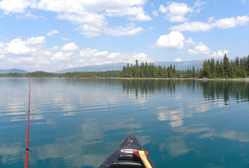
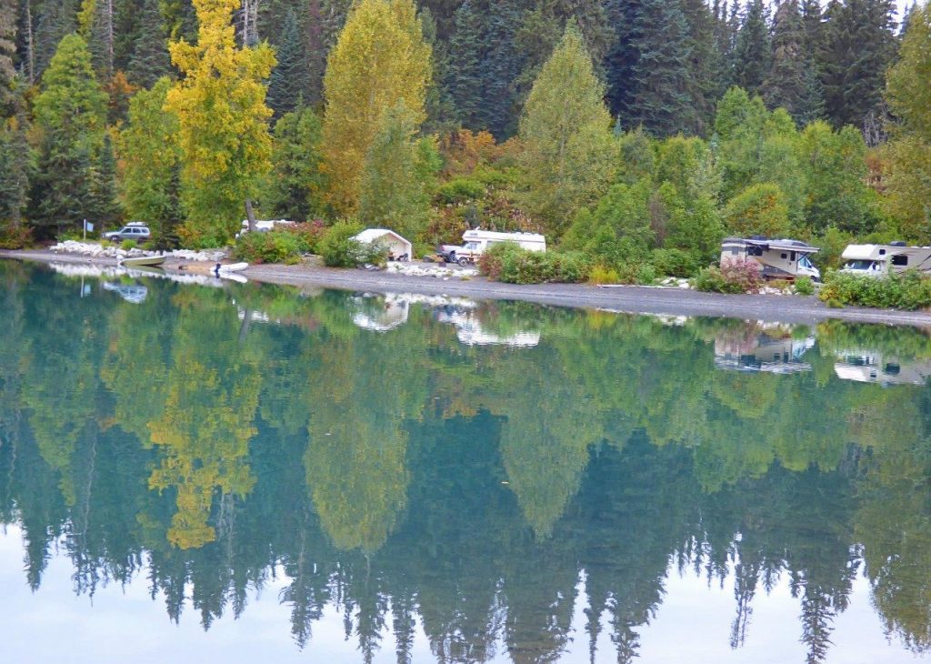
Our favourite provincial park on the entire trip was Boya Lake, 87 km from the Yukon border. It’s far away from traffic noise, WIFI, and when it’s full it’s still quiet. Boya Lake itself is clear aquamarine with a white glacial silt bottom and 24 of the 44 sites are snugged up to its shore. Even so we didn’t expect to find a lakefront site so I could hardly contain my excitement before jumping out with the dogs and yelling, “Honey, I’m home.” A loon added its mournful call. Aah, four days of being lost in nature.
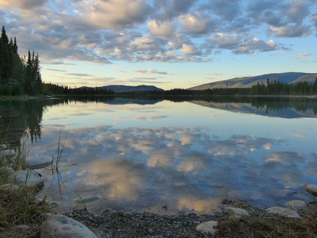
A stay at Boya wouldn’t be complete without canoeing. No motors are allowed on the lake but canoes are available. With the first dip of the paddle, all my cares disappeared. For me, this is a spiritual place. My days began with tea in a china teacup, watching the squirrels and listening to the loons. They ended with the Master painter sweeping peach and mauve sunsets over the lake. If you want a true getaway, this is the place to go and the only thing wrong with Boya Lake …the stay is never long enough.
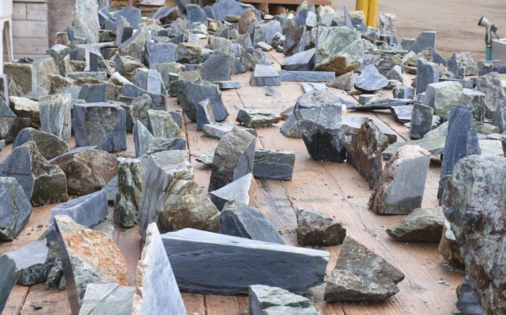
Jade City is a fascinating place to stop. They offer travellers free overnight camping, WIFI, and coffee. The family that runs it has been mining jade since the 70s and it’s part of the reality show, “Jade Fever.” Watch them cutting jade outside for sale. I bought a small slab for an RV cutting board. The store has a dizzying selection of jade, rocks and gems.
The main hub for travellers fueling up and getting supplies is Dease Lake. It’s also the jumping-off point for paddlers on the Dease River or adventurers going to Telegraph Creek.
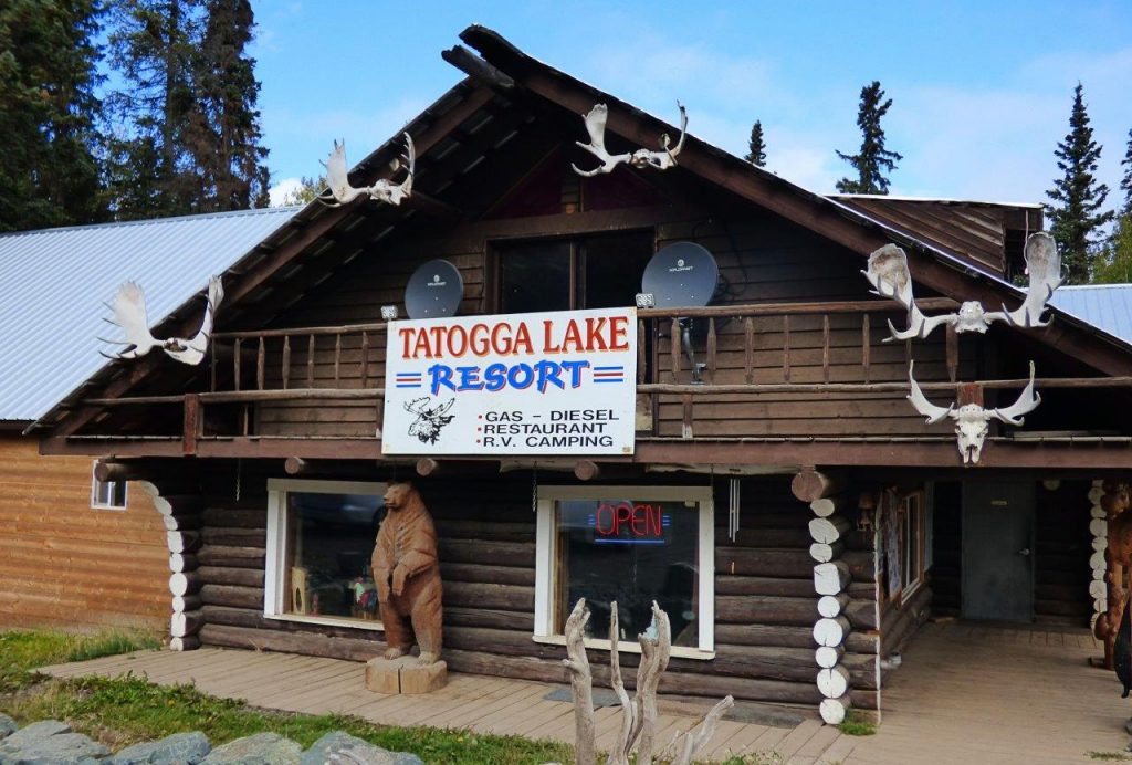
We were welcomed by a stuffed moose in the dining room of the Tatogga Lake Resort, an interesting log building that resembles a museum inside. There’s a one-ton jade boulder by the fuel pumps although they aren’t always open. It’s mainly a seaplane base for tours into the mountains.
South of Tatogga is Kinaskan Lake Provincial Park with 50 sites in a well-looked-after park beside the lake.
We followed the glacial blue waters of the Nigunsaw River before crossing the Bell Irving River bridge to stop at Bell 2 Lodge. Though they principally cater to heliskiers in the winter, during the summer travellers can stay in chalets, the lodge or at the campground. It has 10 full-service sites plus 3 dry camps. There is a restaurant and fuel.
A gorgeous green lake welcomed us to Meziadin Lake Provincial Park where we camped overnight. They have 66 sites, some with power but no sani-dump and we were lucky to get a spot.
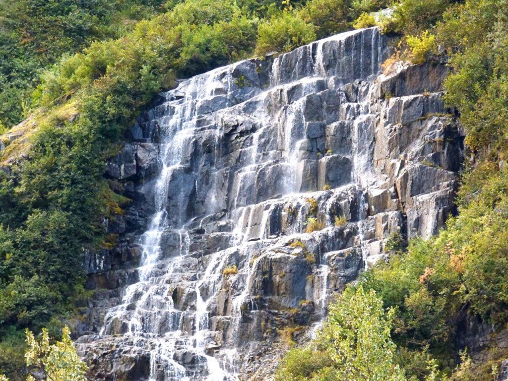
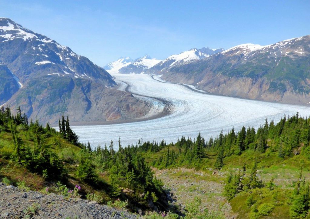
No trip would be complete without taking the road from the Meziadian junction to Stewart and Hyder, Alaska. It’s a photographer’s dream. Prepare to be wowed as glaciers drape the towering mountains, and waterfalls plunge from the tops. We pulled in where a waterfall broke up into a myriad of veils. Bear Glacier flows blue from the mountain to a lake beside the road.
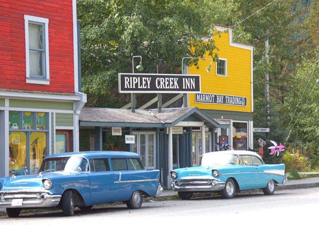
Stewart is nestled at the foot of glacier-topped Stewart Mountain, on Portland Canal. We stayed in full-service Bear River RV Park. There is a beautiful boardwalk over the estuary. Heritage buildings and funky storefronts make up the main street. Stay a few days and take a trip to Hyder, Alaska.
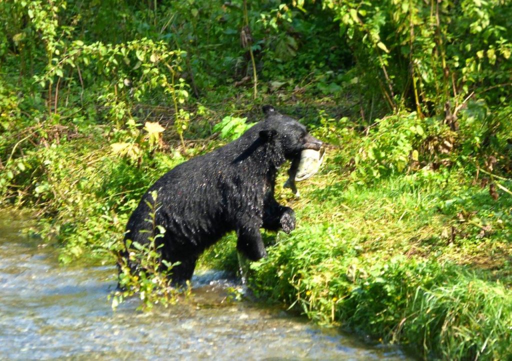
Crossing an unguarded border we drove into Hyder that looks like the old west. Remember, just because you crossed into the USA without being questioned, you still deal with the border guards coming back into Canada. Get Hyderized at the old Glacier Inn. Visit Fish Creek Wildlife Observation Site for safe bear watching from the boardwalk. We went along 25 km of rough gravel road, sometimes one-lane, up the mountains to see Salmon Glacier. What a breathtaking sight but it cost us a tire. A tire guy drives around Stewart in his truck fixing tires!
After we left Meziadin we stopped at Gitanyow – the Land of the Totems. At one time they had more original totems than anywhere else. Kitwanga village was our home for the night. We visited Gitwangak Battle Hill Historic Site where from the top of the hill tribes fought rivals.
Summing up the Stewart-Cassiar trip my advice would be to prepare for driving through the wilderness, allow plenty of time to explore and learn the history.
Fuel stops from Kitwanga are at the junction of Highways 16 and 37: Gitanyow 19 km; Meziadin Junction 149 km; Stewart 220 km; Bell 2 249 km, Tatogga Lake(not always open) 392 km; Iskut 406 km; Dease Lake 499 km, Junction 37 at Yukon border 724 km.
TIP: If you find this blog interesting why not subscribe to the enewsletter and never miss another story!
Other information to help you plan your camping trip include:
Wilderness Adventure Along the Stewart-Cassiar Highway
Kitwanga Junction
Exploring Northern British Columbia – A Circle Tour Adventure: Stewart-Cassiar Highway
Discover British Columbia’s Travel the Great Northern Circle Tour
For camping accommodations in British Columbia check out the Camping Map.
Share your BC travel and camping photos using hashtag #campinbc #explorebc
Wintering in BC’s Okanagan? Check Out Things To Do Oliver to Osoyoos
The towns of Oliver and Osoyoos, located on the southern end of British Columbia’s Highway 97, are popular with outdoor enthusiasts year-round and attract thousands of snowbirds and RVers in the winter months.
Oliver
With its rich agricultural industry, Oliver currently produces half of the wine grapes for British Columbia and, with over 40 wineries, is known as Canada’s wine capital.

Local bistros and winter wine tasting are a must-do as are the distilleries, cideries and breweries for tours and sampling. Firehall Brewery, with the fun tagline of the ‘Beer of Wine Country’, is located in an old firehall that dates to 1948. In and around town try out the food trucks and year-round fruit markets and visit Big Al’s Baker and Deli, a local favourite.
Shop the boutiques featuring local artists around Main Street and take in a show or play at the Venables Theatre, or a movie at the classic one-room Oliver Theatre. For some history, there’s the Oliver and District Heritage Society, which offers educational programs, heritage walks and more. The museum has exhibits and artifacts, while the archives (at a separate location) houses a research library. Indoor and outdoor activities and lessons, including overall wellness, arts and culture and sports and leisure, can be booked with the Oliver Parks and Recreation Society.

Hikers and walkers enjoy the view from the (7.7 km; moderate) Golden Mile Trail, which starts at Tinhorn Creek Vineyards. Closer to town, explore Rotary Beach at Tuc-el-Nuit Lake or visit Lion’s Park where you can access the Oliver hiking and biking trail at the east boundary. There is an off-leash dog park here. Other great hiking spots are Burwell Lake Recreation Site, northwest of Oliver, and Inkaneep Provincial Park and Ny-lin-tn (previously called McIntyre Bluff), both north of the town.
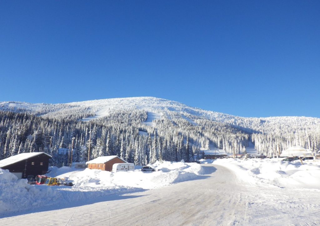
Winter sports enthusiasts love Baldy Mountain Resort, 40 minutes east of Oliver, which has a fantastic snowshoe rental and events program, including a moon candle-lit outing. The McKinney Nordic Ski Club, around 30 km southeast of Oliver, has 14 km of cross-country trails with a variety of difficulty and 5 kms of snowshoe trails. There is no lodge, but an outhouse is on-site.
For something unique visit Sunkeya Farm Alpacas, located northwest of Oliver. Its farm store sells yarn and alpaca fibre socks, hats, scarves, blankets and more. Be sure to call before you visit. There’s also the Oliver Indoor Flea Market on Station Street where you can be sure to find a few bargains and hidden gems to enhance your RV living.
Osoyoos
Located on Osoyoos Lake, amongst grasslands and highlands, Osoyoos has a dry winter climate, generally with mild temperatures from October through April and a low average annual snowfall of only 5.4 cm. The US border is a mere 5 km from town.

Osoyoos is home to one of Canada’s few true desert environments. The region caters to its many snowbirds, is very pet friendly and has a multitude of boutiques to explore and fitness and art courses to try.
Its restaurateurs and chefs are passionate about promoting local, fresh food that’s been sustainably raised. Choose from casual cafés, wine bistros and upscale dining experiences. During winter the Osoyoos Farmers Market heads indoors. The Oliver and Osoyoos Winery Association puts together a December event with special promotions called Winter With Country.

A memorable experience is a visit to the Nk’Mip Desert Cultural Centre (pronounced in-ka-meep). At this 1,600-acre desert conservation area you can learn about the Osoyoos Indian Band and take in local food and wine tastings, dinner evenings and special events.
More culture can be had at Osoyoos Performing Arts and the Art Gallery Osoyoos; the gallery offers works by local and non-local art and artisans. For winter festivals and events visit the Destination Osoyoos event calendar for performances at the South Okanagan Events Centre, Junior B hockey games (Osoyoos Coyotes at the Sunbowl Arena) and more.

Skiing, snowboarding and snowshoeing aren’t far with Baldy Mountain Resort only 40 minutes northeast of Osoyoos.
Walks include the 1.5 km boardwalk at the Osoyoos Desert Centre, a 67-acre nature interpretive facility, where you can explore and learn about one of the world’s rarest ecosystems (the semi-arid, antelope-brush); Pioneer Walkway, a paved path on the strip of land that separates the north and south ends of Osoyoos Lake; Legion Beach Park, a 10-minute walk from Main Street; and Osoyoos Oxbows Trailhead, located at the north end of Osoyoos Lake, a protected wetland popular with bird watchers. For dog walking areas and off-leash park info visit the city of Osoyoos webpage on dogs in parks.

Golfing in the winter and early spring is possible in Osoyoos. Contact Osoyoos Golf Club and Sonora Dunes Golf Course direct as season opening and tee times are dependent on the weather. Popular indoor activities are five-pin bowling at Kobau Lanes, curling at Osoyoos Curling Club and pickleball at the Sonora Community Centre.
Pamper yourself at Solterra Desert Spa at Spirit Ridge Resort or Levia Wellness Spa, a farm-to-table spa experience. Another ‘getaway’ option is booking a hotel or motel. Several Osoyoos accommodations offer special weekly winter rates for snowbirds looking for a little break from their campgrounds. Check with Destination Osoyoos for updated information and deals.
For information when in the area:
Oliver Visitor Centre: 6431 Station Street
Osoyoos Visitor Centre: 9912 BC Highway 3
Want to read more on Winter Activities check out https://www.campingrvbc.com/category/activities/winter-activities/
TIP: If you find this blog interesting why not subscribe to the enewsletter and never miss another story!
Share your BC travel and camping photos using hashtag #CampInBC and #ExploreBC
For places to camp in BC in the winter go to https://www.campingrvbc.com/winter/
RVing in British Columbia This Winter? Here’s Some Camping Trip Prep
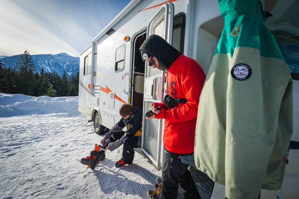
Winter RVing in British Columbia is something that all RVers and campers should experience. Imagine waking to a wonderland of snow outside while being warm and cozy inside. After breakfast strap on the snowshoes, hit that favourite ski hill or cross-country trail, head to a beach for a magical shoreline hike or catch dinner while you ice fish on a frozen lake.
All revved up and don’t know where to go this winter? The Camping and RVing BC Coalition has a Web page which lists over 150 campgrounds and RV parks in the province that are open for business in the winter.
But before you set off, winter camping comes with its own unique challenges and safety considerations, so you’ll need to prepare the RV for various conditions before embarking on a trip. Below is some helpful advice to make your winter RV trip a more carefree one.
Water
One of the biggest mistakes that you can make in winter is connecting the regular water hose to the campground supply and having it freeze overnight. Consider buying a heated water hose to prevent freeze-ups or bursting. And always keep hoses and cables off the ground or out of the snow.
Another option is to fill your fresh-water tank and then disconnect your hose. Often the water tank is located inside the RV and, as long as the unit is heated, the water in the tank should not freeze.
Do not assume that because your RV is heated that water lines running through it will not freeze. Any semi-exposed line can freeze! (Examples are in compartments behind hatches that are not insulated.) Verify the temperature the water heater is rated to operate down to.
Tip: Use a hairdryer to thaw frozen pipes.
Waste Tanks
Always make sure your black and grey water tanks are empty before your trip. Add one litre of RV potable antifreeze to each tank to protect the dump valves from freezing. Insulate the pipes draining into the tanks with foam pipe insulation.
Always keep your black water valve closed and only dump when full or when you’re ready to leave. This will help prevent ice from forming.
If you must keep your sewer hose connected at all times, be sure it is placed and supported at a steep angle so all residue runs down.
Tip: Wrap the sewer hose in insulation or heat tape to prevent ice from forming inside the pipe.

Warmth, Insulation & Condensation
Feel for any drafts and, where possible, insulate and/or seal the areas. Check window seals and re-caulk where needed. For drafty walls and floors add foam insulation panels or foam board flooring.
Examine the weather stripping on all exterior doors, slide-outs and access hatches and cover the AC unit. Insulate and re-seal accordingly. Most RVs have roof vents or skylights, which are ideal places for heat to leak out (these usually have exterior covers to prevent rain and snow from getting in). Seal these off by inserting an RV vent cushion or make your own with insulation and a moisture-proof fabric.
Saying this, one consequence of a well-sealed RV is condensation which builds up from internal heat and moisture, therefore keeping at least one vent about 2.5 cm open will allow for some ventilation.
Tip: Change any indoor curtains to a heavier or insulating fabric to block cold air. Add a moisture-resistant rug or carpet to the floor for the winter trip.
Tip: Insulate the gap behind light fixtures and electrical outlets.
Test the furnace and use compressed air or a brush to remove dust, debris, insects or spider webs. For those not using a furnace a portable ceramic or electric space heater is another option to stay warm, but make sure to open a window or vent, especially when heating with propane. For milder nights a heated blanket may suffice, just make sure it has the automatic switch-off function.
If you use propane to heat your RV it’s likely to last only a few days in really cold weather. For longer stays consider getting a 100 lb propane tank to supplement the regular tanks. Insulate the outside propane regulator from freezing conditions such as excessive wind chills.
If you plan to be situated for a while place wooden blocks underneath any stabilizing jacks to prevent ice formation and invest in an RV skirting (they generally snap on) to avoid cold air and wind from getting up and into the underbelly of the unit.
Tip: Use an electric dehumidifier; alternatively, a container of moisture absorbent will help to remove dampness from the air and help prevent corrosion, mold and mildew.
TIP: If you find this blog interesting why not subscribe to the enewsletter and never miss another story!
Other Tips
- Park your RV in the sun whenever possible. You’ll be amazed at how much a good winter sun can heat up your RV.
- Park your RV on support boards. These boards will prevent your RV tires from ‘sinking’ if the ground thaws.
- Pack winter bed quilts/sleeping bags and enough winter clothing to last a few days in the event of furnace or electrical failure.
- Make sure that the heat tape you buy can be crossed over itself, as this will provide the most efficient seal.
- Periodically start the engine to keep everything in good running order.
Additional resources for RVing in winter:
More tips on RVing in winter
Places to camp in BC in the winter
Check out the ‘Camping How To’ section of our Web Blog
Winter tips from Go RVing Canada.
Share your BC travel and camping photos using hashtag #CampinBC
It’s always a great day to #CampinBC
Exploring British Columbia’s BC Ale Trail
New experiences are brewing nearby!
The BC Ale Trail is a series of 20 self-guided itineraries pairing 150+ local craft breweries throughout BC with the super, natural landscapes that surround them. BC’s craft breweries closely adhere to COVID-19 safety protocols and are ready to welcome you safely — whether you visit one of their patios for a pint or pick up some beer to-go.

Almost 200 breweries dot the super, natural landscapes of British Columbia. Let the BC Ale Trail be your guide for exploring BC’s ancient rainforests, vast, raw nature, mountain peaks that touch the sky, historical ranch-lands, West Coast culture, farm-to-glass culinary experiences, lakeside lifestyles and cities on the edge of wilderness – all while enjoying great, local, craft beer on your own self-guided Ale-venture!
Within each Ale Trail on our website, there are recommended itineraries to explore – this includes an array of craft breweries, pubs, restaurants, cafes, liquor stores, outdoor activities, sightseeing and more — all either on the way or very close to your campground! Some brewery patios are even dog-friendly!
The BC Ale Trail is divided into six regions – Kootenay Rockies, Northern British Columbia, Thompson Okanagan, Vancouver Island and Vancouver, Coast and Mountains.

Kootenay Rockies
The Kootenay Rockies is a go-to destination for beer lovers and wilderness explorers – enjoy spectacular parks, hot springs, hiking trails and of course, beer from 15 breweries.

Northern British Columbia
Explore the craft beer community in Northern British Columbia with 11 breweries situated among Northern BC’s sweeping glaciated valleys, volcanic rock formations, towering mountain ranges, and mist-shrouded coast.

Thompson Okanagan
Enjoy the diverse region of the Thompson Okanagan featuring views of the Rocky Mountains and vast desert landscapes, dotted with lakes, grasslands, and rolling hills paired with 34 craft breweries.

Vancouver Island
Experience craft beer culture from your choice of 46 breweries on Vancouver Island, interwoven with natural beauty, agricultural splendour and some of BC’s most spectacular beaches.

Vancouver, Coast & Mountains
Explore a craft beer scene in Vancouver, Coast & Mountains that’s finding fame across the world with 95 breweries and growing, in a city that loves to get outside – bordered by the sea, forest and mountain peaks.
Other Useful Information
Take the BC Ale Trail on the road with you! Download our FREE mobile app. With a database of over 250 locations including breweries, taphouses, liquor stores, visitor centres and more. Use the app to find a location near you, check-in once you arrive to collect points and when you have enough, you can redeem them for a reward at participating locations.
Read blogs from the BC Ale Trail website and explore more on the BC Ale Trail via its social media channels.
TIP: If you find this blog interesting why not subscribe to the enewsletter and never miss another story!
For places to Camp in British Columbia go to the Camping Map
Share your BC camping and travel pictures using hashtag #campinbc, #explorebc, #bcnice
It’s always a great day to #CampinBC
Who is Your Wildlife Companion In British Columbia?

Have you ever thought about who your camping companions really are? No, I don’t mean the ones who helped you pack for the trip and set up camp – I mean your wildlife companions. Have you ever just sat quietly for 60 seconds and listened? I mean really, really listened to all that you hear in that brief moment of time. Take a moment to take in the sounds, sights, and smells of a campsite. This could make a great camping activity for the whole family, by making it a family tradition where once a day the whole family sits in silence for just 60 seconds (at different times each day) and make a note of all that you hear (If you have children, this could be a segway to a future school project during the school year).

Most times, you will hear a barking dog, a crow, a raven or even the bright blue Stellar Jays who makes harsh, nasally chirping sounds – I refer to them as the food thieves of the camp, so don’t leave that snack bowl unattended as one in a bowl means a whole flock is sure to follow, one by one. You may even see the gray and black Whiskey Jacks – aka the Canada Jay, Robins, Geese, Owls, Eagles as well as seagulls (depending on your location) but there are others lurking in the treed forest you are calling home for a few days each year.

Now that we have covered the feathered ones, what about the ones you can see? Most of us can say we have seen a squirrel or chipmunk as well as a raccoon while we camp, possibly even a deer, or you’ve been lucky enough to see a bear. But have you really looked? What others are out there? You might have even seen a ground squirrel – you know, they are the ones that are perfectly perched on their hind legs letting out a short squeak now and then. What about the ones that scurry along every night while you sleep? Busy out there rummaging through everything to get every last morsel that was dropped on the ground – they are the deer mice – the ones with the bulging eyes. I had one enter my RV just this past summer – so my tip to you is that you make sure everything is sealed in airtight containers to lessen the attraction via their nose! A bowl of pistachios left on my counter was the attractant. And if you camp in tents, never snack in the tent either.

What about the ones you don’t immediately see? Like ants, spiders, worms, and flies? Then there are those pesky flying insects like mosquitoes, noseeums, black flies, and the Crane Fly better known as Leather Jackets (aka Daddy Long Legs or Mosquito Hawks) and an infestation that hit some parks in British Columbia in the summer of ‘22, where we saw large numbers of the yellow Tussock Moth, which feed on the needles of the Douglas Fir and can decimate a forest in a year and a half.

The next time you are out camping – take a minute (we know you have it) to just sit, relax and try to detect all the wonderful and not so wonderful creatures of the day and into the night.

For places to camp in British Columbia go to Camping & RVing BC Camping Map.
TIP: If you find this blog interesting why not subscribe to the enewsletter and never miss another story!
Share your BC travel and camping pictures using hashtag #campinbc, #explorebc, #bcnice, #green
It’s always a great day to #CampinBC
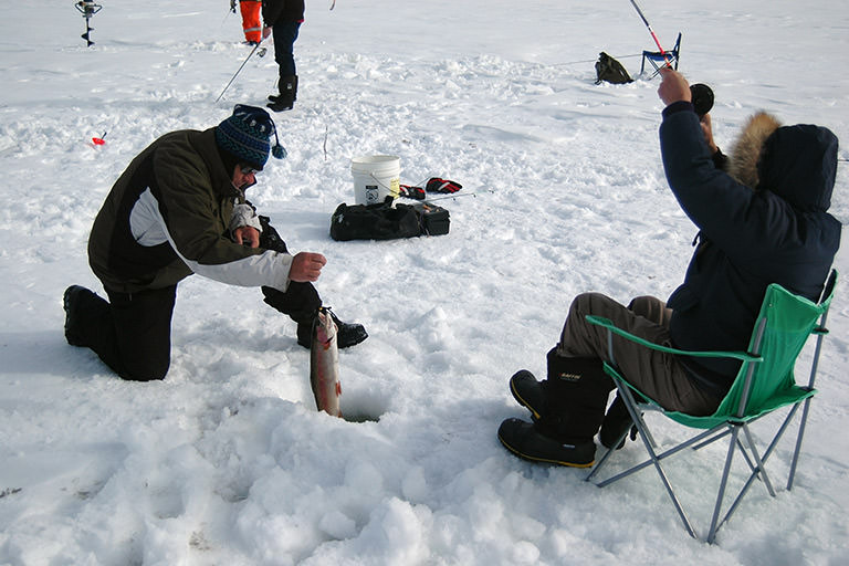
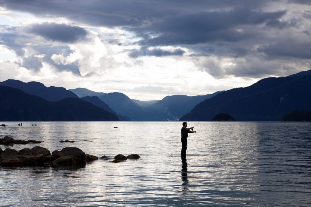
The Ins and Outs of Fishing in British Columbia
Pairing a chilled, buttery chardonnay or local craft beer with a freshly caught salmon or trout for dinner is the epitome of a combined camping and fishing holiday. British Columbia is fortunate to have both saltwater and freshwater fishing (also known as tidal and non-tidal) opportunities often close to campgrounds, RV parks or Recreation Sites.

Freshwater Fishing
For freshwater anglers that like to fish from a quiet river bank or float along in a small boat, British Columbia has an abundance of lakes (25,000 and counting) and thousands of kilometers of streams and rivers. Perhaps the most iconic, and sometimes elusive, species are the steelhead and white sturgeon (which can only be fished in the Lower Fraser. To fish either species you must purchase a conservation stamp). Other popular species for freshwater anglers include rainbow trout, cutthroat trout, kokanee, char and whitefish.
Saltwater Fishing
Saltwater anglers who yearn for the open sea or a sheltered cove along the coast, are spoiled for choice along the Pacific coastline that stretches from Victoria, BC all the way up to Alaska. Renting a fishing charter and guide provides recreational anglers an opportunity to fish for species such as halibut, or a trophy sized chinook.
Fishing Licences and Regulations
To fish in British Columbia waters, all anglers require a valid licence.
Licenses for non-tidal/ freshwater fishing can be purchased at local hardware stores, sporting good centres or tackle shops. To view vendors throughout BC or to purchase an e-licence click here. A comprehensive guide to licensing, regulations, and more is available in the guide Freshwater Fishing Regulations Synopsis produced by the Ministry of Forests, Lands & Natural Resource Operations.
Licences for tidal/saltwater fishing are available through the Fisheries and Oceans Canada website. A handy guide that gives you all the information you need on licences; species and allowances; packing and transporting; safety and much more can be viewed in the British Columbia Sport Fishing Guide.
Fishing in a national park requires a Parks Canada Fishing licence.

Fishing Equipment
Rods, reels and an assortment of tackle can be bought at sporting or fishing stores. Some lakeside private campgrounds loan rods and tackle, or you can borrow equipment for free at locations throughout the province thanks to the Freshwater Fisheries Society of BC’s Rod Loan Program.
Handling Your Catch
Important information for Handling & Releasing your catch is on the Freshwater Fisheries Society of BC’s website. If you plan to keep your catch, make sure you are prepared with an ice-filled cooler to keep your fish in. Treat your fish humanely by giving it a sharp blow on the head immediately, clean it promptly, and store it on ice to prevent spoilage. Never harvest more fish than you need, and to comply with the law, you must leave the head, tail and all fins on your catch until you return home or to your campsite.

Other Useful Information
Camping & RV in BC has a google map that plots all the stocked freshwater fishing lakes in BC. The map data is directly provided by the Freshwater Fisheries Society of BC, who stock all BC lakes. The map also plots campgrounds making it easy to plan your camping and fishing trip. You can determine what lakes you will fish, species stocked, and find nearby campgrounds.
Read blogs on the Camping & RV in BC website about favourite fishing spots of some of BC’s visitors.
For camping opportunities in British Columbia go to the Camping Map
TIP: If you find this blog interesting why not subscribe to the enewsletter and never miss another story!
For fishing tips and information visit:
Travel British Columbia
Freshwater Fisheries Society of BC
Hello BC
Share your BC camping and travel pictures using hashtag #campinbc, #explorebc, #bcnice
It’s always a great day to #campinbc
The Underwater ‘Treasures’ of Pavilion Lake in British Columbia’s Cariboo
Located halfway between Cache Creek and Lillooet, Pavilion Lake is a brilliantly hued body of water with plenty to explore both above and below the water.
We love to use Pavilion Lake as a paddle destination when camping at nearby Marble Canyon Provincial Park (read our blog) . On our most recent trip, we paddled approximately half the distance along the highway side of the lake, and clocked a trip of around seven kilometres. The highway side of the lake is a mix of waterfront cabins and steep banks going up to the highway. On my next trip, I hope to explore the other side of the lake where there are a couple of boat-access-only properties but mostly it is untouched forest.

Pavilion Lake is a popular summertime destination and the limited areas of waterfront that are accessible from the highway (and not private property) can get busy. Kayaking offers visitors the opportunity to get away from the crowds and find a little solitude on the water.
While the steep limestone cliffs and colourful water provide a beautiful destination above the water, Pavilion Lake is internationally known for what lays below the surface.

In the mid 1990s, strange structures below the surface of the water were scientifically identified as microbialites – rare calcareous structures likely produced by microbial communities, which are estimated to have started forming 11,000 years ago. Researchers believe the microbialites are similar to some of the earliest life forms on Earth, dating back 500 million years. Pavilion Lake has been studied extensively via the Pavilion Lake Research Project (PLRP), a joint effort between the University of British Columbia and NASA.

Recreational scuba divers can visit Pavilion Lake and explore three areas with microbialite structures. The North and South dive sites are accessible along the side of the highway down to a depth of 40 metres. The most popular diving location, called Island to Sky Blue, is where we have done the bulk of our diving. This site covers all the areas around the island and the former Sky Blue Water Resort. Divers can explore down to a depth of 40 metres. The remainder of Pavilion Lake is designated a Special Features Zone and no diving is permitted in order to further protect the fragile microbialite structures.

With proper training and equipment, diving at Pavilion Lake is a truly unique experience. The microbialites are reminiscent of coral and the water, particularly in the shallows, can look quite tropical. That is more or less where the comparison ends, though, as the water temperature at Pavilion Lake can be very cold!

For those who are not certified or prepared to dive in the cold water, Pavilion Lake remains an excellent destination for kayaking, canoeing, or paddle boarding. While gliding across the surface of the water and enjoying the spectacular mountain views, keep the treasures that lay below in mind and make sure to do your part to protect this fragile ecosystem.
TIP: If you find this blog interesting why not subscribe to the enewsletter and never miss another story!
For camping opportunities in this area and throughout BC go to the Camping Map
Share your BC travel and camping pictures using hashtag #campinbc, #explorebc, #bcnice, #green
It’s always a great day to #campinbc
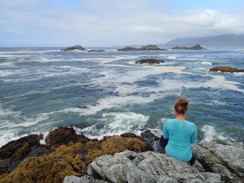
Kayaking in British Columbia’s Nootka Sound Off the West Coast of Vancouver Island
The west coast of Vancouver Island contains many hundreds of kilometres of coastline, ranging from protected inlets to wild and windswept shorelines. Multi-day ocean kayaking trips are an excellent way to explore some of the hidden treasures of the BC coast. When looking for a kayaking location offering a diversity of scenery, Nootka Sound scores highly as it offers both calm and protected waters in and around Bligh Island and the Spanish Pilot Group and the exposed, “next stop Japan,” sort of views that make the west coast famous.
Nootka Sound is accessible from Gold River, a thousand-or-so resident town just over an hour west of Campbell River. What it lacks in cell phone service, Gold River certainly makes up for in beauty. With towering mountains and lush forests (well, those parts that don’t bear the scars of decades of clear cutting), Gold River is the gateway to a wilderness paradise. Nootka Sound can be accessed directly from Gold River via private boat, an extremely long paddle, or the unique experience of the MV Uchuck III which will wet-launch potential paddlers anywhere along its route through Nootka Sound and Kyuquot Sound. For our trip, we chose none of the above, opting instead to drive another hour along logging roads in order to launch ourselves further up the inlet at the Cougar Creek Rec Site.

Launching complete, we paddled out of Cougar Creek and headed for Bligh Island Marine Provincial Park. The park is a popular recreational destination, known for its good fishing and protected waters. Our original destination for the night, a user- maintained campsite at Charlie’s Beach on Bligh Island, turned out to be extremely busy, so we sought an overnight home instead on nearby Vernaci Island. While the marine park encompasses the southern part of Bligh Island, the Villaverde Islands, the Pantoja Islands, Verdia Island, Vernaci Island, and Spouter Island, good campsites are few and far between. Anyone who has paddled on the BC coast knows the struggle of the often nearly vertical water-rock-trees configuration; so when a good campsite is available, make yourself at home!

On day two, it was time to leave the protected part of Nootka Sound, take advantage of the perfect weather, and head to the exposed outer coast beyond Burdwood Point. As we set out, the sun was shining, the winds were calm, and the ocean had just enough gentle swell to be a reminder that nothing but thousands of kilometres of ocean lay directly ahead. Our crossing was uneventful, and before long we were paddling into a large crescent shaped bay rimmed by a smooth pebble beach. Rocky islets just off-shore provided picture-perfect views, and we made sure to set our tents up to maximize the panorama before us. All was perfect, and we spent the afternoon lounging in the sun and fishing off the rocks.

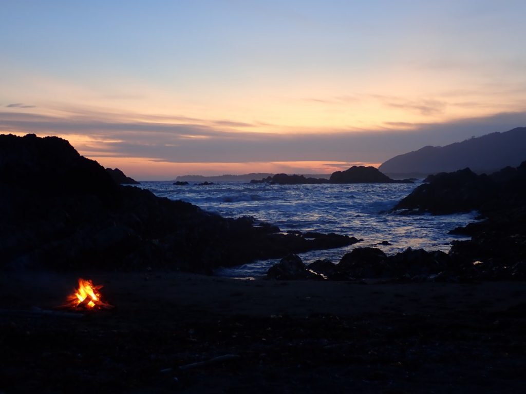
The west coast is an undeniably wild place, and by evening the weather had shifted and a storm was blowing in. The now relentless wind had whipped the ocean into a frenzy, turning the previously calm bay into a scene from Oahu’s famous North Shore. The picture-perfect rocky islets broke up the waves and made the view to the right akin to looking into a washing machine.
The winds raged on all night, and when we woke in the morning we knew that despite the glorious sunshine, there was a zero percent chance that we were getting off the beach that day. Sometimes, when it comes to Mother Nature, all you can do is watch, snack on dehydrated cheese, and wait her out! Fortunately for us, our enormous beach provided plenty of walking opportunities and there was even a creek, complete with shallow pools sheltered from the wind, which made a perfect place to break out our air mattresses and enjoy a float. The day passed with many rounds of wilderness bocce and naps, and by the time we were huddled around the marine radio listening to the forecast while cooking dinner, we had our plan: wake up very early and make a break for it while the wind and swells were forecast to be more manageable.

As the sun rose the next morning, we loaded up our gear, investigated the fresh bear tracks on the beach, and set out into the surf. The first hour or so of our paddle was, in the words of my father, “entertaining.” While we were paddling through the type of waves that make your companions disappear, we were far from the only ones on the water. If you paddle early in Nootka Sound, you are guaranteed to see recreational fisherman hauling their catch out of the water all around you.
TIP: If you find this blog interesting why not subscribe to the enewsletter and never miss another story!
Before we knew it, we were back inside the protected waters of the Spanish Pilot Group and the relentless wind and waves had completely disappeared. The power of Mother Nature is incredible, and it is so important to always be prepared for an extended and unexpected stay.
The remainder of our trip was all calm seas and sunshine and before long our trip was at an end. Nootka Sound is a wonderful place to explore for kayakers of all levels. The protected inner islands provide peaceful paddling, while the exposed outside is great for those comfortable with big seas and surf landings. With so much still to explore in the area, I am sure we will be back to see more of what Nootka Sound has to offer.
For camping and RVing options in British Columbia go to the Camping Map.
Share your BC travel and camping pictures using hashtag #campinbc, #explorebc, #bcnice, #green
It’s always a great day to #campinbc
Follow the BC Farmers’ Market Trail on Your British Columbia Travels
Stay local, support local, and shop local — outdoors or online — with BC Farmers’ Market Trail! Our market finder is your quickest route to fresh, local, in-season food, and artisan goods direct from the people who produce them.
At 145+ authentic farmers’ markets, you’ll find dedicated vendors who grow, make, bake, or raise the products they sell, across 10 regions of British Columbia. Take a peek and get inspired by the bustling markets local to some of our featured regions!
Northern BC
Each farmers’ market offers unique products, reflecting its distinctive landscapes — from misty Haida Gwaii, to the Skeena River, volcanic valleys, glacial lakes and snowy mountains.

Sunshine Coast
Decade old farmers’ & artisan markets enrich the culture of this sunny mainland coastline.

Cariboo Chilcotin Coast
The geographic heart of the province, this region spans from the west coast to the historic Gold Rush region.

Kootenay Rockies & Columbia Basin
The southeastern corner of BC is renowned for its orchards, pasture and farmland—it’s a hub for fresh local food and farming.

Hop on the trail to find an online market or a market near you!
Maintaining the health and safety of farmers’ market organizers, vendors, and shoppers, along with the communities in which they operate is a top priority for all of us.
TIP: If you find this blog interesting why not subscribe to the enewsletter and never miss another story!
For places to camp in BC go to the Camping Map
Share your BC camping pictures using hashtag #campinbc
It’s always a great day to #CampinBC
Plan to Visit Marble Canyon Provincial Park in British Columbia’s Cariboo Region
The dry interior of the province is one of our favourite camping destinations. Marble Canyon Provincial Park, located along Highway 99 between Cache Creek and Lillooet, fits the bill for everything we like.
The campsite offers 30 high density, first-come-first-serve sites and on a sunny weekend afternoon, it is pretty much guaranteed that the campground will be over capacity between the campers and the day-trippers. As the afternoon wears on, some of the day users will depart, and there is a chance that late arrivals may find a campsite in one of the parking-lot style sites. For those lucky enough to snag one of the premium lakefront sites, the busyness of the park melts away.

The campsite at Marble Canyon Provincial Park is bookended by Crown and Turquoise Lakes. When the water is high, the two lakes merge and visitors can kayak or paddle board between both lakes. A full circumnavigation of the two lakes is about two kilometres. For those looking for a longer paddle, just up the road is Pavilion Lake (watch for the next blog published soon), a gorgeous lake home to extremely rare freshwater microbialites studied by NASA!

One of our favourite things to do when visiting Marble Canyon Provincial Park is to hike to the waterfall on the opposite side of the lake. From the campsite, walk or drive to the north end of Crown Lake. From here, follow the trail along the non-highway side of the lake for about three quarters of a kilometre. The trail skirts along the lakeshore in places and climbs the hillside in others. Before long, visitors will arrive at a beautiful waterfall. In the winter, this waterfall freezes and is hilariously referred to as Icy BC (and a variety of other thematic route names including Body Shop and No Deductible) by ice climbers.

Marble Canyon Provincial Park protects a dramatic landscape of steep limestone cliffs and lovely lakes. It is extremely busy during the summer with campers and day-trippers alike, but it makes an excellent shoulder season destination as well. The first time we ever visited Marble Canyon Provincial Park was the last weekend of September – warm sunny days but certainly below freezing overnight. Our trip was instigated by a desire to climb a few of the many rock-climbing routes in the area. While it has been almost a decade since that climbing trip, Marble Canyon Provincial Park is a place we keep going back to – and keep finding new things to explore when we are there.

If you are looking for widely spaced campsites and a moderate climate, Marble Canyon Provincial Park is probably not the place for you. The campground is undeniably squishy, but for us it works, as when the small beach is busiest, during the heat of the day, we prefer to be on or in the water. During early mornings, late afternoons, and evenings, Marble Canyon Provincial Park can be a peaceful and beautiful destination for a weekend getaway.
TIP: If you find this blog interesting why not subscribe to the enewsletter and never miss another story!
For other camping opportunities in this area and throughout BC go to the Camping Map
Share your BC travel and camping pictures using hashtag #campinbc, #explorebc, #bcnice, #green
It’s always a great day to #campinbc
Published: July 21st, 2022
Connect With Us