Wasa Lake Provincial Park in BC’s Kootenay Region
Last summer we spent ten days motorcycle touring through southeastern British Columbia. One of our favourite destinations between Golden and Nelson was Wasa Lake Provincial Park in the Kootenay region.
Wasa Lake Provincial Park is unlike any provincial park I have visited previously – and I have visited a lot! Located approximately 200 kilometres south of Golden and just 40 kilometres north of Cranbrook, the Wasa Lake Provincial Park campground actually caused me a bit of concern when we were arriving. Despite the fact that I had made a reservation at a campground with around 100 sites, the arrival route to the campsite made me feel like there must somehow be two Wasa Lake Provincial Parks in BC (spoiler: there’s not).

After driving through numerous small communities along the Columbia River, enjoying beautiful views while driving along Columbia Lake, relaxing with a late afternoon dip at Fairmont Hot Springs, then heading for Wasa Lake late in the day, we followed Google’s directions and turned off the highway at Wasa Lake Gas and Food. We saw the main beach area, lovely grassy areas with tell-tale BC Parks picnic tables, a nice looking bike path, and a sani station – so far so good. Then we turned left and were suddenly in the middle of what appeared to be a residential area. Houses and summer cabins flanked both sides of the road and I was left wondering where exactly 100 campsites were going to fit! Fortunately for us, before long it all became clear: Wasa Lake Provincial Park is actually made up of several smaller, disconnected sections. There is a campground set back from the lake, a large day use area with a playground and boat launch, and two smaller protected areas on the opposite side of the lake with no facilities.

With that sorted, we set about preparing our campsite. Our site was similar to most in the loop: a standard BC Parks gravel pad surrounded by grassland and light tree cover. The site offers both pit and flush toilets throughout the campground and has a shower building near the entrance. A walk around the campsite to orient ourselves uncovered a children’s bike park, an amphitheatre, and a self guided interpretive trail called the Forest of the Rainshadow.
The Forest of the Rainshadow is a 3 or so kilometre, hour-long loop hiking trail departing from near the campground amphitheatre. The sign at the trailhead invites hikers to “wander through a Ponderosa pine and Douglas-fir forest as you make your way gradually uphill to open grasslands… Along the way investigate how the forces of nature and the influence of humans have shaped the Forest of the Rainshadow.” As we did our hike, we saw numerous markers with numbers, which leads me to believe that at one time there was a brochure with information about each marker similar to the Otter Marsh Interpretive Trail we did at Big Bar Lake Provincial Park (see blog). Unfortunately, I was not able to find any information to accompany The Forest of the Rainshadow. Despite this, I would recommend The Forest of the Rainshadow as it is a lovely walk with great views of Wasa Lake.

The next morning we set out to explore the other sections of Wasa Lake Provincial Park. A great way to do this is by cycling or walking the Wasa Lions Way – an 8 kilometre paved loop around Wasa Lake that connects all the parts of Wasa Lake Provincial Park. Our trip around the lake took us to two sections of Wasa Lake Provincial Park on the west side of the lake without any developed facilities. These areas have undergone significant grassland restoration and it was really interesting to learn about fire maintained temperate grasslands and how fire suppression since the 1940s has negatively impacted these ecosystems.

As we rounded the north end of Wasa Lake we entered back into the largest area of the park. Wasa Lake Provincial Park has four day-use areas with buoyed swimming areas, which provide safe access to the warmest swimming lake in the Kootenays and over 2,000 metres of beaches. There are 45 picnic sites, a change house, a boat launch, and an adventure playground.

Wasa Lake Provincial Park is an absolute gem for family camping. We observed that most campers seemed to have their bicycles, and between the many trails to explore, the great beaches, and the laid back vibe, I can see how Wasa Lake Provincial Park would be a great place to unwind.
TIP: If you find this blog interesting why not subscribe to the enewsletter and never miss another story!
For other places to camp in this area or elsewhere in British Columbia go to the Camping Map.
Share your BC travel and camping photos using hashtags #campinbc #explorebc.
Soak in the Sunshine Coast Along BC’s Salish Sea Route – Saltery Bay to Lund
Indigenous cultures, artistic communities, sea-inspired activities, spectacular coastlines and old growth forests make up British Columbia’s Salish Sea Coastal Route. This blog covers the Sunshine Coast part of the drive, from Saltery Bay north to Lund. Click here for the Sunshine Coast blog from Langdale to Egmont which also includes ‘Getting There’ from the BC Mainland.

Saltery Bay
After a 50-minute ferry ride across Jervis Inlet from Earl’s Cove you arrive at Saltery Bay on the Malaspina Peninsula. It was named in the early 1900s when it was the base for a salmon saltery and fish packing plant. Nearby are Mermaid’s Cove and Saltery Bay Provincial Picnic Park, a popular stop for, yes, a picnic. Mountain bikers can explore the 48-km Elephant Bay Loop. Between Saltery Bay and Powell River lies Lang Creek Estuary, a superb location for salmon fishing and beach casting when the fish run in autumn. There are several hiking trails and forest recreation sites along the way too. Palm Beach Regional Park off Hwy 101 before Brew Bay is open year-round and bids adieu to summer with the Sunshine Music Festival on Labour Day Weekend.

Powell River/Texada Island
Powell River is the ancestral home of the Sliammon First Nation. The city of Powell River lies along the shores of the Georgia Strait at the heart of the Malaspina Peninsula and faces west to Vancouver Island. Inlets and Powell Lake separate this area from the rest of the BC mainland, making it a magical place to visit.
It’s an area steeped in Indigenous culture, logging and BC heritage (check out the educational forestry museum). Late winter sees the Powell River Film Festival in the classic Patricia Theatre, Canada’s oldest continuously running cinema. The townsite has over 400 buildings dating to the original 1910 town plan and, in 1995, was designated as a National Historic District of Canada. Stroll around for yourself or book a heritage walking tour or take in an Indigenous experience, such as the Tla’amin Nation Cultural Tours where you can meet skilled craftspeople and learn about traditional practices. Music gatherings include the Townsite Jazz Festival in April and the PRISMA Festival & Academy Festival in mid-June, which unites renowned guest artists with top international music students for two weeks; spectators are invited to watch the symphonies and orchestras that take shape here. Mid-July means outdoor entertainment with a unique logger sports event.

Local produce can be purchased at the Townsite Public Market and Coast Berry Company, a blueberry, strawberry and honey farm and café, and the Powell River Blackberry Festival and street party is in August. For an educational outing visit the Tla’amin Salmon Hatchery.
From kayak and canoe rentals and dive trips to day tours and eco resort indulgences, there are numerous tour opportunities and 32 lakes in the Powell River area. Golfers and cyclists should head southeast to Myrtle Point Golf Club and explore the roads through Paradise Valley agricultural area.

Beachgoers can check out Willingdon Beach Municipal Campsite on the northern edge of town (open year-round), Mowat Bay Park at the bottom end of Powell Lake, or, northeast of town, Haywire Bay Regional Park, operated by the Regional District. Travellers to Vancouver Island can take a ferry from Powell River to Courtenay.
Southwest across the water from Powell River is Texada Island, the largest of the Gulf Islands, with Courtenay, Vancouver Island beyond that. Each July the sandy beaches of Gillies Bay on Texada are home to the community event of Sandcastle Weekend. Other entertaining gatherings are the Texada Island Fly-In (air and car/bike show), the Texada Island Blues & Roots Festival, the Sunshine Music Festival and the Run the Rock 8 km and half-marathon/marathon. Said to be the toughest marathon in Canada it attracts runners from around the world. For a calmer outing visit Texada’s beaches to experience their vast intertidal zones or chill out and watch some skimboarding.
For more on Powell River read the blog Powell River, Insulated By Nature.
Lund
At the most northern end of Highway 101 is Lund, a quaint village known for craft harbour, fishing (Lund Seafood Festival in May), sea touring and being the gateway to Desolation Sound, the deep-water area at the northern end of the Salish Sea. Lund sits on Tla’amin land in the qathet Regional District and is home to the Coast Salish people. Its first European settler was Swede Charlie Thulin who, in 1889, named the harbour after a city in his home country.
Visit art studios such as Tug-Gumh Gallery or indulge yourself at Nancy’s Bakery or the Lund Resort at Klah Ah Men, an award-winner in Indigenous tourism.

East of Lund is Okeover Arm Provincial Park and Okeover Inlet, a superb spot for harvesting oysters and clams (tidal water licence required). Diver’s Rock Regional Park and Copeland Islands Marine Provincial Park are just north of Lund. The latter is made up of a small chain of island, islets and rocks in Thulin Passage and is a prime area for wildlife viewing and wilderness camping; there are also some anchorages for small vessels. For an unforgettable experience book a water taxi or snorkel/dive trip to Savary Island, southeast of Lund—it has some of the warmest waters north of the Baja and sandy shores to relax on. Lund Water Taxi offers services to Savary and Cortes Islands, Sarah Point (start of Sunshine Coast Trail) and Desolation Sound. They also have bicycle and kayak transfer services.
Water enthusiasts and hikers are keen on Inland Lake Provincial Park and the Sunshine Coast Trail from Powell River to Sarah Point, approximately 47 km north of Lund. There is 13 km of wheelchair accessible trail around Inland Lake.
TIP: If you find this blog interesting why not subscribe to the enewsletter and never miss another story!
The Sunshine Coast region is home to the traditional and ancestral territories of the Sḵwx̱wú7mesh Úxwumixw, shíshálh, Tla’amin, Klahoose and Homalco Nations. Visitors are encouraged to learn about how they can engage in cultural exploration.
Read our suggested drive along the Salish Sea Coastal Route or learn about winter activities on the Sunshine Coast.
Check out the first part of this tour up the Sunshine Coast by reading the blog Soak in the Sunshine Coast Along BC’s Salish Sea Route – Langdale to Egmont
For places to camp in British Columbia go to the Camping Map.
Share your BC travel and camping photos using hashtags #campinbc #explorebc.
Soak in the Sunshine Coast Along BC’s Salish Sea Route – Langdale to Egmont
Indigenous cultures, artistic communities, sea-inspired activities, spectacular coastlines and old growth forests make up British Columbia’s Salish Sea Coastal Route. This blog covers the Sunshine Coast part of the drive, from Gibsons area north to Egmont. See part 2 which covers Saltery Bay to Lund.

The Sunshine Coast area is only accessible by ferry, boat or plane providing an island feel experience. It has a mild coastal climate with many sunny days however, visitors should be prepared for wet days. (Boaters and hikers, check the weather before heading out.) Rain or shine, there are plenty of things to do in this incredible part of British Columbia. Fill your days exploring beaches, biking, paddling or fishing. Book a land or sea tour, take in a museum or festival, visit an art gallery or relax at a spa. Fuel up at breweries, cideries, distilleries, farmers’ markets and specialty food shops.
Getting There
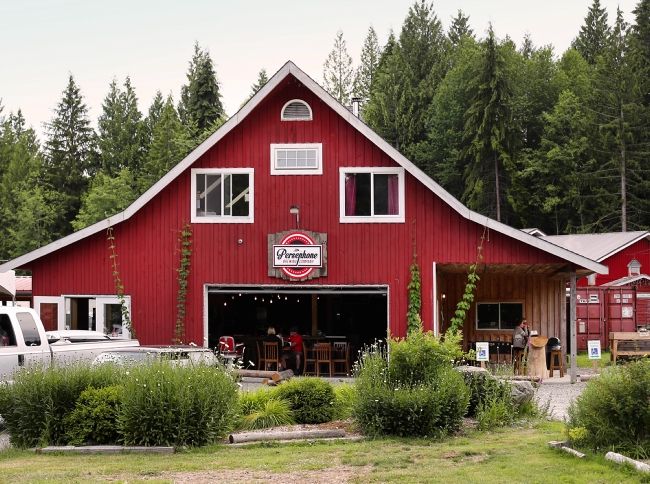
The 40-minute BC Ferry ride to Langdale on the Sechelt Peninsula departs from Horseshoe Bay in West Vancouver; along the way take in Coast Mountain views and the spectacular Howe Sound. For travellers heading northwest to Powell River and beyond there’s a ferry between Earl’s Cove and Saltery Bay across the Jervis Inlet and on to the Malaspina Peninsula area of the Sunshine Coast. Total kilometres (not including ferry rides) from the Langdale ferry terminal to the village of Lund is approximately 140 km.

Langdale
The Sunshine Coast has more artists per area than any other place in Canada, and Langdale is one of the anchor towns of the Purple Banner Tour, a self-directed studio and gallery tour which runs northwest to Powell River. A purple banner on a property indicates an artist at work, and some of them open their studios to the public. Another crafty event is the Sunshine Coast Art Crawl, which takes place from Langdale to the Earls Cove area every October, with over 175 venues taking part!
Hikers and walkers can stroll the beach at Hopkins Landing or Smith Cove Park, which has a great viewpoint toward Gambier Island. Test your quads along Soames Hill Trail between Langdale and Gibsons, you will be rewarded with spectacular views of nearby islands and the Salish Sea. Mountain bikers should check out Sprockids Park and its 14 km of well-kept trails.

Gibsons
Perched on a hillside with harbour views, the town of Gibsons is a steppingstone to the Sunshine Coast. Coffee shops, boutiques and art galleries are popular with locals and tourists, and the Gibsons Public Market is open year-round. A must while here is Tidepools Aquarium, a collect-and-release aquarium located inside the market.
History buffs will enjoy the Sunshine Coast Museum & Archives (recently named one of the best community museums in BC). For more art there’s the Gibsons Public Art Gallery and The Kube, with its working artists’ studios, gallery and curated retail. The Gibsons Landing Jazz Festival is held each June and is a fun way to kickstart the summer.
Roberts Creek/Davis Bay Area
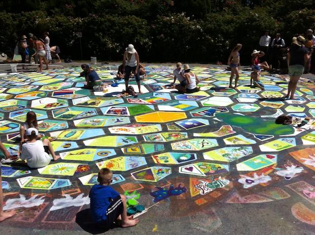
There are more than a few fun events in and around Roberts Creek and Davis Bay with farmers’ markets in both communities and Davis Bay’s annual sandcastle competition in July. Creek Daze is an August event that celebrates all that is whimsical in the area, with live music, food and craft vendors and games. Be sure to visit the Roberts Creek General Store and the Roberts Creek Mandala artwork on the way to the pier.
East of Roberts Creek is Kitchen Sink Rescue, with its farm animal sanctuary, and the Sunshine Coast Golf & Country Club. Low tide at Roberts Creek Provincial Park means sand bar exploring, sea star spotting and seal watching.
Sechelt
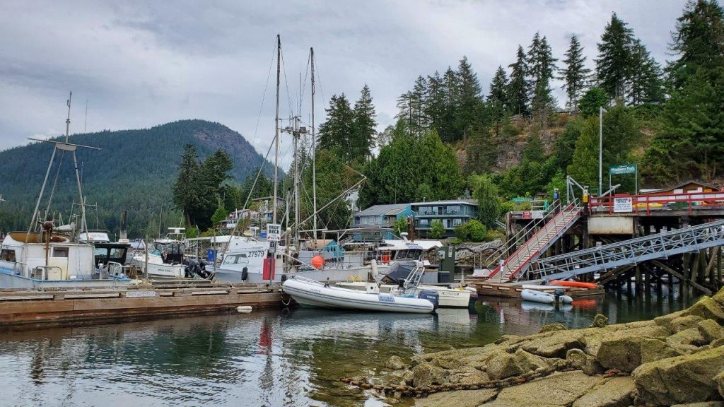
Sechelt is located on a narrow isthmus that separates Sechelt Inlet from the Salish Sea and is surrounded by forests. It’s a magnificent area to kayak or to take a float plane tour for a bird’s-eye view.
Art is in the air each spring in Sechelt with its Festival of the Performing Arts and in August during the Sunshine Coast Festival of the Written Arts, a gathering of Canadian writers and readers. October sees Oktoberfest followed by the Sechelt Festival of Lights in early December. The Raven’s Cry Theatre shows movies and hosts events and the shíshálh Nation tems swiya Museum has a large collection of artifacts including cedar baskets and ancient stone tools.
Take in the sights and smells of local flora at the Sunshine Coast Botanical Garden and wander along the long, sandy beaches in Porpoise Bay Provincial Park.

Halfmoon Bay
Northwest of Pender Harbour on the way to Halfmoon Bay is Sargeant Bay Provincial Park and Trout Lake Picnic Area. South of Halfmoon Bay is Coopers Green Park with its beaches and great diving. Hikes can be had at Halfmoon Bay and Coopers Green trailheads.
Pender Harbour
Surrounded by sea inlets, this community is water-centric and full of fun. The end of May means the annual Pender Harbour May Day, and 2025 will be its 80th year! The Pender Harbour Blues Festival in June and August sees the Harbour Chamber Music Festival and the Pender Harbour Wooden Boat Show, a celebration of marine heritage, with historical boats, land-based displays and kids’ activities. Winter features the very original Pender Harbour Christmas Boat Parade.

Madeira Park, just south of Pender Harbour, is a hub of marine activity. Check out the many paddle sport and fishing rentals in the area.
Earls Cove to Egmont
At the north end of the Sechelt Peninsula, Earls Cove is home to the ferry terminal location for sailings to Saltery Bay. The ferry links the lower and upper areas of the Sunshine Coast.
Experience a scenic 50-minute (16 km) ride up the Agamemnon Channel, around the northeast tip of sparsely populated Nelson Island and into Jervis Inlet. You will think you’re in Norway with views of rugged mountain slopes and fjords. Don’t be fooled, it’s the Coast Mountain Range!

South of Earls Cove is Ruby Lake and the sandy beaches of Dan Bosch Park. Ruby Lake and nearby Sakinaw Lake have great trout fishing in season and are perfect for freshwater activities, including canoeing portages. The lagoon at Ruby Lake is a rewarding spot for waterfowl and wildlife viewing.
East of Highway 101 on the drive up from Pender Harbour is the large provincial park of Spipiyus, renowned as having the oldest closed-canopy temperate rain forest in Canada. Its hiking trails even offer ocean views.
Egmont is a waterfront village on Secret Bay, 7 km east of the BC Ferries terminal. It’s the trailhead for Skookumchuck Narrows Provincial Park, and has modern marinas offering moorage and supplies for yachts and floatplanes. Boat charters are available here, as are a variety of guided tours, including kayaking. Make sure to visit the Egmont Heritage Centre to learn about the Shíshálh peoples and the history of logging and fishing in the community.
TIP: If you find this blog interesting why not subscribe to the enewsletter and never miss another story!
The Sunshine Coast region is home to the traditional and ancestral territories of the Sḵwx̱wú7mesh Úxwumixw, shíshálh, Tla’amin, Klahoose and Homalco Nations. Visitors are encouraged to learn about how they can engage in cultural exploration.
Read Part 2 of this drive Saltery Bay to Lund. Also, our suggested drive along the Salish Sea Coastal Route or learn about winter activities on the Sunshine Coast.
For places to camp in British Columbia go to the Camping Map.
Share your BC travel and camping photos using hashtags #campinbc #explorebc.
Kokanee Creek Provincial Park, British Columbia
On a recent trip through the Kootenays we spent a few nights at one of my favourite campsites in the area: Kokanee Creek Provincial Park.
Kokanee Creek Provincial Park is a large and popular campground 20 minutes east of Nelson. The park has four separate campgrounds, accepts reservations for 132 of its 189 vehicle-accessible sites, and has many things to see and do during your stay.
On our last stay, we camped at the Sandspit Campground, which is by far the largest campsite area. Other campground areas include the Redfish Campground, the Osprey Point Campground, and the Friends Campground, which offers 13 sites with electrical hook ups. Kokanee Creek Provincial Park has all the facilities you would expect in such a large and popular provincial park: water taps, a large adventure playground, a sani-station, both pit and flush toilets, and shower buildings at both the Sandspit and Friends campgrounds.

Kokanee Creek Provincial Park has quite an interesting history. Archaeological evidence indicates that areas within the park were used as seasonal campsites by Indigenous peoples. In the late 1800s, a wealthy Englishman named Charles W. Busk moved to the Nelson area and established the “Busk Estate” – which included a large mansion where he entertained guests. By 1913 Busk was disenchanted with his new lifestyle and he died only a few years later. Today, all that remains of the original Busk Estate are some stone walls and an oval concrete swimming pool – but these are generally well hidden! One hiking trail in the park is called the Historic Busk Estate Trail and that is where you might start if you wanted to try to find the ruins.

Kokanee Creek Provincial Park has an excellent nature centre open daily from 8am to 8pm. There are many programs for all ages run out of the nature centre and it is highly advisable to see what programs are being offered while you are there.

One of the reasons Kokanee Creek Provincial Park is so popular is that it provides access to more than a kilometre of sandy beaches. There is a boat launch and wharf and watersports including swimming, paddling, waterskiing, and windsurfing are popular.

When we visited, we spent most of our time at the park exploring some of the 9.5 kilometres of hiking and walking trails. We started our hike at the nature centre and set out to explore the spawning channel. Lots of interesting interpretive signage teaches about Kokanee – landlocked Sockeye Salmon. It is interesting to read about how human impacts such as mining in nearby Kimberley and the construction of the Duncan Dam have impacted Kokanee over the years and lead to hatcheries and spawning channels being built. After leaving the spawning channel area we headed uphill along the Canyon Trail to the Canyon Lookout. This is a beautiful trail following the creek with a viewing platform at the end. From there, we took the previously mentioned Historic Busk Estate Trail (no luck finding the swimming pool for us!) all the way back down to Kootenay Lake near the edge of the park. We found the dog beach, then followed a trail along the lakeshore past the Friends Campground, past the Sandspit Campground, and then connected with the Grassland Trail where we found a beautiful and much less busy sandy beach, before completing our loop and re-emerging back at the nature centre for an ice cold drink at their coffee shop. This loop was about 5.5 kilometres long and took us approximately an hour and a half to hike.
Kokanee Creek Provincial Park is a West Kootenay favourite – and for good reason. With lovely campsites, great services, and lots to explore, this certainly won’t be our last trip to Kokanee Creek.
TIP: If you find this blog interesting why not subscribe to the enewsletter and never miss another story!
For other camping and RV accommodations in British Columbia check out the Camping Map.
Share your BC travel and camping photos at hashtag #CampinBC, #exploreBC
It’s always a great day to #CampinBC
Bridge Lake Ice Caves in British Columbia’s Cariboo: A Cool Place to Visit on a Hot Day
On a recent trip to Bridge Lake Provincial Park (read our blog), we took a day trip to a nearby destination we had read about that seemed too good to be true on a sweltering Cariboo day – the Bridge Lake Ice Caves.
Now, if you are picturing ice caves in the traditional sense, a glistening and icy blue arch, you will be disappointed. But the Bridge Lake Ice Caves have an even more interesting heritage. A Recreation Sites and Trails BC location in partnership with numerous local organizations, the Bridge Lake Ice Caves highlight a unique geological feature of the Bridge Lake shoreline. The annual freeze/thaw process, coupled with ongoing erosion, has created a shoreline full of crevices into which the annual snowfall melts and refreezes into ice. In the bottom of these caves and crevices, the ice remains cold and persists well into the summer, if not year round.
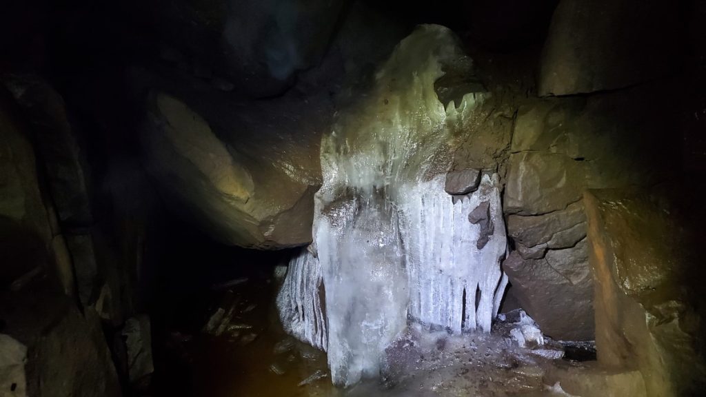
When we visited in mid August, it was plenty hot walking the trails around the rec site, but when we descended towards the ice caves the air became cooler and cooler the further we descended. Several of the crevices we looked in contained nothing more than moist rock walls and cool temperatures, but in two areas in particular we were able to find actual ice.
According to the interpretive signage and the Recreations Sites and Trails BC website, local historians and storytellers have shared that the ice caves were used by both local First Nations and early European settlers to harvest ice to preserve food and to keep cool.

While the ice caves themselves are cool (both literally and figuratively!), the government of BC and local community organizations have done an excellent job of developing a family-friendly rec site in the heart of the Cariboo. The site has several trails named after local wildlife. On our trip we walked the Low Mobility Wolf Trail, the Beaver Trail, the Coyote Trail, and the Owl Trail. The trails are marked with totems, and represent the animal on whose trail you are travelling.

The low mobility Wolf Trail is a 0.5 kilometre, hard packed, low-grade, gravel nature trail leading from the parking lot to two viewing platforms (one of which is wheelchair accessible) overlooking the ice caves and Bridge Lake. Along the trail there are several outdoor workout facilities, including a balance beam to hop over, a push up/pull up station, and a zig-zag balance walk. At the end of the Wolf Trail there is a serious flight of stairs to run up and down for those looking for more cardio. The workout stations along the Wolf Trail are called Otter, Raven, Loon, and Eagle and each is marked with a totem.

From the end of the Wolf Trail we descended the stairs to the Beaver Trail. The Beaver Trail hugs the lakeshore and is a much rougher trail than the Wolf Trail. Next, we headed up the Coyote Trail, which was very steep and rough. This brought us to the ice caves area where we enjoyed the view and explored. To head back to the parking lot, we took the Owl Trail, which was again wide, flat, and hard packed. Along the trail there were excellent viewpoints of Bridge Lake and plenty of benches to take a break if needed.

When I first heard about the ice caves, the picture that popped into my head turned out to be completely inaccurate to what we experienced. In reality, the Bridge Lake Ice Caves recreation site provides an excellent series of walking and hiking trails. There are beautiful views over Bridge Lake and the ice caves themselves are fascinating both geologically and historically.
TIP: If you find this blog interesting why not subscribe to the enewsletter and never miss another story!
For campgrounds in this area and elsewhere in British Columbia check out the Camping Map.
Share your BC travel and camping photos using hashtag #campinbc #explorebc
It’s always a great day to #CampInBC
Bridge Lake Provincial Park Nestled in the Interlakes Region of British Columbia’s Cariboo
When planning a family camping trip for family stretching from Vancouver Island to the far north of BC, we recently settled on meeting in the middle, so to speak, and packed up for a week in the Cariboo.
Bridge Lake is one of many, many lakes in the Interlakes District, a region known for fishing. In fact, Highway 24, stretching from 100 Mile House to Little Fort, is often referred to as the Fishing Highway and Bridge Lake is situated smack dab in the centre.
Bridge Lake Provincial Park is quite large, at just over 400 hectares, and protects undeveloped shoreline and numerous islands within Bridge Lake itself. A small campground is located just three kilometres from the community of Bridge Lake at the south end of the lake. The Bridge Lake Provincial Park campground has 13 vehicle accessible campsites, and 3 “walk in” campsites right along the water, perfect for those willing to walk the extra 50 feet down the wide, well maintained trail.

As we were travelling with our tent trailer, we opted for one of the vehicle accessible campsites and were pleased to find our site to have a nice mix of sun and shade and lots of privacy. There is one set of outhouses in the campground loop, and one additional outhouse near the day use boat launch and walk in tenting area. There is no water available at the campsite as the previous well has been decommissioned, so it is important to plan ahead and either bring the water you need with you or be prepared to buy small bottles at one of the nearby general stores. Cell service was spotty in the campground, but several places in the park, including the boat launch, had improved reception.

Bridge Lake Provincial Park campground is located on a little peninsula that sticks out into Bridge Lake. The peninsula is criss-crossed by trails, and it is easy to walk for a kilometre or two just by following the obvious trail leaving near campsite number three and then exploring the various trails that branch down to the water. Stick to the main path and eventually you will circle back to the boat launch and walk in camping area.

Bridge Lake is an excellent water destination. During our trip we spent lots of time exploring the bay near the boat launch by paddleboard. A short paddle out of the bay brought us to a white buoy marking an unexpected shallow spot where stacked boulders littered the lake bottom making the water in which we were paddling sometimes less than a foot deep. The rocks were a bit slippery, but with caution you can have your very own walking on water moment!

For those looking for a longer paddle, there are plenty of options as well. We explored the south-east portion of the lake’s shoreline as an 8 kilometre paddle which included several blue herons, lots of daydreaming about owning one of the many waterfront recreational properties, a stream flowing into the lake, and a number of small islands including one rocky outcrop that I nicknamed Seagull Island for obvious reasons.

In true Cariboo form, our trip was complete with both spectacular sunsets and spectacular thunderstorms.
Throughout the course of our trip, it seems that the campsite had 3 or 4 vehicle accessible spaces that remained empty each night. That being said, the camper turnover was nearly 100%, and we had different campsite neighbours every night of our trip. My impression is that many people used Bridge Lake Provincial Park as a stopping off point between two other destinations, but having spent the better part of a week there, I still feel like we have only scratched the surface of what the region offers and we will certainly be back!
TIP: If you find this blog interesting why not subscribe to the enewsletter and never miss another story!
Check out the blog on the Bridge Lake Ice Caves! There is an excellent series of walking and hiking trails at the Recreation Site as well as beautiful views over Bridge Lake and the ice caves themselves are fascinating both geologically and historically.
For campgrounds in this area and elsewhere in British Columbia check out the Camping Map.
Share your BC travel and camping photos using hashtag #campinbc #explorebc
It’s always a great day to #CampInBC
Hiking in British Columbia is a Popular Activity so be Prepared
There are thousands of hiking trails in British Columbia, from the Rocky Mountains to the Pacific Coast, trails that lead to panoramic mountain-top views, tranquil lakes, and breathtaking waterfalls. British Columbia has a large variety of hikes for everyone of all fitness levels.
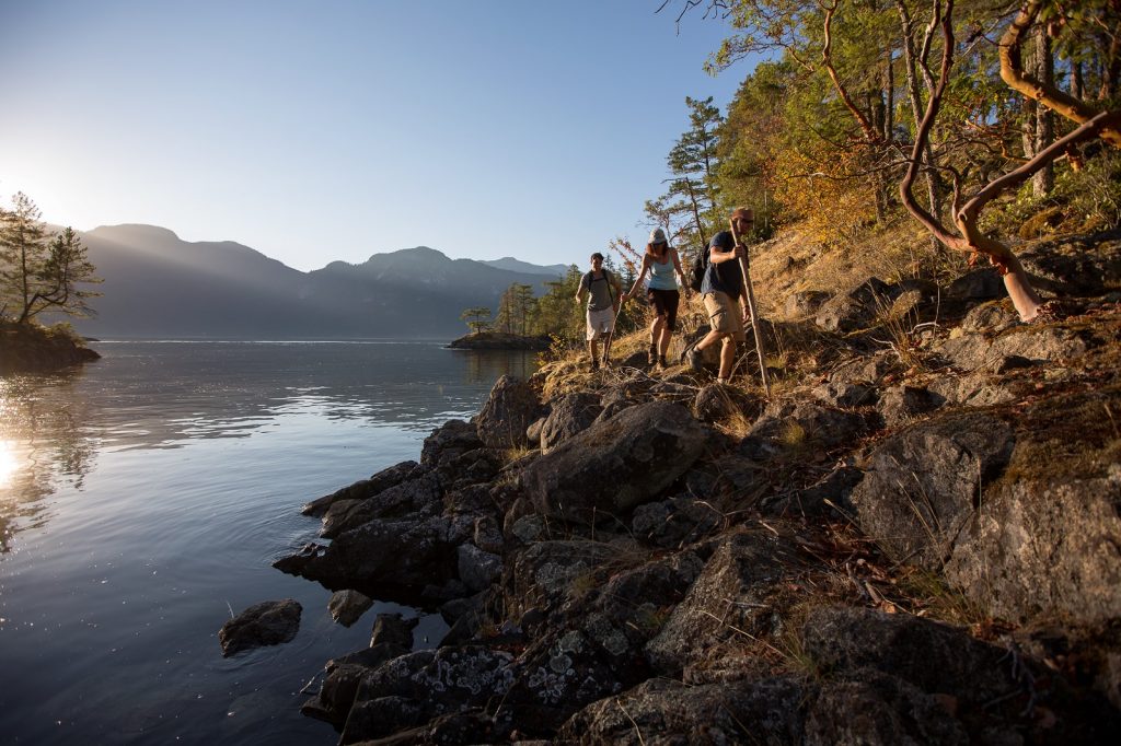
Hiking trails are usually divided into two categories – day hikes and overnight hikes. Day hikes are trails that can be hiked from start to finish during daylight hours. There are many popular day hikes in major urban areas, such as Vancouver’s North Shore, Squamish, Whistler, Penticton and Victoria. Overnight hikes involve packing all your gear and camping overnight, anywhere from a single night to multi-day trips. The world famous West Coast Trail on the Pacific Coast of Vancouver Island is BC’s most famous multi-day trail as it takes an average hiker 7-days to complete the rugged route.

BC Parks manages hundreds of trails throughout the Province and many of their parks have campsites with convenient access to popular trails. Access to BC Parks hiking trails are free, however camping fees and campsite reservations are required in many areas. There are thousands of back-country hiking trails that are much less maintained but managed by Recreation Sites and Trails BC.
There are seven National Parks located in British Columbia that are managed by Parks Canada. Entry fees are required to use the hiking trails in these parks and additional camping fees and reservations apply, depending on the areas.
There are many, many more hiking trails and parks that are managed by local and municipal governments throughout British Columbia.

Hiking Safety
Exploring British Columbia’s natural beauty can easily be taken for granted if you do not take the proper safety precautions before heading out. Unfortunately, there are dozens of people who become lost while hiking each year in BC and some are never found. Taking the following precautions will help to ensure you have a safe hiking experience.
Here are some of the main precautions to take:
- Always tell someone where you are going and when you expect to be back. Leave as many details with this person as possible so if they don’t hear back from you at the agreed time, they know to notify the police. Knowing the details of where someone has hiked helps search authorities pinpoint areas to search.
- Never hike alone. The rugged and remote wilderness can easily lead to an injury with no help nearby, leaving you stranded and a long way from help.
- Always carry the 10-Essentials (see below).
- Be prepared for encounters with wild animals. Grizzly bears, black bears, and cougars are some of British Columbia’s larger animals that can pose a danger to humans.
- Check the weather conditions and other local information
What To Bring – The 10 Essentials
- Light – Pack a headlamp or flashlight with fully charged batteries in case you are on the trail after dark.
- Food and Water – Ensure you take the proper amount of food and water for your hike. Do not rely on clean water sources along the trail.
- Fire Starter – Pack waterproof matches so that you can start a fire to keep warm at night if you become stranded.
- Extra Clothes – Pack adequate clothing for the conditions and be wary that temperatures can change significantly at higher elevations or during nighttime.
- Pocketknife – A strong knife can be a useful tool for survival as it can be used for things like cutting small pieces of wood to start a fire.
- Shelter – Simple items like a reflective emergency blanket or garbage bag.
- Signaling Device – A whistle can be one of the most important devices to help attract attention so rescuers can find you.
- First Aid Kit – Bandages, wraps, items for blister control, and more can be important if you become injured while hiking.
- Navigation – A compass, map, and GPS are the most important navigational tools. DO NOT rely on your cell phone as many areas of BC do not have cell phone access due to the mountainous terrain, including areas that are a mere kilometer from major urban cities.
- Sun Protection – Sunscreen and a hat can help protect you against sun burns and sun stroke.
For safety information while outdoors go to Adventure Smart
Other Useful Information
Camping & RV in BC has a google map that shows where all the private campgrounds, provincial parks, national parks and recreation sites are and each listing indicates whether they are close to hiking trails.
Read blogs on the Camping & RV in BC website that highlight some of our visitor’s favourite places to hike.
For camping in British Columbia go to the Camping Map.
TIP: If you find this blog interesting why not subscribe to the enewsletter and never miss another story!
For more information on hiking and trails, visit:
Vancouver Trails
Recreation Sites & Trails BC
HelloBC
BC Parks
Parks Canada
Share your BC camping and travel photos using hashtag #campinbc, #explorebc, #bcnice
It’s always a great day to #campinbc
Pender Island, British Columbia: The Perfect Weekend Away
If you are looking for a new adventure, why not consider one of the Gulf Islands situated off the east coast of Vancouver Island, British Columbia? A few summers ago we decided to pick one or two Gulf Islands each year to explore, and Pender Island proved to be an excellent choice.

To get to Pender Island, you take a ferry either from Tsawwassen or from Swartz Bay. When planning your trip, remember to check the routes and schedules on the BC Ferries website because they vary depending on the time of the year. If you are travelling during peak times, it is well worth making a reservation.
On our trip, we departed from Tsawwassen south of Vancouver and stopped at both Galiano and Mayne Islands before arriving at Otter Bay on North Pender Island; it took a little less than 2 hours with no transfers. If you are coming from Swartz Bay (Sidney, Vancouver Island), then the ferry is about 40 minutes.

Pender Island is actually two islands (North Pender and South Pender) joined by a small one-lane bridge, which was built in 1955. The canal was dredged in the early 1900s to allow the passage of boats including the SS Iroquois, a steamboat ferry which provided transportation between the Gulf Islands, Sidney and Nanaimo. Unfortunately in 1911 it sank outside Sidney, killing over 20 people.
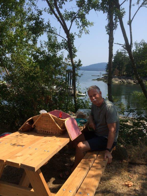
We spent a lot of time exploring the 34 square kilometers of the islands; we wanted to see as much as possible on our few days there. Based on 2021 census data there are just over 2,400 full-time residents on the north island and about 300 on the south. It is the second largest of the Gulf Islands that we have visited: Salt Spring (11,635), Galiano (1,396), Mayne (1,304) and finally, Saturna (465) which we still have on our list to visit. It was interesting looking up the census data as I really had a sense that the south island was much less populated with a more rural/farming feel.
There is no public transportation on the island but, as with Mayne Island, they have “car stops” set up to encourage giving those travelling-on-foot a ride. Apparently Pender Island was the first island to start the program and it has been successfully running since 2008; it now has 29 stops.
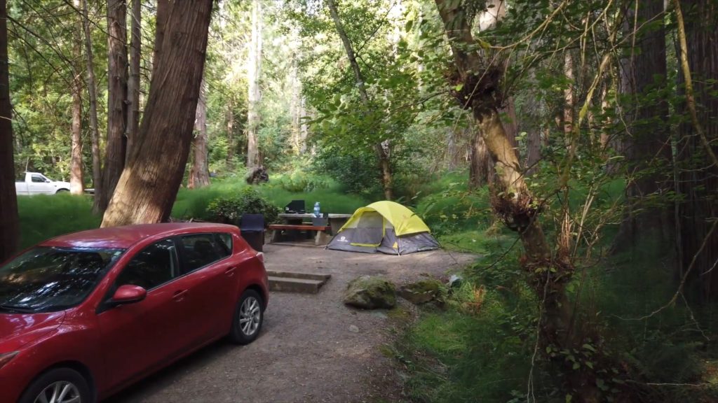
When planning a place to stay, I would recommend Prior Centennial Campground on North Pender Island with 17 sites. There are lots of trails in the park and, for those interested in Disc Golf, there is a trail from the campsite to the Golf Island Disc Park. Reservations at this park are through the Parks Canada website. Speaking of golf, and considering that my husband is an avid golfer, we had to check out the Pender Island Golf and Country Club, a nine-hole course known for its challenging shots and beautiful views.

For those arriving on Pender Island by boat, there is moorage available at Port Browning Marina Resort near Bedwell Harbour. We had lunch at the pub on their patio and enjoyed the view and excellent food.
We also had a great picnic lunch at Hope Bay. For dessert we picked up some chocolates at Pender Island Chocolates. On our next visit we plan to have a lunch or dinner at the HUB at Hope Bay.
Our getaways always seem to focus on food and hiking!

We found some fun trails on North Pender around Magic Lake and will definitely return to Mount Norman on South Pender. We picked up Mount Norman trail head on Ainslie Point Road (just off Canal Road). The first part of the trail winds its way through the lush, beautiful trees before you start the climb to the summit which is the highest point on Pender at 800 feet. From the observation platform at the top, you will have a panoramic view of the surrounding islands, including Salt Spring.

Since I am a bit of a history buff, we had to visit the Pender Island Museum at Roesland in the Gulf Islands National Park Reserve (2408 South Otter Bay Road). Roesland is an old homestead with the museum in the historic Roe House. For 70+ years, it was the heart of the rustic Roesland Resort, attracting families year after year.
The museum website describes the Roe house as being built in “1908, and a “kit” house ordered from a Vancouver Island lumber company. All the pre-cut lumber was delivered to Roesland by barge and put together on its log base in about a week. Total cost for the three-bedroom house: $589.62!
It was a beautiful sunny day on our visit; we enjoyed tea and goodies in the historic Roe House. The property and buildings sit on Roe Inlet which has lots of easy walking trails around the property.
TIP: If you find this blog interesting why not subscribe to the enewsletter and never miss another story!
Pender is perfect for a weekend getaway and year-round holiday destination. I would suggest a visit any season; whether you choose the busy summer months or the sleepy shoulder seasons, you will not be disappointed.
Check out Four Reasons to Visit Pender Island This Fall
For places to RV and camp in British Columbia go to the Camping Map.
Share your BC travel and camping photos using hashtag #campinBC, #exploreBC, BCnice
Wintering in BC’s Okanagan? Check out Things To Do from Kelowna to Penticton
Snowbirds and off-season RVers head to British Columbia’s mid-Okanagan, sometimes called the “Napa of the North”, for more than its sunny and mild winter days. There are plenty of activities and things to try, both out of doors and in.
Kelowna
The largest city in the Okanagan, Kelowna has a thing or two to boast about. It’s hip and urban yet outdoorsy, surrounded by water, mountains and agriculture, and has a fantastic food and wine scene based on local produce. Its winters are generally temperate with scenic snowshoe trails and powdery ski runs an easy drive away.

Looking for things to do in the winter? Browse some unique boutiques and shops (Bernard avenue and Pandosy Village, near the beach, are musts), sip a cider, gin or beer in a tasting room, or enjoy a farm-to-table meal. If you’re hankering for BC-caught oysters or a Friday fish fry head to Codfathers Seafood Market. It’s owned and operated by fishmongers who promote sustainable harvesting.
Wintertime in Kelowna means annual festivals and events and winter wine tours offer a variety of vineyards and trails to visit. Tourism Kelowna has a helpful webpage that lists what farms, markets and orchards are open. The snowy season is a great time to purchase jams, preserves, honey and cheese.

Arts and entertainment ranges from galleries and museums to events and live shows. Kelowna Museums organizes workshops and operates the Okanagan Heritage Museum, the Okanagan Military Museum and the unique Laurel Packinghouse, which is part museum part venue area.
There are a number of winter hiking spots in and around Kelowna, including Johns Family Nature Conservancy Regional Park, Rose Valley Regional Park, Myra Bellevue Provincial Park and Bear Creek Provincial Park. Mission Creek Greenway has over 20 kilometres of trails, including an area where you can spot salmon spawning.

Just 20 minutes east of the city is the Kelowna Nordic Ski and Snowshoe Club which has 75 km of groomed ski trails which meander through beautifully wooded forests and hills. Dogs are allowed on the snowshoe trails (all 70 kms) and about 1/3 of the ski trails. You can ice skate at Stuart Park, a free outdoor rink with a fire pit for warming up, hike at Knox Mountain Park, just north of downtown, and walk along the waterfront boardwalk; the trail connects to the Rotary Marsh Park, a fantastic spot for birding.

Ski and snowboard options include Big White Ski Resort (to the east) and SilverStar Mountain Resort (to the northeast), both around an hour’s drive from Kelowna; shuttle service is available. These winter playgrounds also offer snowmobiling, snowshoeing and fat tire biking. For a real bird’s eye view in winter book a helicopter tour with OK Heli.
After such activity relax and get pampered at a local day spa or salon. It seems fitting while in Kelowna to try a Vinotherapy massage, where the residue (pips and pulps) of wine making are rubbed into the skin.
Summerland
The town of Summerland, a leader in the agri-tourism business, is on the lower end of Okanagan Lake with Peachland to the north and Penticton to the south. Nearby vineyard slopes and hills provide outstanding viewpoints of the valleys and lake.

There are many parks and trails to explore. A popular winter hike, snowshoe or cross-country outing is the Kettle Valley Railway Trail, part of the Trans Canada Trail. The rail line was once used to transport silver ore to the BC coast. There’s also the 268-acre Mount Conkle Park and its ‘Bonk Loop’, and for a fantastic view of Summerland hike or snowshoe up the volcanic dome of Giant’s Head.
Indoor winter options include the rink at Summerland Arena or the Summerland Community Centre for bingo or a game of billiards or shuffleboard. Tour Summerland Art Gallery, the Summerland Museum and Archives Society and try specialty shops such as Summerland Sweets, which has manufactured fruit syrup, jam and candy since 1962. For some cool nostalgia check out Nixdorf Classic Cars, which boasts an inventory of 100 vehicles from 1936 to 1970, and even a muscle car section. If you’re craving craft beer, be sure to visit Detonate Brewing and Giant’s Head Brewing. Click here for a list of community events in Summerland.
Penticton
The hub of the South Okanagan for outdoor recreation, Penticton has over 80 wineries in the region, and over a dozen combined craft breweries, cideries and distilleries in and around downtown.
There are plenty of restaurants and ambiances to choose from, from pubs and casual spots to elegant bistros and even the rooftop patio at Slackwater Brewing, which hosts trivia nights. Be sure to check out the Penticton Ale Trail which highlight’s the town’s breweries and eateries. Many wineries remain open during the winter; contact the winery before setting out and do sample some ice wines. There are several wine tour companies you can book with should you prefer not to drive.

Try your hand at the Cascades Casino or watch a flick at the Landmark Cinemas. For an art fix visit the Penticton Art Gallery and shop or the Lloyd Gallery (representing over 40 Canadian artists) or give an improv workshop a go with the Penticton Arts Council.
Shows and lessons are held at the Leir House Cultural Centre and the local Elks Lodge has art workshops, as do some of the local wineries such as Noble Ridge Vineyard where you can make a silk scarf while enjoying a glass of wine. There’s also Pottery at Artables.
Take in a show at the Dream Café, the Cleland Community Theatre, or the South Okanagan Events Centre, where you can also watch the Junior A Penticton Vees hockey team.
The Penticton Community Centre offers special programs and activities along with its pool and fitness area and the Penticton Curling Club has leagues from November to March. For a winter walk you can easily access the Kettle Valley Rail Trail or rent a fat bike from Freedom Bike Shop to cruise along it, or perhaps a snowshoe tour with Hoodoo Adventures is more your thing.
Try out the outdoor Penticton Skating Rink. Check the website for details on opening etc.

Just over 30 minutes southwest is Apex Mountain Resort for downhill skiing and snowboarding; there’s also a 1-km ice skating loop, ice rink and tubing area for the kid in you. Apex organizes evening snowshoe outings followed by dinner and wine at its Gunbarrel Saloon, which has many times been named best après-ski bar in Canada!
For epic cross-country skiing and snowshoeing head to the Nickel Plate Nordic Centre, just west of Apex. Shuttle bus services are available. Golf in late winter in Penticton is possible, depending on the weather of course. Contact Penticton Golf & Country Club for more information.
For information when in the area go to:
Kelowna Visitor Centre: 238 Queensway Avenue, Kelowna
Summerland Visitor Centre: 15600 Highway BC 97, Summerland
Penticton Visitor Centre: 888 Westminster Ave W #120, Penticton
Want to read more on Winter Activities check out https://www.campingrvbc.com/category/activities/winter-activities/
TIP: If you find this blog interesting why not subscribe to the enewsletter and never miss another story!
Share your BC travel and camping photos using hashtag #CampInBC, #ExploreBC
For places to camp in BC in the winter go to https://www.campingrvbc.com/winter/
It’s always a great day to #CampinBC
Porpoise Bay Provincial Park on British Columbia’s Sunshine Coast – A Great Place for a Camping Holiday
The Sunshine Coast has long been the kind of destination that is geographically quite close to Vancouver and the Fraser Valley but feels like a true getaway.
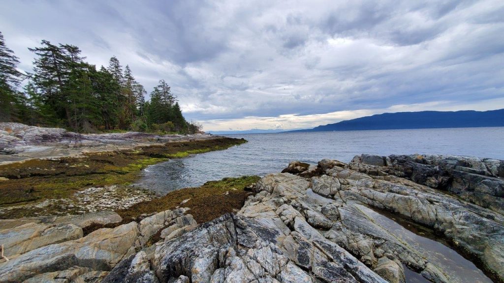
Porpoise Bay Provincial Park is an ideal destination for family fun. At only four kilometres north of Sechelt and at the very south end of the Sechelt Inlet, Porpoise Bay Provincial Park makes an excellent base camp for a larger exploration of the Sunshine Coast. There are plenty of opportunities to get active, whether your chosen speed be relaxing and swimming at the beach, hitting the trails, or exploring the local waterways and marine parks.
If a relaxing, family-friendly getaway is what you seek, Porpoise Bay Provincial Park allows you to easily set up your campsite, wander down to the beach, and basically stay there for the rest of the week. The long sandy beach is ideal for afternoon naps and the gradual grade of a large portion of the beach makes it perfect for splashing around in the shallows. Just keep in mind that there are certain parts of the beach where the shore drops away quickly, and there are no lifeguards on duty.

Adjacent to the beach there is an adventure playground and grassy area perfect for keeping kids entertained. When your day in the sun, salt, and sand is complete, use the hot showers located at either the day use or the campground to tidy up.
From the campground, there are a number of walking trails leading along Angus Creek. After crossing a bridge, head out to the estuary mudflats, which can provide excellent bird watching. The trails are not lengthy and make for a nice morning or evening stroll. Please remember to keep your pets on a leash and stick to the designated trails to protect the sensitive ecosystem.

One thing of note at Porpoise Bay Provincial Park is that a clean air policy is in effect at this park. This means that individual campsites do not have campfire rings or allow fires. If there is no campfire ban in effect and s’mores are what you desire, find one of the three communal campfire sites in the campground and get to toasting!

If a more active vacation is what you had in mind, exploring the local waterways and marine parks is easily done with Porpoise Bay as a base camp. Sechelt Inlet itself offers plenty of paddling opportunities including everything from relatively protected single day explorations close to the campground to multi-day trips north of Tuwanek and into Salmon or Narrows Inlets – watch out for afternoon headwinds and plan your paddles to maximize the typically calmer mornings when heading back to Tuwanek.

For those seeking a more exposed paddling experience, a number of marine parks dot the western side of the Sunshine Coast and make excellent day paddles. Smuggler Cove Marine Provincial Park is a lovely anchorage and is accessible by paddling around the peninsula from the launching point near Brooks Road. If you don’t have a boat, the marine park is also accessible by a four-kilometre long hiking trail, also leaving from Brooks Road.

Further up the coast, the community of Pender Harbour makes a good launching point to explore the protected waters of Pender Harbour. For those looking for a little more adventure, heading out around Moore Point and down to Francis Point Provincial Park allows you to really feel the wind in your hair! On your way back, take the time to poke around the many bays and coves inside Pender Harbour and dream about what it would be like to own one of the beautiful properties in the area.
Porpoise Bay Provincial Park on the Sunshine Coast is a beautiful destination with plenty of ways to enjoy the ocean. If land-based activities are more your speed, consider a trip to Skookumchuck Narrows Provincial Park (check out this blog) to take in the misty west coast vibe and marvel at a true wonder of nature.
TIP: If you find this blog interesting why not subscribe to the enewsletter and never miss another story!
For camping accommodations in this area and elsewhere in British Columbia check out the Camping Map.
Share your BC travel and camping photos using hashtag #campinbc #explorebc #bcnice.
Published: August 19th, 2021
Connect With Us
