Port Renfrew, British Columbia: Fall Camping, Old Growth Forests and Beautiful Beaches
Last fall we took a Vancouver Island camping trip north of Sooke to Port Renfrew. We started out in Victoria and traveled to Sooke along Highway 14. We have spent lots of time in Sooke with family and were excited to explore beyond to the Port Renfrew area, especially when most campers have packed away their gear for the season.

From Sooke our first stop was French Beach Provincial Park (about 20 kilometres from Sooke). It was late September, so no reservations were required. It was fairly quiet on the weekdays, but it filled up on the weekend. We definitely appreciated the extra blankets on our bed at night and extra layers around the fire. Some days we needed toques and gloves for beach walks and other days we were wearing shorts. Take home message – be prepared for all weather!!

After a few days at French Beach, we drove to Port Renfrew, another 50 kilometres along the same highway. The road was bumpy in spots with lots of corners to slow down for, but fully paved. We recommend stopping at the charming logging community of Jordan River which is well known for surfing. There is ocean-front camping (first come, first served) at Jordan River Regional Park with a picnic area, which is a great place to watch the surfers. Before leaving we stopped for coffee, snacks and wifi at the Cold Shoulder Cafe.
Between Jordan River and Port Renfrew there are many beaches to explore (all along the 47 kilometre Juan de Fuca Marine Trail); some of our favourite beaches are China Beach, Mystic Beach and Sombrio Beach. All are absolutely beautiful, and it is difficult to recommend just one!

We arrived at our destination for the next few nights, Port Renfrew. It is well known for being the trailhead for the Juan de Fuca Trail and the West Coast Trail, as well as, the beautiful, natural Botanical Beach. Check out Things To Do in Port Renfrew.
While in the Port Renfrew area, we stayed at Pacheedaht Campground. They have numerous ocean-front campsites and many set back from the water in the wooded area.

Over the next few days, we explored. First on our list was Botanical Beach, known for being one of the richest tidal pools on the west coast. We made sure that we checked the tide charts for the area before we went. We arrived an hour before low tide (it was 1.6 metres), which was good for beachcombing. We took the Botanical Beach Loop Trail which circles past Botanical Beach, as well as, Botany Bay. This 2.9 kilometre trail takes you from the parking lot down to the beach and follows along above the beach. The loop takes about 40 minutes, but was much longer since we stopped at all the beaches.

Next on the list was Avatar Grove. We picked up a Port Renfrew visitors guide which helped send us off in the right direction. It was a 15–20 minute drive and then both an upper and lower trail; both seemed to take about 20-30 minutes depending on how many photos you stop to take. The upper trail is an old creek bed with lots of fallen trees, rustic stairs and surrounded by old growth Douglas Firs and Red Cedars. At the end of the trail is the large Red Cedar known as Canada’s gnarliest tree with a burl 10 feet in diameter. Both trails are awe inspiring!
A little further up the road is a hike to the famous “Big Lonely Doug”, Canada’s second largest Douglas Fir and estimated to be about 1,000 years old! It has become a symbol for protecting old-growth forests. Much has been written about this mammoth tree; I enjoyed reading the history written by the Walrus; if you want to learn more, just do a quick google search. We have a second trip planned back to the area next spring, so we wanted to save that hike for our next visit.
Lastly, dinner at the local pub was a must to finish off our camping trip. The waterfront Renfrew Pub located on the pier at Snuggery Cove had a very comfortable friendly atmosphere with a mix of locals and tourists. We tried the fish and chips and pulled-pork tacos and then took a walk out on the pier, which was a nice way to end our visit to memorable Port Renfrew.
TIP: If you find this blog interesting why not subscribe to the enewsletter and never miss another story!
For places to camp in British Columbia go to the Camping Map.
Share your BC travel and camping photos using hashtags #campinbc #explorebc.
Discovering Camping in British Columbia in the Fall Season
It’s time to bring out the sweaters and store the flip flops! The fall season is a perfect time to avoid the crowds and explore BC while camping. In the shoulder season, Provincial Parks and private campgrounds usually have space available, allowing you to be spontaneous in where you camp.
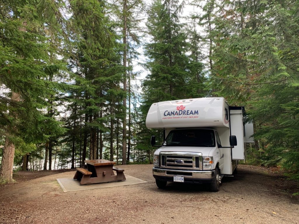
My husband Allan and I took a 1,500 km trip through BC a few years ago with a 24ft RV rented from CanaDream. We “loosely” followed Highway 3 from the Vancouver area, up north on Highway 6, and ending by following Route 97 south until we hit Highway 3 again. This route gave us amazing variety in the landscapes we saw. In the morning we might cross a high mountain pass surrounded by majestic evergreens. By lunchtime we were in the Okanagan area, surrounded by bald hills and semi-arid desert. The majority of roads had little traffic, so we enjoyed pleasant drives each day.

We started the trip by spending two nights at Fort Camping in Fort Langley. The campground location was ideal for having a level campsite with clean restrooms. A short stroll brought us to the charming town of Fort Langley with more options for restaurants, boutiques and ice cream shops than was possible to explore. Since we had our bikes, we enjoyed taking the Fort to Fort Trail, a paved path off the main road. Naturally one end of that trail ended at Fort Langley National Historic Site, a chance to step back in time.
Since we had a flexible schedule, we could discover some hidden attractions along the way. One of our favourite spots was the Grist Mill in Keremeos, 47 km (29 miles) northwest of Osoyoos. Because of the heavy rain, we needed our umbrellas but that didn’t stop us from enjoying the site. A cozy café offered Grist Mill cookies and scones, while the outdoor displays gave insight into how the belts and gears coordinated to grind local wheat into flour.

The Kettle River Museum in Midway packs a large amount of history in a small space. We explored the actual KVR Station, part of the legendary Kettle River Railway. The museum offers a look at how people lived before electricity and motors. You can even tour the last caboose from the railroad line.
A highlight of the trip was driving through the Okanagan valley and seeing all the fruit stands. It seemed as if there was a competition going on as to who could make the most elaborate pumpkin displays. We’d stop at one stand to buy apples and admire the pumpkins. 10 minutes later we’d stop to buy corn because we were attracted to another pumpkin display.

Our route also took us past numerous wineries…many, many wineries! The Kelowna area alone has five designated wine routes. Just follow the signs which are displayed along the road. Most signs give the name of the winery as well as how far it is off the road. Some places offer wine tours where you relax on a bus while going from one winery to another. No need to select a designated driver!

Our favourite campground was Kekuli Bay Provincial Park south of Vernon. Almost every campsite has an amazing view overlooking Kalamalka Lake. It’s worth getting up early to see the sunrises. The Okanagan Rail Trail is a designated bike and hike path that goes directly through the campground. We did a 20-mile ride that goes right next to the shore. Best of all, the trail is flat!

We saw a small sign for the Nikkei Internment Memorial Centre near New Denver in the Kootenay Rockies and decided to stop. It is the only site in Canada dedicated to telling the story of the 22,000 people of Japanese descent that were interned in Canada. We toured the actual 14ft by 28ft “shacks” that housed two families with up to six children each. The centre also has displays of clothing, furniture, and a peace garden and communal bath house. A sobering yet very informative place to stop.
TIP: If you find this blog interesting why not subscribe to the enewsletter and never miss another story!
Our road trip through BC only scratched the surface. We didn’t get to explore Vancouver Island or gawk at the astonishing hoodoos in the East Kootenays. We did get to experience camping in Provincial Parks and privately-owned campgrounds, meeting other campers along the way. Those we stayed at are listed below. Now we’re planning our next route to check out even more that BC offers!
Fort Camping – Fort Langley
Cottonwoods Meadows RV Country Club – Chilliwack
Hazelmere RV Park – Surrey
Kekuli Bay Provincial Park – Vernon
Brookvale Holiday Resort – Osoyoos
Kootenay River RV Park – Castlegar
Sugar Lake 2 Mile – Cherryville
For other campgrounds in the area or elsewhere in British Columbia go to the Camping Map.
Share your BC travel and camping photos using hashtag #campinbc #explorebc
It’s always a great day to #campinbc.
BC’s Tofino, Ucluelet Summer Adventures
On the road again and out to British Columbia’s west coast in our RV. Tofino, surfer tourist mecca and Ucluelet, it’s lesser known and frequented fishing centred cousin. It had been about eight years since we paid a visit to this corner of our beloved Vancouver Island. What had changed? What hadn’t?

As with any road trip there are some stops along the way to explore, grab provisions and generally enjoy. One of our favourites is Chemainus. It’s an easy drive from Victoria and a great place for lunch. We dined at Sawmill Taphouse with its delicious pizzas and craft beer. In the same plaza there is also a grocery, liquor, and dollar store as well as a pharmacy. Chemainus is also very RV friendly with its ample specified RV parking near the little downtown core where you can peruse the famous murals, grab a coffee or eat at one of the other local restaurants like Bonnie Martin or if you like Vietnamese Pho Triple 7.

After lunch we headed for Coombs and the Goats on the Roof although I haven’t seen goats in some time, I’m sure they are still there. We just like it for the browsing – clothes, food, plants, you name it. A must for us is The Old Country Market which has an eclectic array of interesting foods and novelty items.

Our first camp stop was at Sproat Lake Provincial Park. Here you have a choice of either the lower campground (close to the water with sites closer together) or the upper campground (where we stayed) which is more private but requires a bit of a hike to get to the lake or even the shower facilities should you need them. If you do venture down to the lake, be sure to look for the signs that direct you along the lakeside path to the petroglyphs. They are quite impressive.

After a relaxing two-night stay at Sproat Lake it was on to the Tofino area. Here we stopped for lunch and a walk on Long Beach before heading to our campsite at Surf Grove on Cox Bay. It was beautiful! Right on the beach. Yummy food truck on site as well as Long Beach Lodge, a quick stroll down the beach with multiple dining options from fine to casual outdoor. As the weather was good, we opted for outdoor on the beach watching the surfers and taking in the stunning view and crashing waves.

As our next stop was only a short drive away in Ucluelet we decided to spend the day in Tofino proper. We wandered the shops and refreshed our memory of the surroundings fueled by a delicious brunch at Roar inside the colourful Hotel Zed with its quirky driftwood VW Classic Bus.

With our legs stretched and our bellies full we headed for Ucluelet and Island West Resort. Although not as polished as our Tofino site it did overlook the water and was only a 5–10-minute walk to town with an abundance of shops and eateries. We loved the laid-back vibe of Ucluelet where even though we weren’t, we felt like locals especially at Eagles Nest Pub right on-site at Island West Resort.
Ucluelet has a rich history as a fishing village. If you go be sure to visit Crystal at Neptune Seafood Market & Processing. Crystal operates one of the last fish processing plants on the west coast. The industry is no stranger to difficult times but continuing to eke out a living has led her to pivot to a market approach where tourists and local customers alike can come, and purchase seafood processed on the spot. It doesn’t get any fresher!

After ten fun-filled days we were headed home but to break up the trip we had one more stop, Little Qualicum Provincial Park, where we camped at the Lower Campground and hiked to the falls which is always a joy.
You may also wish to visit Cathedral Grove or lunch in Port Alberni but no matter what you choose the west coast is a prime destination with its plethora of outdoor activities and natural splendour. Whatever you’re into – hiking, biking, surfing, sampling local foods, shopping or more there’s no shortage of things to do or places to explore. There’s something for everyone of all ages and capabilities. In fact, they just finished the accessibility ramp to Cox Beach so now there’s really no excuse. Get out there!
TIP: If you find this blog interesting why not subscribe to the enewsletter and never miss another story!
For campgrounds and RV parks in British Columbia go to Camping and RV in British Columbia
Share your BC travel and camping photos using hashtag #CampInBC, #ExploreBC
It’s always a great day to #CampinBC
How to Find the Ideal RV Site for Seasonal Camping in British Columbia
Dreaming of escaping to the outdoors without the hassle of packing up and hauling your RV every weekend? Seasonal camping might be for you.
By reserving a campsite for a whole season, you get the freedom to come and go as you please, with your RV always set up and ready. It’s the ultimate way to maximize your time outdoors, minimize the logistics, and truly settle into a summer rhythm.

So how do you find your ideal seasonal camping spot in BC? Here’s what to consider before you commit.
Pick the Right Location
You might already have a favourite campground—or be on the lookout for something new. Either way, think beyond the scenery.
Consider:
- How far is it from home, especially during peak traffic?
- Are grocery and other stores, restaurants, and outdoor activities nearby?
- What about essentials like gas stations, pharmacies, or the nearest hospital?
The best site is one that balances convenience, natural beauty, and comfort, so you’ll look forward to every visit.

Define Your Ideal Setting
If you love hiking, reading, and soaking up nature, look for a quiet, laid-back campground. Prefer the beach, games, and new friends for the kids? Choose an RV resort with a clubhouse, planned activities, and community vibes.
- Are you after peace and seclusion or a family-friendly, community environment?
- Do you prefer a resort-style RV park with amenities or a more rustic campground.
- Is being by a lake, river or ocean important to you (think cooler temperatures on hot sunny days).
- Do you want a shaded or open site?
- What kinds of on-site or nearby attractions appeal to you? Hiking, biking, fishing, boating, kids’ activities, events or farmers’ markets in the area, etc.
Do a Trial Visit
A test run is important. Try out some campgrounds this summer for next year’s seasonal rental.
- Visit the campground during both peak and quiet times.
- Try a weekend or two before locking in a full season.
- Talk to current seasonal campers.
- Walk around the site and take note of noise, layout, and cleanliness.
- Check out amenities – washrooms, laundry, pool, activities, playground for kids.
- What about security?

Check Out Reviews
- Read online reviews. Look for consistent mentions of friendly and helpful management, cleanliness, decent water pressure, acceptable noise levels and strong internet/cell reception if this is important to you.
- View photos. They often show the site’s proximity to neighbours and how much sun and shade there is.
Research Seasonal Availability, Cost and Conditions
Not all campgrounds and RV Parks offer seasonal camping – do your research. Check out https://www.campingrvbc.com/ and https://www.travel-british-columbia.com/camping/seasonal-campsite-rentals/. Also, the Super Camping/Select Lodging Flip Book.
- Book ahead – seasonal spots can often be reserved months in advance, sometimes a year out.
- Ask about seasonal rates, deposit, contract.
- Are there additional charges, e.g. electricity, water, wastewater disposal
- What is the cancellation policy?
- Are there restrictions, i.e. length and width of RV, 50-amp hookup, addition of decks or storage sheds, firepits, pets, etc.
- Ask for a copy of the campground rules.
Choose the Right Site for Your RV
Not all campsites are created equal. Consider:
- Your RV’s size and layout
- Pull-thru versus back-in availability
- Shade or open site
- Closeness to your neighbours
- Electrical and water hookups, sewer access
- Proximity to accessible facilities if needed
Sites with the best views or conveniences tend to go fast, so book early!
Plan for Pets
Bringing your furry friend? Make sure the campground is pet friendly. Look into:
- Extra fees
- Off-leash areas or dog beaches
- Pet wash stations

Check WiFi and Satellite Access
If you plan to stream, work remotely, or stay connected, don’t assume campground WiFi will be reliable.
- Ask about WiFi coverage and speed
- Consider a portable router or mobile hotspot
- For satellite TV, choose a south-facing site with minimal tree coverage
To recap, seasonal campers are drawn to the lifestyle for its blend of affordability, community, and connection to nature. By reserving a campsite for the entire season—often from spring to fall—these people create a “home away from home” where they can relax, unwind, and build lasting friendships with fellow campers. Many seasonal campers enjoy returning to the same spot year after year, embracing the slower pace, outdoor activities, and freedom from city stress.
TIP: If you find this blog interesting why not subscribe to the enewsletter and never miss another story!
For campgrounds and RV parks in British Columbia go to Camping and RV in British Columbia
Share your BC travel and camping photos using hashtag #CampInBC, #ExploreBC
It’s always a great day to #CampinBC
Make Every Stop Count: Take the 2025 BC Farmers’ Market Summer Challenge on Your Camping or RV Adventure
Summer in BC is a time for hitting the road, discovering new landscapes, and making memories at campgrounds, lakes, and mountain trails. If you’re one of the many who spend the sunny season RVing or camping across the province, there’s a new way to make your summer travels even more rewarding—by joining the 2025 BC Farmers’ Market Summer Challenge.

Whether you’re a seasoned RV explorer, a weekend camper, or planning your first summer road trip, the Summer Challenge invites you to connect with local communities and fuel your journey with the freshest produce, artisan treats, and handcrafted goods—straight from the source. It’s all part of a simple idea with a big impact: every time you stop at a BC farmers’ market, you’re supporting local growers, makers, and the Canadian economy.
Your Passport to Fresh Finds on the Road
The BC Farmers’ Market Trail App is your guide to discovering more than 145 farmers’ markets across the province. This summer, the app is your ticket to the 2025 Summer Challenge. It’s easy to join, and even easier to make part of your camping and RV routine.

Here’s how it works:
- Download the BC Farmers’ Market Trail App
- Sign Up For the 2025 BC Farmers’ Market Summer Challenge on the app’s home screen
- Check in at BC Farmers’ Market member markets as you travel and complete the 2025 Summer Challenge Survey each time at you do
Every check-in gets you closer to unlocking prizes, earning ‘Super Foodie Status,’ and discovering your new favorite foods.
A Delicious Detour Worth Taking
Imagine this: You roll into a lakeside campground on a Thursday evening. On Friday morning, instead of just hitting the beach, you stroll into town and find a vibrant farmers’ market buzzing with fresh berries, local honey, smoked salmon, sourdough bread, and handmade crafts. You grab a coffee from a local roaster and chat with the people who grow and make the food you’ll cook over the campfire later that night.

That’s the kind of experience the Summer Challenge is all about.
BC Farmers’ Markets are more than places to shop—they’re a window into the heart of a community. Each one reflects the unique landscape and people of its region. Whether you’re parked near the ocean, the Okanagan, or nestled in the Rockies, you’ll find a farmers’ market ready to welcome you with seasonal produce and local charm.
RVers and Campers: You’re Already on the Trail
If you’re RVing or camping, you’re already exploring the backroads and small towns that make BC special. Why not add local farmers’ markets to your itinerary? Not only does it make mealtime more exciting (goodbye, boring canned meals!), it’s a great way to reduce waste, support sustainable farming, and meet friendly faces along the way.

The app makes it easy to plan ahead too—check market days and times before you go, and use it to discover nearby stops you might otherwise miss. Plus, the more you participate, the closer you’ll get to the Super Foodie badge—just one more reason to take the scenic route.
Join the Local Food Movement, One Stop at a Time
The 2025 BC Farmers’ Market Summer Challenge isn’t just about food—it’s about being part of something bigger. It’s a fun, hands-on way to take action on values you care about: supporting local and eating well.
Even if you’re new to BC Farmers’ Markets or just curious, this is your moment. If you’re already a die-hard farmers’ market fan, the challenge is a great excuse to try new ones and turn your usual farmers’ market habit into a summer-long adventure.

So, as you plan your camping getaways and RV routes this summer, don’t forget to include a few farmers’ market stops along the way. With the BC Farmers’ Market Trail App in your pocket and your cooler ready, your next trip might just be your tastiest one yet.
Take the challenge. Download the app. Make your summer journey one that supports BC—one farmers’ market stop at a time.
TIP: If you find this blog interesting why not subscribe to the enewsletter and never miss another story!
For campgrounds and RV parks in British Columbia go to Camping and RV in British Columbia
Share your BC travel and camping photos using hashtag #CampInBC, #ExploreBC
It’s always a great day to #CampinBC
RV Safety Tips for a Trouble-Free Trip
Hitting the road in your RV opens the door to unforgettable adventures—but safety must come first. Whether you’re a new RV owner or a seasoned traveller, these pre-trip checks and driving tips will help you stay safe and confident on the road.
Pre-Trip Checks
Comprehensive Inspection: Have the RV’s brakes, tires and additional systems like tow/haul modes and air brakes inspected before the camping season or any big trip. Refer to your RV’s manual and educate yourself to do so or hire a professional such as a Certified Recreational Vehicle Technician. Preventative maintenance will help to limit breakdowns or accidents.

A general rule is to inspect the brakes every 4,800 kilometers (3,000 miles). Check the tire pressure before each trip and during stops on long journeys. Properly inflated tires improve safety and fuel economy; improper inflation affects handling and braking.
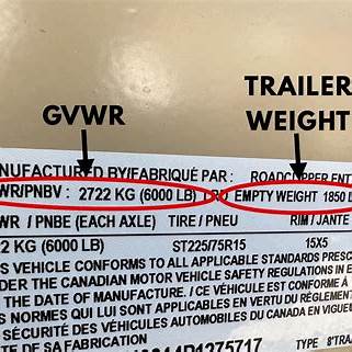
Weight Limits: Familiarize yourself with the RV’s weight limits and avoid overloading the unit. Too much weight can lead to poor handling and tire blowouts. Gross Vehicle Weight (GVW) is the weight of the RV, including passengers, cargo and liquids; Gross Combined Weight (GCW) is the total weight of the tow vehicle and RV combined.
Safety Detectors: Install and maintain smoke detectors and carbon monoxide (CO) detectors to protect against fire and poisoning. Invest in a portable, battery-operated smoke detector if the unit does not come with one. Have at least one smoke alarm near the sleeping area and know the location of the fire extinguisher(s). Verify that the extinguisher’s pressure gauge or indicator is in the operable range or position and lift the extinguisher to ensure it’s full.
If the RV has a generator inspect the exhaust system each time before using it. Don’t use the generator if the exhaust system is damaged or is making any strange noises.
Mirrors and Cameras: Confirm that all mirrors adjust smoothly and ensure that any cameras are functioning to eliminate any blind spots. Keep in mind that the vehicle’s size can affect visibility.

Secure Items: Loose items – both inside and outside of the RV – can become projectiles during sharp turns and sudden stops. Secure everything properly and check that the door locks work on cupboards and the fridge. (There’s a story about a jar of flying pickles here!)
Emergency Preparedness: Keep a charged cell phone, emergency contacts and any roadside assistance membership information within reach.
Driving Tips
Whether you’re towing a travel trailer or driving a Class A motorhome, RVs have different driving techniques and rules compared to cars and trucks. Be aware of your speed and required braking distance and allow plenty of space to maneuver.
‘Off-tracking’ Education: When an RV is steered, especially a larger one such as a motor home, the rear doesn’t follow the exact path of the front wheels. This is called “off-tracking,” and it means that the back end can substantially swing out during turns. It’s therefore important to plan any turns with extra care.
For tight corners and narrow roads, take wide turns by positioning the vehicle so that the rear has enough room to swing.
Practice: Before navigating busy streets or campground roads, practice driving, steering and turning into a controlled environment. Have an adult act as a spotter if you’re getting accustomed to the RV.
Braking: The faster an RV is travelling, the longer it will take to stop and the greater its braking distance. Motor homes often use air brakes, which have a slight delay in engagement compared to hydraulic brakes.
Begin decelerating well in advance of any stop, especially on downhill grades where brakes might overheat. Avoid abrupt steering or hard braking as it can destabilize the vehicle and anything that’s being pulled.
Route Planning: RVs can be tall and wide. Use a mapping tool or RV-specific GPS to check for any height or weight-restricted overpasses or bridges and narrow roads. Knowing your vehicle’s turning radius will help with tight turns.

Environmental Factors: Strong winds and crosswinds can be challenging when driving an RV. Sudden wind gusts can push a vehicle off the road or amplify off-tracking effects during a turn. Adjust your driving speed and turns to the weather conditions to maintain vehicle stability.
Park Smart: Park the RV with enough space around the unit so that the exhaust travels away from the unit. Avoid parking near tall grass or anything that could spark a fire.
Every RV trip is an opportunity to learn. After each adventure, reflect on what — if anything — went wrong or what could be improved on. Note what worked and went smoothly too! With each outing pre-trip checks will become second nature, and you’ll have increased confidence behind the wheel.
TIP: If you find this blog interesting why not subscribe to the enewsletter and never miss another story!
For campgrounds and RV parks in British Columbia go to Camping and RV in British Columbia
Share your BC travel and camping photos using hashtag #CampInBC, #ExploreBC
It’s always a great day to #CampinBC
A BC Circle Tour From Vancouver Island to Northern BC and Back
Exploring BC has become much more leisurely since my husband and I purchased an RV. Come along for the ride and see BC from our perspective as we tootle around our home province.
I find that driving a large RV about four hours behind the wheel is comfortable. It also provides a framework for where to stop and stay. If traveling with friends, it leaves more time to relax and socialize at the end of the day.

As I have family and friends in the Prince George and Burns Lake area of Northern BC my husband and I thought it would be fun to circumnavigate BC, driving up through the centre of the province. Then we would head west to Prince Rupert and south via BC Ferries from Prince Rupert to Port Hardy on Vancouver Island and back to our home in Victoria. This loop is approximately 2,500 km (1,550 mi) so leave lots of time to explore BC and plan accordingly.
We began our BC loop with a ferry ride from Vancouver Island’s Swartz Bay to Tsawwassen Terminal on Vancouver’s lower mainland, followed by a short drive east to Hope staying at Coquihalla Campground. We spent a couple of nights visiting friends in the area and exploring Hope which has some wonderful bike trails. There was even a bike park right outside our campground. Great for kids! Whether taking a walk or ride around town be sure to get a selfie with the Rambo statue as the movie was filmed here.

We then headed north through the stunning Fraser Canyon that follows the impressive Fraser River to Lytton and on to Ashcroft – a little slice of heaven and a must for the train enthusiast. We camped at a small full-service campground called Legacy Park right on the Thompson-Okanagan River. Train tracks ran on either side. It was quite the sight to see them rumbling so close. Ashcroft is full of train lore. You can visit the local museum, view the many tile mosaics dispersed across numerous buildings and if you also happen to love vintage cars there are many charming old vehicles scattered throughout town.

We love BC’s Provincial Parks, so we made sure to include a couple in our journey. First up, Lac La Hache in Cariboo Country, home to rolling hills, ranches and horseback riding. We chose a site with a lake view to relax and take in nature before connecting with friends and relatives further north in northern BC’s ‘capital’ of Prince George. There is a lot to see and do here. One of the fascinating places is The Exploration Place Science Centre, home to 70 million year old fossils and dinosaurs with fun things for kids to participate in.

Yellowhead Hwy 16 traverses an area known as the Lake District with great views and abundant fishing. Burns Lake, where we stopped to visit with more friends, is a lovely scenic lake and the weather was particularly hot. After our visit we headed for Smithers and Tyee Lake Provincial Park. It was refreshing to stay at one of the few provincial parks in BC with 30amp electrical power. What a relief to be able to run our air conditioning unit to cool off!

If you get a chance along the way, check out New Hazelton. It’s lovely with its picturesque mountain backdrop and intriguing First Nations heritage.

Hwy 16 took us through Terrace and on to the scenic ocean route westward to Prince Rupert. Stop in at the old fish cannery (as we did) in Port Edward, now a museum, or feast on fresh seafood at one of the local pubs or restaurants but whatever you do, bring your raincoat! You’ll need it as Prince Rupert gets an average of 219 days of rainfall a year.

From Prince Rupert we boarded the ferry over to Port Hardy on Vancouver Island and camped in Port McNeill at Cedar Park which was new to us. After disembarking the ferry at midnight, the short 30-minute drive from Port Hardy to Port McNeill was somewhat stressful. The ferry ride itself is 16 hours and stunningly scenic but once on the Island the highway was pitch black. Be forewarned, there are no lights in this remote part of northern Vancouver Island. Once we turned off the highway towards our campground the road was gravel and rough in parts and although we had to set up in the dark it was totally worth it. We awoke the next morning to sunny skies and an incredible ocean view!

TIP: If you find this blog interesting why not subscribe to the enewsletter and never miss another story!
For campgrounds and RV parks in British Columbia go to Camping and RV in British Columbia
Interested in RV tours and trips throughout BC go to Trips & Drives
Share your BC travel and camping photos using hashtag #CampInBC, #ExploreBC
It’s always a great day to #CampinBC
Explore Spirit Loop on Vancouver Island
It conjures some imagery, doesn’t it? A path steeped in the history of coastal first nation peoples. Join me as I tour yet another magical area of my beloved BC.
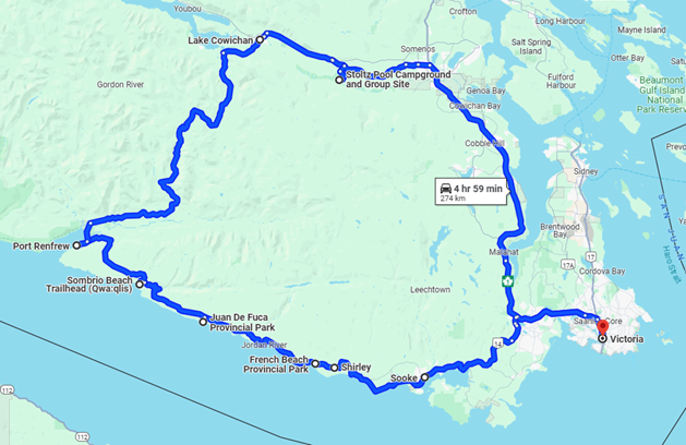
Vancouver Island’s Pacific Marine Circle Route or Spirit Loop as it is now called parallels part of the West Coast Trail on Vancouver Island but is more attainable for the average person not into extreme hikes. It can also be done by car or in this case RV in a day even, although my husband and I took nearly two weeks to complete it. After all, it’s not only island time but recreational vehicle time, right?
There is no shortage of things to see and do along the way as well as places to stop, camp and explore.
Heading out from our home in Victoria we stopped in at the local Sheringham Distillery in Sooke. After all, you need provisions. If you go at the right time of year you can take in the Sooke Fine Art Show where they transform the local sports arena into a spectacular art gallery showcasing amazingly talented local artists.
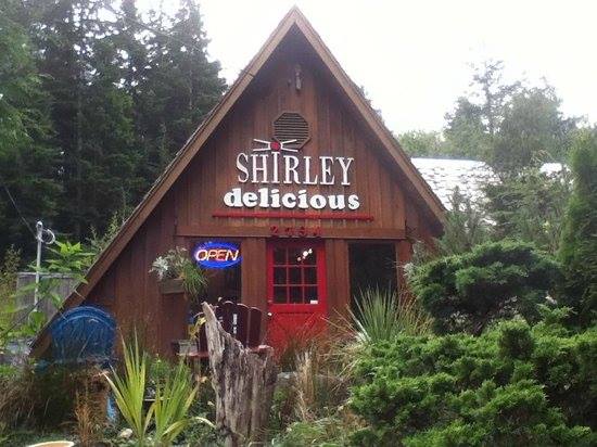
Then we enjoyed a light lunch at the popular Shirley Delicious Café in Shirley, BC before arriving at our first campsite at French Beach Provincial Park.
Alternatively, if you don’t mind getting cozy with your neighbours, the Capital Regional District (CRD) hosts a beachside campground at Jordon River where you can literally park your tires in the sand and admire the open ocean view.
We also stayed at Juan de Fuca Provincial Park from which you can walk to China Beach. It’s one of those rustic west coast campgrounds where we’ve never been able to stay without it raining. And by rain, I mean downpour that has my husband frantically digging minor trenches to divert the water from our outdoor living space.
If you are into hiking, there are numerous options along the way. One of which is Sombrio Beach (also located in Juan de Fuca Provincial Park). They have built a beautiful big parking lot where you can leave your vehicle while you get out into nature.
Along the way we stopped off for lunch at a pub in Port Renfrew – Wild Renfrew before exploring the possibility of staying at Pacheedaht Campground, yet another magnificent spot for oceanside camping.

Ultimately, we decided to stay a few days at Lakeview Park on Lake Cowichan, a lovely municipal campground right on the lake within walking distance to the township of Lake Cowichan where we wandered the shops and took in happy hour at one of the restaurants which is more our speed.
Our last stop was Stoltz Pool Provincial Park on Cowichan River where floating down the river on an inner tube is a fun pastime during the warmer months. It was a bit early in the season to don a bathing suit, but we enjoyed our stay very much all the same.
There is so much to see and do on Vancouver Island it never gets old, whether we are exploring somewhere new or revisiting old haunts. Speaking of old haunts, I’ll share some of our favorites in a future blog.
TIP: If you find this blog interesting why not subscribe to the enewsletter and never miss another story!
For campgrounds and RV parks in British Columbia go to Camping and RV in British Columbia
Share your BC travel and camping photos using hashtag #CampInBC, #ExploreBC
It’s always a great day to #CampinBC
Explore British Columbia’s Scenic West Kootenays
Mountains, lakes and old-growth forests make up the West Kootenays, a scenic and outdoorsy area of the Kootenays region in southeastern BC. Bordering Washington, Idaho and the edge of Montana, it’s nestled between the Okanagan and the East Kootenays, with the Purcell Mountain range as a divider. The Selkirk and Monashee mountains are also in the West Kootenays and the ski town of Revelstoke in the Columbia-Shuswap region and the Trans-Canada Highway are to its north.

There are no major urban centres here. Rather, you’ll find unique alpine culture and artistic and eclectic communities. Major highways that run through the West Kootenays are Hwy 3 in the south (zigzags east-west through Creston, Castlegar and Grand Forks), highways 3A (north and east of Hwy 3) and 3B, which links the towns of Rossland and Trail. Highways 6, 23 and 31 run north-south in the central-northern area of the West Kootenays, with Hwy 23 hugging the east side of the long and thin Upper Arrow Lake.

Situated where the Columbia and Kootenay rivers meet, Castlegar is the crossroads of the West Kootenays and a great spot for trout and kokanee fishing. There are countless hiking and biking trails to try in spring, summer and fall when you can experience mountain meadows in bloom and autumnal changes. Nearby parks include Millennium Park, with its swimming ponds and dog park, and Zuckerberg Island Heritage Park, located in the middle of the Columbia River and accessible by a pedestrian bridge. Castlegar has local markets and hosts various events throughout the year, including music festivals and cultural celebrations. A camping option is Castlegar RV Park and Campground.
Thirty minutes southwest is the picturesque ski town of Rossland and Red Mountain, a prime spot for winter adventures and summer exploring. Rossland Lions is the community campground and Nancy Greene Provincial Park (southwest of Castlegar and north of Rossland) has a refreshing sub-alpine lake and is great for an overnight stay or day visit.

East of Rossland is Trail (check out Trail Creek Falls, Centennial Trail and the sandy beach at Gyro Park) and Beaver Creek Provincial Park along the Columbia River. The 18-hole Birchbank Golf Club boasts mountain and river views and a long golf season, averaging over 210 days annually, and Trail Museum and Archives has three galleries and free admission.
Northeast of Castlegar is Nelson, amidst the Selkirk Mountains, and Kokanee Creek Provincial Park with its four campgrounds, boat launch area and beautiful sandy beaches. Nelson City Campground is walkable to the town’s sights, numerous heritage buildings and amenities. While in Nelson chill out at Rotary Lakeside Park or hike to Pulpit Rock across Kootenay Lake, where stand-up paddle boarding and kayaking are popular. The multi-use Great Northern Rail Trail (49 km) near the town is part of the TransCanada Trail system. An amazing fact about this area is that it’s home to the last remaining inland temperate rainforest on earth, with old-growth western white pine, Douglas-fir, lodgepole pine, western red cedar, western hemlock, subalpine fir and Engelmann spruce.

Communities close to and along Kootenay Lake include Creston to the south, known for its agriculture and wineries, and Kaslo at the more northern (west side) end of the lake. This village is often called the “Little Switzerland of Canada”. While in Kaslo check out the SS Moyie Sternwheeler National Historic Site, the vessel worked on Kootenay Lake from 1889 until 1957 and is the oldest of its kind in the world. North of Kaslo is Kootenay Lake Provincial Park (Davis Creek and Lost Ledge campgrounds) and, near Kaslo, is Goat Range Provincial Park, which protects the natural spawning site of the Gerrard rainbow trout, the largest of its kind. Ainsworth Hot Springs on the west shore of Kootenay Lake is a must-visit and just 15-minutes between Balfour or Kaslo on Hwy 31. Close by is Cody Caves Provincial Park where you can book a tour of its magnificent caves system.
Granby Provincial Park (southwest of the locality of Needles/Hwy 6) is one of the least-explored wilderness areas in southern BC. Close to the Washington border on Christina Lake is Gladstone Provincial Park, which has lakeside camping and recreational activities.
Upper Arrow and Lower Arrow Lakes are a widening of the Columbia River and lie between the imposing Selkirk Mountains on the east and the Monashee Mountains on the west. Valhalla Provincial Park, in the Selkirk range, was created to protect the diverse topography, alpine lakes and unique vegetation of the area.
A neat experience in the northern part of the West Kootenays is the vehicular/passenger ferry across the top end of Upper Arrow Lake, which connects Galena to Shelter Bay, on the west side. (There is also a similar ferry that connects Balfour to Kootenay Bay across Kootenay Lake.) When near Galena it’s worth a trip down Hwy 23 and inland to Halfway Hot Springs. There are over 20 campsites here, and about half of them are vehicle accessible though large RVs are not recommended. Forty-five minutes south is the community owned Nakusp Hot Springs, with its two spring-fed pools. Temperatures are regulated for winter and summer, with one pool kept warmer than the other. Hot Springs Campground is also located here. For more information on the area read the articles on campgrounds around Nakusp and Arrow Lake.

Golf courses in the West Kootenays include Redstone Resort in Rossland, Birchbank in Genelle, Champions Lake in Fruitvale, Castlegar Golf Club, the Salmo District Golf Club, Valley View in Winlaw and Granite Point in Nelson. Northeast of here on Kootenay Lake are Balfour Golf Course and Kokanee Springs in Crawford Bay, and the par-9 Riondel Golf Club on the east side of the lake.
TIP: If you find this blog interesting why not subscribe to the enewsletter and never miss another story!
For campgrounds and RV parks in British Columbia go to Camping and RV in British Columbia
Share your BC travel and camping photos using hashtag #CampInBC, #ExploreBC
It’s always a great day to #CampinBC
Campsite Criteria to Consider for the RVer
My husband and I are very particular about where we camp. Realtors will tell you location, location, location is the most important when it comes to selecting a home or in this case a campsite. After all, we want the best experience possible. Typically, we favour dry camping as we find it the most relaxing and these campsites are often in truly spectacular environments, but we are not above the creature comforts of a campground with partial or full amenities.

Whenever we visit a new campground, after settling in we take a walk around making notes on the various sites for reference should we return. We have our favourite spaces at places we frequent and if those aren’t available, we simply don’t go or choose another date when they are available. That’s the bonus of being flexible.
Here are our campsite criteria or how we define location, location, location. However, before we even start it’s worth mentioning that a good web presence for any campground with the ability to book directly online is a real bonus. It makes travel planning so much easier whether it’s a long trip or a short stay. And websites that have good photos of the campsites as well as the campground can make or break it when we’re deciding where to book.

Private vs Public
Our favourite campgrounds tend to be public by which we mean those located on Federal, Provincial or Municipal lands. They are frequently set in stunning natural surroundings in more remote places which ticks our boxes of privacy, outdoor living space and a chance to immerse in nature. Some of our favourites are Goldstream Park | BC Parks, French Beach Park | BC Parks and Bamberton Provincial Park | BC Parks. Goldstream is so convenient as it’s just 30 minutes from our home on Vancouver Island, but the tranquil temperate rainforest setting makes one feel miles away from everything. French Beach offers nature and the ocean so close you can hear the surf from your campsite. And Bamberton is small, rustic and stunning for its mountain meets the sea setting.
Although we prefer public campgrounds when the private ones get it right it’s the best of all worlds like three of our favourite local resorts: Park Sands Beach Resort in Parksville, Pedder Bay RV Resort & Marina in Victoria and Living Forest Oceanside Campground + RV Park in Nanaimo. They are all on the ocean with full hook-ups, a picnic table, sun, shade and ample room to enjoy. Pedder Bay and Living Forest also boast large hedges between sites. It’s a little piece of paradise.

Private campsites can also have various amenities especially for those traveling with kids or pets. Features like a pool, play area for children and laundry facilities for those longer journeys, even camping supplies, stores or restaurants. And of course, there is the convenience of full hook-ups making living easy.
The Campsite
We have taken time and paid special attention to ensure we are equipped with excellent off-grid solar and tank capacity so for us back-country or dry camping isn’t an issue, but we do have some specific requirements to be comfortable. We need a campsite with ample sun to take full advantage of our solar. However, we aren’t sun worshipers, so we also like shade. A balance of both is ideal. No solar? You can always run your generator, but we try to do so as little as possible for ourselves and out of respect for fellow campers. We find the noise a bit much especially in a peaceful forest or oceanside setting. We like our privacy too, away from other campers if possible, at least visually, so we look for sites with bushes or plantings, hedges, a fence or privacy screen of some sort. As most campgrounds have a circular or grid design, we find the outer circle or row to be the best.

Campground Amenities
We will take electrical at every opportunity followed by water and finally sewer hook-up. Some public sites have electrical which is great especially when it is particularly hot in summer or chilly in the shoulder season. When hot it’s a relief to be able to run the AC and if it’s cool our small space heater is perfect for taking the edge off. It’s also great to have a picnic table or even just room to set up our portable table especially since we prefer to cook outside keeping our RV clear of cooking odours.
Lastly, know the reservation dates at your preferred campgrounds, book early and select weekdays rather than weekends if your schedule allows. It’s a quieter time and you are more likely to be able to secure your desired site.
TIP: If you find this blog interesting why not subscribe to the enewsletter and never miss another story!
For campgrounds and RV parks in British Columbia go to Camping and RV in British Columbia
Share your BC travel and camping photos using hashtag #CampInBC, #ExploreBC
It’s always a great day to #CampinBC
5 Holiday Gifts for the Camping Family
Each year I write a blog about holiday gifts for the camper and traveler. This year I am basing my blog on you – the camping family. Don’t worry, these items can still be used by the campers without kids.
Personal Washing Machine for the Campsite

My first item is a washing machine. Yes, a washing machine. If you are camping for a week or two, this is better than sliced bread. I think someone was spinning their salad one day and said let’s make it bigger and wash the unmentionables or the kids’ clothes. I wouldn’t try washing jeans, but one pair of shorts or a T-shirt at a time might work. You can just sit it on the seat of the picnic table and keep the kids busy by cranking their laundry clean. Make it fun by letting them crank once for each year they are or whatever you come up with. Once it’s spun clean, rinse and then remove the water and spin it again, shake it out and hang on your clothes line, this will allow you to pack less for the family – a real bonus.
Igloo Trailmate Journey 70 qt Cooler, Carbonite

I think the cooler companies are toying with us. Each year they come out with one that I think is the ultimate and then they do it again. I like this one, but I think the coolers should come with pneumatic wheels and then they would truly be all-terrain wheels, but this IGLOO brand Trailmate boasts the ability to roll through sand, stones and more. The price of coolers is also rising, so they all need to up their game if they want to stay in business. Check out walmart.ca for the cooler.
Hats, Hats, Hats

There is always a need for a hat. No one can deny that, especially when camping. We tend to be a little more stationary, so covering the head and neck is paramount. Getting kids to wear hats is a game all in its own. I have bought more hat types than most people do in a lifetime. I have a toque (beanie) great for sleeping on cooler nights. A baseball cap for those sunny walks, a big floppy hat for laying on the floatie and a large, brimmed straw hat for everything in between. What should we look for in a hat? A larger hat should have a pull cord to tighten, especially if it’s windy and be thick enough to block the sun and heat but remember straw hats do not have the ability to hold out much rain. And make sure the brim of the hat keeps the sun off your ears – they can quickly get burned. There are also mosquito repellent hats.
Outbound Drinking Water Jug Hand Pump

What is the one thing common to all camping families? Getting the children to drink water. This has got to be one of my favorite items I own. I take my 20-litre bottle in to the store to fill up to bring camping every trip. Once at the campsite, I just sit it on my crate that I have emptied out – it’s at the perfect height for everyone. I wrap a towel on it and use a clothes peg to keep it covered and out of the sun – it helps keep it cooler too.
Therm-a-Rest Compressible Pillow Cinch

I will admit it – I am a pillow snob. To me, a good night’s sleep starts with a pillow. I always hated bringing my home pillow camping, so I looked into options. I have bought a few different ones over the years, and there was always something wrong – too hard, too fluffy, too flat but this was most appealing as it is so versatile for camping, road trips, air travel and anywhere else you want better rest. If its too flat – cinch it a bit, want it harder – cinch it more. Also, the best thing is for air travel, it compacts down to fit in my carry-on tote, and I hook a lanyard on it – no more dropped pillows on the plane because I hang it on my seat back. These pillows are available at cabelas.ca
I hope this gives you some inspiration for items for the camper in your life.
TIP: If you find this blog interesting why not subscribe to the enewsletter and never miss another story!
For campgrounds in British Columbia go to the Camping Map.
Share your BC travel and camping photos using hashtag #campinbc
It’s always a great day to #campinbc.
Camping at Mabel Lake Provincial Park in British Columbia’s North Okanagan
This fall we went back to Mabel Lake Provincial Park for the first time in years, and it was even better than last time!
We love the quiet, peacefulness of Mabel Lake. It has an especially calm feeling in the fall as the cooler weather sets in. We booked ahead through the BC Parks Reservation System as it was a long weekend, a good plan since it was full.
To get to Mabel Lake Provincial Park, take Hwy 6 east from Vernon to Lumby then head north onto Mabel Lake Road for 36 kilometres. The last 1 kilometre is gravel, but well-maintained.
Mabel Lake is about 30 kilometres long and attracts the fishermen in the family. Many were fishing in small boats, belly boats and from the shore. Being that my husband will take any opportunity to fish, it worked great for me as it gave me lots of time to enjoy my book while he was out fishing for our supper. Apparently, the lake has many varieties and some big fish in deep water including Rainbow and Lake Trout and Chinook and Kokanee Salmon. Don’t forget to buy your Freshwater fishing licence before you arrive, as there is no cell service in the campsite.

The campground has 114 sites, fresh drinking water, wood for a fee (outside of the fire ban periods), a big sandy beach, boat launch, lots of trails and a sani-dump. There is also a privately- run general store which had shut down for the season, but looks like they have basic supplies plus boat rentals. This campsite is great for kids, riding bikes, playing in the wide-open grassy fields and on the playground.
Uniquely laid out, the campsite has three loops: Trinity, Monashee and Taylor Creek. The Taylor Creek loop is set back slightly from the lake in the forest. We camped in the Trinity Loop, but the Monashee loop looked equally as nice, both bordering and close to the lake. We were so lucky to snag a waterfront site with easy access for fishing and a great view.

This dog-friendly campsite has a big sandy dog beach and trails which meander through the campground. There is also easy access to the Taylor Creek trail which winds alongside the creek.
We saw lots of interesting mushrooms along the Taylor Creek Trail. Friends we were with had taken a mushroom identification course and pointed out some Lobster mushrooms and Scarlet Waxy Cap mushrooms.
Throughout our stay, I kept asking “Who was Mabel?”. Being that we did not have cell-service, I had to look it up when we returned home. The park website shared that the lake was named after Mabel Charles, daughter of a Hudson’s Bay Company manager during the late nineteenth century.

Whilst there we decided to do a road trip on one of the days; with water and snacks, we headed north on the Mabel Lake Road. About 10 minutes down the road (6.5 kilometres), we arrived at the Cascade Falls Trail. It was well-marked and located on the east side of the road. There is a small parking area for a few cars; otherwise, people just parked on the side of the road. The trail leading to the falls is short but could be difficult for some, as it requires climbing over roots and the path gets quite narrow and rocky at times. We found we had to watch our step in a few spots but didn’t find it too difficult. The falls were well worth the short hike. Apparently, they are even more spectacular in May/June with the spring runoff and during the hot summer days that bring a cool breeze.

A little further down the road, watch for a cedar tree covered with shoes. Yes shoes…runners, hiking boots, kids’ shoes and flip-flops! Either attached to the trunk of the tree or hanging off the branches, there must be hundreds. Surprisingly, some actually look like they are in pretty good shape despite being covered with dirt from the gravel road! We saw another tree like this one on the road from Port Hardy to Cape Scott Park earlier this summer.
This “shoe” tree marks the start of the Mystic Trail. As we meandered along the trail towards the lake, we passed an old rustic moss-covered log cabin. We were surprised when we peaked inside to see three little beds with three teddy bears, just like the Goldilocks story. Further along the trail are a variety of unique sculptures.

We talked to some locals who said the enchanted forest trail was there when they were kids and came with their parents. While the history of the trail is a bit of a mystery, it is a fun place to meander around, and kids would love it.
We continued down to the beach and enjoyed the different types of rocks and a beautiful view.
Back in the car, a little further down the road (about 15 kilometres from Cascade Falls) we stopped at Cottonwood Beach. The campsite is 3 kilometres off the main road as it winds down to the lake. A good campground either as a destination or to keep in mind if you forget to book a reservation at Mabel Lake Park and find it full; or like us if you’re looking for another place to stop and explore. There are a real variety of campsites, some close to the water and some back in the trees.

After Cottonwood Beach we headed back to our campsite at the Provincial Park; others may choose to head north another 70 kilometres to Revelstoke.
Whether you are camping in the heat of the summer or the cool fall, keep in mind this park is a little higher up in the mountains, so temperatures tend to be a cooler. For us, it’s a great choice in any season!
TIP: If you find this blog interesting why not subscribe to the enewsletter and never miss another story!
For other campgrounds in the area or elsewhere in British Columbia go to the Camping Map.
Share your BC travel and camping photos using hashtag #campinbc #explorebc
It’s always a great day to #campinbc.
Village of Radium Hot Springs, BC: A Great Place for a Fall Trip
With kids back to school, we decided to join the retirees and other seniors for some fall camping in the Kootenays. We started out from our home base in the Okanagan, headed south through Osoyoos to Rock Creek and stayed one night at Kettle River Provincial Park. We have camped there a lot but always in the heat of the summer, so it was nice to enjoy some cooler weather. From there, we headed east to Moyie Lake Provincial Park; located 20 Kilometres south of Cranbrook it had been years since we camped here and was nice to return. Both campsites had lots of space, and both were open until early October. Another welcome surprise was that since my husband had turned 65 this year and we were camping outside of the peak season; we were eligible for the seniors’ half price camping rate.

Radium was our next destination. We lived in Invermere when we were first married, and it is always nice to return to our old stomping grounds and see how things are changing. Radium still had the same welcoming feel, a mecca for outdoor enthusiasts young and old. Being that it was mid-September, we could sense that things were slowing down for the winter. We were immediately greeted by the bighorn sheep at the gas station as we pulled into town.

As far as RV accommodations go, we would recommend The Canyon RV Resort. We liked the flat treed sites with some right on Sinclair Creek, which can be viewed from the highway. From what I understand they close for the winter sometime in October, so check to make sure they are open if you are travelling later into the fall. We agreed with the great reviews we had read online and will definitely be back. For those travelling without an RV or planning to camp, there are also many cute motels as well as high-end hotels available in the village.

While in Radium we wanted to check out The Springs Course. It is one of two golf courses, the other called The Radium Course. The Springs is consistently rated as one of the best in BC. It is located between two high mountain ranges, the Purcells and the Rockies. Its panoramic views of the Columbia River kept us in awe as they did many years ago when golfing there.
Next on the list, hot springs!! Just east of the Village of Radium is the entrance to Kootenay National Park and Radium Hot Springs. The hot springs and surrounding lands have long been used by Indigenous peoples. Radium Hot Springs got its name when trace amounts of Radium were found in the water. Parks Canada has a good overview of its history on their website.

A soak in the hot springs was at the top of my list; needless to say, it was beautiful. Another benefit of travelling in the early fall was that there was plenty of room to park and not too many people in the pool. It really has not changed much over the years. We used to love going to the pools in the winter when it was snowing, a real perk of living in the area. Another favourite memory of living in the area was going to Fairmont Hot Springs which is just about 30 minutes south. We used to soak in the hot springs after a day of skiing at the mountain just above them.

I have also heard that the Sinclair Canyon Trail network has some good trails with views of the creek, educational signs and rest areas with benches. We didn’t get a chance to do any of those this trip but saw one of the trail-heads just above the hot springs. It was hard to pass this one up, but we need a reason to come back!
After leaving Radium we ventured further into Kootenay National Park along scenic Highway 93. Many of the campgrounds were closed at that time of the year; they seem to have different fall closing dates, so good to check before arriving. We went for a great walk in Marble Canyon which is about 90 kilometres from Radium. The trail is short (about a kilometre), with neat rock formations as it winds its way along Tokumm Creek through the narrow gorge and across many bridges.

I can’t really describe how awe-inspiring and beautiful the mountain scenery is in Kootenay National Park, but it is definitely a great place to explore at all times of the year, including the fall.
TIP: If you find this blog interesting why not subscribe to the enewsletter and never miss another story!
For places to camp in this area and elsewhere in British Columbia go to the Camping Map.
Share your BC travel and camping photos using hashtags #campinbc #explorebc.
Wonder and Awe – Yoho National Park in BC’s Kootenay Rockies
If you are looking for stunning steep mountains, spectacular waterfalls and turquoise glacial waters, Yoho National Park is the place to visit!
After travelling from the village of Radium through Kootenay National Park along scenic Highway 93, we ventured into a camping area we had not visited in the past, beautiful Yoho National Park.

From the Marble Canyon Trail in Kootenay National Park, we continued north on Highway 93 for 18 kilometres to the intersection of Highway 1 (also referred to as Castle Junction). Curious as I am, I had to find out why it is known as Castle Junction. It is named after Castle Mountain, so-called for its castle-like appearance which is a few kilometres away with a popular hiking trail. This area is in Banff National Park, so by the end of the day we had travelled through three national parks: Kootenay, Banff and Yoho. From Castle Junction, we travelled west along Highway 1 for a half hour until we entered Yoho National Park.

Our first stop was the Yoho National Park Visitors Centre to pick up a visitor’s guide and a park pass. The visitor centre is located at the entrance to the town of Field, less than 10 kilometres from the eastern park entrance.
After getting our very-affordable pass, we visited the small town of Field, with a population of less than 200, and which is the only community in the park. Field was established in the 1880s as a settlement for the Canadian Pacific Railway (C.P.R.) workers and is home to various historic buildings from this era. There are also a couple of places to eat and a few shops. I loved wandering around the pottery shop, Velvet Antler Pottery & Gallery, the Siding Cafe where we picked up some supplies, and we made plans to come back for dinner at the very popular Truffle Pigs Bistro.
Nearby, we had a choice of two campgrounds: Monarch and Kicking Horse. Both were located close to each other and off the same highway exit, which made it easier to check them both out. Monarch was smaller with 44 sites but located close to the highway, so we opted for Kicking Horse which was just up the road with 88 sites. Kicking Horse was a great campground, central to most of the day trips we made, it had a nice new shower house, and we found the campsite to be very quiet. Even though there were quite a few campers set up, it seemed deserted during the day because most people were off on day-trips.

Just up the road from our campsite was Takakkaw Falls; we planned this well as we checked in and left our trailer at the campsite and then drove to the falls. There are no long vehicles/trailers allowed on the road because of the switchbacks and there are warnings that vehicles over 23 feet need to reverse to get around the corners. Apparently, the day before, the road was closed as a longer bus got stuck on one of the switchbacks. The falls were a short 20–30-minute walk, busy with visitors, and absolutely beautiful! After the falls we followed the trail in the opposite direction towards the hike-in, backcountry campgrounds: Laughing Falls (6.5 kilometres) and Twin Falls (8.6 kilometres).

Another trip was to the learn more about the C.P.R. Spiral Tunnels. Just a short drive on the highway east from our campsite was the lookout. Built in the early 1900s, the tunnels are a pair of rail loops (inside the mountain!) designed to help trains navigate the steep incline which was more than twice the allowed grade.
Another short trip took us to the Natural Bridge, located on the road to Emerald Lake. It is a limestone rock formation created by the erosion of the stunning glacial water of the Kicking Horse River.

Our last visit in Yoho National Park was the iconic Emerald Lake, surrounded by beautiful turquoise, glacial water and the President Mountain range. We intentionally arrived by 9:00 am to beat the crowds. Keep in mind, it was September so earlier in the summer might be a better time. We easily found a parking spot but by the time we left, the cars were lined up over a kilometre down the road. We hiked around the lake (5.3 kilometres) which took about an hour; the first half (if heading left from the parking lot) was a wide-open trail alongside the lake; after reaching the end of the lake and crossing the bridge, the trail becomes less developed with lots of slippery spots and roots to climb over. But it is still an easy hike.

After the trail, we grabbed a coffee and snack and found a nice spot beside the lake to enjoy the magnificent view! We didn’t see any swimmers (swimming is not for the faint-of-heart, it is so cold even in the summer), but there were lots of people who had rented canoes. We were also excited to see a couple who had just got married and were having their wedding photos taken on the bridge.
To finish off our September camping trip, we stopped at Canyon Hotsprings before heading home to the Okanagan. We had a long leisurely dip in their natural hot spring pool. We timed this well because it was the last day they were open before closing for the season. They have two pools, with warm water piped in from a source 3 kilometres away. A great, relaxing way to finish up our late summer/early fall camping season. We are looking forward to our next trip!
TIP: If you find this blog interesting why not subscribe to the enewsletter and never miss another story!
For places to camp in British Columbia go to the Camping Map.
Share your BC travel and camping photos using hashtags #campinbc #explorebc.
Kayaking the Nuchatlitz on BC’s West Coast
The west coast of Vancouver Island is a rugged and beautiful place. Windswept beaches, crystal-clear bays, and dramatic rock formations make the area a mecca for kayakers seeking a multi-day adventure.
Nuchatlitz Inlet is one such kayaking paradise. Located north of Nootka Island and approximately two thirds of the way up the west coast of Vancouver Island, Nuchatlitz Inlet is primarily accessed from either Zeballos or Tahsis. On our recent trip, we opted to take a water taxi out of Zeballos. Another way of accessing the Nuchatlitz area is on the MV Uchuck III, which provides passenger and freight service to remote areas along the BC coast.
For our trip we were dropped off by water taxi at Rosa Island. Rosa is nestled right in the middle of Nuchatlitz Provincial Park and serves as the primary drop off point for kayakers accessing the area via boat. When we were there, we were happy that we were being dropped off and then moving on to another camping location, as Rosa was extremely busy. This is variable, though, as we spoke to people later in our trip who told us they had Rosa all to themselves.

From Rosa we paddled approximately 14 kilometres our first day, weaving our way through Chuish and Wy-ash Islands, past Ensanada Islet, through the Colwood Rocks, around Belmont Point, and finally to Benson Point. Benson Point is a spectacular stretch of sandy beach that on a sunny day makes visitors feel as if they have been transported to the tropics! Commercial kayak guiding groups use the Benson Point area, and we were fortunate to have the entire area to ourselves.

On day two, we explored the Mary Basin area. Our paddle this day was approximately 10 kilometres and included a bear sighting, numerous sea otters, and lots of beautiful views. At the end of the Mary Basin, an extremely narrow opening leads to the Inner Basin. This area is only accessible when the tides are right, as the current flows so fast in and out of the narrow opening that paddlers can get trapped until the next tidal exchange. Unfortunately for us, the tide had just started rising when we were there which meant we could get into the Inner Basin, but we would have been stuck in the basin for many hours before we could get back out. Not wanting to spend that much time, we opted to save the Inner Basin for a future trip.

For our 22-kilometre paddle on day three, we left Benson point, crossed Nuchatlitz Inlet, then headed out around Ferrer Point in order to experience the extreme west coast of Vancouver Island. On the outside the wind is stronger, the swell is bigger, and kayaking is a whole lot more adventurous. Ferrer Point is on Nootka Island, and we had initially hoped to paddle a little bit down the outside of the island and visit Third Beach, which is a popular campsite for those hiking the Nootka Trail. However, given the surf conditions we decided to turn back and instead explore Louie Bay, which turned out to be one of my favourite places of the whole trip.

In December 1969, a Greek freighter wrecked on the rocks near Ferrer Point. The ship was dragged into Louie Bay and blown up in hopes of scrap metal salvage. As things sometimes happen, something clearly went awry and to this day rusting and abandoned remains of the ship remain in Louie Bay. At low tide it is possible to walk through them, and on a rising tide – like the one when we were there – it becomes possible to float through the wreckage. I find the human history of remote locations fascinating, so the Louie Bay shipwreck was a big hit for me.

On our fourth day we left Benson Point and headed into Nuchatlitz Marine Provincial Park. We spent two nights on Wy-ash Island, often referred to as “Island 44.” Wy-ash was a great place to end our trip, as we were able to walk a trail across and around the island, see a reassembled sea otter skeleton, and spend a couple of days exploring the protected waters of the provincial park. As our trip came to a close, we paddled back to Rosa Island where we were picked up by the water taxi and transported back to Zeballos.

Nuchatlitz is an excellent paddle destination as it offers opportunities for most levels of kayaking experience. From an intermediate commercially guided trip to a self-supported adventure full of swell and surf, Nuchatlitz Inlet offers it all and is an amazing location to enjoy a truly west coast experience.
TIP: If you find this blog interesting why not subscribe to the enewsletter and never miss another story!
For places to camp in British Columbia go to the Camping Map.
Share your BC travel and camping photos using hashtags #campinbc #explorebc.
Wasa Lake Provincial Park in BC’s Kootenay Region
Last summer we spent ten days motorcycle touring through southeastern British Columbia. One of our favourite destinations between Golden and Nelson was Wasa Lake Provincial Park in the Kootenay region.
Wasa Lake Provincial Park is unlike any provincial park I have visited previously – and I have visited a lot! Located approximately 200 kilometres south of Golden and just 40 kilometres north of Cranbrook, the Wasa Lake Provincial Park campground actually caused me a bit of concern when we were arriving. Despite the fact that I had made a reservation at a campground with around 100 sites, the arrival route to the campsite made me feel like there must somehow be two Wasa Lake Provincial Parks in BC (spoiler: there’s not).

After driving through numerous small communities along the Columbia River, enjoying beautiful views while driving along Columbia Lake, relaxing with a late afternoon dip at Fairmont Hot Springs, then heading for Wasa Lake late in the day, we followed Google’s directions and turned off the highway at Wasa Lake Gas and Food. We saw the main beach area, lovely grassy areas with tell-tale BC Parks picnic tables, a nice looking bike path, and a sani station – so far so good. Then we turned left and were suddenly in the middle of what appeared to be a residential area. Houses and summer cabins flanked both sides of the road and I was left wondering where exactly 100 campsites were going to fit! Fortunately for us, before long it all became clear: Wasa Lake Provincial Park is actually made up of several smaller, disconnected sections. There is a campground set back from the lake, a large day use area with a playground and boat launch, and two smaller protected areas on the opposite side of the lake with no facilities.

With that sorted, we set about preparing our campsite. Our site was similar to most in the loop: a standard BC Parks gravel pad surrounded by grassland and light tree cover. The site offers both pit and flush toilets throughout the campground and has a shower building near the entrance. A walk around the campsite to orient ourselves uncovered a children’s bike park, an amphitheatre, and a self guided interpretive trail called the Forest of the Rainshadow.
The Forest of the Rainshadow is a 3 or so kilometre, hour-long loop hiking trail departing from near the campground amphitheatre. The sign at the trailhead invites hikers to “wander through a Ponderosa pine and Douglas-fir forest as you make your way gradually uphill to open grasslands… Along the way investigate how the forces of nature and the influence of humans have shaped the Forest of the Rainshadow.” As we did our hike, we saw numerous markers with numbers, which leads me to believe that at one time there was a brochure with information about each marker similar to the Otter Marsh Interpretive Trail we did at Big Bar Lake Provincial Park (see blog). Unfortunately, I was not able to find any information to accompany The Forest of the Rainshadow. Despite this, I would recommend The Forest of the Rainshadow as it is a lovely walk with great views of Wasa Lake.

The next morning we set out to explore the other sections of Wasa Lake Provincial Park. A great way to do this is by cycling or walking the Wasa Lions Way – an 8 kilometre paved loop around Wasa Lake that connects all the parts of Wasa Lake Provincial Park. Our trip around the lake took us to two sections of Wasa Lake Provincial Park on the west side of the lake without any developed facilities. These areas have undergone significant grassland restoration and it was really interesting to learn about fire maintained temperate grasslands and how fire suppression since the 1940s has negatively impacted these ecosystems.

As we rounded the north end of Wasa Lake we entered back into the largest area of the park. Wasa Lake Provincial Park has four day-use areas with buoyed swimming areas, which provide safe access to the warmest swimming lake in the Kootenays and over 2,000 metres of beaches. There are 45 picnic sites, a change house, a boat launch, and an adventure playground.

Wasa Lake Provincial Park is an absolute gem for family camping. We observed that most campers seemed to have their bicycles, and between the many trails to explore, the great beaches, and the laid back vibe, I can see how Wasa Lake Provincial Park would be a great place to unwind.
TIP: If you find this blog interesting why not subscribe to the enewsletter and never miss another story!
For other places to camp in this area or elsewhere in British Columbia go to the Camping Map.
Share your BC travel and camping photos using hashtags #campinbc #explorebc.
Soak in the Sunshine Coast Along BC’s Salish Sea Route – Saltery Bay to Lund
Indigenous cultures, artistic communities, sea-inspired activities, spectacular coastlines and old growth forests make up British Columbia’s Salish Sea Coastal Route. This blog covers the Sunshine Coast part of the drive, from Saltery Bay north to Lund. Click here for the Sunshine Coast blog from Langdale to Egmont which also includes ‘Getting There’ from the BC Mainland.

Saltery Bay
After a 50-minute ferry ride across Jervis Inlet from Earl’s Cove you arrive at Saltery Bay on the Malaspina Peninsula. It was named in the early 1900s when it was the base for a salmon saltery and fish packing plant. Nearby are Mermaid’s Cove and Saltery Bay Provincial Picnic Park, a popular stop for, yes, a picnic. Mountain bikers can explore the 48-km Elephant Bay Loop. Between Saltery Bay and Powell River lies Lang Creek Estuary, a superb location for salmon fishing and beach casting when the fish run in autumn. There are several hiking trails and forest recreation sites along the way too. Palm Beach Regional Park off Hwy 101 before Brew Bay is open year-round and bids adieu to summer with the Sunshine Music Festival on Labour Day Weekend.

Powell River/Texada Island
Powell River is the ancestral home of the Sliammon First Nation. The city of Powell River lies along the shores of the Georgia Strait at the heart of the Malaspina Peninsula and faces west to Vancouver Island. Inlets and Powell Lake separate this area from the rest of the BC mainland, making it a magical place to visit.
It’s an area steeped in Indigenous culture, logging and BC heritage (check out the educational forestry museum). Late winter sees the Powell River Film Festival in the classic Patricia Theatre, Canada’s oldest continuously running cinema. The townsite has over 400 buildings dating to the original 1910 town plan and, in 1995, was designated as a National Historic District of Canada. Stroll around for yourself or book a heritage walking tour or take in an Indigenous experience, such as the Tla’amin Nation Cultural Tours where you can meet skilled craftspeople and learn about traditional practices. Music gatherings include the Townsite Jazz Festival in April and the PRISMA Festival & Academy Festival in mid-June, which unites renowned guest artists with top international music students for two weeks; spectators are invited to watch the symphonies and orchestras that take shape here. Mid-July means outdoor entertainment with a unique logger sports event.
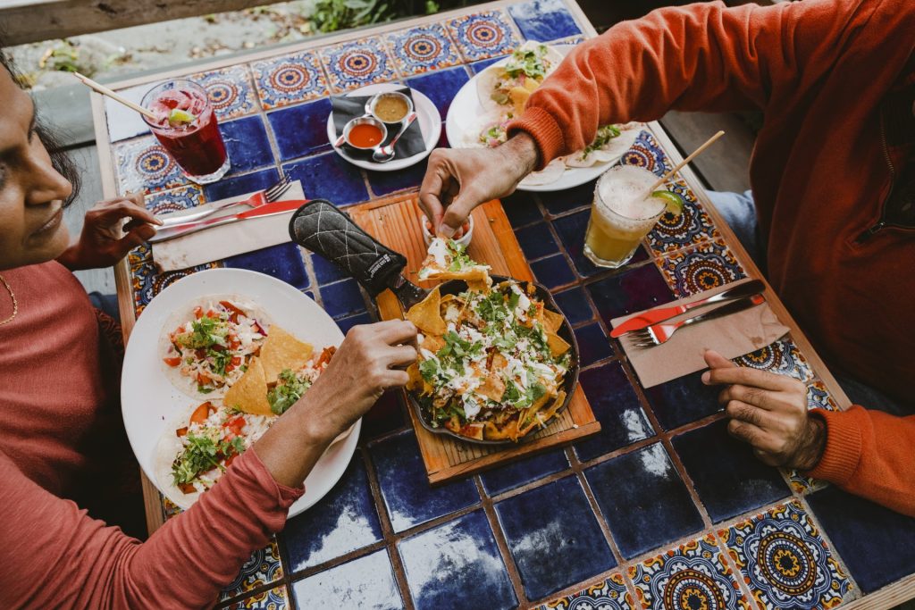
Local produce can be purchased at the Townsite Public Market and Coast Berry Company, a blueberry, strawberry and honey farm and café, and the Powell River Blackberry Festival and street party is in August. For an educational outing visit the Tla’amin Salmon Hatchery.
From kayak and canoe rentals and dive trips to day tours and eco resort indulgences, there are numerous tour opportunities and 32 lakes in the Powell River area. Golfers and cyclists should head southeast to Myrtle Point Golf Club and explore the roads through Paradise Valley agricultural area.

Beachgoers can check out Willingdon Beach Municipal Campsite on the northern edge of town (open year-round), Mowat Bay Park at the bottom end of Powell Lake, or, northeast of town, Haywire Bay Regional Park, operated by the Regional District. Travellers to Vancouver Island can take a ferry from Powell River to Courtenay.
Southwest across the water from Powell River is Texada Island, the largest of the Gulf Islands, with Courtenay, Vancouver Island beyond that. Each July the sandy beaches of Gillies Bay on Texada are home to the community event of Sandcastle Weekend. Other entertaining gatherings are the Texada Island Fly-In (air and car/bike show), the Texada Island Blues & Roots Festival, the Sunshine Music Festival and the Run the Rock 8 km and half-marathon/marathon. Said to be the toughest marathon in Canada it attracts runners from around the world. For a calmer outing visit Texada’s beaches to experience their vast intertidal zones or chill out and watch some skimboarding.
For more on Powell River read the blog Powell River, Insulated By Nature.
Lund
At the most northern end of Highway 101 is Lund, a quaint village known for craft harbour, fishing (Lund Seafood Festival in May), sea touring and being the gateway to Desolation Sound, the deep-water area at the northern end of the Salish Sea. Lund sits on Tla’amin land in the qathet Regional District and is home to the Coast Salish people. Its first European settler was Swede Charlie Thulin who, in 1889, named the harbour after a city in his home country.
Visit art studios such as Tug-Gumh Gallery or indulge yourself at Nancy’s Bakery or the Lund Resort at Klah Ah Men, an award-winner in Indigenous tourism.

East of Lund is Okeover Arm Provincial Park and Okeover Inlet, a superb spot for harvesting oysters and clams (tidal water licence required). Diver’s Rock Regional Park and Copeland Islands Marine Provincial Park are just north of Lund. The latter is made up of a small chain of island, islets and rocks in Thulin Passage and is a prime area for wildlife viewing and wilderness camping; there are also some anchorages for small vessels. For an unforgettable experience book a water taxi or snorkel/dive trip to Savary Island, southeast of Lund—it has some of the warmest waters north of the Baja and sandy shores to relax on. Lund Water Taxi offers services to Savary and Cortes Islands, Sarah Point (start of Sunshine Coast Trail) and Desolation Sound. They also have bicycle and kayak transfer services.
Water enthusiasts and hikers are keen on Inland Lake Provincial Park and the Sunshine Coast Trail from Powell River to Sarah Point, approximately 47 km north of Lund. There is 13 km of wheelchair accessible trail around Inland Lake.
TIP: If you find this blog interesting why not subscribe to the enewsletter and never miss another story!
The Sunshine Coast region is home to the traditional and ancestral territories of the Sḵwx̱wú7mesh Úxwumixw, shíshálh, Tla’amin, Klahoose and Homalco Nations. Visitors are encouraged to learn about how they can engage in cultural exploration.
Read our suggested drive along the Salish Sea Coastal Route or learn about winter activities on the Sunshine Coast.
Check out the first part of this tour up the Sunshine Coast by reading the blog Soak in the Sunshine Coast Along BC’s Salish Sea Route – Langdale to Egmont
For places to camp in British Columbia go to the Camping Map.
Share your BC travel and camping photos using hashtags #campinbc #explorebc.
Soak in the Sunshine Coast Along BC’s Salish Sea Route – Langdale to Egmont
Indigenous cultures, artistic communities, sea-inspired activities, spectacular coastlines and old growth forests make up British Columbia’s Salish Sea Coastal Route. This blog covers the Sunshine Coast part of the drive, from Gibsons area north to Egmont. See part 2 which covers Saltery Bay to Lund.

The Sunshine Coast area is only accessible by ferry, boat or plane providing an island feel experience. It has a mild coastal climate with many sunny days however, visitors should be prepared for wet days. (Boaters and hikers, check the weather before heading out.) Rain or shine, there are plenty of things to do in this incredible part of British Columbia. Fill your days exploring beaches, biking, paddling or fishing. Book a land or sea tour, take in a museum or festival, visit an art gallery or relax at a spa. Fuel up at breweries, cideries, distilleries, farmers’ markets and specialty food shops.
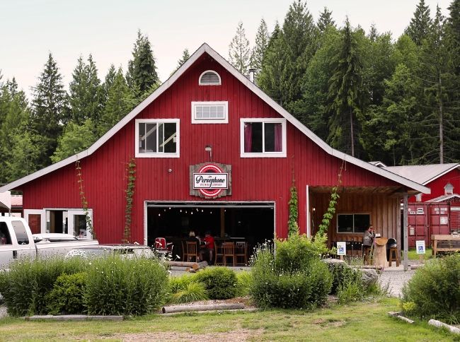
Getting There
The 40-minute BC Ferry ride to Langdale on the Sechelt Peninsula departs from Horseshoe Bay in West Vancouver; along the way take in Coast Mountain views and the spectacular Howe Sound. For travellers heading northwest to Powell River and beyond there’s a ferry between Earl’s Cove and Saltery Bay across the Jervis Inlet and on to the Malaspina Peninsula area of the Sunshine Coast. Total kilometres (not including ferry rides) from the Langdale ferry terminal to the village of Lund is approximately 140 km.

Langdale
The Sunshine Coast has more artists per area than any other place in Canada, and Langdale is one of the anchor towns of the Purple Banner Tour, a self-directed studio and gallery tour which runs northwest to Powell River. A purple banner on a property indicates an artist at work, and some of them open their studios to the public. Another crafty event is the Sunshine Coast Art Crawl, which takes place from Langdale to the Earls Cove area every October, with over 175 venues taking part!
Hikers and walkers can stroll the beach at Hopkins Landing or Smith Cove Park, which has a great viewpoint toward Gambier Island. Test your quads along Soames Hill Trail between Langdale and Gibsons, you will be rewarded with spectacular views of nearby islands and the Salish Sea. Mountain bikers should check out Sprockids Park and its 14 km of well-kept trails.

Gibsons
Perched on a hillside with harbour views, the town of Gibsons is a steppingstone to the Sunshine Coast. Coffee shops, boutiques and art galleries are popular with locals and tourists, and the Gibsons Public Market is open year-round. A must while here is Tidepools Aquarium, a collect-and-release aquarium located inside the market.
History buffs will enjoy the Sunshine Coast Museum & Archives (recently named one of the best community museums in BC). For more art there’s the Gibsons Public Art Gallery and The Kube, with its working artists’ studios, gallery and curated retail. The Gibsons Landing Jazz Festival is held each June and is a fun way to kickstart the summer.
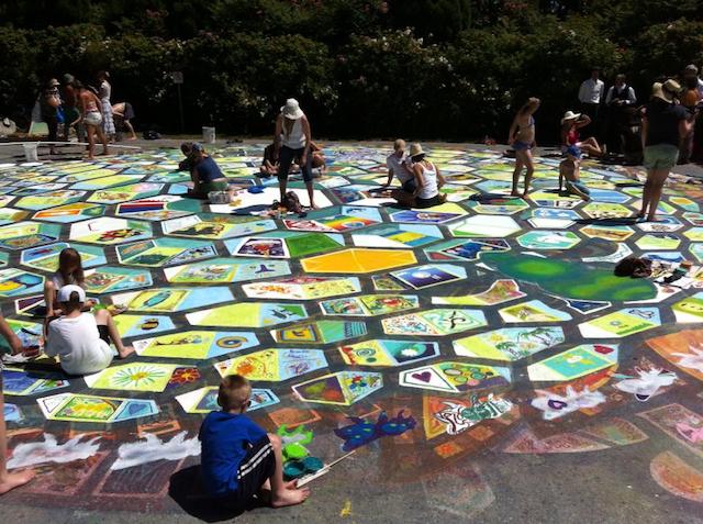
Roberts Creek/Davis Bay Area
There are more than a few fun events in and around Roberts Creek and Davis Bay with farmers’ markets in both communities and Davis Bay’s annual sandcastle competition in July. Creek Daze is an August event that celebrates all that is whimsical in the area, with live music, food and craft vendors and games. Be sure to visit the Roberts Creek General Store and the Roberts Creek Mandala artwork on the way to the pier.
East of Roberts Creek is Kitchen Sink Rescue, with its farm animal sanctuary, and the Sunshine Coast Golf & Country Club. Low tide at Roberts Creek Provincial Park means sand bar exploring, sea star spotting and seal watching.
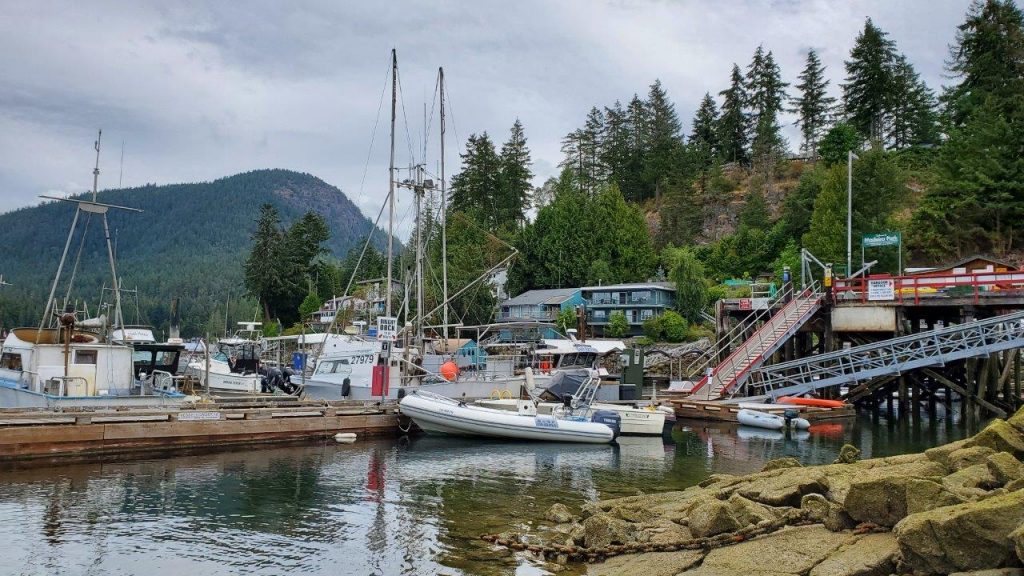
Sechelt
Sechelt is located on a narrow isthmus that separates Sechelt Inlet from the Salish Sea and is surrounded by forests. It’s a magnificent area to kayak or to take a float plane tour for a bird’s-eye view.
Art is in the air each spring in Sechelt with its Festival of the Performing Arts and in August during the Sunshine Coast Festival of the Written Arts, a gathering of Canadian writers and readers. October sees Oktoberfest followed by the Sechelt Festival of Lights in early December. The Raven’s Cry Theatre shows movies and hosts events and the shíshálh Nation tems swiya Museum has a large collection of artifacts including cedar baskets and ancient stone tools.
Take in the sights and smells of local flora at the Sunshine Coast Botanical Garden and wander along the long, sandy beaches in Porpoise Bay Provincial Park.

Halfmoon Bay
Northwest of Pender Harbour on the way to Halfmoon Bay is Sargeant Bay Provincial Park and Trout Lake Picnic Area. South of Halfmoon Bay is Coopers Green Park with its beaches and great diving. Hikes can be had at Halfmoon Bay and Coopers Green trailheads.
Pender Harbour
Surrounded by sea inlets, this community is water-centric and full of fun. The end of May means the annual Pender Harbour May Day, and 2025 will be its 80th year! The Pender Harbour Blues Festival in June and August sees the Harbour Chamber Music Festival and the Pender Harbour Wooden Boat Show, a celebration of marine heritage, with historical boats, land-based displays and kids’ activities. Winter features the very original Pender Harbour Christmas Boat Parade.

Madeira Park, just south of Pender Harbour, is a hub of marine activity. Check out the many paddle sport and fishing rentals in the area.
Earls Cove to Egmont
At the north end of the Sechelt Peninsula, Earls Cove is home to the ferry terminal location for sailings to Saltery Bay. The ferry links the lower and upper areas of the Sunshine Coast.
Experience a scenic 50-minute (16 km) ride up the Agamemnon Channel, around the northeast tip of sparsely populated Nelson Island and into Jervis Inlet. You will think you’re in Norway with views of rugged mountain slopes and fjords. Don’t be fooled, it’s the Coast Mountain Range!

South of Earls Cove is Ruby Lake and the sandy beaches of Dan Bosch Park. Ruby Lake and nearby Sakinaw Lake have great trout fishing in season and are perfect for freshwater activities, including canoeing portages. The lagoon at Ruby Lake is a rewarding spot for waterfowl and wildlife viewing.
East of Highway 101 on the drive up from Pender Harbour is the large provincial park of Spipiyus, renowned as having the oldest closed-canopy temperate rain forest in Canada. Its hiking trails even offer ocean views.
Egmont is a waterfront village on Secret Bay, 7 km east of the BC Ferries terminal. It’s the trailhead for Skookumchuck Narrows Provincial Park, and has modern marinas offering moorage and supplies for yachts and floatplanes. Boat charters are available here, as are a variety of guided tours, including kayaking. Make sure to visit the Egmont Heritage Centre to learn about the Shíshálh peoples and the history of logging and fishing in the community.
TIP: If you find this blog interesting why not subscribe to the enewsletter and never miss another story!
The Sunshine Coast region is home to the traditional and ancestral territories of the Sḵwx̱wú7mesh Úxwumixw, shíshálh, Tla’amin, Klahoose and Homalco Nations. Visitors are encouraged to learn about how they can engage in cultural exploration.
Read Part 2 of this drive Saltery Bay to Lund. Also, our suggested drive along the Salish Sea Coastal Route or learn about winter activities on the Sunshine Coast.
For places to camp in British Columbia go to the Camping Map.
Share your BC travel and camping photos using hashtags #campinbc #explorebc.
Kokanee Creek Provincial Park, British Columbia
On a recent trip through the Kootenays we spent a few nights at one of my favourite campsites in the area: Kokanee Creek Provincial Park.
Kokanee Creek Provincial Park is a large and popular campground 20 minutes east of Nelson. The park has four separate campgrounds, accepts reservations for 132 of its 189 vehicle-accessible sites, and has many things to see and do during your stay.
On our last stay, we camped at the Sandspit Campground, which is by far the largest campsite area. Other campground areas include the Redfish Campground, the Osprey Point Campground, and the Friends Campground, which offers 13 sites with electrical hook ups. Kokanee Creek Provincial Park has all the facilities you would expect in such a large and popular provincial park: water taps, a large adventure playground, a sani-station, both pit and flush toilets, and shower buildings at both the Sandspit and Friends campgrounds.

Kokanee Creek Provincial Park has quite an interesting history. Archaeological evidence indicates that areas within the park were used as seasonal campsites by Indigenous peoples. In the late 1800s, a wealthy Englishman named Charles W. Busk moved to the Nelson area and established the “Busk Estate” – which included a large mansion where he entertained guests. By 1913 Busk was disenchanted with his new lifestyle and he died only a few years later. Today, all that remains of the original Busk Estate are some stone walls and an oval concrete swimming pool – but these are generally well hidden! One hiking trail in the park is called the Historic Busk Estate Trail and that is where you might start if you wanted to try to find the ruins.

Kokanee Creek Provincial Park has an excellent nature centre open daily from 8am to 8pm. There are many programs for all ages run out of the nature centre and it is highly advisable to see what programs are being offered while you are there.

One of the reasons Kokanee Creek Provincial Park is so popular is that it provides access to more than a kilometre of sandy beaches. There is a boat launch and wharf and watersports including swimming, paddling, waterskiing, and windsurfing are popular.

When we visited, we spent most of our time at the park exploring some of the 9.5 kilometres of hiking and walking trails. We started our hike at the nature centre and set out to explore the spawning channel. Lots of interesting interpretive signage teaches about Kokanee – landlocked Sockeye Salmon. It is interesting to read about how human impacts such as mining in nearby Kimberley and the construction of the Duncan Dam have impacted Kokanee over the years and lead to hatcheries and spawning channels being built. After leaving the spawning channel area we headed uphill along the Canyon Trail to the Canyon Lookout. This is a beautiful trail following the creek with a viewing platform at the end. From there, we took the previously mentioned Historic Busk Estate Trail (no luck finding the swimming pool for us!) all the way back down to Kootenay Lake near the edge of the park. We found the dog beach, then followed a trail along the lakeshore past the Friends Campground, past the Sandspit Campground, and then connected with the Grassland Trail where we found a beautiful and much less busy sandy beach, before completing our loop and re-emerging back at the nature centre for an ice cold drink at their coffee shop. This loop was about 5.5 kilometres long and took us approximately an hour and a half to hike.
Kokanee Creek Provincial Park is a West Kootenay favourite – and for good reason. With lovely campsites, great services, and lots to explore, this certainly won’t be our last trip to Kokanee Creek.
TIP: If you find this blog interesting why not subscribe to the enewsletter and never miss another story!
For other camping and RV accommodations in British Columbia check out the Camping Map.
Share your BC travel and camping photos at hashtag #CampinBC, #exploreBC
It’s always a great day to #CampinBC
Where to Go Camping and RVing in British Columbia
British Columbia offers breathtaking natural scenery, diverse wildlife, and numerous outdoor activities and cultural events including hiking, fishing, cycling, and attending farmers markets or museums.

For a first-time camper, it’s a chance to immerse yourself in nature, disconnect from technology, and experience the serenity of the wilderness but also enjoy some culture.
There are four types of camping experiences to choose from and they offer a mix of frontcountry and backcountry access. Frontcountry means an area within 1 km of a park road or a highway. Frontcountry campgrounds are accessible by vehicle, and they offer a range of amenities not available in more remote locations. Backcountry campgrounds are still mainly vehicle accessible (some are hike in only) but usually on gravel or forestry roads and are more remote with limited facilities.

Choosing the right campsite and doing the research, you must consider factors such as location, amenities, scenery, and activities available. The map located on campingrvbc.com allows users to search and locate over 1,700 campgrounds offering unique camping experiences. Here is an overview of the opportunities.
Private RV Parks
In British Columbia, you can enjoy a variety of amenities at more than 400 of BC’s private sector RV parks/campgrounds that are well-maintained, accessible, and enjoyable for all levels of campers.
British Columbia’s independently owned and operated campgrounds provide services and facilities to suit every lifestyle and budget. Whether you prefer a full-service site with electrical, water and sewer hook-up, a limited-service site with just electrical and/or water, or perhaps a basic site for your tent or tent-trailer, you will find lots to choose from throughout all regions of BC and within all the terrains that this stunning province has to offer. Camp by a lake, on a river, at the foot of a mountain, or under a canopy of tall trees in the forest, it’s all here in BC.

Glamping
Don’t have your own home away from home? That is not a problem, as quite a few campgrounds offer “Glamping” – the opportunity to drive up in your own vehicle and rent an RV, Yurt or Cabin, or as some call it, “Ready to Camp units.” Reservations are always recommended as this type of vacation is popular. Most private sector businesses offer online reservation capability and many allow bookings up to 12 months in advance.
Parks Canada (National Campgrounds)
Parks Canada is responsible for protecting nationally significant examples of Canada’s natural and cultural heritage. They operate seven national parks in British Columbia that offer camping, of which four have glamping oTENTiks.

A great option for beginners, frontcountry campgrounds may include:
- washrooms with showers
- kitchen shelters
- electrical
- water hookups
- Wi-Fi access zones
Check first.
Parks Canada operates a reservation service that opens early in the new year but also has a selection of first-come-first-served campsites. Reservations are recommended as the demand is high in peak periods. National parks include: Kootenay National Park, Pacific Rim National Park and Mount Revelstoke National Park.
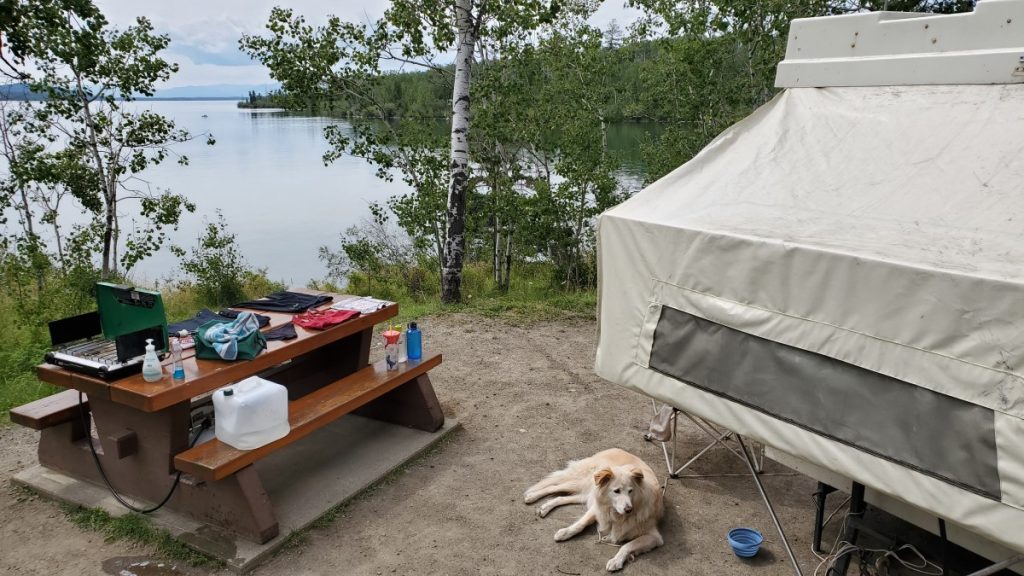
BC Parks (Provincial Campgrounds)
If it’s more wilderness that you seek, then BC Parks, which has over 640 Provincial Parks with more than 10,000 Frontcountry campsites and approximately 2,000 walk-in or backcountry campsites, as well as 39 group campgrounds. (If you’re venturing into BC’s backcountry, ensure you camp safely and responsibly and refer to a backcountry guide for more information).
Rustic Recreational Sites
For a more rustic feel, then you will want to visit Recreational Sites & Trails BC (RSTBC) who provide public recreation opportunities through the development, maintenance and management of a network of recreation sites and trails throughout British Columbia. The BC Ministry of Tourism Culture and the Arts maintains more than 1,200 recreation campsites under this program.

Other Camping Opportunities
Campertunity is an online marketplace that showcases campsites for you to rent on private land throughout BC. There are also opportunities to rent trailers, domes, yurts, and cabins.
Know the Camper’s Code
All campground operators have rules and a behaviour etiquette, but the industry has endorsed the Camper’s Code as an approach to develop a friendly camping culture.

The camper’s code has 9 rules that are really easy to follow. When all campers follow them, camping is enjoyable for all, nature stays pristine, fellow campers become friends and animals stay wild and free. www.camperscode.com
Whatever you have for a first-time experience, take the time to sit and see the wildlife and listen to the sounds of camping, because “It’s always a great day to #CampinBC”.
TIP: If you find this blog interesting why not subscribe to the enewsletter and never miss another story!
To find camping accommodations throughout British Columbia go to https://www.campingrvbc.com/
Share your BC camping and travel photos at hashtag #campinbc
It’s always a great day to #campinbc
Following the Gold Rush Trail through British Columbia’s Cariboo & Beyond
Follow the trail of the first prospectors who flocked to British Columbia in the mid-1800s in search of gold and riches. Travel through rugged mountains, steep canyons and past raging rivers of the Fraser Canyon and into the dry plateaus and rolling hills of the Thompson Okanagan and Cariboo regions. Continue north to Prince George, called the Northern Capital of BC, then east and south towards the stunning BC Rockies returning to Hope in Fraser Country.

A Sampling of Things To See and Do Along the Way
The Fraser Canyon offers up plenty to see. Yale Historic Site was an original Gold Rush boomtown where the steamers stopped as the waters of the Fraser River were too rough beyond this point for boats to navigate. It is known as the official start of the Gold Rush Trail although mile zero is actually in Lillooet.
Hell’s Gate Airtram offers a ride over the thundering waters where 200 million gallons of water cascade through the narrow passage of the gorge every minute.
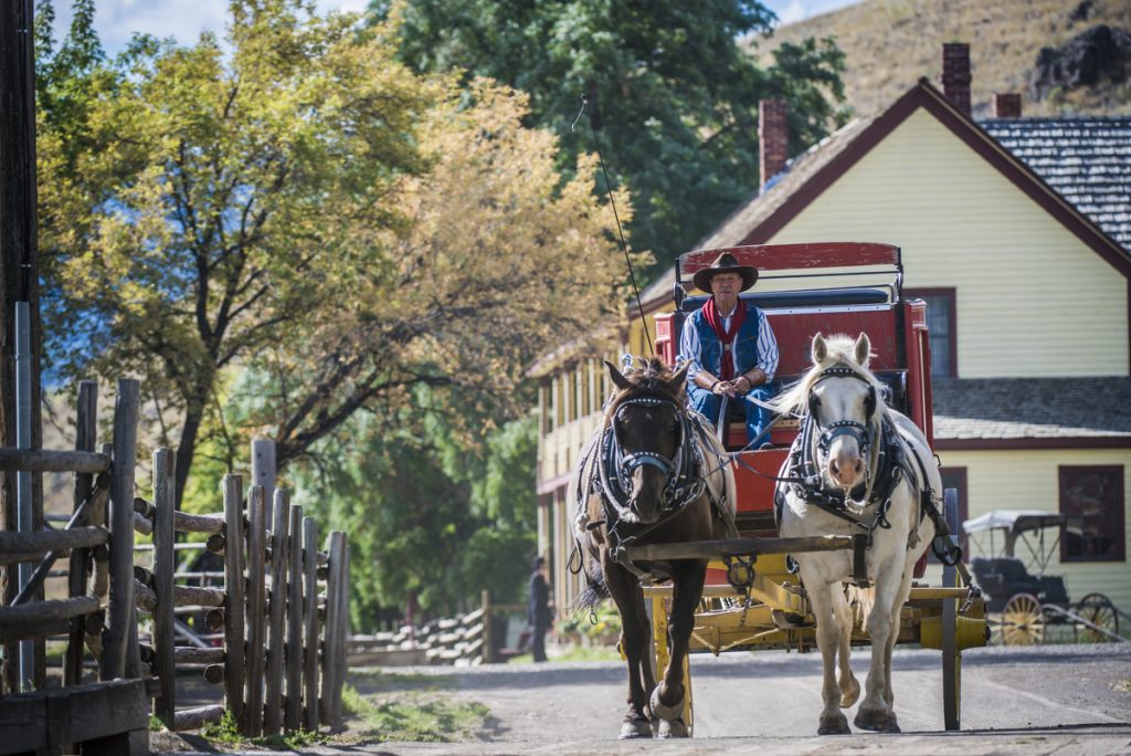
Entering the drier climate of the Cariboo you will find Historic Hat Creek Ranch. Dating back to 1861 you can relive the history through interpreters dressed in period clothing, take a stagecoach ride and pan for gold.
Continuing on to Clinton, check out this Wild West town! Antique shops, many with original storefronts, are full of treasures and an 1892 museum are reasons to take a break here. Then on to Williams Lake home to cowboys and the popular annual Williams Lake Stampede (July 1st). Do some gold panning in Quesnel, home to the world’s largest gold pan and check out Mandy the haunted doll at the Quesnel & District Museum.

A side trip to Barkerville is well worth the one-hour drive each way. This thriving historic town is a tribute to the gold rush era that made BC’s gold industry famous. 125 plus heritage buildings, displays, a theatre, events, activities and more showcase the life of Barkerville’s colourful past. Designated a Historic Site of Canada and a Provincial Heritage Property it is the largest living-history museum in western North America.
Known as the capital of Northern BC, the city of Prince George is a bustling community where arts and culture, events and outdoor adventure awaits. Visit the Exploration Place Museum & Science Centre with dinosaurs, fossils, hands-on experiences for kids and adults alike. The Central British Columbia Railway and Forestry Museum features original buildings and rolling stock and is home to one of the largest vintage rail collections in BC.
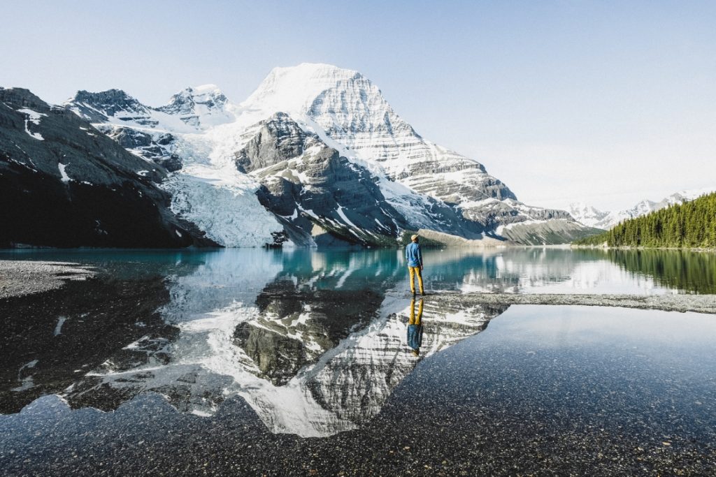
Situated at the foot of Canoe Mountain in the Robson Valley is the village of Valemount and the closest community to Mount Robson Provincial Park and Jasper National Park. Explore some of the many hiking trails for stunning views of snow-capped mountains, spectacular waterfalls and create lasting memories.
Along the way stop at Blue River and experience a boat ride down the river through Grizzly Mountain Valley and the world’s only inland temperate rainforest where you may be lucky enough to see bears, moose, osprey, eagles and other BC wildlife.
Outdoor adventurers will want to stop at Wells Gray Provincial Park to see and experience some of nature at its very best. A wide array of paths offer trails for different hiking levels plus stunning waterfalls provide many viewing opportunities, including Helmcken Falls, the fourth highest falls in Canada. Bring your kayaks and bikes and get ready to experience this amazing park.
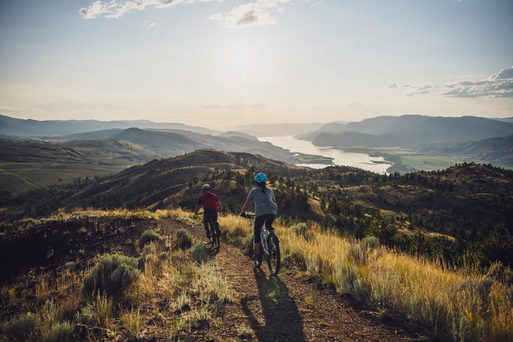
Kamloops is one of the major cities in the Okanagan with great restaurants, shopping, entertainment, arts and culture, sports and outdoor activities. Stop in at a winery or a local brewery. Visit BC Wildlife Park and experience wildlife up close.
Amazing white and yellow cliff formations are located in Castle Rock Hoodoos Provincial Park in Deadman Valley. Hiking is not permitted as the landscape is very fragile but stunning scenery provides an opportunity to take home some great photographic memories.
Spences Bridge lies at the confluence of the Thompson and Nicola Rivers and is a prime location for excellent fishing. River rafting, swimming, canoeing, kayaking or fishing are all close by.
This circle route has much to offer. Spend a few days, a week or more, exploring some or all of the communities and attractions along this route.
For a ‘guided’ tour read our suggested trip along the Gold Rush Trail.
TIP: If you find this blog interesting why not subscribe to the enewsletter and never miss another story!
For places to camp in British Columbia go to the Camping Map.
Share your BC travel and camping photos using hashtag #campinbc #explorebc
7 Steps to Getting Your Camper or RV ready for the Camping Season
Like others who Camp and RV, when we get a day or two of sunshine at this time of year, we start counting the days until the first trip. Now it’s time time to plan the days, the camping days that is. How many trips can be enjoyed in the Spring, Summer and if I am lucky (weather wise), right into the fall and beyond. First thing after the planning is the preparation of the home away from home for it’s first outdoor adventure of the year. We have a 24.5-foot Denali and here are the seven main steps I take to prepare.

1. Start Booking Your Camping Spots
It’s time to do the camping mambo, so to speak. We turn to our calendars, or in my case my cell phone’s digital one. I plan all my trips in that handy, trusty little box, that does such a good job that I have now enlisted it to telling me when to book. This year I want to camp in a BC Provincial Park, so I will go online to BC Parks reservation system to make a booking. They have information on their site about how far in advance you can book and which sites require a reservation. I check with friends to see who will join in, and then enter my data and book it as soon the reservation system allows me. If you prefer you can call the BC Parks call center, but remember there is an additional charge for this service and the wait times can be lengthy, my advice is to book online.
Reservations for 2024 are already open for Parks Canada sites, and private campgrounds are already booking up fast. Get more information on most campgrounds in BC here.

2. Air Out The Unit And Give It A Good Clean
So now I’ve booked my site, and it’s time to “wake up” my home away from home. It’s been a fairly mild fall and winter so it’s time to think about the unveiling of the RV, Motorhome or even the tent. Who says you can’t bring out the tent and dust it off, set it up and make sure that all the zippers, pulls and guy wires are intact? Great time to give it a wash and really air it out. Tenter’s often don’t give a thought to their sleeping accommodation until packing the vehicle for the trip or worse, they arrive at the location and find that its missing pieces or it has “had” a winter stow-a-way. Let this year be different – a prepared year.

It really doesn’t matter what your mode of camping is, they all have similarities that need attending to. Chances are your RV or camper has been closed up, unattended for the last five months. First thing to do is take off the protective covering you used for storing. But before pulling it off, why not give it a really good shampoo and a hose down and let it dry, before packing it away for the next five plus months. You will feel better about storing the cover clean, so when it comes time to put the RV to sleep for next winter it’s one less thing to do.

3. Time For Maintenance on Your Tires
We have finished washing and drying the cover which is stored for the season -– what’s next? Tires. The vehicle has been leaning on them for the winter and they might just be a little “tired”, so why not take the time now to inflate, rotate, clean and grease the bearings. Checking over every inch of the outside is the best place to start. Make sure there are no new problems that need attending to both on the outside you can see and the inside tire wall you cannot. We also apply tire protectant to the walls of the tire.
4. Water System On Board? Time For A Good Flushing
If you have a travel trailer, tent trailer, fifth wheel, motorhome or even a truck camper, chances are you have a water system attached that you winterized for the winter. You probably used a non-toxic antifreeze in the late fall designed for RVs and will now need to flush the system out with fresh water until there is no more pink water flowing. Once this is done, some people like to add a ¼ cup of liquid bleach and run it through the tank and then flush it once again with fresh water. Once this is done, it is now time to turn the heater’s bypass valve into the operating (normal) position and check each and every tap and faucet for leaks. Better to find it now rather than on a camping trip.

5. Check Your Batteries
Always wear protective safety gear when checking batteries at any time. First, make sure you have disconnected the hook-up power (the 120V power cord) and then make sure that all power is in the OFF position. We trickle charge our trailer all winter to maintain charge to the battery – other friends remove their batteries in the fall and keep them stored with a trickle charge in their shed or garage. Check the battery connections to make sure that they are clean and that the terminals have not corroded over the fall and winter. Check all sides including the bottom of the battery for cracks, as this sometimes happens during a severe winter freeze. Replace all cracked batteries. Check the battery fluid levels and only use “distilled water”.

6. Inspect Propane Tanks
Propane tanks are the next item up for inspection. Make sure the tanks are in the off position. This is where you want to check hoses, regulators and valves for premature aging and/or drying out. Check the date stamp is within ten years as they cannot be filled if older, unless they are re-valved. If you notice any of the above, replace and then proceed to testing the refrigerator, stove and furnace all work when the propane is engaged.
TIP: If you find this blog interesting why not subscribe to the enewsletter and never miss another story!
7. Clean the Inside
Final things to do, is give the whole inside a complete wash, vacuum and wipe out all cupboards and drawers. I always do a thorough clean before putting the RV to sleep for the winter but I also do a spring clean to freshen the trailer. It allows me to check for leaks, mold or if an unwanted pest has entered. I then open windows to air out the rig to make sure I have clean air for the first trip. As well as inside, I clean out the pass-throughs and repacking this allows me to confirm I have all items needed for the first camping trip and to purge unwanted items.
For more tips check out: RV Maintenance Tips for Keeping Your Exterior in Top Shape
To locate places to camp in BC go to the Camping Map.
Share your BC travel and camping pictures using hashtag #campinbc, #explorebc
It’s always a great day to #CampinBC
Spring Activities & Camping Abound in British Columbia’s Okanagan
In the mountains there is still plenty of white stuff, but in the valleys, once the snow melts, the trees start to bloom and the leaves turn green.

There are a variety of activities available in early spring, especially because the temperate climate of the Okanagan is so warm early in the season. Consider indulging in some of the following if you’re looking to get camping this spring:
If you’re a fan of wines and brews, consider taking one of the area’s many wine tours. In Kelowna, you can take the Lakeshore Wine Route, starting at Sperling Vineyards to CedarCreek Estate Winery. Home of the award-winning restaurant, Home Block, CedarCreek is a popular way to enjoy the valley and the views of Okanagan Lake. As your day winds down, you can head back to Apple Valley Orchard and RV Park for a good night’s rest. The next day, you’ll be geared up to head down to Penticton to explore one of the province’s mighty Ale Trail destinations. In fact, Penticton was recently named Canada’s Craft Beer Capital!
You’re wise to spend several days using Kelowna as your home base, especially in spring. The flowers are out and the birds are singing, so it’s a great time to visit. Plan to spend a day visiting the Kettle Valley Railway in Myra-Bellevue Provincial Park, where you can enjoy biking, hiking and walking across the 18 trestles that still exist from the decommissioned railway line.
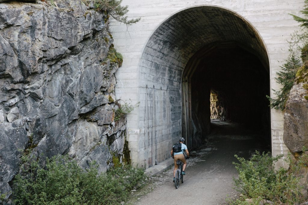
Of course, spring skiing is still an option if you’re so inclined, with Big White Resort, located just 60 kilometres east of Kelowna, a short day trip away. Another great accommodation in the Kelowna area is Holiday Park RV & Condo Resort.
It’s a great time of year to visit the South Okanagan, as the fruit trees are in bloom in early April. Their heady scent permeates the air. In Penticton, you can enjoy time at a variety of different campgrounds and resorts, including Oxbow RV Resort, South Beach Gardens Campground or Barefoot Beach Resort. While in Penticton, you can enjoy all kinds of different activities and events. In fact, Visit Penticton has a great events calendar you can enjoy year round. Some favourite activities around the Penticton area include a day trip on the Kettle Valley Steam Railway in Summerland (and don’t forget to swing by Summerland Sweets while you’re in town, or to indulge the adults’ sweet tooth, consider a visit to Bottleneck Drive. You’ll have a chance to enjoy breweries, wineries, distilleries and cideries, all in close proximity to each other).

TIP: For places to camp in British Columbia, go to the Camping Map!
As you wind your way south, golf, swimming, boating and hiking are top activities to enjoy. Outside the busy summer season, there are many places to see and things to do that are just waiting to enjoy. Book a spot at Gallagher Lake, where you’ll enjoy amazing views among the ponderosa pines any time of year. If you plan on staying in sleepy Oliver, consider booking at Lakeside Resort, a full-service year-round resort that’s budget friendly. It’s also near Nk’Mip Canyon Desert Golf Course, if you’re looking to practice your swing. Also in Oliver is Fairview Mountain golf course, which is known to be open (weather permitting, of course) 11 months of the year! While you’re in town, swing by the Oliver Visitor’s Centre, as there are events going on all year round in Canada’s Wine Capital.

Closer to the border is Osoyoos, known as Canada’s Warmest Welcome, where – if you’re not careful – you could drift across the American border, which bisects Osoyoos Lake. In town, you have a variety of options for accommodations, including Brookvale Holiday Resort.
Stationed in Osoyoos also allows you to head east into Boundary Country or west to the Similkameen on day trips. Each are wonderful (consider visiting the Rock Creek Fall Fair, and don’t forget Keremeos is known as Canada’s Fruit Stand Capital) and are close enough to stay in Osoyoos, the only true desert in Canada, while exploring all the Okanagan has to offer.
For campgrounds in the Okanagan and elsewhere in British Columbia go to the Camping Map.
Share your BC camping photos using hashtag #campinbc
Haida Gwaii Adventures, British Columbia
Although I have travelled BC, especially between Vancouver and Prince George, more times than I can count, when my husband and I bought an RV we slowed down; really began to see this amazing province we call home. In this blog I am sharing one of our many BC explorations.
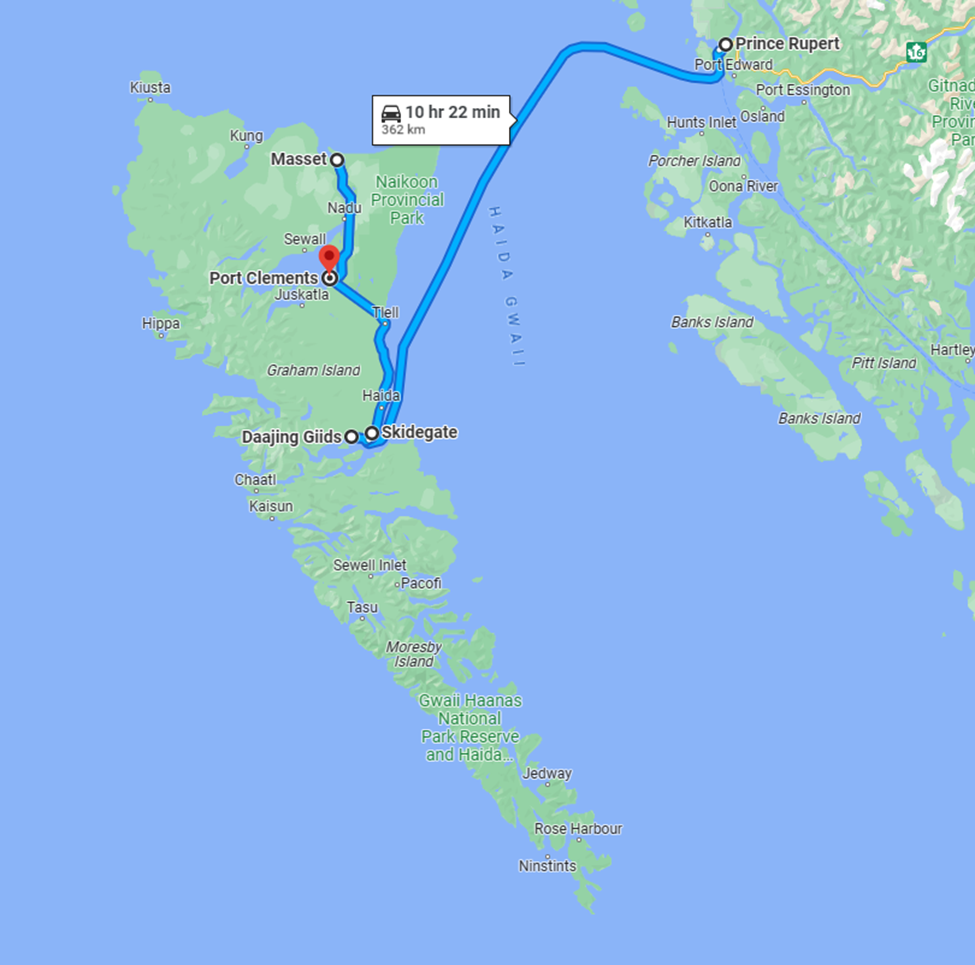
We had heard much about Haida Gwaii, the mystical secluded archipelago made up of a cluster of islands off the northern coast of BC. We were eager to discover it for ourselves. It’s sparsely populated and not easy to get to. Most of the inhabitants are indigenous and live in villages located almost exclusively on Graham Island.
There is an expression about remote communities that there are only three ways to access them, by water, by air or by birth. We chose water taking the ferry that is part of BC’s provincial ferry system from Prince Rupert to Skidegate on Haida Gwaii. Reserve early as it fills up fast particularly during the busy season. We encountered others who had not been so attentive in their planning. They were stuck on the island until they could secure another sailing. Not always easy with an RV.

A curious fact about the ferry to Haida Gwaii, not only does it take eight hours, but oversized vehicles need to be backed onboard. “Excuse me, as in backing up all the way down the ramp and onto the ferry?” Of course, if you need assistance the ferry workers have you covered. They have professional drivers that will do it for you if you prefer. As I do all the driving, I looked at my husband, “you got this,” he said. And I did, but it’s a long ramp and a technical drive not for the faint of heart.

Once on the island our first campsite was on the ocean surrounded by serene ancient forest just outside Daajing Giids (a more appropriate culturally representative name than the former Queen Charlotte City). It was quintessential west coast. A light rain fell, the kind that doesn’t really get you wet, but causes mist to form drifting across the beach and through the trees draped with moss.

We walked the rugged beach, and to our delight came across wild sea asparagus which we harvested for our dinner. In fact, wild harvest is a common practice. You won’t find any fancy high-priced touristy seafood restaurants here. The locals acquire and trade amongst themselves the abundance from the land and sea rather than marketing to visitors.

Next, we drove to Masset on the northern end of Graham Island. Along the way were many deer grazing beside the roadway, a local phenomenon. We rode our bicycles around Old Masset enjoying the authentic aboriginal village, oceanfront, and a quick bite at one of several food trucks that serve as “eating out” Masset style. You may also wish to trek just a bit further to Tow Hill to take in the vast Pacific Ocean vistas.

Heading back south to catch our ferry off island we explored Port Clements mingling with the locals as they fished off the pier in the heart of town. We also stopped for photos at area attractions Halibut Bite and Balance Rock.

The ferry between Haida Gwaii and Prince Rupert runs during the day, or you can take it overnight. Staterooms are available so you can get some rest as Transport Canada doesn’t allow you to stay in your vehicle below deck for safety reasons. Hecate Strait is renowned for its turbulent seas. We chose a daytime crossing on our way over to Haida Gwaii to take in the sights and an overnight on the way back to Prince Rupert (with a stateroom). The overnight ferry from Haida Gwaii aligned perfectly with our intent to board yet another ferry, this time from Prince Rupert to Port Hardy on the northern tip of Vancouver Island. This route might be known to those who have traversed the inside passage on an Alaskan cruise. The scenery and the wildlife are spectacular!
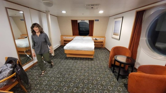
We recommend Haida Gwaii to the more adventurous. Its natural beauty is stunning but it’s short on amenities so prepare accordingly. The towns on Haida Gwaii are small. Ideally take your own accommodation (we had our RV), your own food (groceries are limited) and fuel can be very expensive as it must be barged in so fill up before you come. The number of eateries, coffee shops, stores and accommodations are sparse compared to mainland standards and the residents aren’t particularly fussed about catering to off-island interests so don’t expect much other than to supplement what you brought.
In short, this is no tourist mecca. You don’t come to Haida Gwaii for the modern-day amenities or atmosphere. You come to appreciate the simplicity, the unspoiled First Nations culture and wild natural wonder of the west coast.
TIP: If you find this blog interesting why not subscribe to the enewsletter and never miss another story!
For RVing and camping accommodations in British Columbia go the camping map.
Share your BC travel and camping pictures using hashtag #campinbc #exploreBC
It’s always a great day to #campinbc
Winter Activities On British Columbia’s Sunshine Coast for Snowbird RVers
From the artistic community of Gibsons to the harbour village of Lund, mountains meet the sea along the Sunshine Coast, a mainland area uniquely only accessible by ferry, boat or plane. Winters are typically mild and range from 2 to 10ºC (20 to 50°F) during the day. In lower elevations, rains keep the flora and forests lush, while higher areas see snow.
There’s plenty to do both inside and out if you’re RVing here in the winter. Make sure to get out on the water and head up some slopes. You will be rewarded with majestic views and an excellent chance of seeing animals in their natural environment.

Arts, Shops and Spas
This scenic and inspiring region boasts a thriving art community with more artists per capita than any other area in Canada. The Purple Banner Tour is a self-directed studio and gallery tour. Purple flags along the Sunshine Coast Highway and local streets from Langdale to Lund indicate galleries or artists’ studios, many of which are open to the public. (Visitation appointments may be necessary.) There are also many eclectic shops and boutiques to explore that sell locally produced and handmade items.
The town of Gibsons on the shores of Howe Sound has a collection of fine galleries, clothing and giftware shops and bookstores. Molly’s Lane and Marine Drive are some streets to check out, as are the Gibsons Public Art Gallery and the Sunshine Coast Museum and Archives. The Kube has working artist studios, an art gallery and curated retail.
In Sechelt the Raven’s Cry Theatre shows movies and hosts events and the shíshálh Nation tems swiya Museum has a large collection of artifacts including cedar baskets and ancient stone tools.
The Sunshine Coast also has funky thrift and vintage shops and there are craft fairs and year-round and seasonal markets, including the Gibsons Public Market, the Roberts Creek Community Farm Market and Powell River’s Townsite Public Market. Sechelt has a winter market in the pre-Christmas season and the Powell River Community Resource Center hosts the Uptown Winter Market.
There are fun and practical general stores, including one at Roberts Creek and Halfmoon Bay. Madeira Park is the main shopping centre for the Pender Harbour region.
Historic Powell River has an educational forestry museum and, in late winter, hosts the Powell River Film Festival in the classic Patricia Theatre, Canada’s oldest continuously running cinema. The townsite has over 400 buildings dating to the original 1910 town plan and, in 1995, was designated as a National Historic District of Canada. Stroll around for yourself or book a heritage walking tour. There’s also the unique opportunity to take in an Indigenous experience, such as the Tla’amin Nation Cultural Tours where you can meet skilled craftspeople and learn about traditional practices.
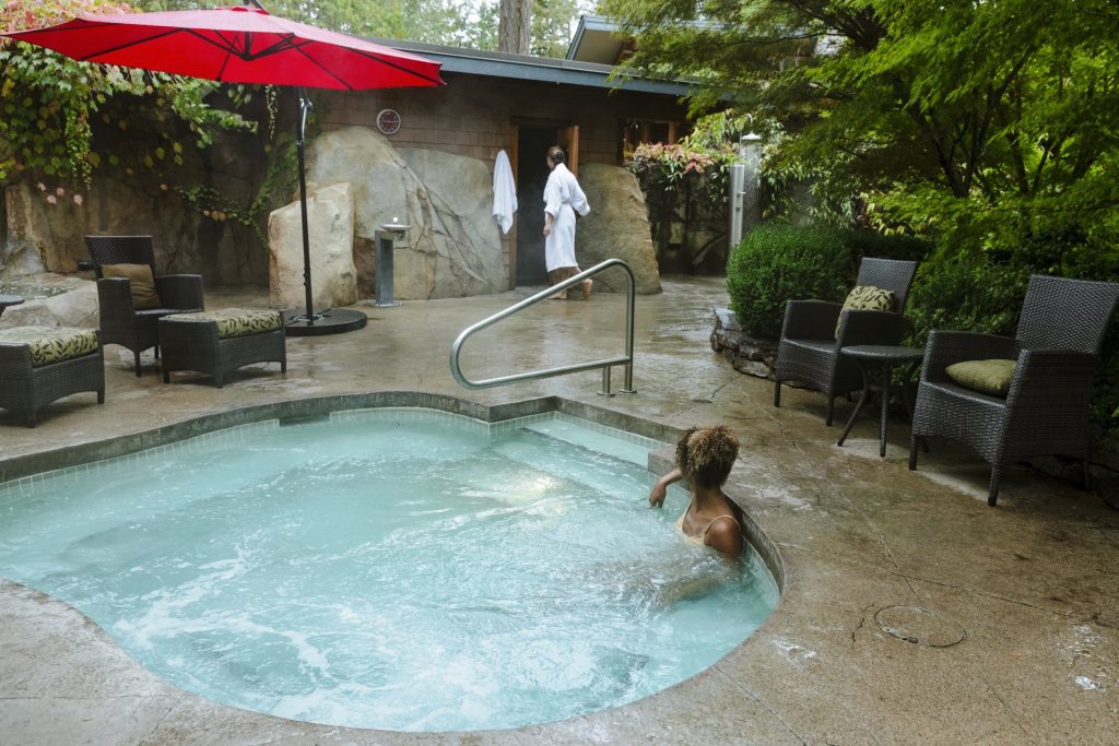
Of course, it’s not the West Coast without some zen spa treatments. A few to visit are Painted Boat Resort Spa in Madeira Park, with its Canadian Wilderness Scrub, Seabreeze Spa in Halfmoon Bay, Shades of Jade in Roberts Creek and Beyond Bliss in Powell River.
Click here for the Sunshine Coast Tourism events calendar.
Coffee Culture, Drinks and Dining
A dedicated coffee culture thrives in the Sunshine Coast. For mojo, pastries, brunch and more check out:
Black Bean Cafe, Beachcomber Coffee Company and Wheatberries Bakery in Gibsons
Gumboot Café, Roberts Creek
Basted Baker and Strait Coffee in Sechelt
Skookumchuck Café and Bakery, amongst the trees in Egmont
Base Camp Coffee, 32 Lakes Coffee Roasters and Bakery, River City Coffee Roasters and Edie Rae’s Café at the Old Courthouse Inn, all in Powell River.
Nancy’s Bakery, Lund (popular for its blackberry cinnamon buns).
Drinks and dining options range from sustainable restaurants and bistros to distilleries, cideries and breweries. Here are a few to sample:
Tap Works Brewing Company, The 101 Brewhouse & Distillery, Banditry Cider, Persephone Brewing Company and farm and Sunday Cider, all Gibsons area.
Bruinwood Estate Distillery and Sea Cider Farm and Ciderhouse, Roberts Creek
The Backeddy Pub in Egmont for Pacific Northwest fare with inlet views.
Townsite Brewing for craft beer, Monks on Marine for a steak and Guinness pie and Costa Del Sol for Latin cuisine, all Powell River.
The Bricker Cider Company and TwentyTwo Taphouse in Sechelt. Also, Jamar Canteen for Lebanese food and cooking demos. For comfort food try the Wobbly Canoe or the Gourmet Girl.
You can always refer to the BC Ale Trail for self-guided itineraries along the Sunshine Coast. Many establishments are dog friendly.
Outdoor Activities and Tours
When visiting the Sunshine Coast in winter you’ll need waterproof gear and to have extra clothing on hand. Plan any hikes—particularly in the off-season—and respect trail rules and any closures.
Wildlife such as elk, deer and coyotes are active year-round and blue herons and bald eagles can be easily spotted. Along the coast you will see seals and even sea lions, and molluscs and sea anemones in tidal pools. Guided wildlife tours are recommended for safety and best viewing. If you’re in Gibsons on a weekend the Nicholas Sonntag Marine Education Centre may be of interest.

Popular hikes and hiking areas include:
Soames Hill Park and “The Knob”, Gibsons, for sea and island views.
Iris Griffith Wetlands Park, Baker Beach Park and Mount Daniel/Garden Bay Marine Provincial Park near Madeira Park.
Pender Hill Park and beachcombing and birdwatching around Pender Harbour.
Cliff Gilker Park, Roberts Creek.
Smuggler Cove Marine Provincial Park and trails around Halfmoon Bay.
Suncoaster Trail and Skookumchuck Narrows Provincial Park near Egmont—witness the spectacular tidal changes of the Sechelt Rapids.
Sechelt area: Kinnikinnik Park, Porpoise Bay Provincial Park and the lush forest of Hidden Groves.
Willingdon Beach Trail, Powell River.
Lund and area. Explore nearby marine parks, including Desolation Sound (by boat) and the Sunshine Coast Trail, Canada’s longest hut-to-hut hiking trail.
Creek areas and falls to visit in the winter are: Cliff Gilker Park, Langdale Falls, Homesite Creek, Kelly Falls and David Lam Falls in Blackwater Creek.

Inland from Sechelt, winter recreation fans enjoy the cross-country ski and snowshoe trails at Dakota Ridge. (Alpha Adventures organizes tours here.) The ski trails are well groomed and the snowshoe trails vary in difficulty. Just north are the trails in and around Tetrahedron, a wonderful provincial park for backcountry snowshoeing. Powell River is home to Knuckleheads, a sub-alpine area popular for snowmobiling and snowshoeing.
Tours are a great way to get out and about and experience the Sunshine Coast from a local’s perspective. Sunshine Coast Tours has a boating day trip to Princess Louisa Inlet (where you can see Chatterbox Falls); you can also charter a floatplane to view this hidden gem. Harbour Air Seaplanes offers scenic flights from Sechelt. Winter kayak or go on a boat tour of the Halfmoon Bay or Pender Harbour areas; various companies offer rentals and tours.
If you fish the Sunshine Coast is a dream come true, with its inland lakes and streams, meandering coastline and the Salish Sea. The Powell River area is famous for Chinook salmon and a winter fishing charter is an unforgettable adventure. Companies include OTB Charters (Pender Harbour) and Powell River Sportfishing and Coho Point Fishing Charters. All anglers in BC must obtain separate licences to fish in tidal (salt) water and/or freshwater.
NB: Visitor Information Centres across the Sunshine Coast may have shortened business hours in the winter.
TIP: If you find this blog interesting why not subscribe to the enewsletter and never miss another story!
Sunshine Coast Tourism reminds locals and visitors that they’ re on the traditional territories of the Tla’amin, Klahoose, shíshálh, Skwxwú7mesh, and Homalco Nations”. Its Know Before You Go webpage has details on safe, responsible and respectful travel.
Share your BC travel and camping pictures using hashtag #campinbc #exploreBC #sunshinecoastbc
It’s always a great day to #CampinBC
Winter in Valemount, British Columbia: Where the Mountains Move You
If you want to embrace winter without the crowds, head to Valemount in east-central British Columbia, a village with epic snow-filled adventures and activities. But be prepared, this place takes the white stuff seriously.

Nestled in the Robson Valley, along and east of Highway 5 (Yellowhead Highway) and between the Rocky, Monashee and Cariboo mountains (to the east, south and west), Valemount is the closest town to Jasper, Alberta, which is just over an hour by car. This area gets snow and the locals live for it, with many of them working in the winter tourism industry and eager to show visitors what their playground is all about. There’s even a winter party in Valemount and it’s aptly called Winterfest. Mark your calendars for February 17, 2024.
Skiing and snowboarding
You won’t find a traditional ski mountain in Valemount, which means no lift lines either! Its unofficial hill is Crystal Ridge, Canada’s only sled-assisted ski area, with six semi-cleared runs (670 vertical metres) and a designated up-track for snowmobiles. The access trail is 12 kilometres of stunning mountain views, and the descent has fantastic tree runs and often pure powder.

Just outside of town is Five Mile Road, a logging road which, in the winter, is fantastic for tobogganing, skiing and dog walking. People can ski tour or snowmobile up the logging road and come down in style.
Cross-country skiing, snowshoeing, skating and more
Seasoned cross-country skiers and beginners can enjoy 14 kilometres of track-set trails at Jackman Flats (north of Valemount between the Rocky and Cariboo mountains) and Camp Creek (south of Valemount), both groomed by the non-profit Yellowhead Outdoor Recreation Association (YORA). With various loops to navigate, there are straightaways, curves and hilly stretches to have fun on. Camp Creek allows dogs and has a warming cabin and toboggan area.

Ungroomed ski trails can be found along the Fraser River at Tête Jaune Cache and overnight Nordic ski and snowshoe trips can be planned to cabins, though some are accessed via helicopter only. The McKirdy Meadow and Clemina Creek cabins are accessible via ski touring and snowmobile and are also maintained by YORA.

Overlander Falls Trail is close to town and Mount McKirdy is just minutes away and rewards snowshoers with remarkable lookouts. Snowshoeing and cross-country areas continue north and east of Valemount around the forests of Tête Jaune Cache, Rearguard Falls Provincial Park and Mount Robson Provincial Park, with the famous Mount Robson, the tallest mountain in the Canadian Rockies.
For outdoor skating, visit Cranberry Marsh (officially called the Starratt Wildlife Management Area) to glide on the lake, snowshoe or ski the six-kilometre loop, and bird watch while you’re at it. This area is very important for breeding and migration.
Indoor public ice skating takes place at the Canoe Valley Recreation Centre and drop-in curling is at the Valemount Curling Club on Elm Street, while Tourism Valemount has information on winter hiking and a booklet on geocaching.

If dog sledding is on your bucket list check out Cold Fire Creek Dog Sledding (250-968-6808; 1-877-295-8505). The company offers a range of tours, from 1 hour to overnight excursions.
Moose Lake and Shere Lake are great ice fishing options when conditions allow. A provincial fishing licence is required for all recreational anglers.
Snowmobiling/sledding
Unique to Valemount is its many kilometres of managed sledding (snowmobile) terrain. VARDA, the Valemount & Area Recreation Development Association, oversees four snowmobiling areas. Its website details where the sledding is permitted and lists trail pass information. Passes are required when sledding on VARDA-managed trails.
Expect amazing scenery and powdery snow, but also be prepared for variable conditions. You’re in the mountains after all. Visitors are encouraged to book a guide if new to the region and to always be aware and up to date on avalanche conditions. Snowmobile rentals are available from Alpine Country Tours and avalanche courses can be booked with Frozen Pirate.

Allan Creek is the first trail to open each season. It has snow bowls, meadows, frozen lakes and steep hills to explore. Clemina Creek offers excellent tree sledding, Chappel Creek boasts elevations from 1,830 m to 2,440 m and generally some of the best snow in the surrounding mountains, while the Westridge Family Loop (22 km) is fantastic for beginners and offers landscape views and a warming hut. Note that backcountry safety equipment is mandatory while at Crystal Ridge sledding hill.
Cat and heli skiing, scenic tours
Treat yourself to a cat skiing adventure with Cariboo Snowcat Skiing, or an unforgettable helicopter ride, guided ski touring or heli-skiing with Robson HeliMagic or CMH Heli-Skiing It’s recommended to book in advance with these companies, though cancellations do arise.
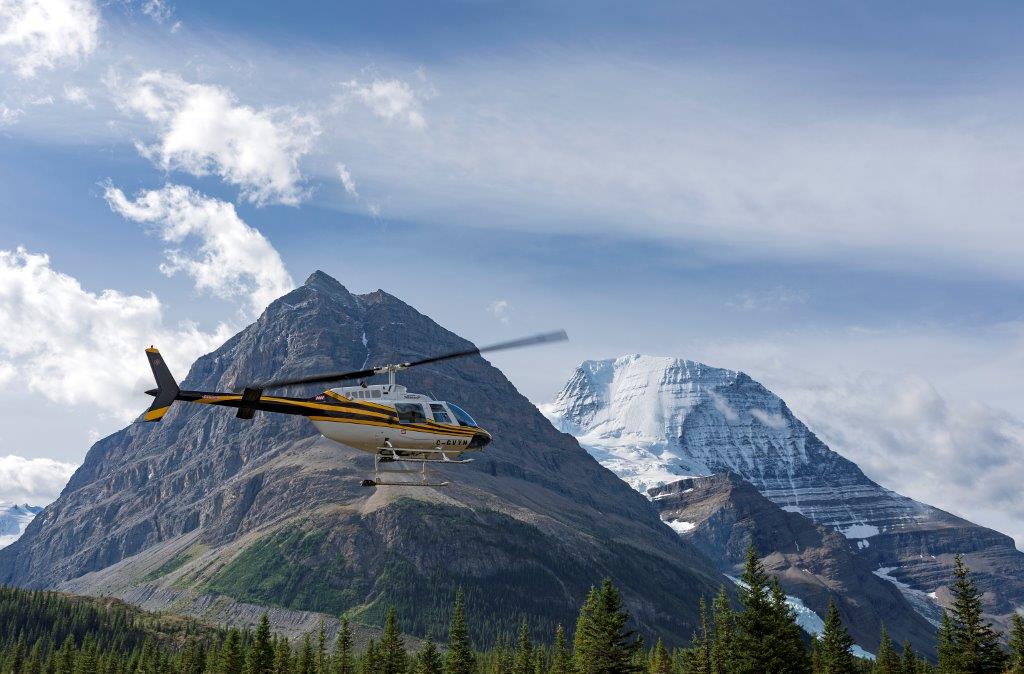
Whatever you get up to in Valemount this winter you will surely be moved by the magic of the mountains.
TIP: If you find this blog interesting why not subscribe to the enewsletter and never miss another story!
All visitors to the area who plan to venture out are strongly encouraged to educate themselves in avalanche awareness. For more information visit the Know Before You Go website, speak with a Tourism Valemount team member and check out the local webcams.
Note: Due to El Nino, the end of 2023 did not start out as a typical snow season in Valemount, and there was little snow in the community and at the lower lying areas such as Jackman Flats at that time. Check before you go regarding the condition of cross-country ski trails and ice conditions on Cranberry Marsh.
Tourism Valemount Visitor Centre
www.visitvalemount.ca; [email protected]
785 Cranberry Lake Rd, Valemount; (250) 566-9893
winter hours: Mon-Fri 8:30 am – 4:30 pm (closed 12:30 pm – 1:30 pm)
For more information on Valemount, read our summer article.
5 Ways to Enjoy Winter in Wine Country, Okanagan, British Columbia
As cooler temperatures emerge, and the snow blankets the vineyards, the valley transforms from a sun-soaked paradise to the ultimate winter destination. From champagne powder to frozen waterfalls to theatrical sleigh ride shows, the winter can be a magical time to explore the Okanagan.
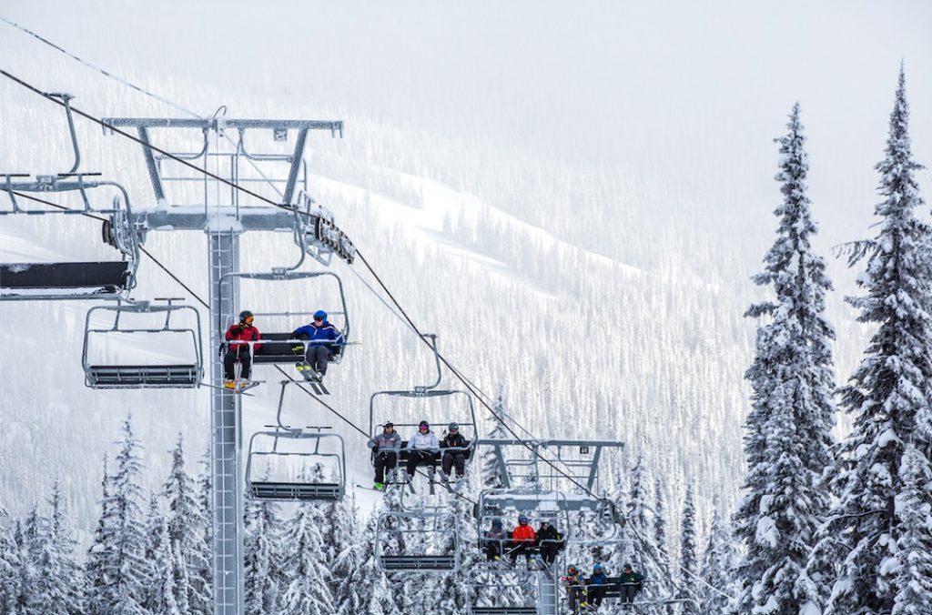
1. Take A Winter Road Trip
With surrounding mountains and expansive lake views, Route 97 through the Okanagan Corridor is one of BC’s top scenic drives. In the winter, the sweeping landscape is enveloped in glistening tones of white and blue. Be sure that your vehicle or RV is ready for winter and always check road conditions in advance of your trip.

2. Winter in Wine Country
The colder weather brings with it the perfect opportunity to enjoy the elegant, bold reds the Okanagan is so good at crafting. Try out the exceptional vintages garnering international attention, and raise your glass to the upcoming year. Check out one of the many events at the Winter Wine Festival.
3. Winter Camping
What could be more magical than waking up in a winter wonderland? Enjoy the warmth of a roaring fire with mulled wine in hand, unwind in the great outdoors, and try your hand at winter camping. With many RV Parks and Provincial Campgrounds open year-round, escape to the Okanagan for the ultimate winter getaway.
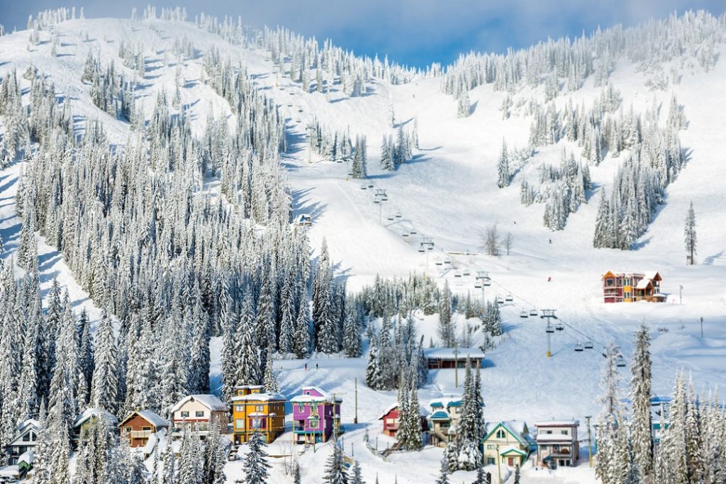
4. Ski Three Resorts in a Week
The Okanagan is home to a multitude of mountain resorts so you don’t have to travel far to hit the slopes. Known for unparalleled champagne powder, the mountains boast beautiful villages that will get you right into the festive spirit. And you don’t have to ski to enjoy the winter culture. From dog-sledding and ice-fishing to a horse-drawn sleigh ride to a rustic cabin in the woods – there’s an array of wonderful experiences for anyone looking to embrace the snow season.
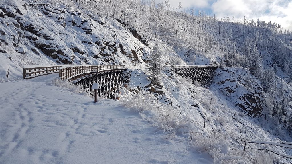
5. Snowshoe the Myra Canyon Trestles
Rent a pair of snowshoes this winter and explore the historic Kettle Valley Rail Trail. At Myra Canyon there are over 18 trestles and 2 tunnels to explore.
Whatever your winter preference this season, be sure to take a step back, enjoy the view, and welcome the festive charm of the Okanagan. To start planning your winter road trip visit route97.net. For more information on winter camping visit https://www.campingrvbc.com/winter/
TIP: If you find this blog interesting why not subscribe to the enewsletter and never miss another story!
For places to camp in BC this winter check out winter camping opportunities.
Share your BC travel and camping pictures using hashtag #campinbc, #explorebc
It’s always a great day to #CampinBC
RV Maintenance Tips for Winter Storage
Whether you’re new to the Trailer RV Lifestyle or a seasoned RVer, you’ll want to stay on top of maintenance so you can enjoy your Recreational Vehicle (RV) for many years to come. Exterior maintenance is a great place to start.

I have added my 10 top things to do prior to storing for the long winter months.
1. Wash your RV exterior

Hose off the loose dirt and grime, then, using a soft brush or sponge, wash the RV with specialized RV soap (found at most dealerships or automotive supply stores), a quick rinse with cold water will do the trick.
Tip: Before washing, remove the black streaks that appear around windows, doors, vents etc. I found this great product from Magic Boss – All Purpose Cleaner available at most Pool suppliers and Amazon (also works on those bugs that have dried on to the front of the trailer). Take extra caution around appliance vents when washing to prevent water from accessing the trailer.

2. Wax or apply a protectant to your RV exterior
Time to channel your inner Karate Kid and do the wax-on wax-off method. This can be a time-consuming task depending on the size of your RV, but it is well worth the effort. Make sure the exterior is dry before you start waxing and spot-test on a small area on any graphics or stickers before widespread application. Also, check to ensure that the wax is appropriate for use on the type of exterior on your RV as well. Apply a coat of good quality wax or protectant to your RV exterior. I waxed mine shortly after purchasing my trailer and it has certainly helped remove the bugs and bird poop after multiple camping trips, especially those pesky ones that splat on the front of the vehicle.
Tip: I now use Wax & Dry Spray Car Wax by Turtle Wax.
3. Clean your awning and keep it dry for storage
Before you roll up your RV awning for storage, clean it well by sweeping off all debris and wash with mild soap and water. Lubricate moving parts (in my case the awning pistons) with silicone spray. When you roll it up, ensure that the awning is in a locked position against the trailer.
Tip: Spray the awning with your cleaner solution and roll it back up and leave it stand for a few hours before reopening and rinsing off the cleaner. This gives the cleaner time to dissolve dirt and stains in the rolled-up position. It saves a lot of elbow grease as you do not need to scrub stubborn areas.
3.5. Batteries
Don’t forget to remove your batteries for the winter and put them on a trickle charger. Replace the battery casing lid to prevent water gathering in the box and freeze-thaw damaging the battery storage box.

4. Inspect any sealed areas thoroughly to prevent water damage and potential rodents gaining access
Your RV is in the elements day-after-day throughout all the seasons, you’ll want to make sure that your RV exterior including the roof, sides, edges, windows, doors, vents, end caps, moldings, compartments, and underside are sealed off and doing their job to protect the interior from potential water damage.
To prevent mice, or other rodents, look for any gaps, openings or areas with aged sealant and re-caulk if necessary. Make sure to use the appropriate sealant and when in doubt, ask your RV dealer or manufacturer for advice.
Tip: One interesting tip I picked up was placing scented dryer sheets in the corners of the RV to reduce bugs and keep spiders out (these work).
5. Lubricate all hinges, locks and moving parts
No-one likes creaky doors, windows or compartments. Lubricating hinges and moving parts with WD40 and all locks with a graphite spray lubricant is an easy maintenance step that takes only a couple of minutes. When I purchased the Denali, it had been stored and not used for the current season, so all the hinges squeaked.
Another often overlooked moving part is the rubber flanges and seals for the slide-out, compartment doors and windows. Every year, clean them and coat them with a protectant for rubber to keep them supple and working properly. Look for products that state RV Slide-out Rubber sealant conditioner.
6. Cover outside vents to keep critters (and condensation) away

Keep the insects out and prevent nesting by installing mesh or covers on outside vents (furnace, refrigerator, water heater) for long-term storage. Buy a proper A/C cover and cover your air conditioning unit to avoid condensation during storage.
My vents have a Max Air flow cover on them, and I have purchased a full breathable RV cover for the trailer and use this during the winter as I must store my trailer outside in all the seasonal elements of the lower mainland in British Columbia.
7. Open your vents
When your RV is not being used during the summer months, the inside living area can get up to 130F degrees depending on your location. That type of intense heat will cause even the toughest materials to break down and fail over time. Open your vents to let the air in. (But remember to keep the outside vents closed to keep the rain out!) I can keep my vents open as they have a Max Air cover but one that is not covered is a rain sensitive one and should automatically close when it rains (but I don’t rely on that, so I close it). Next year, I plan to put a Max Air cover on it like the others, to even out the venting.
I leave the vents open in the winter to allow airflow when the trailer is stored as we store the trailer from November to April with the cover on and the sun can heat the unit. Warm air holds more moisture (water vapour) than cold air. It also rises vertically so the vents allow the warmer air to exit with the moisture.
8. Lubricate your slide-out rails
Lubricate your slide-out rails a couple of times a year to stop rust and corrosion. You can find a can of lubricant spray specifically designed for this project for under $20. This is a much cheaper solution than replacing your slide-outs down the road! I always do this before I put the trailer to bed in the winter as well as coating the rubber slide-out seals with a seal product to protect the rubber.
9. Winterize the water system

Winterizing the water system inside is necessary for me as we encounter many days of minus temperatures in a row during the winter. I do not want the inconvenience of a burst pipe.
First, empty the hot water tank and the holding tanks. On my last camping trip of the season I always do a thorough sewage and grey water dump and clean the tanks. This process means that I only have residual water in the pipes, however for peace of mind I like to install the pink potable ani-freeze.

To do this, close off the bypass valve to the hot water tank and attach a hose to the water pump, the other end is placed inside the potable water jug. Then turn on the pump and it will pull the fluid from the jug. Open all the taps and flush the toilet while the pump is running to ensure the water exits and turns pink with the antifreeze. I use a four-gallon jug of potable antifreeze as my pipes stretch a long distance from the pump to all the taps and toilet in the trailer.
For the left-over antifreeze pour a small amount down each of the sink and shower drains. Before finishing reattach the system pipe to the water pump and then clean all the sink and shower surrounds to remove the pink anti-freeze and prevent staining.
10. Cover the RV

After you finish winterizing the RV, inside and out, it’s time to cover. Breathable lightweight covers are available from dealership stores and RV suppliers. Make sure you cover the tires too. Before covering the tires, I always check the pressures and wash the tires with protectant. Don’t forget the spare.

All the 10 steps mentioned will help protect your RV and make it ready for the first trip of the year.
For additional tips on maintaining your RV, Go RVing Canada has created a handy checklist of maintenance tips to keep your RV exterior in top shape.
TIP: If you find this blog interesting why not subscribe to the enewsletter and never miss another story!
Looking for camping and RVing accommodations in BC? Check out the camping map.
It’s always a great day to #CampInBC, #exploreBC
Sooke to Port Renfrew: A Day Tour to Experience the Rugged Pacific Coast on Vancouver Island, British Columbia
Whenever friends or family visit Victoria and want to experience the rugged west coast but only have a day while on Vancouver Island, a drive to Port Renfrew is the place I take them! Along the route are sandy beaches, panoramic mountains and ocean views, sea lion caves, tidal pools, surfing, hiking trails and a variety of places to dine.

The route from Victoria downtown follows Highway 1 to Exit 10 (View Royal /Colwood) onto 1A that becomes Highway 14 to Port Renfrew. Highway 14 is paved to Port Renfrew and if you don’t stop it’s a four-hour return trip. Traffic is light on this highway so enjoy the drive.
Along the Highway 14 route to Port Renfrew are many places to explore – it would take days to see them all. I’ll suggest a few must stops along the way and other places you may want to consider!!
First stop for me is Serious Coffee located just past the traffic circle on the left in Sooke. My favorite is the granola bar and lunch sandwiches which are available to go. There are a number of other options for food/beverages in Sooke.
Before you depart from Serious Coffee in Sooke set the trip odometer!!
At Muir Creek , just 13 kilometers from Sooke, there is easy access to the ocean. Turn left at the bridge into the parking lot. A flat easy access trail leads to Muir Beach.
Sheringham Point Lighthouse, a Canadian Heritage Lighthouse, is 18 kilometres from Sooke. The access road is between the Fire Hall and Shirley Delicious. Turn left on Sheringham Point Road and proceed 1 km to the parking lot on the right side where there is a short trail to the lighthouse. The site is open to the public daily from 9 am to 8 pm. Caution is recommended as the shore is exposed to high winds and rogue waves.
For lunch or dinner we often take firewood for a favorite meal of hot dogs roasted over the open fire at French Beach Provincial Park – just 3 kilometers past the Sheringham Point Road. Ocean access to French Beach is an easy walk just a couple of minutes from the parking lot. Enjoy the beach walk and keep an eye to the ocean for whales and sea otters, and bald eagles perched tree top.
At Kilometer 28 from Sooke is Sand Cut beach. The parking lot is on the left adjacent to the highway. The hike down is about 15 minutes through forest with boardwalks and stairs to the beach.
Past Sand Cut beach parking lot, the highway dips down to the ocean through Jordan River. Cold Shoulder Cafe is a few hundred metres from Jordan River Regional Park just past the bridge. It’s on the corner where the highway makes a sharp right turn.

Continuing on Highway 14 to Port Renfrew, the next stop is Juan de Fuca Provincial Park. The park has four main areas: China Beach day use, China Beach Campground, the Juan de Fuca Marine Trail and Botanical Beach. Originally the trail was a lifesaving link from the graveyard of the Pacific that saw many shipwrecks along this coastal area.
China Beach day use is at Kilometer 35 from Sooke. The trail to China Beach starts at the end of the parking lot to the left of the entrance road. Although a bit of steep walk down it’s about 15 minutes along a wide and well maintained path to the beach. Enjoy the Sitka spruce, Douglas fir and cedar trees along the trail and when walking the beach watch for seals, sea lions and whales. This park is also a trail head for the Juan De Fuca Marine Trail that extends 47 kilometres to Port Renfrew.
For a stunning panoramic view of the Olympic Mountains in Washington State and Juan de Fuca Strait, take the North Main logging road right across from the entrance to China Beach day use. Proceed carefully up this active logging road for 2.2 kilometers and turn off the main road for about 100 meters. Although narrow there is sufficient space to turn around and return to Highway 14. Enjoy the views high above the water! Return down the logging road and turn right to Port Renfrew.
Continuing along Highway 14 to Port Renfrew at Kilometer 59 from Sooke is the turnoff to Sombrio Beach. This cobbled beach is popular for winter surfing and wilderness camping adjacent to the beach. If visiting during the winter a 4-wheel-drive vehicle might be required but most of the time the access road to the parking lot is accessible by car.
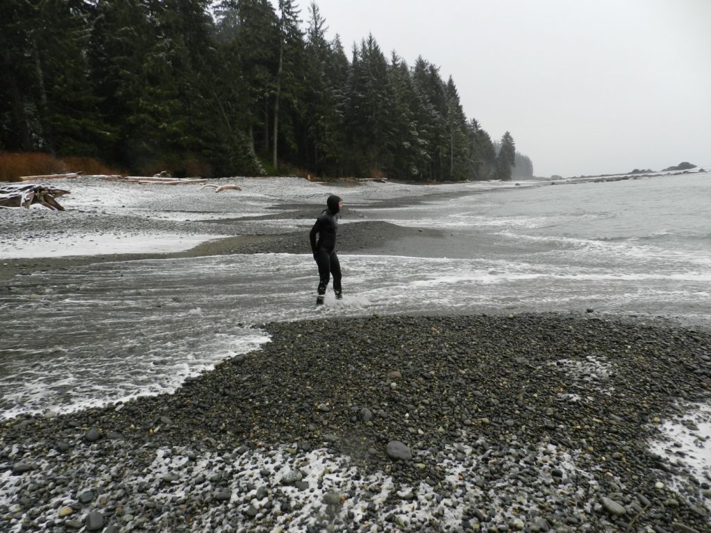
Proceed back to Highway 14, turn left and enjoy the short drive to Port Renfrew. If it’s summertime, and the flowers are blooming under the Welcome to Port Renfrew sign, stop as the humming birds may be feeding!!
Continue driving on Highway 14 as it takes you through Port Renfrew to Botanical Beach parking lot.
There is a coastal hiking trail along Botanical Beach that is the terminus of the Juan de Fuca Trail. The trail provides access to rugged beaches with geological rock features, and at low tide there are many rich tidal pools and kelp beds to view marine life. Explore the tidal area and see pools filled with brilliantly colored marine life. But remember to just view the marine life and avoid touching the water in these sensitive ecosystem pools. Sea urchins, barnacles, mussels, anemones and sea cucumbers are just some of the thriving intertidal life. I suggest “Seashore of British Columbia Guide” to identify mammals, fish, anemones, cucumbers, crabs and many other species.
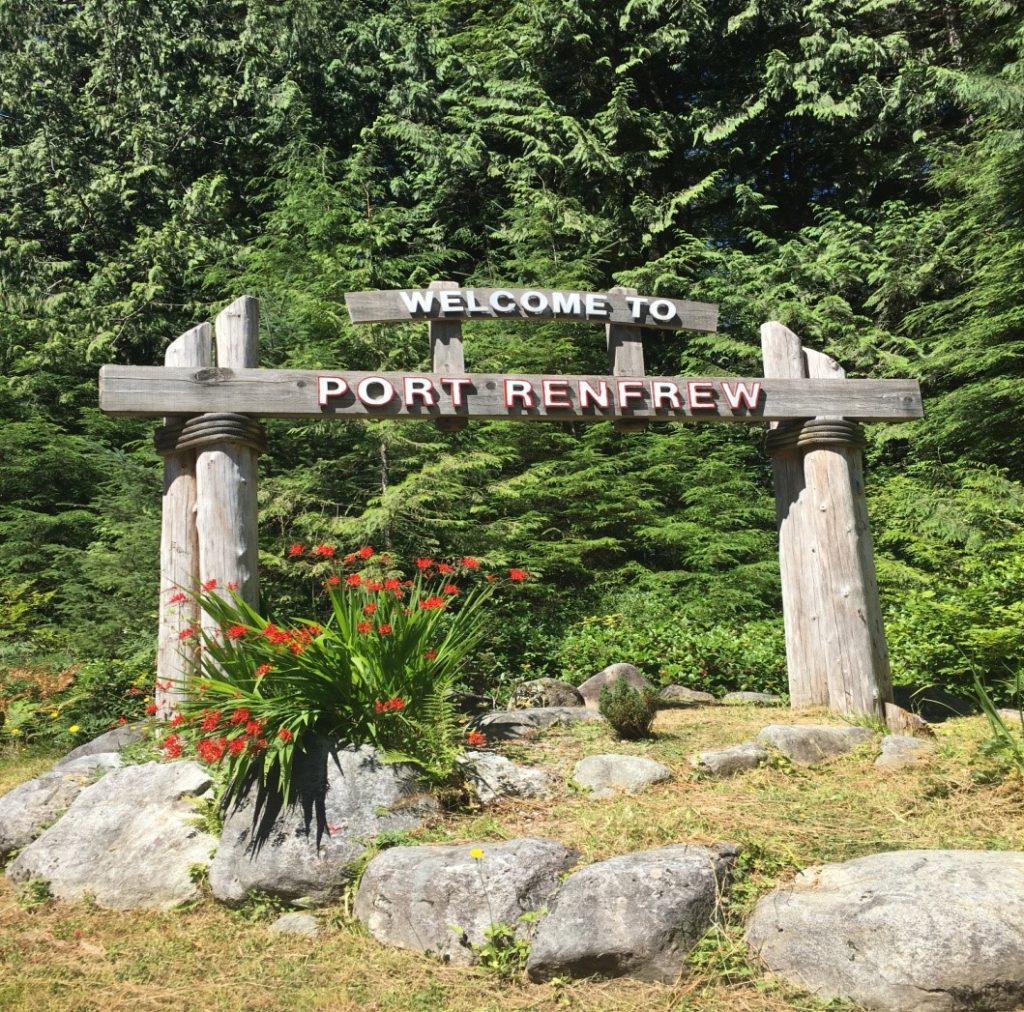
If you want to experience viewing at its best visit Botanical Beach during low tide. I suggest checking the tide table for Port Renfrew. It’s best to arrive at the Park at least 1 hour before low tide. The time of the low tide will obviously determine when you have to depart. Please keep in mind when exploring the beaches and pools to be aware of wave activity and increasing water levels should the tide start coming in while you are exploring!!
So take your lunch with you and find a spot on the beach. If you didn’t bring a lunch then enjoy some of the food offerings in Renfrew. I like Bridgeman’s West Coast Eatery located on the dock at Pacific Gateway Marina. Other activities include kayaking and salt water fishing.
Enjoy the rugged west coast drive.
TIP: If you find this blog interesting why not subscribe to the enewsletter and never miss another story!
Also, check out the Pacific Marine Circle Tour.
For places to camp on Vancouver Island and elsewhere in British Columbia go to Camping & RVing BC Camping Map.
Share your BC travel and camping pictures using hashtag #campinbc, #explorebc
It’s always a great day to #campinbc
Vancouver Island, British Columbia Off-Season Adventures
‘Canada’s Mediterranean’, is how I like to refer to Central Vancouver Island. It offers more year-round outdoor recreational opportunities in mind-blowing scenery, than I’ll ever have time to enjoy in one lifetime. But I’m trying– and the best part is that so many activities are absolutely free!

To get you started let me give you just a couple of very different ‘cool season’ activities on different parts of the Island, along with two fantastic year-round RV parks located close to each mini adventure.
Life’s too short not to visit the best places, right? So let’s start this Island winter season sampler with…
…a Waterfall!
Stocking Creek Regional Park
Nothing screams “Vancouver Island” like a waterfall– we’ve got the tallest one in Canada here, but the one I’ll show you today is near the popular year-round Country Maples RV Resort. Stocking Creek Falls is just south of the neat little town of Ladysmith—and you HAVE to see their downtown Christmas light up if you’re here during the festive season!!

The Stocking Creek Regional Park is the start of a tranquil 2km loop trail in a lush rainforest alongside the clear babbling creek that leads to the stunning viewing platform above the picture-perfect waterfall.
And if you’re nimble and sure of foot (although it’s not recommended for safety reasons), it is possible to get behind the waterfall and look out through the water curtain—it’s so loud back there!!!
Check out the video of the recent winter hike I took there with our RV Snowbirds. Love this park!
Groomed Trail Snowshoeing at Mt. Washington Alpine Resort
And my second ‘quiet season’ Island adventure, is to head up Island to the Comox Valley, and get your rig set up in another great RV park near the ocean – Seal Bay RV Park in Courtenay.
After setting up camp, it’s a short drive inland and up to Mt. Washington Alpine Resort, which borders world famous Strathcona Provincial Park, BC’s oldest park, and home to Canada’s tallest waterfall with a drop of 440 meters!

It’s also one of the few places anywhere that you can ski AND have a view of the ocean!
One of the things they brag about in the Comox Valley is that you can golf in the morning and ski in the afternoon!
Although there are exceptions to all rules, on the East Coast of Vancouver Island, the expectation is that white stuff stays on the mountains, while at sea level, anything that comes down from the sky is rain. I love snow, but I don’t want home delivery– except Christmas Eve.
These days, I head to Mt. Washington to relax. I leave the downhill skiing aside, and instead, pack a lunch and head to the beautiful Raven Lodge just below the ski hill overlooking the valley and Paradise Meadows (and it is!). There you can rent some snowshoes and get out for a couple hours exploring the groomed trails in this stunning location.
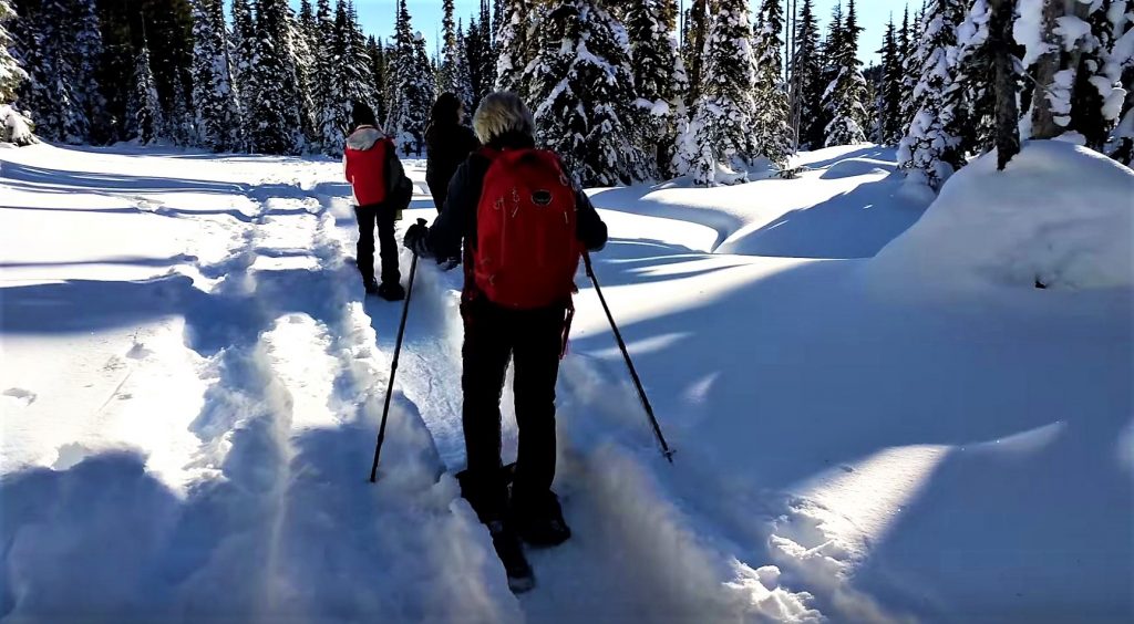
Of course, the crisp mountain air and ‘shoeing works up an appetite, so the perfect ending is to drop off the snowshoes and sit under the massive wood beams of the lodge, and park beside the fireplace in a big comfy chair and enjoy lunch. They make fabulous, well priced lunches, or you bring your own, and just purchase a glass of wine or a hot chocolate while telling stories or dozing by the fire and enjoying the view over the valley.
Check out the video – you want to do this – and if you haven’t tried the modern snowshoes, it’s as easy as walking!
45 minutes later, you’re back down in Courtenay, and just outside of town, the tranquility of Seal Bay RV Park welcomes you home. It even has a stocked fishing pond onsite!
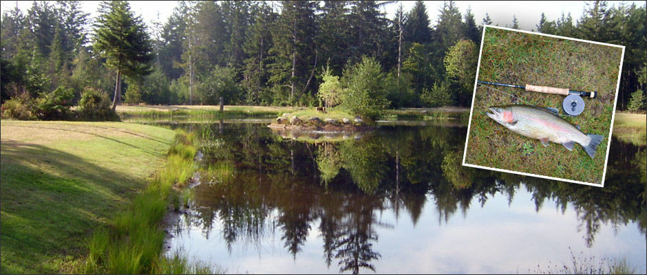
Visit Vancouver Island this Winter and Stay Awhile!
As I said, winter and summer sports are possible on the same day in Canada’s Mediterranean! While the rest of Canada deals with real winter, if you have an RV, you can still stay in Canada where your dollar goes farther, enjoy the lower off-season monthly RV park rates at award winning parks, and have an active lifestyle with endless adventures.
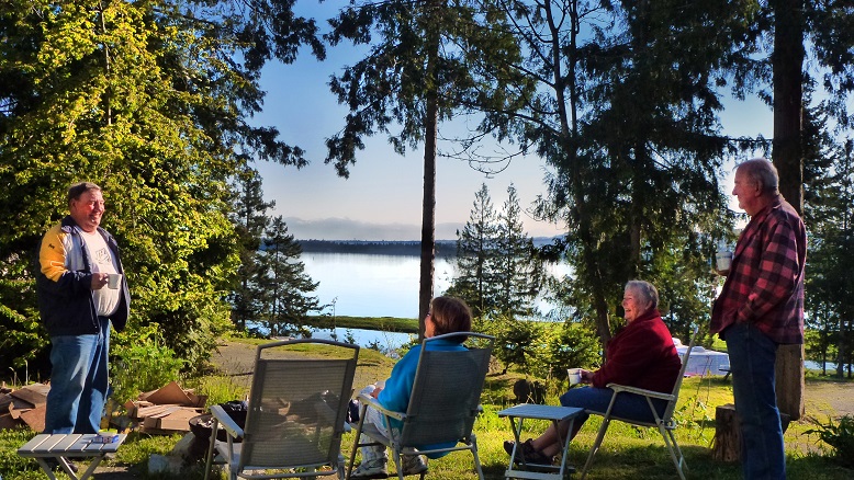
Special Places Google Map Makes it Easy
Visit my ‘Vancouver Island Special Places’ Google Map, and use your favourite digital device to find other amazing places to see and things to do on Vancouver Island. The map currently has over 60 different placemarks of ‘must see places’ and is growing.
The placemarks on the map for each location are colour-coded to indicate the activity level or fitness level needed to explore. Green ones are easy, Yellow a bit more challenging, then Blue, then Red. Clicking on a placemark will open a window of information about the spot, with a short write-up, and links to photos and videos showing you why each place is a jewel.
TIP: If you find this blog interesting why not subscribe to the enewsletter and never miss another story!
This winter, don’t hibernate—activate!
If this area interests you, check out our drive:
From Coast to Coast on Vancouver Island: Vancouver to Tofino
For other places to camp in the winter, plus more winter blogs and how-to information go to Winter Camping in British Columbia.
Share your BC travel and winter camping photos using hashtag #CampinBC
It’s always a great day to #campinbc
Osoyoos & Oliver, in the Okanagan, British Columbia – Offers Plenty To Do in the Summer

Osoyoos Oxbows
For a unique British Columbia experience, head to Canada’s only true desert destination: Osoyoos. Located at the southern end of the Okanagan Valley, Osoyoos averages over 2,039 hours of sunshine every year and temperatures regularly hit the upper 30s in July and August. Fruit and wine abound, making Osoyoos an ideal summertime vacation destination.
To maximize your time in Osoyoos, it is important to take the temperatures into consideration. Start your day early at the Nk’Mip Desert Cultural Centre to learn about the unique ecosystem that makes up the traditional territory of the Osoyoos Indian Band. After taking in the indoor exhibits, head outside (bring water and sunscreen!) and wander through over two kilometres of maintained trails complete with interpretive displays featuring everything from local flora and fauna to a reconstruction of a traditional village. Take the time to complete the upper portion of the loop through the hillside of wild sage and antelope brush – the views are spectacular.
If the heat during your walk at the Cultural Centre gets too much for you to bear, head to Osoyoos Lake which is known for being the warmest freshwater lake in Canada. Sẁiẁs (Haynes Point) Provincial Park is the perfect place to unroll your beach towel for a swim or simply to nap in the sunshine. If walking is more your speed, the park is also home to a lush wetland habitat and an interpretive trail through the marsh will delight birdwatchers of all ages.
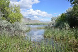
Haynes Point Wetland
Once you have soaked up the sunshine at the beach, head for town and stop for some of the Okanagan’s best gelato at Roberto’s Gelato. Recommended flavours include Okanagan Apricot, Kulfi (Pistachio & Cardamom), Mango, and Chocolate Hazelnut.
In the afternoon, visit the Rattlesnake Canyon, a mining town themed amusement park complete with mini golf, go-karts, a rock-climbing wall, bumper boat, and the Tornado swing chair, which provides a great elevated view of Osoyoos.
If you are still seeking activity as the day goes on, consider heading to the Osoyoos Oxbows – a unique wetland ecosystem formed in the 1950s when the Okanagan River was straightened. Read about the Oxbows at the outdoor kiosk, and then meander along the trail listening for sounds of diverse migratory and resident birds. If you are really ambitious, bring your bicycle and cycle the 18-kilometre International Bike and Hike Trail heading north which runs parallel to the Okanagan River channel.

Oliver Winery
A 20 minute drive north is the town of Oliver. Described as the “Wine Capital of Canada” thanks to the more than 35 wineries that surround the town, Oliver is known for it’s abundant orchards, spectacular vineyards, and arid climate.
It is hard to speak about Oliver without speaking about wine. I am always particularly taken with wineries with unique attributes, and a few of my favourites are definitely in Oliver. Platinum Bench Estate Winery & Artisan Bread Co. forever has a place in my heart thanks to their pairing of great wine with amazing artisan bread baked on site. For me it is a toss up between their Gorgonzola & Fig and Double Cream Brie & Pear varieties. Delicious.

Kismet Winery, Oliver
If a laid back lunch is what you are after, without a doubt you need to visit the Masala Bistro at the Kismet Estate Winery. The location is convenient and the patio, from which you can sample very, very good Indian food, offers gorgeous views over the vineyards. I have to admit, when I was at Kismet there was a long line at the tasting bar so I skipped that part entirely and headed straight for the most perfect samosas I have ever tasted. The wine will have to wait for my next visit, I suppose!
If you have some time to spend in Oliver and you love the outdoors, a hike up McIntyre Bluff does not go amiss. Leaving from Covert Farms – a 650-acre organic farm and vineyard on a plateau north of Oliver – the McIntyre Bluff trail departs right from the wine shop. Parking is well marked and there is a trail log you can sign before you leave. The route heads through the Covert Farms property before starting uphill. The trail has a mostly gradual elevation gain over the next 2.5 kilometres, at which point you arrive at Rattlesnake Lake.
After Rattlesnake Lake, the trail first descends and then ascends more rapidly over the next few kilometres. Eventually the trail levels out and there is a short ridge walk before the view opens up and you are left breathless not from the climb but from the scenery. From the summit, views stretch south over Covert Farms, Oliver, and beyond. To the east, the cliff edge plummets over 850 feet to the valley bottom below. To the north, Vaseux Lake gleams. The entire trip took us about 3.5 hours and is perfectly rounded out with a stop at Covert Farms for wine tasting, a charcuterie board featuring farm-fresh products, and a wander around the property. With a little planning, and plenty of water and sunscreen as the trail is mostly exposed, McIntyre Bluff makes the perfect adventurous addition to any Oliver vacation.
Osoyoos and Oliver are the perfect places to kick back and relax in the sunshine for a couple of days while still offering a variety of activities that will be sure to keep the whole family entertained.
TIP: If you find this blog interesting why not subscribe to the enewsletter and never miss another story!
For places to camp in the South Okanagan and elsewhere in British Columbia go to Camping & RVing BC Camping Map.
Post your BC travel and camping photos using the hashtag #CampinBC
Exploring North Vancouver Island, British Columbia – Port McNeill & Port Hardy to Coal Harbour & Cape Scott
After a busy first-four days we moved campsites from Alder Bay RV Park and Marina to Cluxewe Resort, located just 15 minutes north of Port McNeill. Cluxewe Resort is centred on the ancestral land of the Kwakiutl First Nation and is indigenous owned and operated by the friendliest helpful staff. This resort is open year-round with lots of camping options (ocean front, full service, no service etc.) and cottages available for rent. We walked for hours on the rocky beach in each direction of the resort, enjoyed beautiful sunsets and watched campers fishing for salmon off the shore.

From our new homebase, we headed over to Coal Harbour (no, not the one in Vancouver). It was a short 30-minute drive from the campsite on paved roads. Coal Harbour is located on Quatsino Sound which provides boat access to communities such as Holberg and Port Alice. It is a busy harbour with float plane and boat traffic.
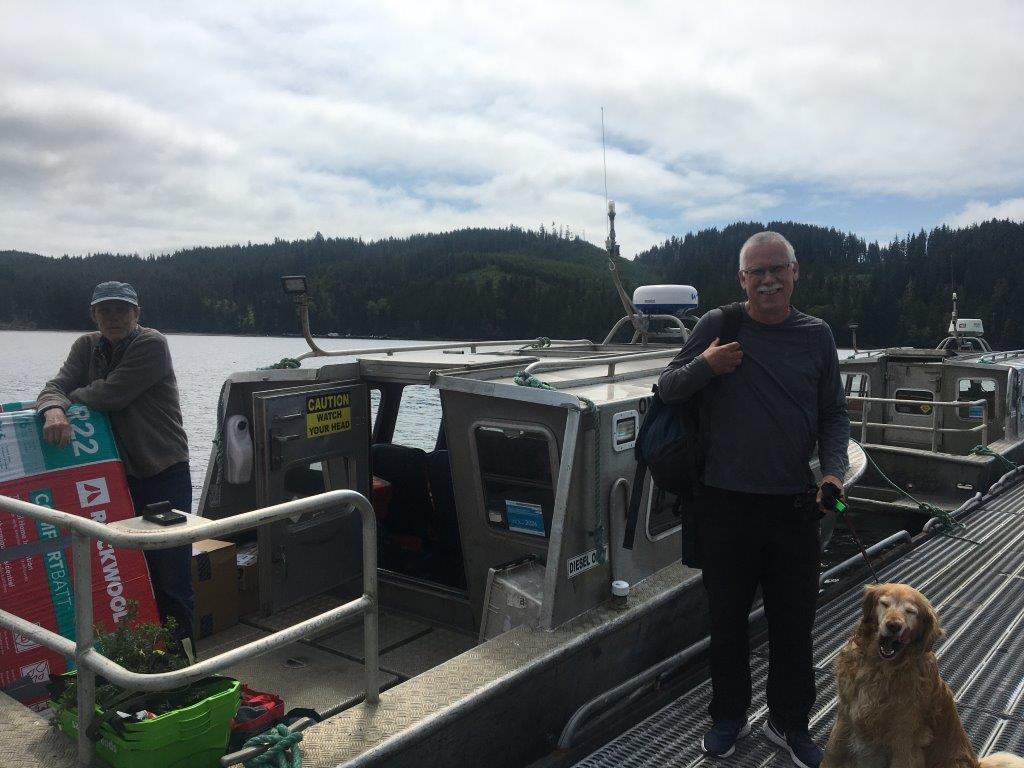
We took the mail boat over to Quatsino from the dock in Coal Harbour, a small boat-access-only community with a population of only 43. The “mail boat run” delivers mail on Mondays and Thursdays, costs $25pp, and is about a one-hour trip.
After our boat ride to Quatsino, we visited the museum in the Float Plane Hanger by the dock. We learned all about its whaling history; the industry closed in 1967 due to declining stock. It also has a history of being an air force base during World War 2, a mining town (it had a 350 metre deep open-pit copper mine which closed in 1996) and now focusing on logging, tourism and fishing. The museum has a huge 6 metre jawbone of a blue whale, apparently the largest in the world! We also checked out the chain saw display, old engines and a 1917 Ford Model T and a 1928 Ford Model A.
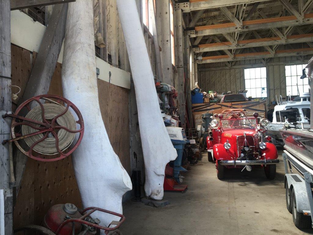
The next morning, at about 10:00 am, we headed off on our day-long trip to Cape Scott Park on the northern tip of the Island. Be prepared for 65km each way on a dusty, bumpy logging road. We have a 4-wheel drive truck which handled the roads well, but also passed a number of low-clearance cars which also seemed to be safely navigating the road. The road was in fairly good condition as much of it had been recently graded; but from what I had read, conditions are constantly changing. There are also lots of warning signs as this is an active logging road, and the logging trucks have the right-of-way. We were incredibly impressed by the accurate signage all the way to the parking lot at Cape Scott Park.

First stop on our trip was the small village of Holberg (population of 35), about 50km along the road. At one time Holberg was a floating logging camp; now, just the remnants of the old wood pilings can be seen on the inlet. A must-stop is the Holberg Pitstop; it is a general store and features lodging. You can stock up on everything from sunscreen to beer and stay overnight in one of the newly-renovated rooms. Next trip we will definitely stay overnight, so we can explore more of the west coast area.

After the “pitstop” we continued on our way to Cape Scott Provincial Park; we were impressed with the road improvement after Holberg (or maybe we were just getting used to the bumps). We arrived at the parking lot around noon with a few spots left and headed off on the trail to San Josef Bay, a 45-minute one-way hike along a well maintained crushed-gravel trail. There are pit toilets at the trail head, as well as, at San Josef Bay. There are also bear caches at the bay and a number of beach-side campsites. We planned ahead so we arrived at low tide, so we could walk from San Josef Bay to Second Beach. It was a gorgeous, sunny day and we loved walking in the shallow surf on the beautiful, soft, sand. Beach features included caves, sea stacks, and wildlife. Other hikers continued along the full 26km Cape Scott Trail.
After our visit to San Josef Bay, we returned to Holberg and the Scarlet Ibis Pub for nachos and a nice, cold drink on the patio overlooking Holberg Inlet. Known for being Vancouver Island’s Most Remote Pub, we found the staff incredibly friendly and the food, good. It was great to sit on the patio with the locals and learn more about the area.
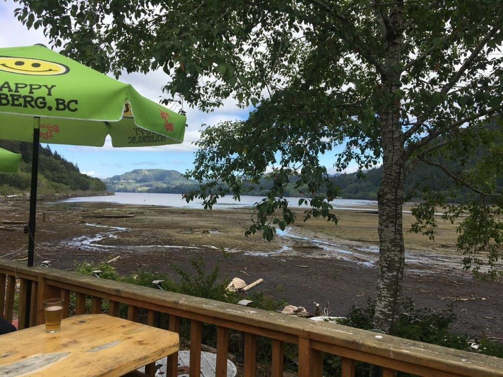
Last stop before heading back to our campsite was the car wash just south of Port McNeill to get our dusty truck cleaned up and ready for our last adventure day before heading home.
The next morning, we went to Storey’s Beach on Beaver Harbour Road just south of Port Hardy. The tide was out, and we felt like we could walk for miles on the blackish sandy beach. This is a beautiful stretch of sand that I would highly recommend. It is good for kayaking too.
TIP: If you find this blog interesting why not subscribe to the enewsletter and never miss another story!
We spent the rest of the day enjoying the beach and sunset back at Cluxewe Resort and some barbequed salmon from Scarlet Point Seafoods in Port Hardy. A great way to finish off our North Vancouver Island trip!
To read about the first half our trip go to Sayward to Port McNeill.
For camping accommodations in this area and elsewhere in British Columbia check out the Camping Map.
Share your BC travel and camping photos using hashtag #campinbc #explorebc
It’s always a great day to #campinbc
Exploring North Vancouver Island, British Columbia – Sayward to Port McNeill
After years of camping on Vancouver Island, we decided this summer we would head to the north end of the island. The furthest north we had travelled was Campbell River and we really wanted to explore more remote locations.
In 8 days, we travelled north from Campbell River to Port Hardy and west from Port Hardy to Cape Scott Park. We explored communities such as Sayward, Telegraph Cove, Port McNeil, Port Alice and Port Hardy and many smaller communities in between. If you are looking for a camping trip filled with beaches, cooler temperatures, small remote communities and abundant wildlife then keep reading, we found it all.

Our first stop was the Village of Sayward, located about an hour north of Campbell River. Sayward is home to about 350 people with logging being a very prominent industry. Locals describe Sayward as a remote hidden gem that stays green most of the year due to the high amounts of rain. Plan to spend some time at Kelsey Harbour watching the sea lions, kayakers launching their boats and the logging operations in the bay. Western Forest Products operates a dry land log sort; this was something new for me to see the logs being dumped into the bay and the tugboats moving them around. I was surprised to see how the tugboats lean way over in the water without tipping over.

Before leaving Sayward, we made a quick stop at the unique Cable Café which was unfortunately closed at that time, but it is worth having a look at as its outside walls are covered with logging cable.
If you are interested in seeing the Dry Land Log Sort in action check out this video https://www.youtube.com/watch?v=PqkI-C82I1A

Moving north from Sayward, we stopped at the Keta Lake rest stop for a picnic lunch. It was a great shady place to stop with 4-5 picnic tables, outhouses and a couple of trails down to the lake.

Next stop was the community of Woss in the Nimpkish Valley (75km north of Sayward), home to the longest working railway in North America. We visited the Woss 113 Heritage Park celebrating 100 years of railway with interpretive signs describing the history of the town, the link to the logging industry and the railway. Locomotive 113 is on display, which is a steam engine that was built in 1920 in Portland and restored in 1988. The town has cell service, as well as two different types of electric-charging stations.

Next stop and our home for the next four nights was Alder Bay RV Park and Marina. Alder Bay is located just south of Port McNeill, open year-round with over 80 sites which are suitable for big RVs, as well as campervans and tents. Positives about this RV park include the super clean bathrooms, 8-minute showers for only $1 and the beautiful sunsets.
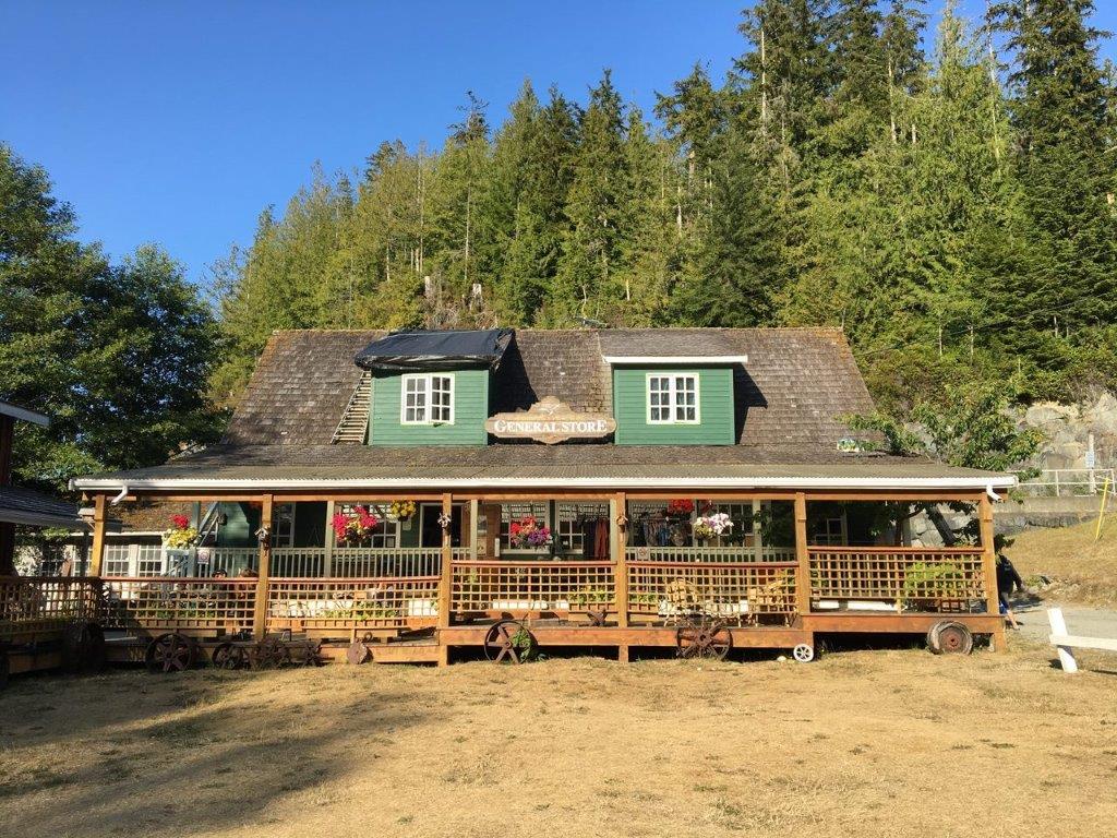
We had four jam-packed days while we stayed at Alder Bay; we spent an evening walking the boardwalk at Telegraph Cove and enjoying the setting sun. It was the perfect time for us to avoid the daytime crowds of tourists and those arriving for whale-watching trips. The General Store (established in 1942) is a welcoming business by the boat launch with all kinds of amenities including local products and wine/beer. Along the boardwalk are many of the original cabins which have been restored and available for vacationers to rent through Telegraph Cove Resort. It was fun to walk along the boardwalk and read the historic stories in front of each of the cabins. The Whale Interpretive Centre is located at the end of the boardwalk, just past the pub and restaurant, a must see for our next visit as it had closed at 6:00 pm.

The next day we headed over to Port Alice, about an hour’s drive (paved road) from our campsite. Port Alice was named after Alice Whalen, mother of the four Whalen Brothers who founded the Whalen Pulp and Paper Company which built a pulp mill in Port Alice in 1917. After exploring the town and the 3km Sea Walk along the water we headed inland on the Alice Lake Loop to the Devil’s Bath Cenote, Canada’s largest cenote (unfortunately, no swimming access) and the Eternal Fountain, a stream with a beautiful waterfall that disappears into an underground cave. Both were accessible by logging roads and have short walks through the forest (pick up a map at the Port Alice Visitor Centre or use Backroad Maps).

After a rest day, we took the ferry from Port McNeill to Alert Bay (Cormorant Island) and Sointula (Malcolm Island). Check out the blogs written about Alert Bay – Island Hopping on Northern Vancouver Island, BC: Port McNeill to Alert Bay and Island Hopping on Northern Vancouver Island, BC: Port McNeill to Sointula.

Highlights at Alert Bay were the indigenous masks and beautiful drums at the U’mista Cultural Centre and at Sointula, the old buildings and the Beautiful Bay Trail at Bere Point Park. A little tip – you can visit both islands on the same day if you let the terminal attendant know, without double the fares!
Overall, an excellent first four days into our North Vancouver Island camping adventure!
For the second half of our trip see Port McNeill & Port Hardy to Coal Harbour & Cape Scott.
TIP: If you find this blog interesting why not subscribe to the enewsletter and never miss another story!
For camping accommodations in this area and elsewhere in British Columbia check out the Camping Map.
Share your BC travel and camping photos using hashtag #campinbc #explorebc.
Travel Scenic Highway 23 North of Revelstoke, BC to Mica Dam & Begbie Falls
In 2020, we decided to explore a region of British Columbia which was new to us. We have camped extensively throughout Vancouver Island, the Interior, Okanagan and the Kootenays but had not camped in the area north of Revelstoke.
Highway 23, north of the city, was the start of our adventure. With no camping reservations this time, our first two nights were at BC Forest Recreation sites on the shores of Lake Revelstoke. Our first night was at Wadey which has 30 sites and is located about 25 kilometres north of Revelstoke, and then our second night was at Carnes Creek (the south campsite), 11 kilometres further north. Carnes Creek was my favourite, probably because I really liked our site which was overlooking the lake. Carnes Creek has two campgrounds, the south location which has 27 sites and the north with 19 sites and a boat launch.

From Carnes Creek, we did a day trip north up the scenic Highway 23 for about an hour to the Mica Dam. It was such a beautiful paved road, winding its way along the lake and very little traffic. Being married to a retired Socials Studies teacher always proves to be educational! My personal tour guide was quick to educate me about the dam and its history. Located 135 kilometres north of Revelstoke, its water flows from Kinbasket Lake south through the dam into Revelstoke Lake. It took six years to build and opened in 1973 as part of the 1964 Columbia River Treaty; it is the tallest dam in Canada and is operated by BC Hydro.
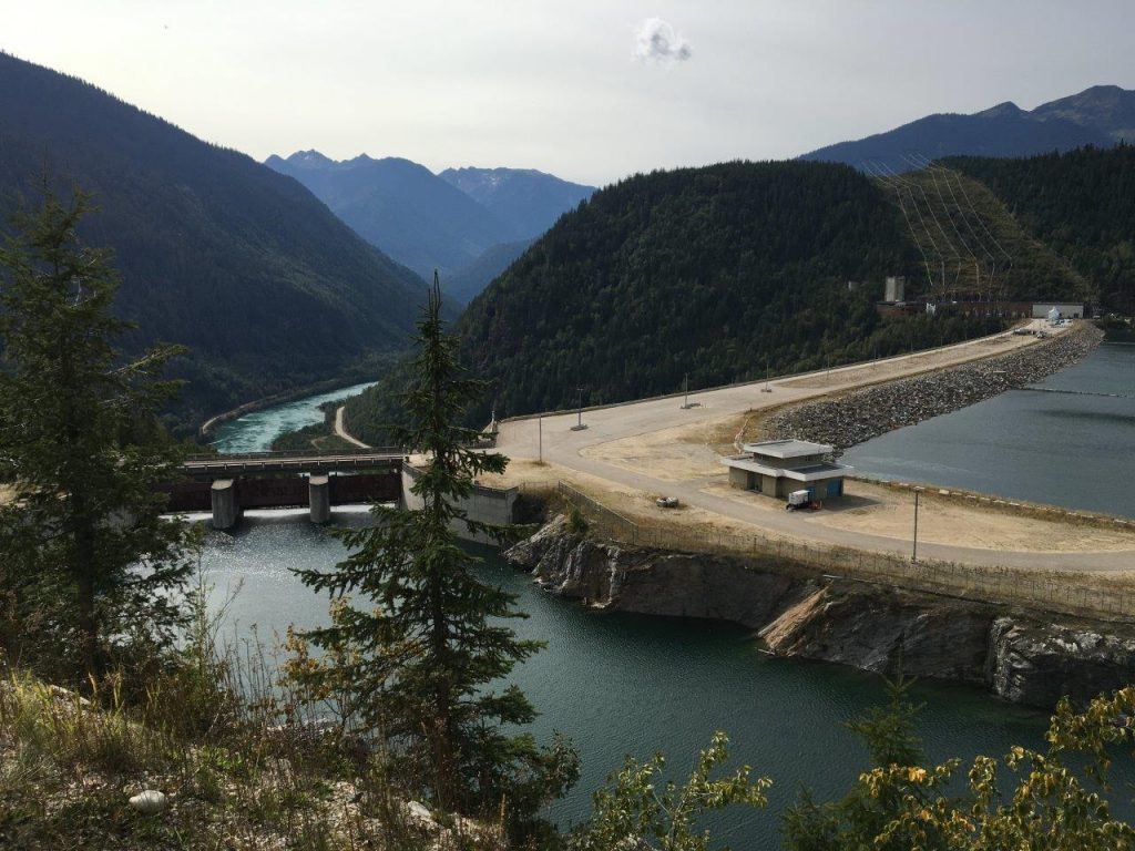
Just before you reach the dam, you will see the old village of Mica Creek which had a population of 4,000 workers and their families when the dam opened. It is a pretty impressive, lake-view site which even includes a swimming pool, golf course, curling rink and an old ski chalet. It also had a high school which closed shortly after the dam was built. Most of the buildings of the old town site are still being used by the dam maintenance employees.

Before we left Carnes Creek, we paddled our kayaks along Revelstoke Lake, under the bridge and up the actual creek. It was a beautiful, calming paddle with the current gently pushing us back down when we were done.
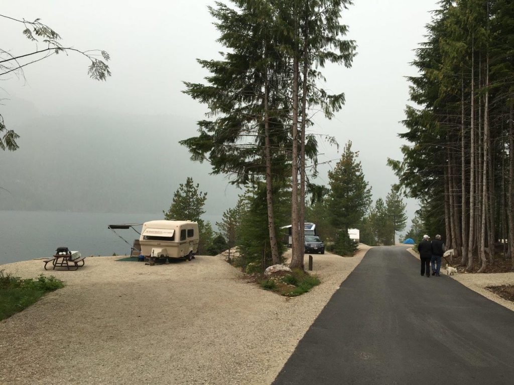
After camping at Carnes Creek, we packed up and moved to Martha Creek Provincial Park (18 kilometres north of Revelstoke). This is a very popular and impressive park; it has lots of sites; 29 of them were new in 2019. It has a very large picnic area, great beach and is attractive to anglers.

On our way home we stopped for a hike at Begbie Falls (about 10 minutes south of Revelstoke on Highway 23). What a lovely hike! The trail winds its way through the trees down to the falls and to Upper Arrow Lake. Not only did we get to see the falls and the beach, but the salmon were also spawning (September). There are different trails you can use but we accessed the trail-head through the Begbie Falls Recreation Site, located at the end of the Begbie Falls Forest Service Road. This access point was a gentle downhill to the beach and falls and not too long.
TIP: If you find this blog interesting why not subscribe to the enewsletter and never miss another story!
We are definitely looking forward to our next camping trip anywhere along Highway 23, such a beautiful part of our province!
For camping accommodations in this area and elsewhere in British Columbia check out the Camping Map.
Share your BC travel and camping photos using hashtag #campinbc #explorebc #bcnice.
Bridge Lake Ice Caves in British Columbia’s Cariboo: A Cool Place to Visit on a Hot Day
On a recent trip to Bridge Lake Provincial Park (read our blog), we took a day trip to a nearby destination we had read about that seemed too good to be true on a sweltering Cariboo day – the Bridge Lake Ice Caves.
Now, if you are picturing ice caves in the traditional sense, a glistening and icy blue arch, you will be disappointed. But the Bridge Lake Ice Caves have an even more interesting heritage. A Recreation Sites and Trails BC location in partnership with numerous local organizations, the Bridge Lake Ice Caves highlight a unique geological feature of the Bridge Lake shoreline. The annual freeze/thaw process, coupled with ongoing erosion, has created a shoreline full of crevices into which the annual snowfall melts and refreezes into ice. In the bottom of these caves and crevices, the ice remains cold and persists well into the summer, if not year round.
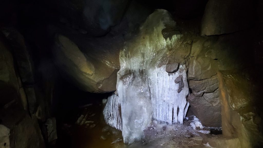
When we visited in mid August, it was plenty hot walking the trails around the rec site, but when we descended towards the ice caves the air became cooler and cooler the further we descended. Several of the crevices we looked in contained nothing more than moist rock walls and cool temperatures, but in two areas in particular we were able to find actual ice.
According to the interpretive signage and the Recreations Sites and Trails BC website, local historians and storytellers have shared that the ice caves were used by both local First Nations and early European settlers to harvest ice to preserve food and to keep cool.

While the ice caves themselves are cool (both literally and figuratively!), the government of BC and local community organizations have done an excellent job of developing a family-friendly rec site in the heart of the Cariboo. The site has several trails named after local wildlife. On our trip we walked the Low Mobility Wolf Trail, the Beaver Trail, the Coyote Trail, and the Owl Trail. The trails are marked with totems, and represent the animal on whose trail you are travelling.

The low mobility Wolf Trail is a 0.5 kilometre, hard packed, low-grade, gravel nature trail leading from the parking lot to two viewing platforms (one of which is wheelchair accessible) overlooking the ice caves and Bridge Lake. Along the trail there are several outdoor workout facilities, including a balance beam to hop over, a push up/pull up station, and a zig-zag balance walk. At the end of the Wolf Trail there is a serious flight of stairs to run up and down for those looking for more cardio. The workout stations along the Wolf Trail are called Otter, Raven, Loon, and Eagle and each is marked with a totem.

From the end of the Wolf Trail we descended the stairs to the Beaver Trail. The Beaver Trail hugs the lakeshore and is a much rougher trail than the Wolf Trail. Next, we headed up the Coyote Trail, which was very steep and rough. This brought us to the ice caves area where we enjoyed the view and explored. To head back to the parking lot, we took the Owl Trail, which was again wide, flat, and hard packed. Along the trail there were excellent viewpoints of Bridge Lake and plenty of benches to take a break if needed.

When I first heard about the ice caves, the picture that popped into my head turned out to be completely inaccurate to what we experienced. In reality, the Bridge Lake Ice Caves recreation site provides an excellent series of walking and hiking trails. There are beautiful views over Bridge Lake and the ice caves themselves are fascinating both geologically and historically.
TIP: If you find this blog interesting why not subscribe to the enewsletter and never miss another story!
For campgrounds in this area and elsewhere in British Columbia check out the Camping Map.
Share your BC travel and camping photos using hashtag #campinbc #explorebc
It’s always a great day to #CampInBC
Green Lake Provincial Park in British Columbia’s Cariboo is a Great Destination for a Camping Holiday
Green Lake Provincial Park is a series of sites surrounding 14-kilometre long Green Lake in British Columbia’s South Cariboo. Of the park’s eleven locations, six have facilities for visitors.
The park contains three vehicle accessible campgrounds: Arrowhead, Sunset View, and Emerald Bay. On our most recent trip to Green Lake Provincial Park, we stayed at the Emerald Bay campground, which offers a mix of single and double campsites. We were very fortunate to get one of the waterfront sites, which was lovely as we almost always travel with our kayaks and we were able to keep our kayaks on our own little beach! The 51 sites at Emerald Bay are spacious and generally private, but there are a limited number of waterfront sites, and those that do have direct access to the water often have a steep trail as the access. The Arrowhead campsite, in contrast, contains 16 high-density sites. While you are undeniably close to your neighbours, your site will also be directly on the water with extremely easy access.
The Emerald Bay and Sunset View campgrounds, in addition to two other sites, Blue Spring and Little Arrowhead, all have day use facilities. Emerald Bay and Sunset View have lovely picnic shelters and all sites have picnic tables. These sites are all great options for a day at the beach!
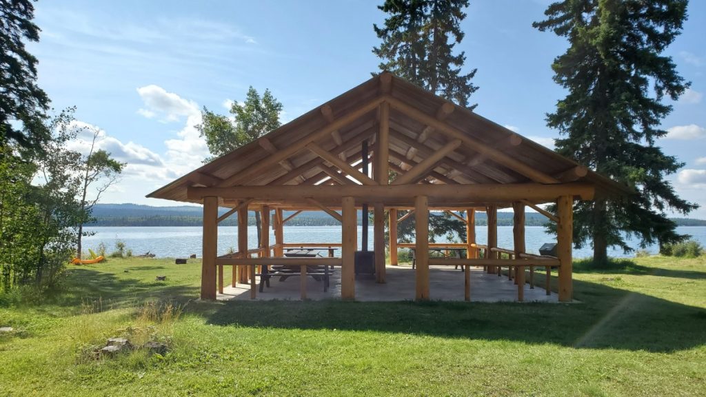
Green Lake is known for its warm, greenish coloured water. Despite only being 14 kilometres long, Green Lake has about 57 kilometres of shoreline. The lake contains numerous small islands and peninsulas, which makes it a perfect destination to explore by kayak. Paddling from the Emerald Bay campground to the Arrowhead Campground is a nice day trip of about 17 kilometres round trip. Along the way, paddlers will pass by the Black Bear and Little Arrowhead sites. Another lovely paddle is from the Emerald Bay campsite across the lake to the Nolan Creek site, then down to the Green Lake Islands site. When paddling on Green Lake, it is important to be prepared for rough conditions, as the lake tends to get very windy in the afternoon. A life jacket is a must and all paddlers should be prepared in case of an unexpected swim.
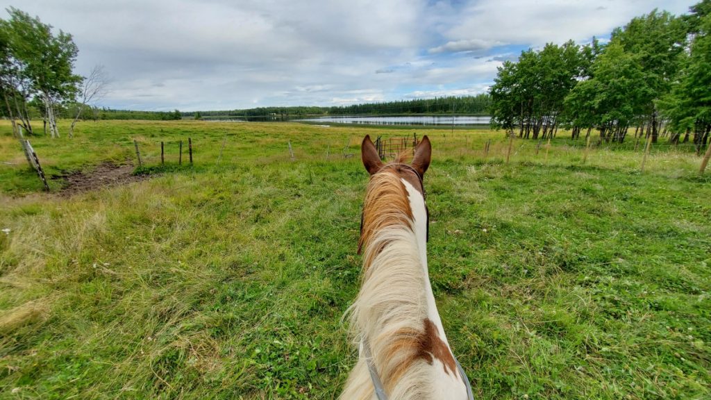
The area surrounding Green Lake is excellent terrain for cycling and horseback riding. On our trip, we did a guided horseback trail ride at a nearby lodge and guest ranch, which was a great experience for this nervous rider. My dad, on the other hand, prefers to cover his distance in the South Cariboo by bicycle, and enjoys nice long road rides while camped at Green Lake.

Green Lake Provincial Park makes a great basecamp for exploring the region, and a few highlights include nearby Chasm Provincial Park, the Bridge Lake Ice Caves, driving to Lone Butte to see the historic water tower, and checking out the many other lakes in the area, including Bridge Lake .
Visiting Green Lake Provincial Park each summer is a tradition for many families. The park offers perfect beachfront relaxation with excellent recreation opportunities both on and off the water.
TIP: If you find this blog interesting why not subscribe to the enewsletter and never miss another story!
For campgrounds in this area and elsewhere in British Columbia check out the Camping Map.
Share your BC travel and camping photos using hashtag #campinbc #explorebc
It’s always a great day to #CampInBC
Summer in Valemount, British Columbia: Where the Mountains Move You
Imagine standing in the middle of a town with a view of three snow-capped mountain ranges. Welcome to Valemount in east-central British Columbia, a village with stand-out summer adventures and activities.
Just over an hour west of Jasper, Alberta, Valemount is in the Robson Valley, situated along and east of Highway 5 (Yellowhead Hwy) and nestled between the Rocky, Monashee and Cariboo mountains (to the east, south and west). It’s a municipality with a big heart – and venturesome residents eager to show visitors what their playground is all about.
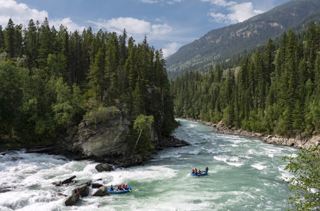
The land that would become Valemount is in the traditional territory of the Secwepemc Nation, Simpcw territory. The name Valemount was coined for the Canadian National Railway station there in 1927, and to this day it has a ViaRail station. It’s the nearest community to BC’s Mount Robson Provincial Park and its namesake, the highest peak in the Canadian Rockies. Choose from three campgrounds here: Lucerne, Robson River and Robson Meadows. From gentle meadows to alpine lookouts, there are hundreds of kilometres of trails to explore. (Note that the popular Berg Lake Trail will be open this summer to Kinney Lake only.) While in the area make a splash whitewater rafting on Class I to Class V rapids, or paddling or floating along the Fraser River (a clear, beautiful blue/green in this part of the province) or on the long and narrow Kinbasket Lake. Amidst the Rocky and Cariboo mountains it’s actually a reservoir created by the construction of the Mica Dam; water levels can vary.

The viewpoint at Rearguard Falls Provincial Park provides an excellent opportunity to witness the end of a long journey for the mighty Chinook, the largest of the Pacific salmon. From the Fraser estuary in the province’s lower mainland to this point, the fish travel upstream for over 1,200 km, though not all make it this far. George Hicks Regional Park also has a viewing platform for the salmon as they enter Swift Creek. Spawning season is generally August to September.
For other camping and RV options search via the Camping and RVing BC Coalition’s campground webpage; Visit Valemount also has RV and camping information. The Valemount Visitor Centre can be found at 785 Cranberry Lake Rd (summer hours June-Sept, Mon-Fri 8:30 am-4:30 pm).

Mountain biking is a way of life in this part of BC. Be sure to check out the Valemount Bike Park. Minutes from the town core, it’s a system of trails ranging from easy cross-country pedals and smooth and flowy downhills to steep and ‘rooty’ adrenaline-filled singletrack options. Cruise the trail and boardwalk along Cranberry Marsh (the Starratt Wildlife Management Area) where you can stop for birdwatching along the 6-km loop. Should you wish to rent a mountain bike or ebike swing by or call District Bike Co. or Bike & Bites; both shops service bikes too. Hiking trails in Valemount range from easy-medium-challenging; it’s best to verify openings with the Visitor Centre before heading out as some trails may be closed for repairs or due to inclement weather. Perhaps you’ll see Sasquatch near Mica Mountain (as sighted in 1955!) as you hike the Mica Mine Trail, the same trail where, in the 1890s, horses and mules hauled minerals down the mountain.
Three kilometres south of Valemount is Cedarside Regional Park on Little Cranberry Lake, a swimming spot with a sandy beach where dogs on leashes are welcome. There are toilets, picnic tables and fire pits; camping is not permitted.
Slow the pace down with some horseback riding or try fly, troll or spin cast fishing. Various species of trout fill nearby rivers and lakes (such as Moose and Shere lakes), as do Rocky Mountain whitefish. Valemount Pines Campground boasts a nine-hole golf course and grassy tent and RV campsites with spacious long-level pull-throughs and private back-in sites near a mountain.

Complement your fish dinner with a trip to the Valemount Farmers’ Market, which runs every Thursday afternoon from late June to September. Along with regional produce you’ll find arts and crafts. For other art options visit Mountain Driftwood Gallery & Gift. Many artisans sell in the area so check with the Visitor Centre for info on pottery, jewelry and antiques and collectibles. The Valemount Museum & Archive is located in an old railway station built in 1914. Learn about local pioneers, historic regional railroad towns and WWII Japanese internment camps. There are community events and summer festivals in and around Valemount such as the Annual Valemountain Days (June 9-11 this year), the annual Bike Fest (June 17) and Canada Day celebrations (July 1). Robson Valley Music Festival in the farming community of Dunster, 60km to the northeast, takes place on August 11-13.
Restaurant options include the Summit Grill and Cranberry Lounge in the Best Western Plus hotel and Cariboo Grill with fine comfort fare and an ample wine list in a cabin-like setting. The Gathering Tree specializes in breakfast and lunch and Valemount Swiss Bakery is known for its scrumptious sourdough breads. Get your mojo fix at Vale Coffee, a small batch roastery and takeaway café and if you’re craving a pint head to Three Ranges Brewing Company for craft-brewed beer in their cozy tasting room or on the patio. The establishment is part of the BC Ale Trail, which lists over 220 craft breweries.
Whatever the outing or adrenaline rush – whether strolling past mountain wildflowers or chuting down rapids – summer in Valemount is bound to please all nature lovers.
For more information on Valemount go to the website at www.visitvalemount.ca, check out the Facebook and Instagram pages or if you are already in the area go to the Valemount Visitor Centre at 785 Cranberry Lake Rd, (250) 566-9893 visitorcentre@valemount.ca.
TIP: If you find this blog interesting why not subscribe to the enewsletter and never miss another story!
For campgrounds in this area and elsewhere in British Columbia check out the Camping Map.
Share your BC travel and camping photos using hashtag #campinbc #explorebc
It’s always a great day to #CampInBC
Bridge Lake Provincial Park Nestled in the Interlakes Region of British Columbia’s Cariboo
When planning a family camping trip for family stretching from Vancouver Island to the far north of BC, we recently settled on meeting in the middle, so to speak, and packed up for a week in the Cariboo.
Bridge Lake is one of many, many lakes in the Interlakes District, a region known for fishing. In fact, Highway 24, stretching from 100 Mile House to Little Fort, is often referred to as the Fishing Highway and Bridge Lake is situated smack dab in the centre.
Bridge Lake Provincial Park is quite large, at just over 400 hectares, and protects undeveloped shoreline and numerous islands within Bridge Lake itself. A small campground is located just three kilometres from the community of Bridge Lake at the south end of the lake. The Bridge Lake Provincial Park campground has 13 vehicle accessible campsites, and 3 “walk in” campsites right along the water, perfect for those willing to walk the extra 50 feet down the wide, well maintained trail.

As we were travelling with our tent trailer, we opted for one of the vehicle accessible campsites and were pleased to find our site to have a nice mix of sun and shade and lots of privacy. There is one set of outhouses in the campground loop, and one additional outhouse near the day use boat launch and walk in tenting area. There is no water available at the campsite as the previous well has been decommissioned, so it is important to plan ahead and either bring the water you need with you or be prepared to buy small bottles at one of the nearby general stores. Cell service was spotty in the campground, but several places in the park, including the boat launch, had improved reception.

Bridge Lake Provincial Park campground is located on a little peninsula that sticks out into Bridge Lake. The peninsula is criss-crossed by trails, and it is easy to walk for a kilometre or two just by following the obvious trail leaving near campsite number three and then exploring the various trails that branch down to the water. Stick to the main path and eventually you will circle back to the boat launch and walk in camping area.

Bridge Lake is an excellent water destination. During our trip we spent lots of time exploring the bay near the boat launch by paddleboard. A short paddle out of the bay brought us to a white buoy marking an unexpected shallow spot where stacked boulders littered the lake bottom making the water in which we were paddling sometimes less than a foot deep. The rocks were a bit slippery, but with caution you can have your very own walking on water moment!

For those looking for a longer paddle, there are plenty of options as well. We explored the south-east portion of the lake’s shoreline as an 8 kilometre paddle which included several blue herons, lots of daydreaming about owning one of the many waterfront recreational properties, a stream flowing into the lake, and a number of small islands including one rocky outcrop that I nicknamed Seagull Island for obvious reasons.

In true Cariboo form, our trip was complete with both spectacular sunsets and spectacular thunderstorms.
Throughout the course of our trip, it seems that the campsite had 3 or 4 vehicle accessible spaces that remained empty each night. That being said, the camper turnover was nearly 100%, and we had different campsite neighbours every night of our trip. My impression is that many people used Bridge Lake Provincial Park as a stopping off point between two other destinations, but having spent the better part of a week there, I still feel like we have only scratched the surface of what the region offers and we will certainly be back!
TIP: If you find this blog interesting why not subscribe to the enewsletter and never miss another story!
Check out the blog on the Bridge Lake Ice Caves! There is an excellent series of walking and hiking trails at the Recreation Site as well as beautiful views over Bridge Lake and the ice caves themselves are fascinating both geologically and historically.
For campgrounds in this area and elsewhere in British Columbia check out the Camping Map.
Share your BC travel and camping photos using hashtag #campinbc #explorebc
It’s always a great day to #CampInBC
RV Security Tips to Prevent Break-Ins and Minimize Camping Theft
Whether people RV for months on end or a couple of times a year their unit is their home on wheels for as long as they make it. Just as you protect yourself on the homefront it’s smart to do so while on the road or at a campsite as break-ins and gear theft do happen.
Here are some tips to help prevent RV burglary and camping gear theft.

Situational Awareness
Be aware of your surroundings and follow that gut instinct. If something doesn’t feel right, it’s likely not. If the park is not sufficiently well-lit at night walk about with a headlamp or flashlight; untrustworthy humans aside, you never know what type of animal you might encounter. While afoot, be on the lookout for tripping hazards such as tent pegs and tree root systems.
Ask the park or campground management about security such as nighttime patrols and what their rules for visitors are. Try to obtain a site in the heart of the campground if being on the periphery or near a road or highway makes you feel uneasy. Report any unsavory incidents to the office. BC Parks encourages all campers to report any security issues to park rangers, park operators and the RCMP to “ensure BC Parks and campgrounds are a safe and welcoming space for everyone”, a spokesperson for the Ministry of Environment and Climate Change Strategy said.

If stopping for the night outside of a designated campground, find a well-lit spot where you’re allowed to park and RV. When driving in and around new cities do some research and avoid high-crime neighbourhoods and don’t flash cash or valuables when out and about.
Verify your location in case of emergency – such as the closest highway exit – and know where the local hospitals are. A camper recalls, “When I was young my father badly injured his thumb while chopping firewood. These were pre-Internet days but thankfully my mother knew where the closest hospital was as it certainly was a chaotic moment!”
When at a campground or park for an extended period get to know the neighbours should either party need to watch the campsite in case of an emergency. Also, know where the fire extinguisher is. One RVer’s suggestion is to keep a couple of metal extinguishers in strategic places around the rig to double as a safety device against intruders and bee and wasp swarms.
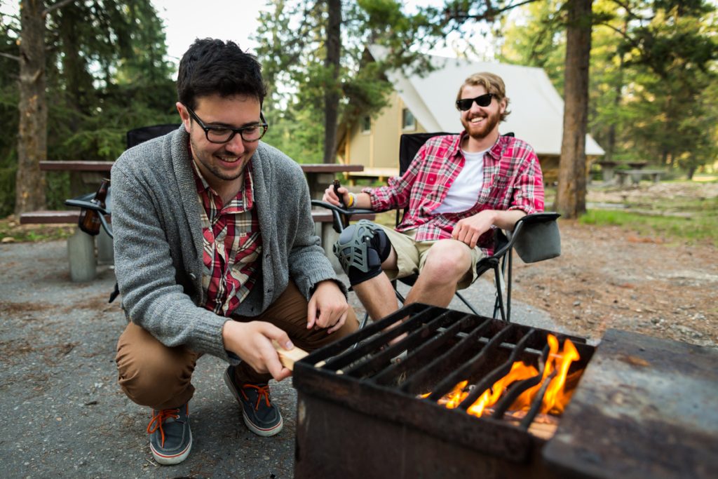
Lock It Up
Lock car and RV doors and windows and close shades when leaving the campsite and invest in locking systems for high-value items such as bicycles, surge protectors and trailer hitches. When away for a few hours or a day-trip store items that you don’t want stolen in a cargo box or storage area and don’t leave cool camping gadgets, electronics, speakers or phones out when away from the site. Stash and secure smaller valuables such as jewellery or cameras inside the RV or leave them at home if grandma’s pearls are not a camping necessity.
A BC Parks’ spokesperson said: “BC Parks and our park operators take public safety and security very seriously – it’s our highest priority. Because parks are public spaces, we encourage all campers to secure their campsites, vehicles and valuables, especially when unattended.”
If the RV’s locks, including the window locks, are rusting or aren’t closing properly it’s time to change them. Door locks can be upgraded to keyless locks with code pads for added security.
Light It Up
Motion-detector lights, including solar and LED options, are a smart choice to scare off furry or unfriendly intruders and see what’s going on at night. Be considerate of nearby campers if using motion-detector lights as no one wants lights flashing on and off in the dark when they’re trying to sleep. Use a solar light to illuminate the RV’s interior when out in the evening or as a night-light for the kids.
Smile, You’re On Camera
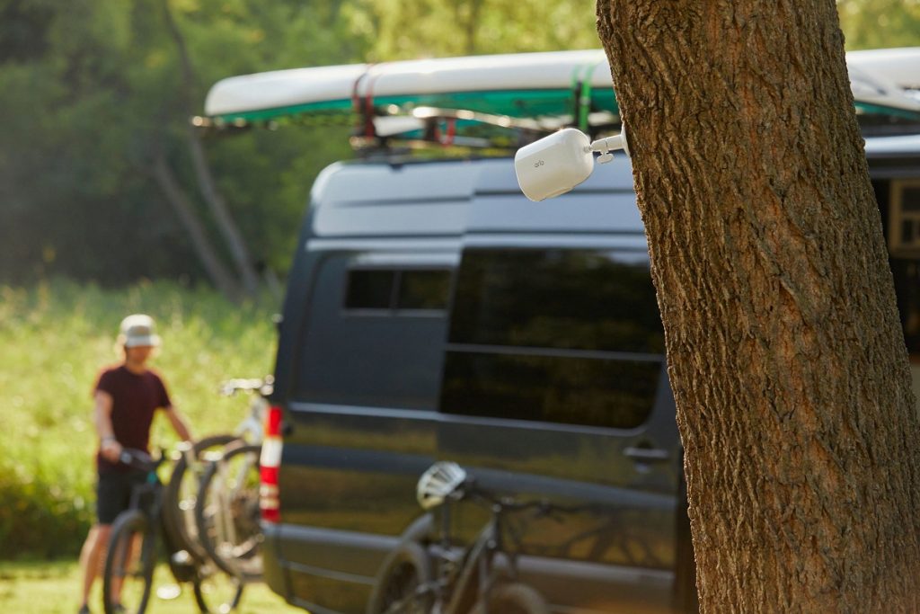
Camera and audio security systems are a good investment to make campers feel at ease and sleep more soundly at night. Plug-and-play and battery-operated options with wireless smart-device monitoring and real-time alerts are popular as are systems with on-site camera angle flexibility; some systems even monitor for leaks or water damage. With many RVers working from their units post-Covid-19, security systems are a good way to protect computer and audiovisual gear. Arlo offers a suite of security systems including ones specifically for the RV. Arlo also indicates that the GO 2 is the best camera for RVs due to its WiFi and Cellular connectivity. Note that different parks and campgrounds may have different rules about the use of personal cameras and security systems. BC Parks, for instance, does not allow individual security cameras if they collect images outside of campsites.
Theft-recovery tracking devices also exist. The Recreation Vehicle Dealers Association of Canada (RVDA) has partnered with KYCS Locate to educate dealers on vehicle theft, enhance lot protection and assist with inventory management and theft recovery. KYCS Locate is sold to new RV owners as peace of mind to safeguard their purchase. KYCS is partnered with Crime Stoppers in Canada and the US and has a number of solutions for the identification of assets and equipment.

Overall, RVing and camping are very safe activities when it comes to personal theft and campers are respectful of their ‘neighbours’, but it doesn’t mean bad things won’t happen to good people. Be aware and cautious of your surroundings and educate young campers to do the same. Stay safe and have a fantastic camping season!
While you keep camping security in mind also think of camping safety. Take the Campers Pledge to follow the nine rules to making camping an awesome experience for everyone: Respect Wildlife, Take Only Photos, Control Your Pets, Store Food Safely, Don’t Litter, Practice Fire Safety and Plan Ahead and Be Prepared, Respect Others and Respect Staff and Signs. Check out the blogs below.
Be a Respectful Camper and Practice the Camper’s Code
Follow the Camper’s Code and be a Responsible and Safe Camper
TIP: If you find this blog interesting why not subscribe to the enewsletter and never miss another story!
For campgrounds and RV parks in BC go to the BC Camping Map.
Share your BC camping and travel photos using hashtags #CampinBC #explorebc
It’s always a great day to #CampinBC
Experience Terrace Treasures in British Columbia’s North
Let’s visit a place where you can enjoy the wilderness, hiking, cultural diversity, fishing, and great campgrounds plus convenient shopping. Welcome to Terrace, “A place to belong,” a city of about 12,000 on Highway 16/The Yellowhead. It sits at the junction of the Skeena and Kitsumkalum Rivers. Below the local bridges fly fisherman try their luck on the river hoping to beat the record for the largest spring salmon. Keep your eyes peeled for the creamy-coloured Kermode or Spirit bear, the symbol of Terrace.
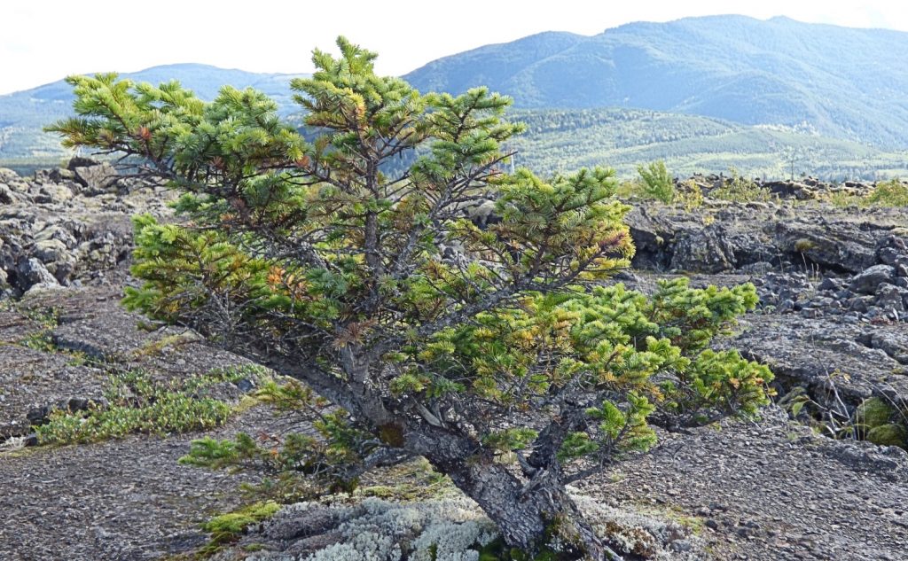
One of the most outstanding places we visited was the Nisga’a Memorial Lava Bed Park, the first provincial park jointly managed by First Nations and BC Parks. Situated 100 km north of Terrace we found ourselves in an alien landscape of ancient lava. In 1750 a volcano erupted, killing thousands of Nisga’a and forcing survivors to relocate their villages. It’s an eerie feeling walking over the remnants of such a cataclysmic event. Take a guided tour to the volcanic crater or walk into Vetter Falls. Nisga’a Visitor’s Centre in a stunning glass longhouse-like building houses the Ancestors Collection with treasures returned to the people.
A suspension bridge over the Nass River at Gitwinksihlw was too much for my fear of heights but a hike to the river to see a traditional fish wheel in the river was intriguing. If it’s hot springs you’re wanting go to Aiyansh Hot Springs.

Kitselas Canyon National Historic Site, 20.8 km east of Terrace on the Skeena River is home to the Gitselasu/Kitselas people. They have lived in the area for over 5,000 years. At the head of the trail are longhouses. Farther on is the Clan Totem Pole Garden with the remains of totems from the 1800s. The viewpoint overlooks the raging rapids.

Friends took us up Trapline Mountain for a picnic at the top. What a panoramic view in the alpine at 1,448 meters, and above the tree line. Ask a local to take you around some of these out-of-the-way places. It will enhance your experience of the area. There are many trails for all levels of hiking or strolling.
On the east side of Terrace is Thornhill Meat Market (2891 Clark St) with fresh meat, great bacon, groceries and deli selection. From May to October, the Skeena Valley Farmers’ Market is open Saturdays from 9-1. What a deliciously diverse selection of food along with beautiful local crafts. Come for the food and stay for the entertainment. We found the biggest craft store in the north at Creative Zone/Crafts and Hobbies for All Ages (4818 Hwy 16 West). It has everything from beads to hides to paints to cloth. Terrace Inn Liquor store (3005 Kalum Rd) has discounted prices so we stocked up. Prevost RV Dealer, on the west end of town, goes the extra mile for RV repairs. When our furnace quit and they couldn’t get a new one for 2 weeks they put in a second-hand unit to keep us going until Prince George and never charged for it. That’s service! There are the usual box stores but also plenty of local businesses.
No trip would be complete without an ice cream cone so we went to Chill Soda Shop located at 4805 Highway 16 in an old Foreman’s Residence beside the railway tracks. I have never seen such a big selection of candy but the best part was their ice cream.

The tourism office on the eastern edge of town is a one-stop for RVers. The ample size lot accommodates bigger rigs and has a full-service dump station. Friendly tourism staff welcomed our furry friends out of the heat.
Terrace is big enough to have all the amenities but small enough to be easy to navigate. For a side trip take the scenic drive along the Skeena River to Prince Rupert for fish ‘n chips. Take a day trip to visit the Haisla village of Kitimat just north of the town of Kitimat.
The Terrace-Kitimat-Prince Rupert area is a wealth of wonderful things to see and experience.
Places to Camp in the Terrace Area
Nass Campground, open May-October has 16 sites.

There are 2 provincial parks with campgrounds. Lakesle Lake Provincial Park is 20 km south of Terrace. Furlong Bay Campground sits beside Lakesle Lake. It has 156 sites, some with power, a shower room and a dump station. In the summer it books up quickly. We got lucky. Fifty sites have power. Wood, dump-station and hydro are extra. Furlong Bay on the lake feels like a tropical rain forest with huge plants. Devil’s Club, a medicine plant Indigenous people taught us how to use, towered over my husband. The leaves were big enough to wrap him up in them if they weren’t so prickly.
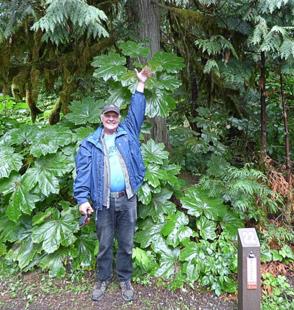
Kleanza Creek Provincial Park, 15 km east of Terrace is beside the Skeena River and Kleanza Creek. There are 34 vehicle-accessible campsites suitable for RVs. For the adventurous, there is a trail to Kleanza Canyon.
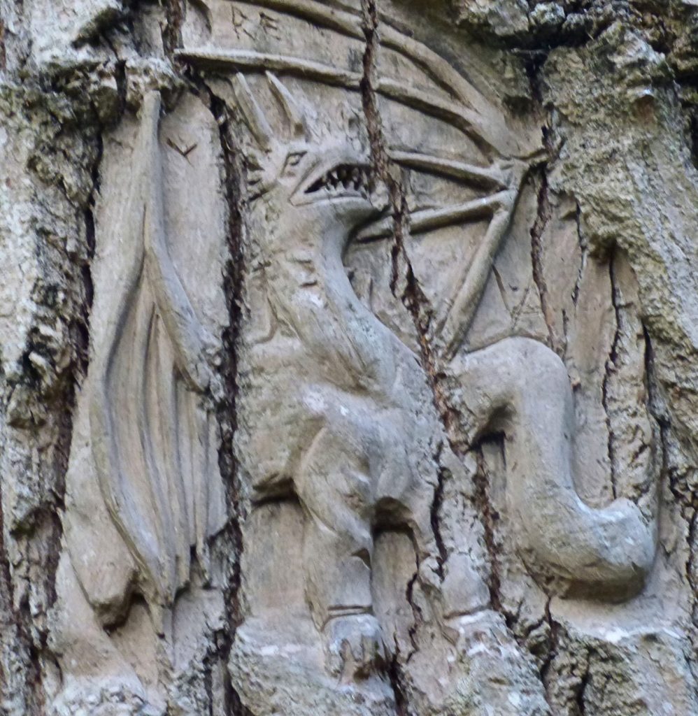
There are 6 private campgrounds. We visited Ferry Island Campground and Park managed by the city and situated beside the Skeena River. 103 spacious sites sit among the trees. Meandering along the 2.8 km loop through the forest we looked for cottonwood tree carvings done by local Rick Goyelle. It was like a treasure hunt finding some of the 55 expressive faces carved into the bark.
Wild Duck Motel and RV Park on the west end of town are clean and friendly. We were surprised to meet up with a pair of older women from Powell River who were touring the north in their camper. One of them has mobility issues so showering at campgrounds can be a problem. They stayed at the Wild Duck because there is a shower room fully equipped for people with disabilities.
TIP: If you find this blog interesting why not subscribe to the enewsletter and never miss another story!
For campgrounds in this area and elsewhere in British Columbia check out the Camping Map.
Share your BC travel and camping photos using hashtag #campinbc #explorebc
Hiking to French Mine Near Hedley in British Columbia’s Okanagan
While recently camped at Stemwinder Provincial Park we were searching for a hike in the region. A quick search on AllTrails brought up the Nickelplate French Mine Loop, a 6.3km circular trail near Hedley BC.
We departed Stemwinder early in the day to avoid the heat as best we could and headed east to Hedley. Hedley is a very small community located between Princeton and Keremeos along Highway 3. Hedley has a rich mining history, and from the highway you can see the remains of the old Mascot Gold Mine stretching up the mountainside. Visiting the Mascot Gold Mine has long been on my bucket list, and thanks to an $800,000 grant from the province as part of a COVID relief program, the mine is slated to reopen to visitors in 2023. In the meantime, however, we thought we would head into the backcountry to explore the French Mine.

To access the French Mine site, head east past Hedley and turn off on the Hedley Nickel Plate Road after about 3 kilometres. The Nickel Plate Road, sometimes called the Corkscrew Road, is aptly named. As we wound our way up the mountainside, we enjoyed spectacular views of the valley below.
Eventually we reached our designated start point and parked our truck and headed out on foot. We chose to hike to the Lower French Mine site first, which turned out to be a beautiful walk along an old road. As it turned out, the access road to the lower French Mine could probably be considered vehicle accessible. However, I was happy we decided to park the truck and walk in as it gave us the opportunity to really enjoy the views.
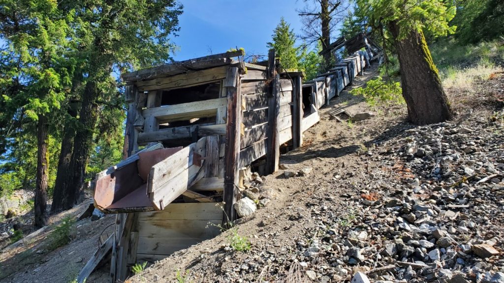
When we arrived at the Lower French Mine site we spent some time looking at the old mining infrastructure. An old ore chute and a concentrator are on the main level, and a short walk up a trail just past the concentrator takes hikers to an open shaft that heads back into the mountainside. When we visited, I was shocked by the serious wind tunnel effect when I stood in front of the mineshaft as ice-cold air poured out of the tunnel around me.
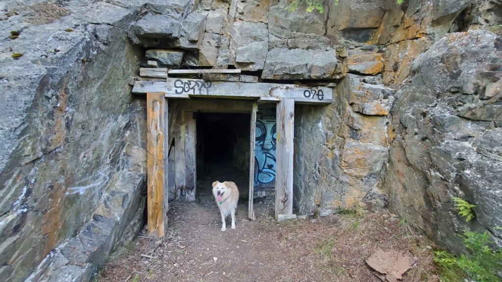
AllTrails indicates that there is a loop hike, and all we needed to do was head uphill and we would come to the Upper French Mine. I 100% do not recommend the scramble between the two mine sites unless you are an experienced scrambler or are part mountain goat. Alas, we did not know this, so as we climbed upwards, I was crossing everything I have that this was the correct trail, and I wouldn’t have to turn around and go back the way we had come up.

Fortunately for me, after 20 or so tense moments, we re-emerged on level ground, scooted along a couple narrow ledges, jumped down a small cliff, and arrived at the Upper French Mine Site. As it turns out, this site is also vehicle accessible. Seriously – skip the scramble linking the two sites and from the Lower French Mine, just walk back the way you came then drive up to the Upper French Mine and save yourself the stress!
Anyway, at the Upper French Mine I was amazed to discover a massive network of tunnels and mineshafts in the mountainside. These shafts have a completely different feel than the one at the lower mine site. The main entrance is enormous, and shafts branch off in every direction imaginable. We stayed in the enormous central cavern, but I’m sure people more adventurous and better equipped than us could spend a lot of time exploring the area.

Since we were parked at the bottom and there was no way I was going back the way we arrived, we returned to our vehicle by hiking out the access road to the Upper French Mine, then down a portion of the Hedley Nickel Plate Road. All in all, our hike was around 7km and took about two hours. Both the Lower and Upper portions of French Mine are worth visiting, but as I have emphasized above, I would do it as two separate trips and not try to link them via the scramble described online.
I am always fascinated by the marks humans leave on the landscape and the French Mine area is a perfect example of this, making it a worthwhile daytrip in the Similkameen area.
TIP: If you find this blog interesting why not subscribe to the enewsletter and never miss another story!
For camping accommodations in British Columbia check out the Camping Map.
Share your BC travel and camping photos using hashtag #campinbc, explorebc
It’s always a great day to #campinbc
Plan a Camping Trip to British Columbia’s Similkameen Valley
BC Parks reservations can be tricky to come by for a summer weekend, so when we snagged a last minute reservation for Stemwinder Provincial Park in BC’s Similkameen Valley we were excited to get out and try a new campsite.
Previously we have camped at nearby Bromley Rock Provincial Park (see our blog) so we had an idea of what the area would be like. The campsite at Stemwinder consists of 28 vehicle accessible campsites sandwiched between Highway 3 and the Similkameen River. The campground is generally laid out on two levels, the top level is right beside the highway and the sites are fairly open. The lower level, beside the river, is more treed. Our site was located right on the corner where you drive from the upper bench to the lower bench, so while it was surrounded on three sides by the campground road it still managed to be decently private since we really only had one neighbour.

The campsite at Stemwinder has pit toilets and one hand pump (on the lower level) for water. There are two short trails leading from near campsites 12 and 13 to access the river. Caution is advised, though, as Poison Ivy lurks just off the established trail! When we visited it was still quite early in the season and the Similkameen River was high. Later in the season the water would be lower and exploring the shoreline would be an option, although BC Parks cautions that the river runs fast and excellent swimming skills are required for anyone venturing into the water at this location. For a more relaxing swimming destination, head to Bromley Rock.

Stemwinder Provincial Park makes an excellent location to use as a base to explore the surrounding area. On our trip, we spent our first day visiting nearby Keremeos. Keremeos offers a huge selection of orchards and vineyards. Pick up a winery and cidery passport at your first stop of the day, and then visit a total of either three or five locations in order to be entered to win a Similkameen Wine Lovers Package. On our visit we focused on the Similkameen cideries and had a great time visiting each location and sampling their offerings.

There are plenty of opportunities to travel back in time in Keremeos. The Red Bridge, originally built in 1907 as a railway bridge, is one of the only covered bridges left on the west coast. Keremeos Grist Mill and Gardens is a provincial heritage site home to a functional water wheel from 1877. The site offers workshops, a restaurant, heritage gardens, an RV campground, and lots more.
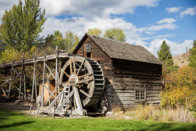
Before heading back to our campsite, we made sure to pop in at some of the many fruit stands in Keremeos. Fresh fruit and samosas were on the menu for us and both were delightful!
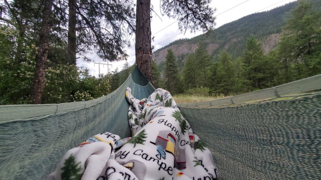
Stemwinder Provincial Park is a great weekend or stopover destination when travelling through the Similkameen region. There is a lot to experience, whether you prefer sampling from vineyards and orchards, exploring a heritage site, or getting out for a hike such as the one at nearby French Mine (see blog).
TIP: If you find this blog interesting why not subscribe to the enewsletter and never miss another story!
Share your BC travel and camping photos using hashtag #campinbc, explorebc
It’s always a great day to #campinbc
Jesmond Fire Lookout – Part of British Columbia’s History
Just a hop, skip, and a big uphill jump away from Big Bar Lake Provincial Park is a piece of British Columbia’s wildfire history.

Located in BC’s Cariboo region, the Jesmond Fire Lookout, maintained by Recreation Sites and Trails BC, preserves one of the still-remaining historic fire watch towers in British Columbia. From 1972 to 1999 wildfire observers were stationed at the Jesmond Lookout tower for three weeks at a time from early May to late September. The observer lived in the tower and was responsible for detecting and reporting early signs of wildfires. Historically, approximately 12 fires per year were detected from the Jesmond Lookout.
BC has a rich history of fire lookouts. Starting in the early 1900s, men were sent to mountaintops with unobstructed views in order to provide early detection of wildfires. The BC Forest Branch was created in February 1912 and to celebrate 100 years of the BC Forest Service in 2012, the 1957 documentary The Man in the Tower was digitized and shared online (https://youtu.be/U8Pi8CF_NT4) and provides a fascinating look at forest management practices of the time and the day to day tasks and equipment of the fire lookout observer.

The Jesmond Lookout is accessible by a rough 4WD road. When we visited, we were able to drive most of the way up the road in our truck. If I were to do the trip again, I would plan for a much longer hike and park much further down the steep and narrow access road. If you plan on hiking the final six kilometres up the Jesmond Lookout Road, as I would do, you will be climbing just under 800 metres – no small feat! Most of the road is treed, but the final kilometre opens up and the road passes through beautiful open country with spectacular views in all directions.

We visited in late June and it started snowing when we were at the lookout. At an elevation of 1970 metres, it is important to be prepared for unpredictable weather and high winds. Winds over 120 km/h have been recorded at the lookout, and the building itself is tethered to the bedrock with metal cables.

Unfortunately, over the years many of the hundreds of primary fire lookout towers in the province have been vandalized or destroyed. In recent years, increased attention has been given to restoring and protecting these sites, which is certainly a valuable endeavour. Other intact fire towers include the Cornwall Fire Lookout near Ashcroft, the Windy Joe Lookout in Manning Park, the Harrison Fire Lookout on the west side of Harrison Lake, and the Nahatlatch Lookout near Boston Bar. The restoration and maintenance of these sites is made possible by partnerships with groups such as the Four Wheel Drive Association of British Columbia and through countless volunteer hours.

Visiting the Jesmond Fire Lookout is an excellent day trip when camping at Big Bar Lake Provincial Park. The Rec Sites and Trails site offers a picnic table and a pit toilet in addition to the historic fire lookout. The journey to get to the Jesmond Lookout is neither short nor simple, but for those well prepared, the trip is well worth the effort.
TIP: If you find this blog interesting why not subscribe to the enewsletter and never miss another story!
See the blog Big Bar Lake Provincial Park in BC’s Cariboo.
For camping accommodations in British Columbia check out the Camping Map.
Share your BC travel and camping photos using hashtag #campinbc #explorebc
It’s always a great day to #campinbc
2023 RV Towables Available in British Columbia Have Great New Features
With a multitude of models and lines available choosing a towable RV is no easy task. Here are a few new standouts on the market for 2023.
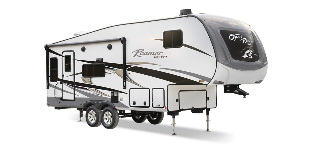
Roamer Light Duty
Open Range RV’s shortest and lightest fifth wheel to date, the Roamer Light Duty packs plenty of features in its 100-inch-wide body. Half-town towable it has four-point automatic levelling, a PVC roofing membrane and triple sealed slideouts and corners. The modern interiors are fresh and inviting, with an oven and three-burner range with flush mount glass cover, theatre seating with heat and massage, 60”x80” queen size bed, flush floors, slides and LED lighting throughout. Its TravelLINK® Smart RV system allows for Bluetooth control of awnings, lighting, slides, heating, cooling and more. Options are aplenty such as a solar package, BBQ grill and folding dinette chairs, and observation camera. Length 27’5”/weight 6,910 lbs (unloaded); sleeps up to four. Open Range is by Highland Ridge RV. Priced from $55,493 USD / $74,000 CAD.

Escape 5.0
Based out of Chilliwack, BC, Escape Trailer Industries allows RV owners to work directly with the factory to customize and personalize their units. Its Escape 5.0 is a one-piece fiberglass fifth wheel that’s easily towed with a mid-size truck. Measuring 21’2” it allows for ease of maneuverability yet it’s roomy on the inside, with high ceilings for a spacious feel. Comforts include a lofted queen bed, separate lounge area, full wet bath and full galley and extensive storage. Options list includes a 12’ power awning and exterior shower package, composting toilet, stainless steel kitchen backsplash, stereo with four speakers, wireless back-up camera and 190W solar panel with charge controller.
The Escape 5.0 targets trucks with a minimum 5’6″ bed and suitable payload/tow capacity. Its aerodynamic design, tandem axle and low centre of gravity makes for excellent road stability, fuel economy and decreased wind resistance. Priced from $44,510 USD / 54,745 CAD.

inTech Sol Horizon
Style doesn’t have to go by the wayside when it comes to small travel trailers. Sol Horizon by inTech is a lightweight (4,000-pound-GVWR), 19’ aluminum framed travel trailer with flare. Its three-ply laminated glass windshield offers a panoramic view and its Tilt–Forward Design™ takes advantage of the unused space over the trailer’s A-frame. The exterior profile provides more space in the front and rear of the camper and delivers 6’6” headroom at the peak, thus allowing for room to move without feeling confined and maximizing the sleeping and lounge space. It has a sizable wet bath and a trendy kitchen with farmhouse sink, commercial-grade faucet and two-burner LP stove with a cast iron grate; the dinette seats up to five. The 10’ awning is standard, with extras such as solar power system and outdoor slideout kitchen on the long options list. The Sol Horizon sleeps four. Priced from $42,539 USD / $56,685.

Winnebago Micro Minnie
Looking for a functional and modern towable with good fuel economy? Winnebago totes the Micro Minnie as a “compact trailer without the compromise”. With no mirror extensions required, at just 7’ wide and 25’5” long the 2306BHS Micro Minnie can sleep five. SUV-towable with a dry weight of 4,672 lbs (max capacity GVWR 6,000 lbs) its layout includes an easy-to-use Murphy bed (54” x 74”) with a regular queen-size mattress and windows for cross-ventilation. Its dinette has a push-down table that converts into an EZ Glide Sofa Sleeper and the kitchen features a flip-up counter, microwave, three-burner cooktop, deep barn sink and refrigerator. The bathroom has ample storage space for linens and there’s headroom in the shower while its 28” x 72” flip-up bunk bed creates additional storage for outdoor equipment. The exterior features a Pack-N-Play portable sleeper and playpen, exterior powered awning with LED lights and off-road tires (Goodyear Wrangler 15″ radial tires on all models except the 1700BH). Starting prices for the 2306BHS are from $50,976 USD / $79,900 CAD.
There are 11 Micro Minnie floorplans and they accommodate from three to five people; purchase prices start at $37,182 USD / $49,350 CAD. Also check out the Micro Minnie FLX. With a full suite of factory-installed, integrated technology it can provide at-home comfort for up to five days when disconnected. Prices start at $64,421 USD / $85,700.

Apex Ultra-Lite
The innovative Apex Ultra-Lite Travel Trailers by Coachmen are ‘Certified Green’ by TRA Certification for energy code compliance and the company offers solar panel packages to allow customers to be self-sustainable while using them off-grid. The majority of the models offer pass-thru storage (some on both sides) and exterior camp kitchens. Functional bedrooms, pantries and under-booth areas provide for a smart use of space and the showers are spacious. Trailers come in various floorplans at 7.5’ wide (two models) and 8’ wide (11 models). All models are lightweight and designed with quality in mind and include USB ports, digital TV antenna with cable hook-ups and Wi-Fi capability, and AM/FM stereos with Bluetooth.
Its largest model, the 300BHS, measures 34’5″ and boasts an 18’ power awning. With an impressive rear private bunkhouse it can sleep nine. Priced from $59,695 USD / $79,650 CAD.

ALTA
ALTA is East to West’s premium laminated travel trailer line. It is offered in ten feature rich floorplans, from the 25’ 1900MMK couples coach to the 37’8” 3150KBH family-oriented bunk house with an impressive outdoor kitchen. Spanish for ‘high’, its models feature high ceilings with six-sided aluminum construction. The line, a division of Forest River, Inc., aims to be well-crafted yet is considered to be entry-level with features that RVers would find in luxury models. MSRP prices range from $39,650 and up, depending on the model.
Its 27’11” toy hauler model, the 2400KTH, was named 2023 Travel Trailer Toy Hauler of the Year by RV News magazine. It has front storage and an outside air compressor and a fold-down ramp door; inside are two comfy Euro incliners and there’s a built-in electric space heater, full-size fridge/freezer and lots of sleeping space. Priced from $71,790 USD / $95,650 CAD.
TIP: If you find this blog interesting why not subscribe to the enewsletter and never miss another story!
For camping accommodations in British Columbia check out the Camping Map.
Share your BC travel and camping photos using hashtag #campinbc #explorebc
Travel the Stunning Stewart-Cassiar/Highway 37 in Northern BC
The Stewart-Cassiar Highway is 724 km of stunning scenery in British Columbia’s north. My husband and I took our time exploring this amazing area from the Yukon border in the north, to Kitwanga in the south and over to Stewart and Hyder, Alaska.
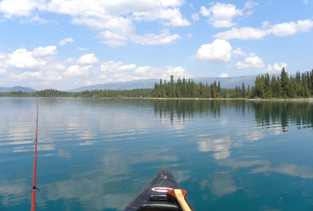
Our favourite provincial park on the entire trip was Boya Lake, 87 km from the Yukon border. It’s far away from traffic noise, WIFI, and when it’s full it’s still quiet. Boya Lake itself is clear aquamarine with a white glacial silt bottom and 24 of the 44 sites are snugged up to its shore. Even so we didn’t expect to find a lakefront site so I could hardly contain my excitement before jumping out with the dogs and yelling, “Honey, I’m home.” A loon added its mournful call. Aah, four days of being lost in nature.
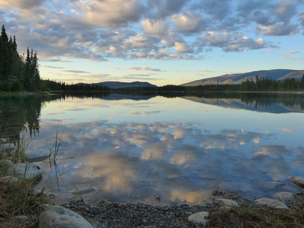
A stay at Boya wouldn’t be complete without canoeing. No motors are allowed on the lake but canoes are available. With the first dip of the paddle, all my cares disappeared. For me, this is a spiritual place. My days began with tea in a china teacup, watching the squirrels and listening to the loons. They ended with the Master painter sweeping peach and mauve sunsets over the lake. If you want a true getaway, this is the place to go and the only thing wrong with Boya Lake …the stay is never long enough.
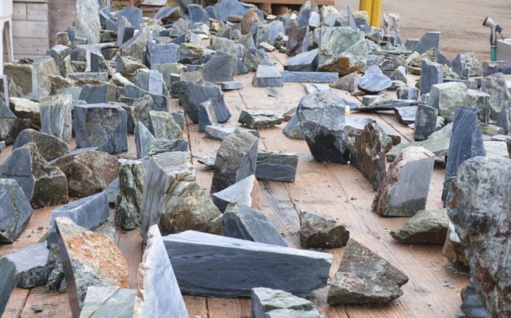
Jade City is a fascinating place to stop. They offer travellers free overnight camping, WIFI, and coffee. The family that runs it has been mining jade since the 70s and it’s part of the reality show, “Jade Fever.” Watch them cutting jade outside for sale. I bought a small slab for an RV cutting board. The store has a dizzying selection of jade, rocks and gems.
The main hub for travellers fueling up and getting supplies is Dease Lake. It’s also the jumping-off point for paddlers on the Dease River or adventurers going to Telegraph Creek.
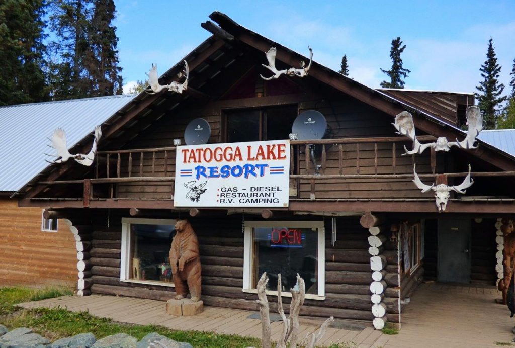
We were welcomed by a stuffed moose in the dining room of the Tatogga Lake Resort, an interesting log building that resembles a museum inside. There’s a one-ton jade boulder by the fuel pumps although they aren’t always open. It’s mainly a seaplane base for tours into the mountains.
South of Tatogga is Kinaskan Lake Provincial Park with 50 sites in a well-looked-after park beside the lake.
We followed the glacial blue waters of the Nigunsaw River before crossing the Bell Irving River bridge to stop at Bell 2 Lodge. Though they principally cater to heliskiers in the winter, during the summer travellers can stay in chalets, the lodge or at the campground. It has 10 full-service sites plus 3 dry camps. There is a restaurant and fuel.
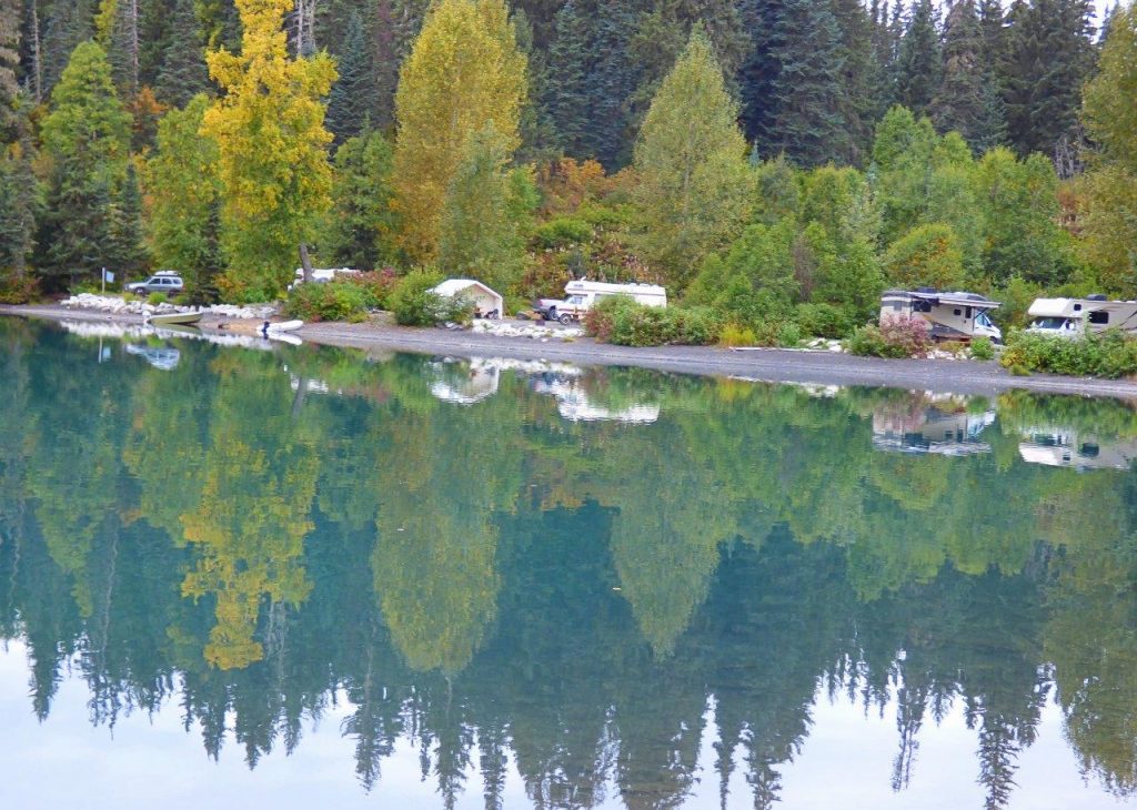
A gorgeous green lake welcomed us to Meziadin Lake Provincial Park where we camped overnight. They have 66 sites, some with power but no sani-dump and we were lucky to get a spot.
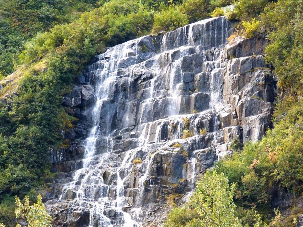
No trip would be complete without taking the road from the Meziadian junction to Stewart and Hyder, Alaska. It’s a photographer’s dream. Prepare to be wowed as glaciers drape the towering mountains, and waterfalls plunge from the tops. We pulled in where a waterfall broke up into a myriad of veils. Bear Glacier flows blue from the mountain to a lake beside the road.
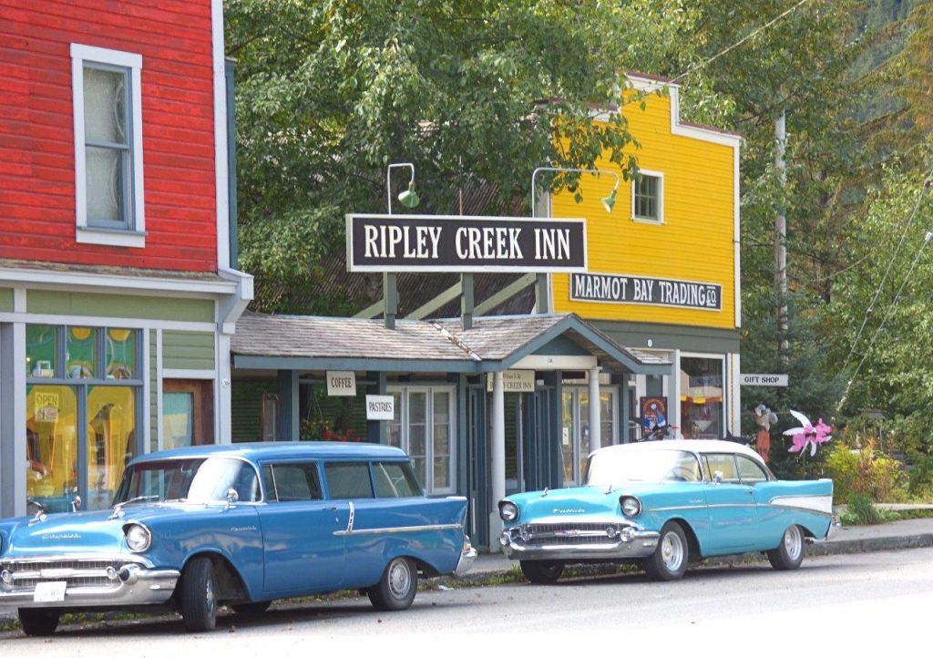
Stewart is nestled at the foot of glacier-topped Stewart Mountain, on Portland Canal. We stayed in full-service Bear River RV Park. There is a beautiful boardwalk over the estuary. Heritage buildings and funky storefronts make up the main street. Stay a few days and take a trip to Hyder, Alaska.
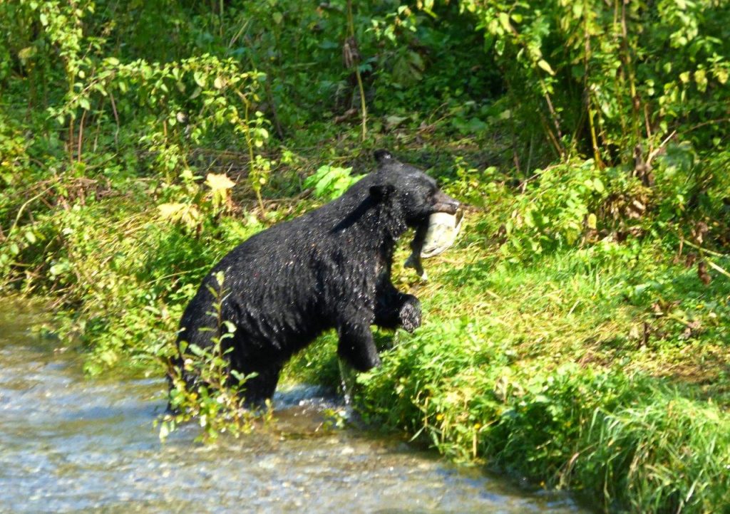
Crossing an unguarded border we drove into Hyder that looks like the old west. Remember, just because you crossed into the USA without being questioned, you still deal with the border guards coming back into Canada. Get Hyderized at the old Glacier Inn. Visit Fish Creek Wildlife Observation Site for safe bear watching from the boardwalk. We went along 25 km of rough gravel road, sometimes one-lane, up the mountains to see Salmon Glacier. What a breathtaking sight but it cost us a tire. A tire guy drives around Stewart in his truck fixing tires!
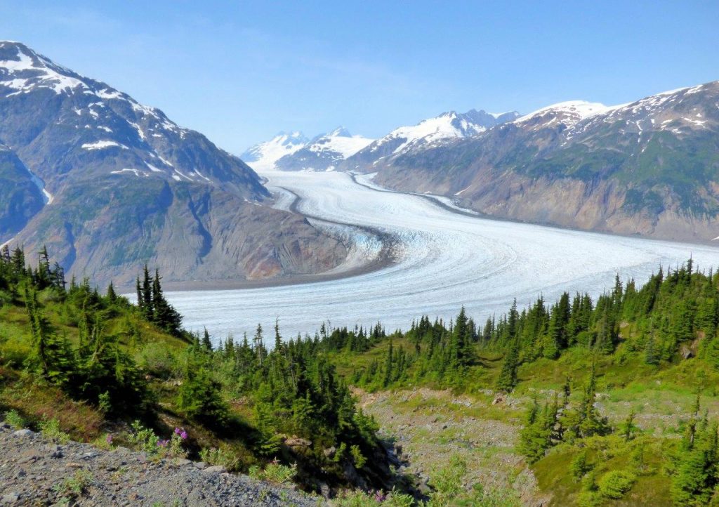
After we left Meziadin we stopped at Gitanyow – the Land of the Totems. At one time they had more original totems than anywhere else. Kitwanga village was our home for the night. We visited Gitwangak Battle Hill Historic Site where from the top of the hill tribes fought rivals.
Summing up the Stewart-Cassiar trip my advice would be to prepare for driving through the wilderness, allow plenty of time to explore and learn the history.
Fuel stops from Kitwanga are at the junction of Highways 16 and 37: Gitanyow 19 km; Meziadin Junction 149 km; Stewart 220 km; Bell 2 249 km, Tatogga Lake(not always open) 392 km; Iskut 406 km; Dease Lake 499 km, Junction 37 at Yukon border 724 km.
TIP: If you find this blog interesting why not subscribe to the enewsletter and never miss another story!
Other information to help you plan your camping trip include:
Wilderness Adventure Along the Stewart-Cassiar Highway
Kitwanga Junction
Exploring Northern British Columbia – A Circle Tour Adventure: Stewart-Cassiar Highway
Discover British Columbia’s Travel the Great Northern Circle Tour
For camping accommodations in British Columbia check out the Camping Map.
Share your BC travel and camping photos using hashtag #campinbc #explorebc
RVing in British Columbia This Winter? Here’s Some Camping Trip Prep
Winter RVing in British Columbia is something that all RVers and campers should experience. Imagine waking to a wonderland of snow outside while being warm and cozy inside. After breakfast strap on the snowshoes, hit that favourite ski hill or cross-country trail, head to a beach for a magical shoreline hike or catch dinner while you ice fish on a frozen lake.
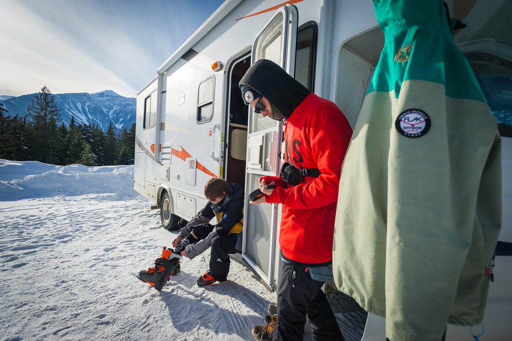
All revved up and don’t know where to go this winter? The Camping and RVing BC Coalition has a Web page which lists over 150 campgrounds and RV parks in the province that are open for business in the winter.
But before you set off, winter camping comes with its own unique challenges and safety considerations, so you’ll need to prepare the RV for various conditions before embarking on a trip. Below is some helpful advice to make your winter RV trip a more carefree one.
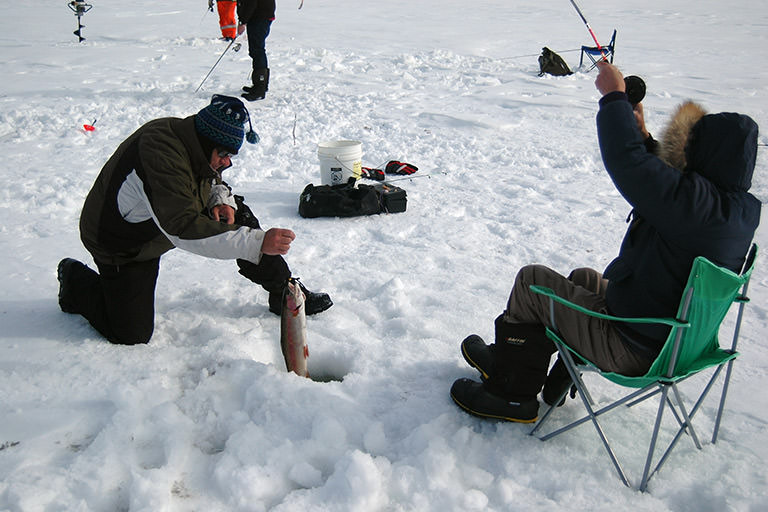
Water
One of the biggest mistakes that you can make in winter is connecting the regular water hose to the campground supply and having it freeze overnight. Consider buying a heated water hose to prevent freeze-ups or bursting. And always keep hoses and cables off the ground or out of the snow.
Another option is to fill your fresh-water tank and then disconnect your hose. Often the water tank is located inside the RV and, as long as the unit is heated, the water in the tank should not freeze.
Do not assume that because your RV is heated that water lines running through it will not freeze. Any semi-exposed line can freeze! (Examples are in compartments behind hatches that are not insulated.) Verify the temperature the water heater is rated to operate down to.
Tip: Use a hairdryer to thaw frozen pipes.
Waste Tanks
Always make sure your black and grey water tanks are empty before your trip. Add one litre of RV potable antifreeze to each tank to protect the dump valves from freezing. Insulate the pipes draining into the tanks with foam pipe insulation.
Always keep your black water valve closed and only dump when full or when you’re ready to leave. This will help prevent ice from forming.
If you must keep your sewer hose connected at all times, be sure it is placed and supported at a steep angle so all residue runs down.
Tip: Wrap the sewer hose in insulation or heat tape to prevent ice from forming inside the pipe.

Warmth, Insulation & Condensation
Feel for any drafts and, where possible, insulate and/or seal the areas. Check window seals and re-caulk where needed. For drafty walls and floors add foam insulation panels or foam board flooring.
Examine the weather stripping on all exterior doors, slide-outs and access hatches and cover the AC unit. Insulate and re-seal accordingly. Most RVs have roof vents or skylights, which are ideal places for heat to leak out (these usually have exterior covers to prevent rain and snow from getting in). Seal these off by inserting an RV vent cushion or make your own with insulation and a moisture-proof fabric.
Saying this, one consequence of a well-sealed RV is condensation which builds up from internal heat and moisture, therefore keeping at least one vent about 2.5 cm open will allow for some ventilation.
Tip: Change any indoor curtains to a heavier or insulating fabric to block cold air. Add a moisture-resistant rug or carpet to the floor for the winter trip.
Tip: Insulate the gap behind light fixtures and electrical outlets.
Test the furnace and use compressed air or a brush to remove dust, debris, insects or spider webs. For those not using a furnace a portable ceramic or electric space heater is another option to stay warm, but make sure to open a window or vent, especially when heating with propane. For milder nights a heated blanket may suffice, just make sure it has the automatic switch-off function.
If you use propane to heat your RV it’s likely to last only a few days in really cold weather. For longer stays consider getting a 100 lb propane tank to supplement the regular tanks. Insulate the outside propane regulator from freezing conditions such as excessive wind chills.
If you plan to be situated for a while place wooden blocks underneath any stabilizing jacks to prevent ice formation and invest in an RV skirting (they generally snap on) to avoid cold air and wind from getting up and into the underbelly of the unit.
Tip: Use an electric dehumidifier; alternatively, a container of moisture absorbent will help to remove dampness from the air and help prevent corrosion, mold and mildew.
TIP: If you find this blog interesting why not subscribe to the enewsletter and never miss another story!
Other Tips
- Park your RV in the sun whenever possible. You’ll be amazed at how much a good winter sun can heat up your RV.
- Park your RV on support boards. These boards will prevent your RV tires from ‘sinking’ if the ground thaws.
- Pack winter bed quilts/sleeping bags and enough winter clothing to last a few days in the event of furnace or electrical failure.
- Make sure that the heat tape you buy can be crossed over itself, as this will provide the most efficient seal.
- Periodically start the engine to keep everything in good running order.
Additional resources for RVing in winter:
More tips on RVing in winter
Places to camp in BC in the winter
Check out the ‘Camping How To’ section of our Web Blog
Winter tips from Go RVing Canada.
Share your BC travel and camping photos using hashtag #CampinBC
It’s always a great day to #CampinBC
Winter Camping for the Beginner in British Columbia
Winter can be a magical time to explore British Columbia and try new activities. Thankfully, there are many campgrounds and parks – both private and public – open in the ‘off-season’.
It’s true that winter camping comes with its own unique challenges and safety considerations for campers and RVers. If heading out in an RV there is winter camping trip prep to follow. For renters, note that a number of RV companies and dealers do rent out motorhomes and units in the winter. Make sure that the RV has double-pane windows, a high efficiency furnace, an interior winter cab blanket and comes with insulated and heated water and waste holding tanks.

When trying winter camping for the first few times it’s recommended to stay close to home and choose a campground not too far off the beaten path. Invest in any necessary items or borrow from friends or family who have ventured out at this time of year; gear rental is also an option. As with all camping trips, having a plan and being prepared is the key.
Here are some helpful tips to make your winter camping experience an enjoyable one. Read an expanded list of tips here.

Essential Gear
- Make a gear list, bring quality winter and windproof clothing, plenty of warm wool-blend socks, long underwear and layer, layer, layer. Mittens are a better option than gloves and a wool hat is a smart choice as is a balaclava.
- Invest in waterproof winter boots with a warm lining and decent treads for traction.
- Pack a water bottle for heating or hand and toe warmers.
- Bring insulated camping chairs (there are even ones with battery heated seats).
- Purchase a portable power pack if you don’t have one and pack extra batteries.
- Pack ski goggles and good sunglasses for snow/sun reflection.
- Have the first aid kit ready and educate yourself about basic first aid. Put sunscreen under your nose and chin and get an SPF lip balm as the snow reflects the sun!
- Trekking poles and snowshoes are a fun option as are binoculars for winter bird watching.

Campfires & Meals
- Read our article on how to build a campfire.
- Get a waterproof case for the firestarter/matches.
- Bring a small shovel to clear snow from around the campfire pit. A small sled will also come in handy for hauling wood or gear around.
- Pack some ready-made or freeze-dried options to simplify meal times. High calorie foods are good in winter as are soups and hot drinks.
- Make sure you have insulated water bottles and tin mugs.
Animal Awareness
Even in the winter campers and hikers need to be aware of animals and their surroundings and continue to respect wildlife. Always exercise caution. Keep food locked away and do not leave scraps behind – pack out what you pack in.
Don’t feed the animals or get too close. Moose can be aggressive, bears can come out of hibernation, and any animal can be unpredictable if provoked. Stay alert, and move about slowly and quietly and respect the wilderness that you are in. BC Conservation Foundation provides good information.
Backcountry Safety
If you plan to venture out on the trails in BC’s backcountry to hike, snowshoe, cross country ski etc. only do so if you, or the person you are with, is experienced in that outdoor activity in winter. Always have an emergency plan and tell someone where you are going and your estimated timeline beforehand. Check out Adventure Smart for more information.
TIP: If you find this blog interesting why not subscribe to the enewsletter and never miss another story!
For more helpful tips check out our FAQ page on winter camping and read the article Tips for Novice Campers.
For accommodations in British Columbia go the Camping Map.
Share your BC travel and camping photos using hashtag #CampinBC
It’s always a great day to #CampinBC
Exploring British Columbia’s BC Ale Trail
New experiences are brewing nearby!
The BC Ale Trail is a series of 20 self-guided itineraries pairing 150+ local craft breweries throughout BC with the super, natural landscapes that surround them. BC’s craft breweries closely adhere to COVID-19 safety protocols and are ready to welcome you safely — whether you visit one of their patios for a pint or pick up some beer to-go.

Almost 200 breweries dot the super, natural landscapes of British Columbia. Let the BC Ale Trail be your guide for exploring BC’s ancient rainforests, vast, raw nature, mountain peaks that touch the sky, historical ranch-lands, West Coast culture, farm-to-glass culinary experiences, lakeside lifestyles and cities on the edge of wilderness – all while enjoying great, local, craft beer on your own self-guided Ale-venture!
Within each Ale Trail on our website, there are recommended itineraries to explore – this includes an array of craft breweries, pubs, restaurants, cafes, liquor stores, outdoor activities, sightseeing and more — all either on the way or very close to your campground! Some brewery patios are even dog-friendly!
The BC Ale Trail is divided into six regions – Kootenay Rockies, Northern British Columbia, Thompson Okanagan, Vancouver Island and Vancouver, Coast and Mountains.

Kootenay Rockies
The Kootenay Rockies is a go-to destination for beer lovers and wilderness explorers – enjoy spectacular parks, hot springs, hiking trails and of course, beer from 15 breweries.

Northern British Columbia
Explore the craft beer community in Northern British Columbia with 11 breweries situated among Northern BC’s sweeping glaciated valleys, volcanic rock formations, towering mountain ranges, and mist-shrouded coast.

Thompson Okanagan
Enjoy the diverse region of the Thompson Okanagan featuring views of the Rocky Mountains and vast desert landscapes, dotted with lakes, grasslands, and rolling hills paired with 34 craft breweries.

Vancouver Island
Experience craft beer culture from your choice of 46 breweries on Vancouver Island, interwoven with natural beauty, agricultural splendour and some of BC’s most spectacular beaches.

Vancouver, Coast & Mountains
Explore a craft beer scene in Vancouver, Coast & Mountains that’s finding fame across the world with 95 breweries and growing, in a city that loves to get outside – bordered by the sea, forest and mountain peaks.
Other Useful Information
Take the BC Ale Trail on the road with you! Download our FREE mobile app. With a database of over 250 locations including breweries, taphouses, liquor stores, visitor centres and more. Use the app to find a location near you, check-in once you arrive to collect points and when you have enough, you can redeem them for a reward at participating locations.
Read blogs from the BC Ale Trail website and explore more on the BC Ale Trail via its social media channels.
TIP: If you find this blog interesting why not subscribe to the enewsletter and never miss another story!
For places to Camp in British Columbia go to the Camping Map
Share your BC camping and travel pictures using hashtag #campinbc, #explorebc, #bcnice
It’s always a great day to #CampinBC
Who is Your Wildlife Companion In British Columbia?

Have you ever thought about who your camping companions really are? No, I don’t mean the ones who helped you pack for the trip and set up camp – I mean your wildlife companions. Have you ever just sat quietly for 60 seconds and listened? I mean really, really listened to all that you hear in that brief moment of time. Take a moment to take in the sounds, sights, and smells of a campsite. This could make a great camping activity for the whole family, by making it a family tradition where once a day the whole family sits in silence for just 60 seconds (at different times each day) and make a note of all that you hear (If you have children, this could be a segway to a future school project during the school year).

Most times, you will hear a barking dog, a crow, a raven or even the bright blue Stellar Jays who makes harsh, nasally chirping sounds – I refer to them as the food thieves of the camp, so don’t leave that snack bowl unattended as one in a bowl means a whole flock is sure to follow, one by one. You may even see the gray and black Whiskey Jacks – aka the Canada Jay, Robins, Geese, Owls, Eagles as well as seagulls (depending on your location) but there are others lurking in the treed forest you are calling home for a few days each year.

Now that we have covered the feathered ones, what about the ones you can see? Most of us can say we have seen a squirrel or chipmunk as well as a raccoon while we camp, possibly even a deer, or you’ve been lucky enough to see a bear. But have you really looked? What others are out there? You might have even seen a ground squirrel – you know, they are the ones that are perfectly perched on their hind legs letting out a short squeak now and then. What about the ones that scurry along every night while you sleep? Busy out there rummaging through everything to get every last morsel that was dropped on the ground – they are the deer mice – the ones with the bulging eyes. I had one enter my RV just this past summer – so my tip to you is that you make sure everything is sealed in airtight containers to lessen the attraction via their nose! A bowl of pistachios left on my counter was the attractant. And if you camp in tents, never snack in the tent either.

What about the ones you don’t immediately see? Like ants, spiders, worms, and flies? Then there are those pesky flying insects like mosquitoes, noseeums, black flies, and the Crane Fly better known as Leather Jackets (aka Daddy Long Legs or Mosquito Hawks) and an infestation that hit some parks in British Columbia in the summer of ‘22, where we saw large numbers of the yellow Tussock Moth, which feed on the needles of the Douglas Fir and can decimate a forest in a year and a half.

The next time you are out camping – take a minute (we know you have it) to just sit, relax and try to detect all the wonderful and not so wonderful creatures of the day and into the night.

For places to camp in British Columbia go to Camping & RVing BC Camping Map.
TIP: If you find this blog interesting why not subscribe to the enewsletter and never miss another story!
Share your BC travel and camping pictures using hashtag #campinbc, #explorebc, #bcnice, #green
It’s always a great day to #CampinBC
The Ins and Outs of Fishing in British Columbia
Pairing a chilled, buttery chardonnay or local craft beer with a freshly caught salmon or trout for dinner is the epitome of a combined camping and fishing holiday. British Columbia is fortunate to have both saltwater and freshwater fishing (also known as tidal and non-tidal) opportunities often close to campgrounds, RV parks or Recreation Sites.

Freshwater Fishing
For freshwater anglers that like to fish from a quiet river bank or float along in a small boat, British Columbia has an abundance of lakes (25,000 and counting) and thousands of kilometers of streams and rivers. Perhaps the most iconic, and sometimes elusive, species are the steelhead and white sturgeon (which can only be fished in the Lower Fraser. To fish either species you must purchase a conservation stamp). Other popular species for freshwater anglers include rainbow trout, cutthroat trout, kokanee, char and whitefish.
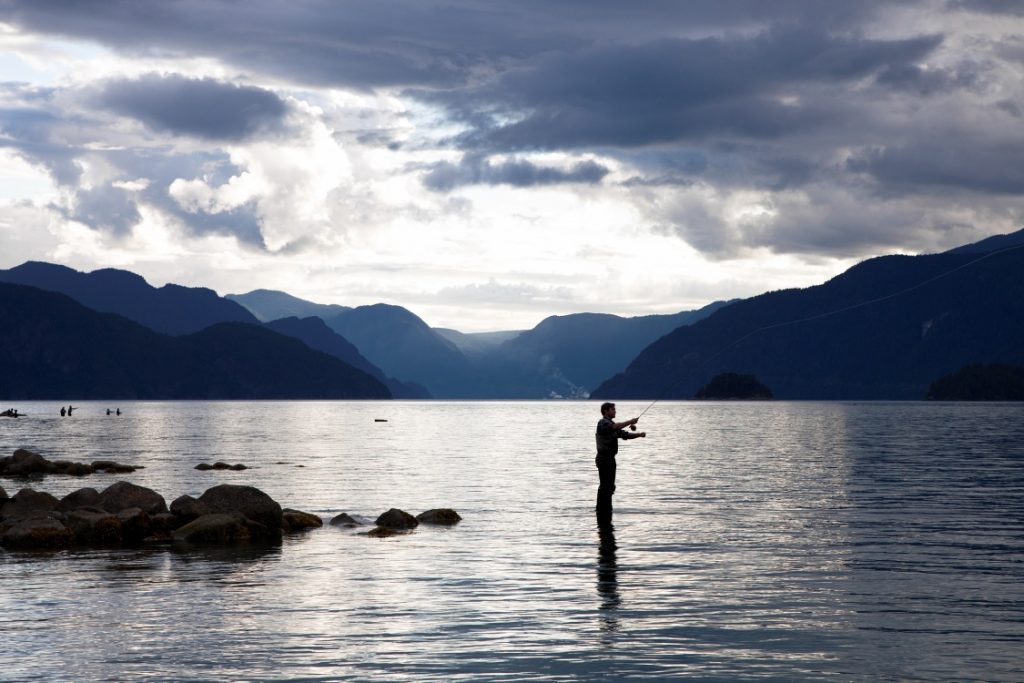
Saltwater Fishing
Saltwater anglers who yearn for the open sea or a sheltered cove along the coast, are spoiled for choice along the Pacific coastline that stretches from Victoria, BC all the way up to Alaska. Renting a fishing charter and guide provides recreational anglers an opportunity to fish for species such as halibut, or a trophy sized chinook.
Fishing Licences and Regulations
To fish in British Columbia waters, all anglers require a valid licence.
Licenses for non-tidal/ freshwater fishing can be purchased at local hardware stores, sporting good centres or tackle shops. To view vendors throughout BC or to purchase an e-licence click here. A comprehensive guide to licensing, regulations, and more is available in the guide Freshwater Fishing Regulations produced by the Ministry of Sports, Recreation, Arts and Culture.
Licences for tidal/saltwater fishing are available through the Fisheries and Oceans Canada website. A handy guide that gives you all the information you need on licences; species and allowances; packing and transporting; safety and much more can be viewed in the British Columbia Sport Fishing Guide.
Fishing in a national park requires a Parks Canada Fishing licence.

Fishing Equipment
Rods, reels and an assortment of tackle can be bought at sporting or fishing stores. Some lakeside private campgrounds loan rods and tackle, or you can borrow equipment for free at locations throughout the province thanks to the Freshwater Fisheries Society of BC’s Rod Loan Program.
Handling Your Catch
Important information for Handling & Releasing your catch is on the Freshwater Fisheries Society of BC’s website. If you plan to keep your catch, make sure you are prepared with an ice-filled cooler to keep your fish in. Treat your fish humanely by giving it a sharp blow on the head immediately, clean it promptly, and store it on ice to prevent spoilage. Never harvest more fish than you need, and to comply with the law, you must leave the head, tail and all fins on your catch until you return home or to your campsite.

Other Useful Information
Camping & RV in BC has a google map that plots all the stocked freshwater fishing lakes in BC. The map data is directly provided by the Freshwater Fisheries Society of BC, who stock all BC lakes. The map also plots campgrounds making it easy to plan your camping and fishing trip. You can determine what lakes you will fish, species stocked, and find nearby campgrounds.
Read blogs on the Camping & RV in BC website about favourite fishing spots of some of BC’s visitors.
For camping opportunities in British Columbia go to the Camping Map
TIP: If you find this blog interesting why not subscribe to the enewsletter and never miss another story!
For fishing tips and information visit:
Travel British Columbia
Freshwater Fisheries Society of BC
Hello BC
Share your BC camping and travel pictures using hashtag #campinbc, #explorebc
It’s always a great day to #campinbc
The Underwater ‘Treasures’ of Pavilion Lake in British Columbia’s Cariboo
Located halfway between Cache Creek and Lillooet, Pavilion Lake is a brilliantly hued body of water with plenty to explore both above and below the water.
We love to use Pavilion Lake as a paddle destination when camping at nearby Marble Canyon Provincial Park (read our blog) . On our most recent trip, we paddled approximately half the distance along the highway side of the lake, and clocked a trip of around seven kilometres. The highway side of the lake is a mix of waterfront cabins and steep banks going up to the highway. On my next trip, I hope to explore the other side of the lake where there are a couple of boat-access-only properties but mostly it is untouched forest.

Pavilion Lake is a popular summertime destination and the limited areas of waterfront that are accessible from the highway (and not private property) can get busy. Kayaking offers visitors the opportunity to get away from the crowds and find a little solitude on the water.
While the steep limestone cliffs and colourful water provide a beautiful destination above the water, Pavilion Lake is internationally known for what lays below the surface.

In the mid 1990s, strange structures below the surface of the water were scientifically identified as microbialites – rare calcareous structures likely produced by microbial communities, which are estimated to have started forming 11,000 years ago. Researchers believe the microbialites are similar to some of the earliest life forms on Earth, dating back 500 million years. Pavilion Lake has been studied extensively via the Pavilion Lake Research Project (PLRP), a joint effort between the University of British Columbia and NASA.

Recreational scuba divers can visit Pavilion Lake and explore three areas with microbialite structures. The North and South dive sites are accessible along the side of the highway down to a depth of 40 metres. The most popular diving location, called Island to Sky Blue, is where we have done the bulk of our diving. This site covers all the areas around the island and the former Sky Blue Water Resort. Divers can explore down to a depth of 40 metres. The remainder of Pavilion Lake is designated a Special Features Zone and no diving is permitted in order to further protect the fragile microbialite structures.

With proper training and equipment, diving at Pavilion Lake is a truly unique experience. The microbialites are reminiscent of coral and the water, particularly in the shallows, can look quite tropical. That is more or less where the comparison ends, though, as the water temperature at Pavilion Lake can be very cold!

For those who are not certified or prepared to dive in the cold water, Pavilion Lake remains an excellent destination for kayaking, canoeing, or paddle boarding. While gliding across the surface of the water and enjoying the spectacular mountain views, keep the treasures that lay below in mind and make sure to do your part to protect this fragile ecosystem.
TIP: If you find this blog interesting why not subscribe to the enewsletter and never miss another story!
For camping opportunities in this area and throughout BC go to the Camping Map
Share your BC travel and camping pictures using hashtag #campinbc, #explorebc, #bcnice, #green
It’s always a great day to #campinbc
Eco-Friendly Items for Your Campsite
The camping and outdoor lifestyle industry is growing at a fast pace. It’s evolving too, and ‘green’ is the way to go, meaning sustainable and biodegradable products with solar and renewable energy solutions. Here are a few stand-out products and companies leading the way to a more responsible future.
Biodegradable Products
Bio-Pak® Alpine Fresh Natural Enzyme Deodorizer and Waste Digester is a safe way to clean black holding tanks and remove odors. Formaldehyde- and biocide-free and zinc- and copper-free, the environmentally friendly formula allows for rapid breakdown of waste and paper and is septic safe—there’s no need for special RV toilet paper. Bio-Pak provides portion control and is easy to use with no messy liquids; it’s also available in Tropical Breeze scent. Walex recommends Porta-Pak black tanks when temperatures are regularly above 32°C/90°F. Available online and in various stores; price varies per pack size (approx. $17CAN/10 pack).

Biodegradable Bio-Kleen Awning Cleaner removes tough stains, mold, mildew, dirt, insects, tree sap, bird excrement, and more from vinyl, canvas and acrylic fabric awnings. It’s concentrated so dilute as required. Available in a variety of sizes including: 32oz, 1 Gallon, 5 Gallon. Bio-Kleen offers a large product range of environmentally safe, cruelty-fee and vegan cleaning products. Available online and in various stores; $17.95USD/32 oz ($23.15CAD).
Caboo specializes in tree-free paper products and wipes. Its 100% biodegradable bathroom tissues, free from chlorine bleach, are made from organically grown sustainable bamboo and sugarcane. The tissues are septic safe and non-GMO project verified. The 2-ply sheets are soft and strong, hypoallergenic, chlorine-bleach free, BPA and paraben- and fragrance-free. Other products are paper towels and baby wipes, both tree-free. Available online and in stores; prices vary per pack size/approx. $45CAD/24 toilet paper rolls.

Dr. Bronner’s 18-in-1 Pure-Castile Soaps are concentrated, versatile and biodegradable. The liquid soaps are available in eight scents (including baby unscented) and are made with organic and certified fair-trade ingredients (no synthetic preservatives, no detergents or foaming agents) and packaged in a 100% post-consumer recycled bottle. Also available in bar form. The company also has lotion and balms, hair care, home and laundry, toothpaste and more. Available online and in stores; $16.99USD/32 oz ($21.95CAD).
Solar Power
It took a natural disaster for the founders of LuminAID to invent their breakthrough portable solar lanterns which are now used in over 100 countries. Collapsible and compact, the lanterns (some inflatable, others pop-up) can provide more than 100 hours of bright light with every charge and are perfect for camping, RVing, hiking and backpacking, or to have in case of an emergency. The company has expanded its product line to include power lanterns with a phone charger, solar speakers and Bluetooth-enabled solar lights. Available online and in various stores; prices vary per product (PackLite Max 2-in-1 Power Lantern $66CAD).

The eRove™ Electric Cooler by Furrion is unique in that it’s also battery powered and solar rechargeable. With 50Qt of space, it can fit up to 72 cans and hold 6Qt of dry storage. The eRove comes with an ePod Power station and a 100-watt solar panel, which provides a rechargeable battery for the cooler. Its optimized cooling system can freeze to -22°C and the cooler features detachable cup and umbrella holders. Available at Furrion dealers (various RV/electronic stores); $899.99USD/$1,150CAD.
Use solar power to cook or warm your food or boil water with the GoSun Go portable solar oven; according to the company, “If you can see a shadow, it will cook”. Simply called the ‘Go’, it features a sturdy yet lightweight frame with stainless-steel cooking tray and vacuum tube; the tube acts as an insulator to enhance the food’s flavor (perfect for dehydrated foods) and keep moisture in. With internal temperatures of 550°F (287°C) the Go can also sterilize pond and lake water. No need to worry about burning yourself as the outside of this portable oven remains cool to the touch and safe. Each Go comes with four silicone cook pans, a universal action mount, cleaning brush, solar dial, cookbook and a carrying case. Specs: .91 kgs (2 lbs)/13.5-oz capacity. Available online and in various stores; average retail price $139.99USD/$180CAD.

Sweet Dreams
The North Face Eco Trail Sleeping Bag (stuffsack size: 22.9 cm x 40.6 cm) is made from fully recycled materials and is good to -7°C. Its shell is 50 Denier (D) 100% recycled polyester ripstop with Non-PFC Durable Water-Repellent finish, the lining is 50D 100% embossed polyester taffeta and the insulation is 600 fill recycled down. Features include:
- Extended width in knees for maximum comfort and mobility and vaulted foot box
- Wraparound J-zip for increased mobility and venting
- Fitted hood (with cinch cord) and draft collar for comfort and heat loss prevention
- Internal phone/watch pocket and tie-down loops for securing bag to sleeping pad.
Available online and in various camping stores; retails from $180CAD for adult sleeping bag.
Yukon Outfitters’ SomniSmart™ hammock is made in part from recycled plastic water bottles. The lightweight hammock is constructed with Repreve® fabric; the company is a world leader in recycled fiber. The SomniSmart™ is available in single- and double-style configurations. Available online from Yukon Outfitters; $79.99USD/$100CAD.
Eco-friendly Gear
Eukarya makes sustainable headlamps from zebra and cherry wood, machined aluminum and high strength tempered glass. Its latest model features brightness memory and up to 14 hours of battery life, USB-C charging and a dedicated rechargeable battery indicator; it’s also water resistant. One tree is planted with each headlamp sold. Origin 2 $129USD/$166CAD plus shipping; available online from Eukarya.

The Hielo Del Dia 12L Cooler Bag by Cotopaxi is a one-of-a-kind handmade cooler made from partially repurposed leftover fabric. The coolers have a waterproof liner and are insulated with repurposed foam and feature a practical side strap; there’s also a side pocket for a water bottle. Cotopaxi sources many materials from other companies and utilizes remnant fabrics and prides itself on ethical manufacturing. Each pack in the Del Día Collection is made by employees who handpick its look, from the fabric selector to the pattern maker and sewer. Also check out Cotopaxi’s colourful windbreakers, backpacks, travel and hip packs and sleeping bags. $100USD/$129CAD plus shipping; available online from Cotopaxi to ship to Canada.
List prices/exchange rate may vary; taxes and any shipping charges applied at online checkout.
There are many ways we can be eco-friendly campers and RVers and responsible global citizens. Choose and use biodegradable and recyclable products and recycle and dispose of waste properly and safely while outdoors. For information on being a good and sustainable camper read up on the Camper’s Code.
TIP: If you find this blog interesting why not subscribe to the enewsletter and never miss another story!
If you have any ecofriendly ideas or products you have used and would like to share with other campers, contact us.
For camping and RVing options in British Columbia go to the Camping Map.
Share your BC travel and camping pictures using hashtag #campinbc, #explorebc, #bcnice, #green
It’s always a great day to #campinbc
Kayaking in British Columbia’s Nootka Sound Off the West Coast of Vancouver Island
The west coast of Vancouver Island contains many hundreds of kilometres of coastline, ranging from protected inlets to wild and windswept shorelines. Multi-day ocean kayaking trips are an excellent way to explore some of the hidden treasures of the BC coast. When looking for a kayaking location offering a diversity of scenery, Nootka Sound scores highly as it offers both calm and protected waters in and around Bligh Island and the Spanish Pilot Group and the exposed, “next stop Japan,” sort of views that make the west coast famous.
Nootka Sound is accessible from Gold River, a thousand-or-so resident town just over an hour west of Campbell River. What it lacks in cell phone service, Gold River certainly makes up for in beauty. With towering mountains and lush forests (well, those parts that don’t bear the scars of decades of clear cutting), Gold River is the gateway to a wilderness paradise. Nootka Sound can be accessed directly from Gold River via private boat, an extremely long paddle, or the unique experience of the MV Uchuck III which will wet-launch potential paddlers anywhere along its route through Nootka Sound and Kyuquot Sound. For our trip, we chose none of the above, opting instead to drive another hour along logging roads in order to launch ourselves further up the inlet at the Cougar Creek Rec Site.

Launching complete, we paddled out of Cougar Creek and headed for Bligh Island Marine Provincial Park. The park is a popular recreational destination, known for its good fishing and protected waters. Our original destination for the night, a user- maintained campsite at Charlie’s Beach on Bligh Island, turned out to be extremely busy, so we sought an overnight home instead on nearby Vernaci Island. While the marine park encompasses the southern part of Bligh Island, the Villaverde Islands, the Pantoja Islands, Verdia Island, Vernaci Island, and Spouter Island, good campsites are few and far between. Anyone who has paddled on the BC coast knows the struggle of the often nearly vertical water-rock-trees configuration; so when a good campsite is available, make yourself at home!

On day two, it was time to leave the protected part of Nootka Sound, take advantage of the perfect weather, and head to the exposed outer coast beyond Burdwood Point. As we set out, the sun was shining, the winds were calm, and the ocean had just enough gentle swell to be a reminder that nothing but thousands of kilometres of ocean lay directly ahead. Our crossing was uneventful, and before long we were paddling into a large crescent shaped bay rimmed by a smooth pebble beach. Rocky islets just off-shore provided picture-perfect views, and we made sure to set our tents up to maximize the panorama before us. All was perfect, and we spent the afternoon lounging in the sun and fishing off the rocks.

The west coast is an undeniably wild place, and by evening the weather had shifted and a storm was blowing in. The now relentless wind had whipped the ocean into a frenzy, turning the previously calm bay into a scene from Oahu’s famous North Shore. The picture-perfect rocky islets broke up the waves and made the view to the right akin to looking into a washing machine.
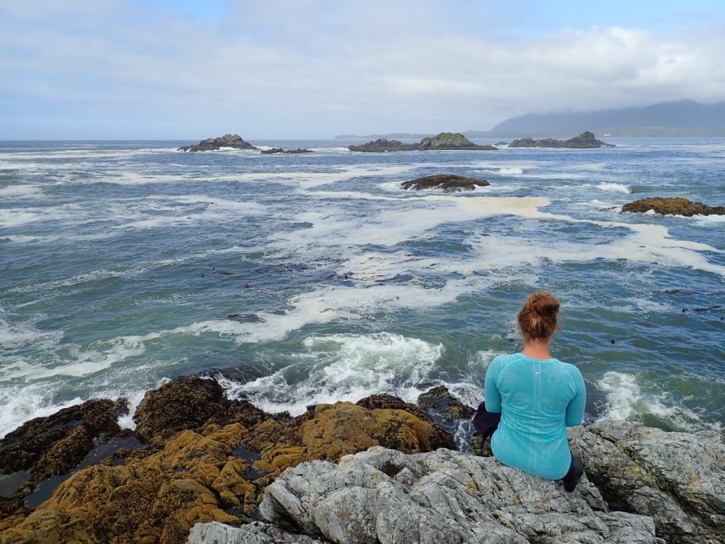
The winds raged on all night, and when we woke in the morning we knew that despite the glorious sunshine, there was a zero percent chance that we were getting off the beach that day. Sometimes, when it comes to Mother Nature, all you can do is watch, snack on dehydrated cheese, and wait her out! Fortunately for us, our enormous beach provided plenty of walking opportunities and there was even a creek, complete with shallow pools sheltered from the wind, which made a perfect place to break out our air mattresses and enjoy a float. The day passed with many rounds of wilderness bocce and naps, and by the time we were huddled around the marine radio listening to the forecast while cooking dinner, we had our plan: wake up very early and make a break for it while the wind and swells were forecast to be more manageable.

As the sun rose the next morning, we loaded up our gear, investigated the fresh bear tracks on the beach, and set out into the surf. The first hour or so of our paddle was, in the words of my father, “entertaining.” While we were paddling through the type of waves that make your companions disappear, we were far from the only ones on the water. If you paddle early in Nootka Sound, you are guaranteed to see recreational fisherman hauling their catch out of the water all around you.
TIP: If you find this blog interesting why not subscribe to the enewsletter and never miss another story!
Before we knew it, we were back inside the protected waters of the Spanish Pilot Group and the relentless wind and waves had completely disappeared. The power of Mother Nature is incredible, and it is so important to always be prepared for an extended and unexpected stay.
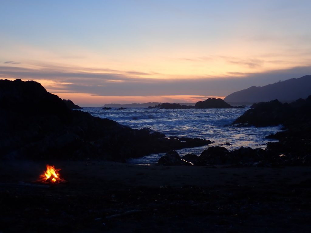
The remainder of our trip was all calm seas and sunshine and before long our trip was at an end. Nootka Sound is a wonderful place to explore for kayakers of all levels. The protected inner islands provide peaceful paddling, while the exposed outside is great for those comfortable with big seas and surf landings. With so much still to explore in the area, I am sure we will be back to see more of what Nootka Sound has to offer.
For camping and RVing options in British Columbia go to the Camping Map.
Share your BC travel and camping pictures using hashtag #campinbc, #explorebc, #bcnice, #green
It’s always a great day to #campinbc
Published: August 4th, 2022
Connect With Us